Créé par Emilie, le 20 juin 2026
Votre guide Ryo
The 7 Most Beautiful Hikes in Puy-de-Dôme
© Shutterstock
Puy-de-Dôme is a place beloved by experienced hikers, and for good reason: sumptuous landscapes, volcanoes of Auvergne covered with a thick blanket of greenery, routes for all levels, and choice - an incredible number of trails await you in this department that seems to have been created for hiking!
So, whether you decide to go wandering with friends, solo, with family, or with your energetic furry ball, you'll definitely find the route(s) that suit you in Puy-de-Dôme. Be careful, you're not immune to falling head over heels for this region with its still wild and so unique landscapes...
Where to hike in Puy-de-Dôme?
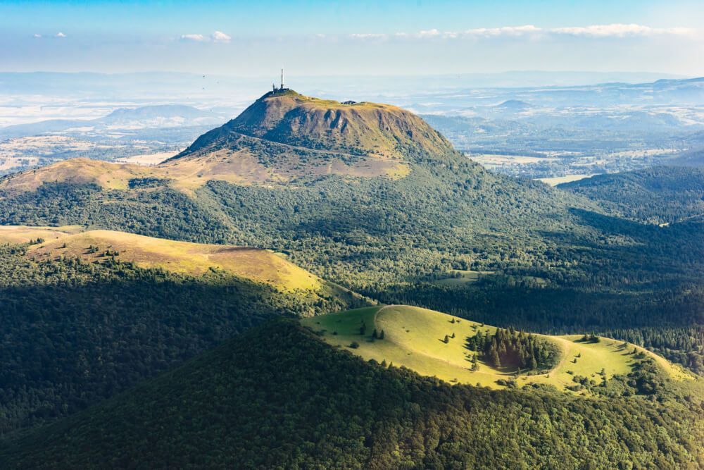
Nature and mountain landscape enthusiasts won't be disappointed exploring Puy-de-Dôme. This green jewel has numerous (dormant) volcanoes, natural regional parks and absolutely sublime mountain ranges. For info: a puy is a dormant volcano. Here are 7 hikes to do in Puy-de-Dôme.
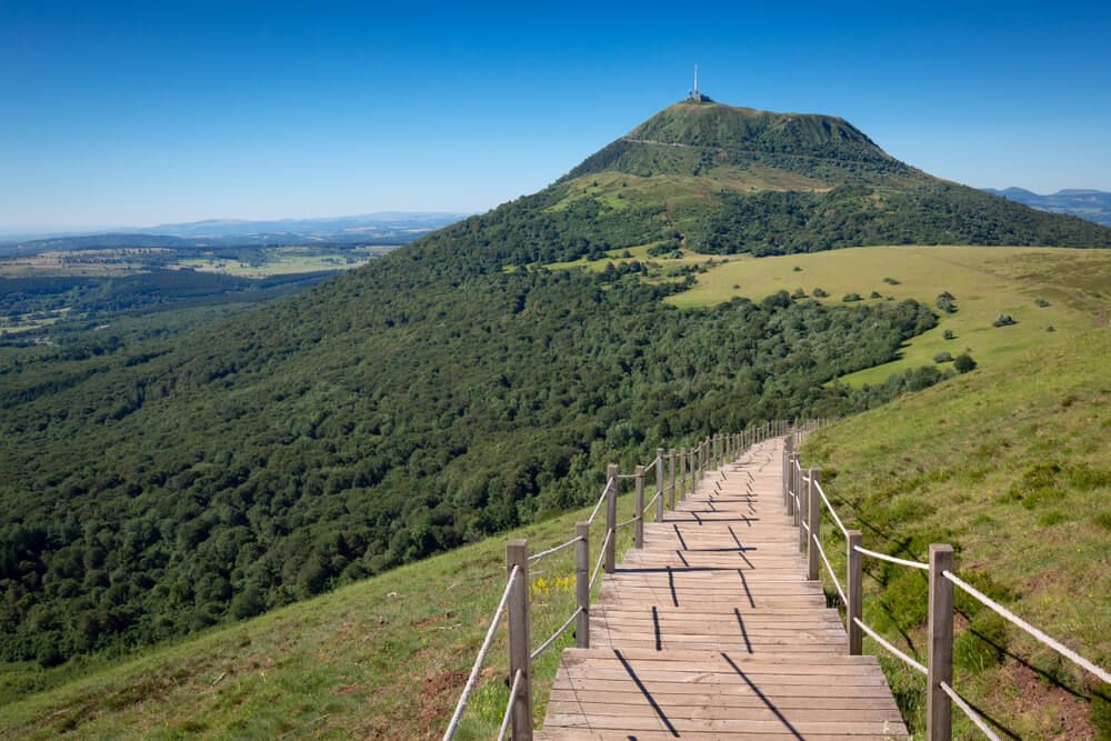
Hike #1: Puy Pariou from Goules parking
- Duration: 2h 25min
- Distance to cover: 6.47 km
- Elevation gain: 197 m
- Highest point: 1172 m
- Lowest point: 968 m
- Difficulty: moderate
The departure and arrival are at Goules parking. The highlight of the show, in addition to the view of the crater, is that steps lead you directly into the hollow of the crater. An ideal place for an impromptu picnic or to take a break. Puy Pariou peaks at 1,200 meters, which will give you the opportunity, once you reach its highest point, to observe the other puys, including Puy-de-Dôme, as well as a view of the city of Clermont-Ferrand.
Hike #2: the adventif massif around Mont-Dore
- Duration: 7h 00min
- Distance: 15.72 km
- Elevation gain: 887 m
- Highest point: 1716 m
- Lowest point: 1006 m
- Difficulty: moderate
This hike will indeed take you a whole day, but it will allow you to pass near 3 magnificent waterfalls, offering you an exceptional view of the Sancy massif all the way to the Puys chain. You'll see, first, the Queurueilh waterfall with its 20-meter high waterfall, then the Rossignolet waterfall which resembles, in its way of falling, a bridal veil. Finally, the 3rd and last waterfall is the Grande Cascade du Mont-Dore, one of the highest in the Auvergne region. Its access is prohibited in winter by municipal order.
Hike #3: The Chiloza waterfalls
- Duration: 1h 45min
- Distance: 4.79 km
- Elevation gain: 140 m
- Highest point: 992 m
- Lowest point: 848 m
- Difficulty: moderate
A walk sheltered from the heat thanks to the undergrowth and the Couze Pavin which forms small waterfalls on either side of the bank. Access is from the road located to the right of the Bois de Gravière Campground in Besse-en-Chandesse. This route requires good walking shoes, as it is relatively rough in places. Normally considered easy, it is not recommended for families with small children or strollers.
Hike #4: on the trail of the Druids
- Duration: 2h 05min
- Distance: 5.27 km
- Elevation gain: 211 m
- Highest point: 701 m
- Lowest point: 510 m
- Difficulty: moderate
Superimposed rock blocks in the middle of the woods, vestiges of water mills, cupule stone linked to ancient rites, megalithic monument composed of menhirs arranged in a circle from the Bronze Age, ruins of an ancient medieval fortress... This is what you can see following the Druids' path. The departure is from the parking lot of the town hall of Fayet-le-Château. This hike in nature is done in the middle of meadows, forests, streams, surprising places that would have a connection with the druidic gatherings that were formerly held in the region. Also to see, the pond at the place called "La Gravière".
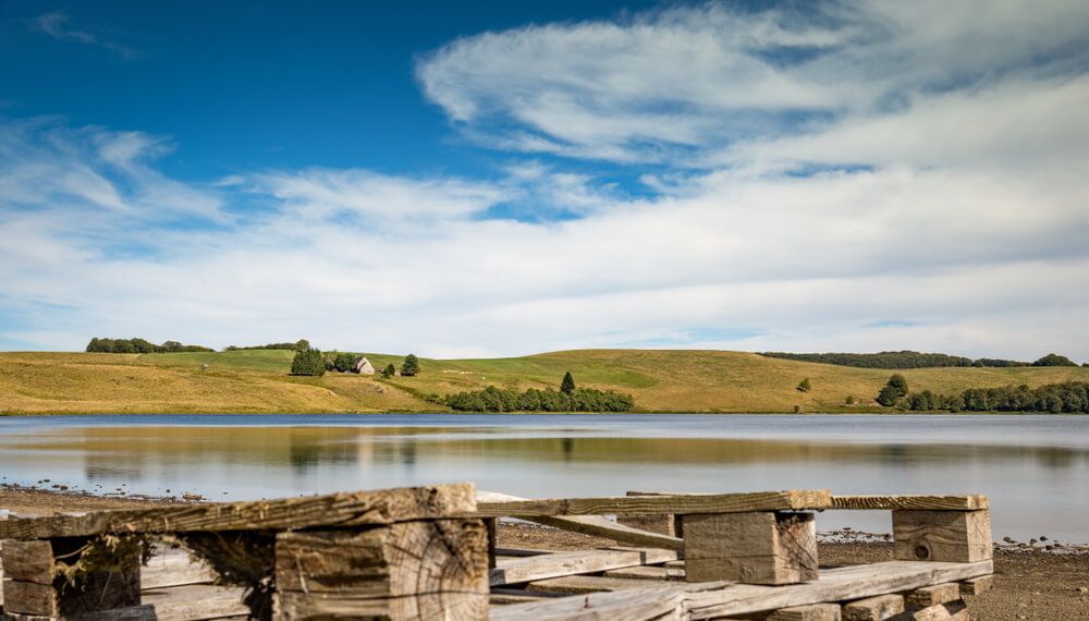
Hike #5: Montbert Forest and Lac Chauvet
- Duration: 2h 25min
- Distance: 7.17 km
- Elevation gain: 117 m
- Highest point: 1257 m
- Lowest point: 1162 m
- Difficulty: easy
A family-friendly walk, between undergrowth, beech and spruce forest, fields flowering in spring, and small picnic or snack by Lac Chauvet. Viewpoints over the Monts Dore, Cantal and the lake. Beware of mud in wet weather, bring good shoes if necessary. It's possible to encounter herds on this hiking section.
Hike #6: The Rajat Caves and the Marais Cirque
- • Duration: 4h 40min
- • Distance: 12.19 km
- • Elevation gain: 409 m
- • Highest point: 1,086 m
- • Lowest point: 863 m
- • Difficulty: moderate
Many sites to discover on this hiking route: the Rajat Caves, Murol Castle, the Cirque and Dent du Marais, the villages of Chautignat and Beaune-le-Froid. The Rajat Caves, in the cliff above the village, were once inhabited troglodyte houses, they probably date from the Gallic period, or even before. You'll appreciate, during this walk, the view of the medieval Murol Castle and the Sancy massif. At the top of the cliff, you can admire Lac de Chambon and the Chaudefour Valley. The Dent du Marais is a needle that measures 100 m in height, it's located above the lake. Near the route, taking the direction of the caves path, you'll discover old Saint-Nectaire aging caves, some of which are still active. If Saint-Nectaire is a cheese you appreciate, it would be a real shame not to take this small loop to bring back a souvenir with a unique taste.
The GR30, discovery of the Volcanoes and Lakes of Auvergne
This GR goes around the puys of Auvergne over nearly 189 km starting from the foot of Puy de Sancy. It takes no less than 9 days to complete the entire hike, whose difficulty is moderate. Tour of puys and mountain lakes, extraordinary viewpoints, typical villages... Everything is designed to make you discover the most beautiful panoramas of Puy-de-Dôme.