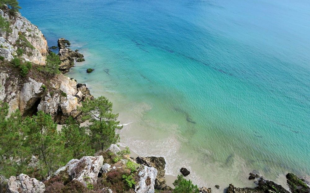
© Shutterstock
 Votre guide Ryo
What to Do in Crozon: 20 Must-See Highlights of the Peninsula in 2026
The Crozon Peninsula thrusts its red schist cliffs into the Atlantic like a fist raised toward the open sea. Three headlands, dozens of wild beaches, megaliths 5,000 years old, and a light that shifts from hour to hour: few territories in Brittany pack as much diversity into 60 kilometres of coastline. Yet most visitors stop at Pen-Hir and leave without having seen half of it. To explore the peninsula at your own pace and miss none of the places that truly matter, the Ryo audio guide to the Crozon Peninsula offers useful audio-guided hiking trails.
What exactly can you do in Crozon? Climb to the Pointe de Pen-Hir and watch the Tas de Pois rise from the surf 70 metres below. Decipher the 65 menhirs aligned at Lagatjar at sunrise, when no one else is there yet. Step inside the marine caves of Morgat by rowing boat, the limestone walls lit up in blue. And in the evening, watch the sun vanish below the horizon from Plage de la Palue, one of the longest beaches in Brittany. This overview covers 20 experiences — panoramas, beaches, military history, hikes, water activities and rainy-day escapes — to help you shape your stay, whether you have two hours or a week.
1. The Pointe de Pen-Hir
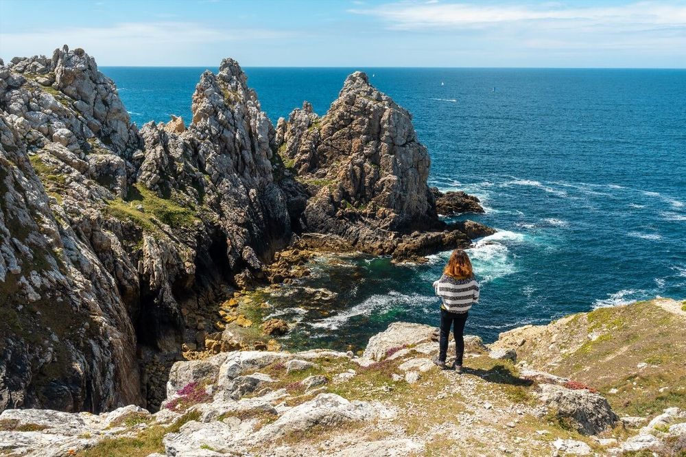
You have to stand at the cliff edge and look south to understand why Pen-Hir (Pointe de Pen-Hir, 29160 Camaret-sur-Mer, rated 4.8/5 on Google with 8,500 reviews) ranks among the most beautiful natural sites in Brittany. The rock plunges 70 metres straight down into an emerald-green sea, and three giant rocks, the Tas de Pois, rise from the surf like petrified sentinels. In rough seas, the waves crash against them in white geysers visible from the headland with the naked eye.
The site belongs to the Conservatoire du Littoral; access is free and open year-round. A waymarked path runs along the cliff edge for about 1.5 km, with two viewing platforms each offering a different angle on the rocks. The first platform is accessible to pushchairs and people with reduced mobility; the second requires a few steps cut into the rock.
Arrive early in the morning in July and August: the car park (paid in season, around €3/hour) fills up by 9:30 am, and the headland itself is swamped with groups from 10 am onwards. Outside the summer season — May, June, September, October — you will often find the place almost deserted, with a raking light that enriches the colours of the rock. Allow 45 minutes to 1h30 depending on your walking pace and how much photography you plan to do.
The car park is 500 metres from the cliff edge along a flat path. There are no snack bars or shops nearby: bring water, especially in midsummer.
2. The Lagatjar Megalithic Alignments
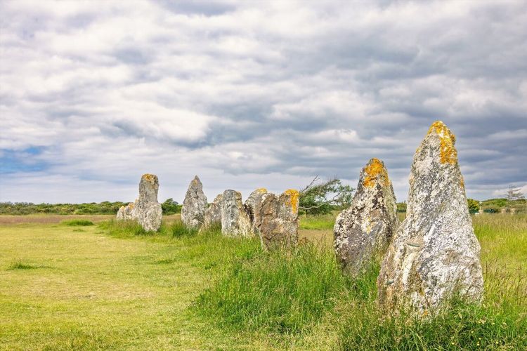
Three kilometres from the centre of Camaret-sur-Mer, the Lagatjar alignments (Route de Lagatjar, 29160 Camaret-sur-Mer, rated 4.3/5 on Google with 1,757 reviews) form one of the most significant megalithic ensembles in Finistère. Around 65 menhirs, some standing over 2 metres tall, are arranged in several parallel rows on an open plateau facing the sea. They date from the Neolithic period, between 3,500 and 2,500 BCE.
The site is classified as a historic monument and access is free and permanent. Unlike Carnac, there are no fences, no obligatory audio guides, no crowds: you can walk to within a metre of the stones and move freely around them. It is this closeness — rare for a site of this scale — that makes the visit so striking.
The best time? At dawn or in the late afternoon, when the oblique light accentuates the relief and the silhouettes of the menhirs stand out against an orange sky. In summer, a few interpretation panels explain the hypotheses about the alignment's function. Allow 30 to 45 minutes on site.
3. Plage de Pen-Hat
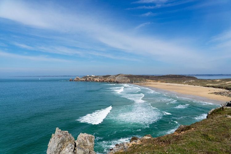
Right at the foot of the Pointe de Pen-Hir, Plage de Pen-Hat (Plage de Pen-Hat, 29160 Camaret-sur-Mer, rated 4.8/5 on Google with 658 reviews) stretches for 600 metres of fine sand framed by ochre cliffs. Its westerly exposure makes it one of the windiest beaches on the peninsula — and one of the most popular with surfers.
In summer, a lifeguard post is open and swimming is supervised during the usual hours. The surf spot works best on an incoming tide with a north-westerly wind; lessons are offered by several local surf schools based in Camaret. Out of season, the beach returns to its wild character: only the gulls and Arctic terns still make use of it. Access is from the Pen-Hir car park via a descending path of about 10 minutes on foot.
4. Cap de la Chèvre
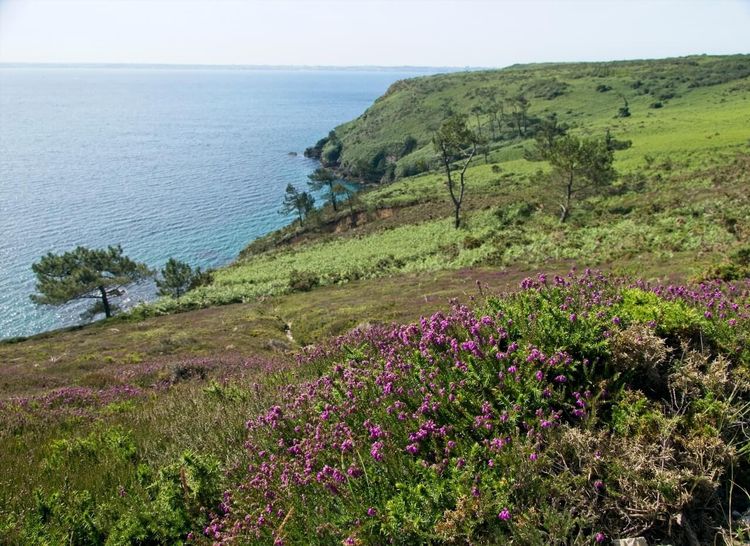
Less frequented than Pen-Hir, Cap de la Chèvre (Cap de la Chèvre, 29160 Saint-Hernot, rated 4.7/5 on Google with 599 reviews) is its equal in terms of spectacle. It is the southernmost point of the peninsula, set at the southern tip of the Crozon headland, and it offers a breathtaking panorama over the Rade de Brest to the north, the Baie de Douarnenez to the south, and on clear days the Île de Sein some sixty kilometres to the west.
The road leading to the headland crosses a landscape of low moorland covered in gorse and heather, with already spectacular views before you even reach the tip. At the end of the road, a former semaphore station converted into a weather observation post dominates the site. The cliffs here are less sheer than at Pen-Hir, making the headland more accessible to families with young children, but the end-of-the-world feeling is identical.
A coastal path links the headland car park to Plage de Saint-Hernot (3 km, about 1 hour one way), an isolated cove that few visitors reach and whose turquoise water in summer is reminiscent of the Mediterranean. The Cap de la Chèvre car park is free and open year-round. In September, common dolphins are regularly spotted from the cliffs — check with the association Bretagne Vivante for periods when sightings are most likely.
The headland is part of the Iroise Biosphere Reserve, classified by UNESCO since 1988: certain areas of moorland remain closed to the public to protect nesting birds from April to July.
5. Plage de la Palue
Plage de la Palue (Plage de la Palue, 29160 Crozon, rated 4.9/5 on Google with 75 reviews) is the longest beach on the peninsula: 2 kilometres of golden sand facing due west, bordered by dunes and protected wetlands. It is also one of the most beautifully empty beaches in Brittany — even in August, the absence of roads leading directly to the sand means a minimum walk from the car park.
The spot is renowned for surfing and bodyboarding. But La Palue is also worth visiting for its sunsets: from the water's edge, the sky turns shades ranging from coral to deep violet in the twenty minutes that follow twilight. Bring a jacket — the Atlantic wind does not let up even in midsummer.
6. The Port of Camaret-sur-Mer
Camaret is the only real town on the peninsula, and its port is its living heart. The Sillon de Camaret, the long natural jetty that forms the harbour, is one of the most photographed landscapes in Brittany: on one side, colourful fishing boats; on the other, beached tuna boats that no one has ever moved, their rusting hulls growing more photogenic with every decade.
Along the Quai Gustave-Toudouze, several restaurants and crêperies serve local seafood: Camaret lobsters, wild abalones, scallops from the Rade de Brest. Avoid the tables directly on the port (Quai Gustave Toudouze, 29160 Camaret-sur-Mer, rated 4.4/5 on Google with 2,054 reviews) — the most touristy ones — and opt instead for those a street back for better value.
The port is also the departure point for boats to the Morgat marine caves (Port de Morgat, 29160 Crozon, rated 4.6/5 on Google with 1,097 reviews) (see section 13) and for dolphin-watching boat trips. At the end of the day, the setting sun bathes the Tour Vauban at the end of the Sillon in orange light: this is the photographers' hour — arrive 20 minutes early to find your angle.
If you would like to explore the maritime and military heritage of Camaret with audio commentary on key sites, the Ryo app offers content on Breton coastal fortifications that usefully complements a visit to the Sillon.
7. The Tour Vauban in Camaret
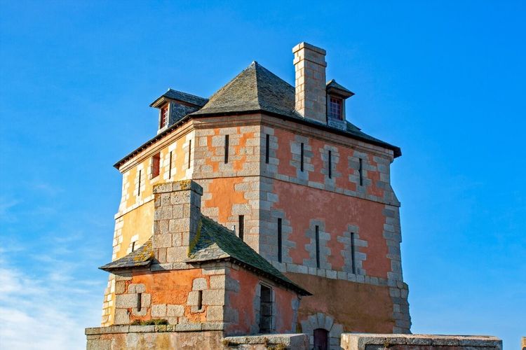
At the end of the Sillon, the Tour Vauban has stood in its squat silhouette since 1696. Designed from 1689 by Marshal Vauban to defend the Rade de Brest, this red-cannonball tower, listed as a UNESCO World Heritage Site since 2008 as part of the "Vauban Fortifications", played a decisive role during the Battle of Camaret on 18 June 1694, when the Anglo-Dutch fleet was repelled.
The interior is open to the public in summer (check with the tourist office for exact opening times, which vary from year to year). Even without going inside, the tower can be admired in its entirety from the Sillon: its distinctive architecture, with its machicolations and pepper-pot roof, is a condensed lesson in 17th-century defensive engineering. Allow 30 minutes to walk around the exterior and understand the defensive system that worked in conjunction with the neighbouring chapel.
8. The Artists' Quarter of Camaret-sur-Mer
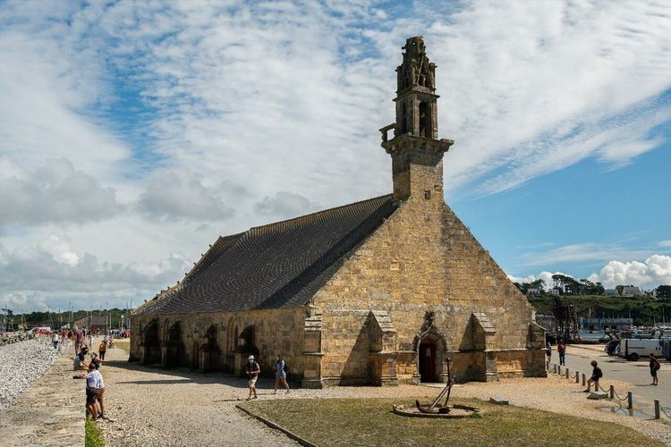
Since the late 19th century, Camaret has attracted a colony of painters whose names remain little known to the general public but whose canvases hang in several Breton museums. Paul Gauguin stayed here in 1894; Eugène Boudin returned regularly. The "artists' quarter" is not a defined perimeter but an atmosphere that runs through the lanes between the Chapelle Notre-Dame de Rocamadour (Sillon de Camaret, 29160 Camaret-sur-Mer, rated 4.8/5 on Google with 6 reviews) and the back of the port.
Today, around ten open galleries and studios are scattered across this area. Several local artists offer studio visits by appointment, including watercolourists specialising in seascapes. A local crafts market, held in summer on the quay, brings together potters, weavers, and engravers. For travellers looking for a less folkloric and more contemporary Brittany, this quarter is worth an hour of unhurried wandering.
The Chapelle Notre-Dame de Rocamadour (17th century, partly listed) is the symbol of the town and the focus of an annual pardon ceremony in September. It contains a remarkable collection of maritime ex-votos — model boats, letters from shipwrecked sailors — accumulated over centuries.
9. The Memorial to the Battle of the Atlantic
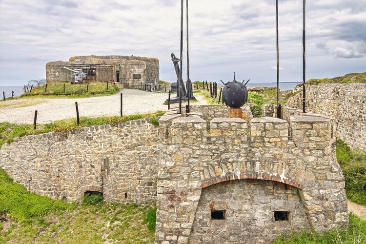
Located at the entrance to Camaret, the Memorial to the Battle of the Atlantic (Route du Mémorial, 29160 Camaret-sur-Mer, rated 4.5/5 on Google with 1,078 reviews) pays tribute to the sailors and airmen who fell in the Rade de Brest and off the Breton coast during the Second World War. The monument itself — a Kersanton stone column topped with a cross — is understated, but the surrounding site is steeped in history: German Atlantikwall blockhouses are still visible a few hundred metres away.
Access is free. A stele lists the names of the units involved and the vessels sunk between 1940 and 1944. For military history enthusiasts, this site pairs naturally with a visit to the Fort des Capucins (see section 10) and the Tour Vauban, which together form a triangle of coastal defence spanning five centuries of Breton military history.
10. Fort des Capucins in Roscanvel
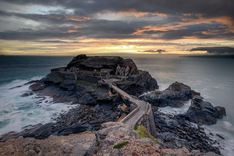
In the commune of Roscanvel, at the tip of a headland jutting into the Rade de Brest, Fort des Capucins (Fort des Capucins, 29160 Roscanvel, rated 4.6/5 on Google with 475 reviews) occupies a rocky islet connected to the mainland by a walkway, accessible only at low tide or by rowing boat. This 19th-century fort long belonged to the French Navy before being handed over to the commune. It is now open for visits during the summer season.
The suspension walkway, about fifty metres long, should be crossed with care in strong winds. Once on the islet, the panoramas over the Rade de Brest, Île Longue (a nuclear submarine base, not accessible) and the Pointe des Espagnols are breathtaking. Check opening times with the Roscanvel town hall before making the trip: access may be closed in adverse weather conditions.
11. Île de l'Aber and Its Fort
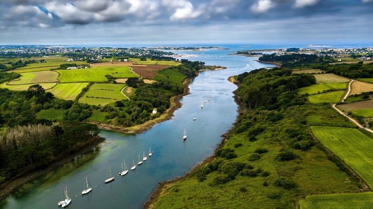
Facing the commune of Crozon, Île de l'Aber (Île de l'Aber, 29160 Crozon, rated 4.8/5 on Google with 32 reviews) is accessible only by boat — shuttles depart from the port of Morgat in summer. The island is home to the ruins of a 19th-century fort built to defend the Aber estuary, a tidal inlet that cuts between the hills.
On the island, the vegetation has remained wild: heather moorland, naturalised Barbary figs, kittiwakes nesting on the rocks. The fort itself cannot be visited in its entirety, but its exterior and the views it offers over the Rade de Brest make the crossing worthwhile. Allow 2 hours including the return shuttle. Outside the season, the island is only accessible by private boat or kayak.
12. The Roscanvel Peninsula
The Roscanvel Peninsula extends northward between the Rade de Brest to the east and the Iroise Sea to the west. It is the least-visited part of Crozon, partly because the nuclear base on Île Longue blocks access at the far end, and partly because no "spectacular" site in the classic sense is found there. But that is precisely what makes it a place apart.
Narrow roads cross preserved hamlets, Breton calvaries appear at crossroads, and the views over the Rade de Brest reveal military maritime activity in all its scale — submarines, frigates, hovercraft. The Pointe des Espagnols (Pointe des Espagnols, 29160 Roscanvel, rated 4.5/5 on Google with 2,100 reviews), at the tip of the peninsula (partially accessible), offers one of the finest panoramas over the Rade de Brest. A walking path circuits it in around 2h30.
For cyclists, the Roscanvel loop (around 15 km) is one of the finest on the Crozon Peninsula: little elevation gain, light traffic, and constant sea views.
13. Plage de l'Île Vierge
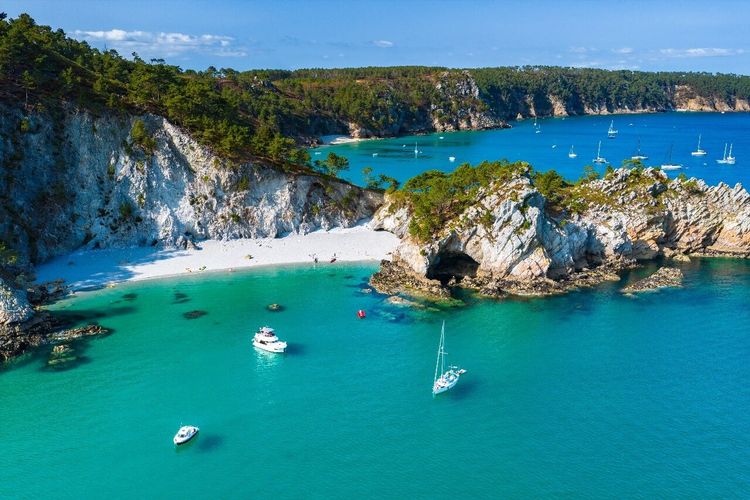
Plage de l'Île Vierge (Plage de l'Île Vierge, 29160 Crozon, rated 4.6/5 on Google with 1,343 reviews) is arguably the wildest beach on the peninsula. It takes its name from a rock offshore said to resemble a female figure — Breton sailors had generous imaginations. To reach it, you must walk 30 minutes from the nearest car park along a coastal path that winds between gorse and rocks.
This access constraint is a blessing: even in midsummer, the beach rarely has more than twenty people on it. The sand is white, the water clear, and on a fine day the view extends to the islands of the bay. Plage de l'Île Vierge is also an excellent snorkelling spot: the rocks framing the beach shelter conger eels, wrasses, and cuckoo wrasses in 2 to 4 metres of water.
No lifeguards, no facilities. Bring water and food if you plan to spend the day, and check the forecast: exposed to the north-west, the beach can become inhospitable in a sudden squall.
14. The Morgat Marine Caves
This is one of the most popular excursions on the peninsula, and it fully deserves its reputation. From the port of Morgat, glass-bottomed boats or rowing boats take visitors on a 30 to 45-minute crossing to the caves carved by the Atlantic into the limestone cliffs.
The best known is the Grotte de l'Autel, whose vault rises 15 metres above the water and whose walls are covered in red algae, limestone formations, and blue reflections that shift with the angle of the sun. Inside, the guide explains how ancient sailors used the caves as shelter in bad weather. Another cave, the Grande Grotte, is 80 metres deep and can be entered by boat up to 60 metres.
Trips are subject to weather and sea conditions. In summer, departures run several times a day from the port of Morgat; booking is recommended in July and August. Prices range from €12 to €18 per adult depending on the operator and the type of boat chosen. The return to port follows the limestone coastline — an opportunity to see from the outside the geological formations that guides tend to overlook.
For hikers, the coastal path leaving the port of Morgat toward Cap de la Chèvre passes above the caves and offers a bird's-eye view of their entrances — a perspective that complements the boat visit nicely. This top 5 of the best hikes to do in Crozon details the routes and elevation profiles to help you plan your outing.
15. Plage de Morgat
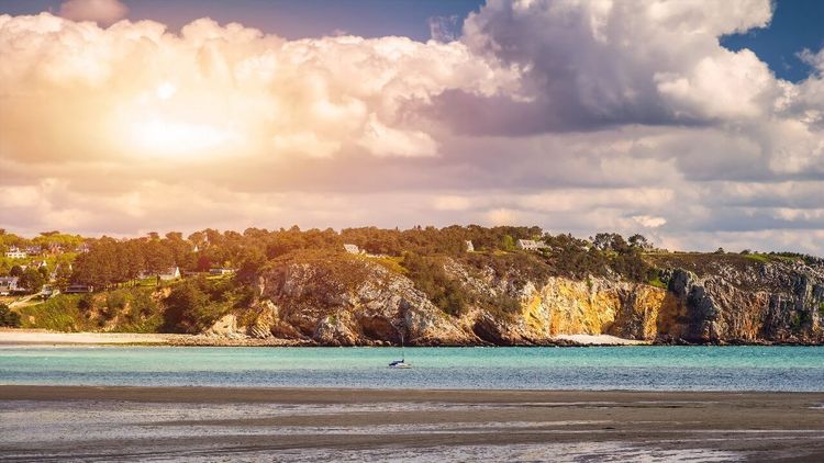
Plage de Morgat (Plage de Morgat, 29160 Crozon, rated 4.5/5 on Google with 465 reviews) offers the comfort that the peninsula's wild beaches do not: nearby parking, lifeguards in season, calm water sheltered by the Cap de la Chèvre headland. Its 600-metre arc of fine sand, relatively sheltered waters, and shallow depth make it the most family-friendly beach on the peninsula.
The village of Morgat itself is worth a short stroll: a few shopping streets, a handful of fish restaurants, and an active sailing school open all summer. It is also the departure point for sea kayak trips to the caves and to Île de l'Aber — several rental operators offer boats by the hour or by the day.
16. A Hike on the GR 34
The GR 34, the "customs officers' path", runs along the entire Breton coastline. On the Crozon Peninsula, it offers some of its finest kilometres: sheer cliffs above the Atlantic, heather moorland, hidden coves, and panoramas over the Iroise Sea and the Rade de Brest. The peninsula features a 65 km loop that can be broken into day sections depending on your fitness level.
Three segments are particularly recommended:
- Camaret – Pen-Hir – Plage de la Palue (10 km, 3h, easy): the most spectacular section, between cliffs and megaliths.
- Morgat – Cap de la Chèvre – Saint-Hernot (12 km, 3h30, easy): alternating white limestone and dark schist.
- Roscanvel – Pointe des Espagnols (7 km, 2h, easy): views over the military harbour, preserved Breton hamlets.
The Ryo app lists audio-guided points of interest on several of these sections, including coastal fortifications and protected natural sites. Browse the best hikes to do in Crozon for GPX tracks and practical advice on each itinerary.
17. Kayaking and Stand-Up Paddleboarding
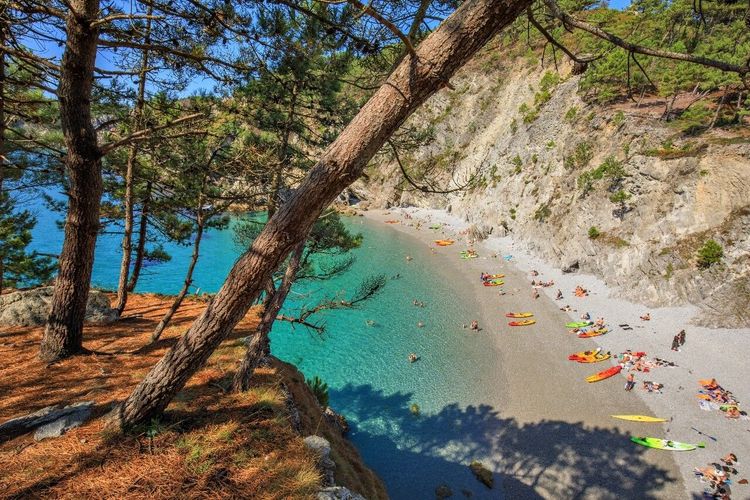
Seen from the sea, the Crozon Peninsula reveals a geography inaccessible on foot: natural arches, caves unreachable by motorboat, coves without paths. Sea kayaking is the ideal way to discover these blind spots along the coastline, and the peninsula has several centres offering rental and guided outings.
The departure from Morgat toward the marine caves (6 km return, beginner level with a guide) is the most popular option. More demanding: the kayak circuit around the Pointe de Pen-Hir (12 km, intermediate level), which lets you see the Tas de Pois from the water and enter marine caves inaccessible to motorboats. Guided sunrise outings are offered by some operators in July and August — advance booking required several weeks ahead.
Stand-up paddleboarding is more accessible but only suitable for sheltered waters (the port of Morgat, the Crozon inlet). Avoid exposed spots if you are a beginner: the currents off the headlands can catch even experienced paddlers off guard.
18. Surfing and Surf Schools
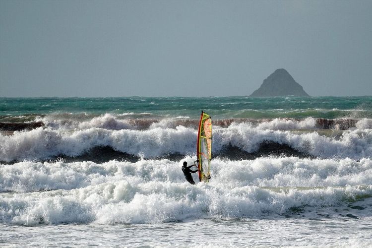
The Crozon Peninsula is one of the best surfing grounds in Finistère. Three spots stand out depending on your level:
Plage de la Palue: the most powerful spot, with waves that can exceed 2 metres in a north-westerly wind. For experienced surfers only. Longboards are of no use here — the short, hollow sections require a strong ability to read the water.
Plage de Pen-Hat: more consistent and more accessible. Surf schools based in Camaret offer beginner lessons at this spot (€50 to €70 for a 2-hour session including equipment). The peak works best on an incoming tide with a base swell of 1 to 1.5 metres.
Plage de Morgat: for beginners and longboarders. The water here is the calmest on the peninsula, with waves rarely above 1 metre.
The surf season runs from September to April for the most consistent conditions. In midsummer, the underlying swell is often absent or too weak, but conditions remain sufficient for learning.
19. The Festival du Bout du Monde
Every summer, usually in early August, the Crozon Peninsula hosts the Festival du Bout du Monde (Fort de Landaoudec, 29160 Crozon, rated 4.6/5 on Google with 16 reviews), one of the largest world music festivals in Brittany. Since 2000, the festival has brought together artists from five continents at the Fort de Landaoudec site in Crozon for three days of open-air concerts facing the sea.
Daily capacity is around 25,000 spectators. The main stage faces the Rade de Brest, with the sea horizon as a backdrop: few festivals in Europe can boast such a setting. The programme blends African, Afro-Cuban, Celtic, electronic, and world music, with one constant: the festive energy of a crowd that comes as much for the location as for the music.
Practical tips: book your tickets and accommodation at least 3 months in advance — the peninsula's accommodation capacity is completely saturated that weekend. Shuttle buses from Brest and Châteaulin are organised to avoid road gridlock. Expect to pay between €45 and €60 per day depending on the programme and your ticket type (concession, full price, 3-day pass).
20. What to Do in Crozon When It Rains
Brittany is not the Côte d'Azur, and the Crozon Peninsula even less so. But rainy days — or high-wind days without rain — have their own magic, and several options allow you to make the most of them.
The Musée de Camaret (Place de la Tour Vauban, 29160 Camaret-sur-Mer, rated 4.5/5 on Google with 1,078 reviews) (Place de la Tour, open year-round with a few winter closures) traces the maritime history of the peninsula from the 17th century onwards: ship models, seabed charts, and accounts from shipwreck survivors. An hour is enough — it is a human-scale museum with no pretensions.
Thalassotherapy and marine treatments: several establishments on the peninsula, particularly in Morgat, offer seaweed treatments and warm baths. This is the most comfortable option on a grey day.
The crêperies of Camaret: Breton crêperies operate in all weathers and are one of the best barometers of local cuisine. Look for those that prepare their batter the day before and use buckwheat from Brittany — the difference is noticeable.
A visit to Landévennec: the village and its medieval abbey (founded in the 5th century by Saint Guénolé, one of the oldest in Brittany) can be visited comfortably even in the rain. The museum of the former abbey houses exceptional pieces tracing fifteen centuries of Breton history. Allow 1h30 to 2 hours for the abbey and its gardens.
And for those who want to make the most of a grey day while staying outdoors: horizontal rain lashing the cliffs of Pen-Hir is a sensory experience in its own right. Put on a serious waterproof and go.
FAQ
How Many Days Do You Need to Properly Visit the Crozon Peninsula?
A minimum of 2 days allows you to cover the essential sites: Pen-Hir, the Lagatjar megaliths, the port of Camaret, Cap de la Chèvre, and a boat trip to the Morgat caves. To enjoy the beaches, hike the GR 34, and visit Roscanvel, allow 4 to 5 days. A full week lets you linger and explore less-visited spots such as Île de l'Aber or the Roscanvel peninsula by bike.
What Is the Best Time to Visit Crozon?
May, June, and September offer the best compromise: often mild weather, limited crowds, and accommodation available without booking months in advance. July and August guarantee the best swimming conditions but push the peninsula to capacity. Winter (November to March) is windy and wild: the natural sites are deserted, but some water activities and most restaurants close.
How Do You Get Around the Crozon Peninsula Without a Car?
A regional coach line connects Brest to Camaret-sur-Mer via Crozon with several daily return trips in season. However, the most spectacular natural sites (Pen-Hir, Cap de la Chèvre, Plage de la Palue) are not served by public transport. Renting a bike or an e-bike in Camaret or Crozon is the best solution: the peninsula is relatively flat and the distances between sites are manageable (less than 20 km between the two extremities). Local taxis also operate from Camaret.
What Can Families with Young Children Do in Crozon?
The best options for families are Morgat beach (calm water, lifeguards in season), the marine cave boat tour (from age 4–5 depending on the operator), the Lagatjar alignments (open space, freedom to move around), and the coastal walk between Camaret and Pen-Hir (suitable for children aged 6 and over). The Festival du Bout du Monde also offers family areas and daytime programming suited to children.
Where Should You Stay on the Crozon Peninsula?
Camaret-sur-Mer and Crozon-Morgat concentrate most of the accommodation options: hotels, gîtes, bed and breakfasts, and several well-equipped campsites. Book at least 3 to 4 months in advance for July and August — capacity is very limited. For an off-season stay, availability is easy to find and rates are significantly lower. Some farm campsites also offer year-round stays.
Can You Visit Crozon as a Day Trip from Brest?
Yes, but it's tight. Brest to Camaret is about 70 km by road (1h15) or a boat crossing (Vedettes de l'Iroise from the commercial port of Brest, 35 min in season). From Brest by boat, a day allows you to visit Camaret, Pen-Hir, and the megaliths comfortably. By car, you can add Cap de la Chèvre and the Morgat caves. Opt for the combination of boat one way and car the other if you only have one day.
Whether you make Crozon a stop on a longer trip through Brittany or the centrepiece of a multi-day stay, the peninsula has the rare quality of never fully revealing itself on a first visit. The cliffs change colour with the seasons, the beaches empty and fill depending on the hour, and the coastal paths always reveal an angle you hadn't noticed before. To plan your hikes with audio-guided information on natural and historical sites, the Ryo app is a useful companion — start by browsing the top hikes in Crozon to plan your walking itineraries according to your level and available time.