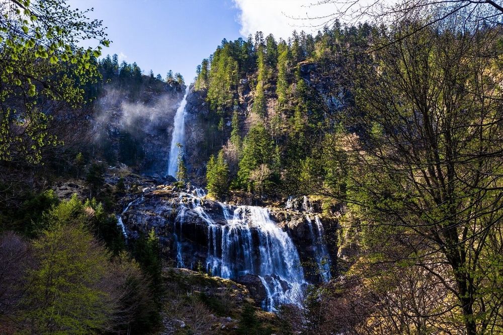
© Shutterstock
 Votre guide Ryo
Hiking in Ariège: 12 Routes to Discover the Pyrenees in 2026
Hiking in Ariège is one of the rare places where you can set out in July without crossing a single-file line of hikers, bivouac on a ridge at 2,400 meters without fighting for a spot, and return in the evening to a gîte d'étape for €22 a night. This is no accident: with fewer than 12 inhabitants per square kilometer, Ariège is one of the least densely populated areas in metropolitan France, and its 4,890 km² of Pyrenean territory remains remarkably unspoiled. From the family-friendly Beille plateau, where marmots watch you unpack your sandwiches at 1,800 meters above sea level, to the 3,077 meters of the pic de Montcalm — the first 3,000-meter summit coming from the Mediterranean — hiking in Ariège covers every level and every ambition. To round off your exploration of Ariège's heritage, the Ryo audio guide tour of Foix immerses you in the history of the county from the departmental capital.
In this guide: the massif des Trois Seigneurs and its 360° panorama over three valleys, the gorges de la Frau carved into black limestone between Montségur and Bélesta, the sentier cathare in its Ariège section with its castles perched on impossibly steep rocky spurs, and the glacial lakes of Vicdessos in a blue that looks like nothing else in the Pyrenees. Technical data sheets for each route, a season-by-season calendar, and all the practical information you need to plan your hiking trip in Ariège in 2026.
Why Ariège Is an Exceptional Hiking Destination
The first reason is geographical. The Ariège territory stretches more than 130 kilometers from north to south, from the Pamiers threshold at 280 meters to the Spanish border ridge at over 3,000 meters. This vertical range of nearly 2,800 meters concentrated within a single department is exceptional in France. For hikers, it translates into a diversity of terrain and atmosphere found nowhere else at this scale: Mediterranean limestone meadows in the foothills, dense beech and fir forests at the montane level, heather and broom moorlands on intermediate ridges, granite and schist scree above 2,000 meters. Whether you are looking for an easy hike in Ariège beside a lake or a high-altitude challenge, the department caters to every profile.
The geology adds a further layer of fascinating complexity. The Hercynian basement — a primary massif 300 million years old — outcrops at altitude and gives the landscapes that dark, almost violet tinge in overcast weather that is so characteristic of the Ariège Pyrenees. The limestone rocks of the foothills have carved out the gorges, caves and springs that make the region famous for prehistory: the grotte de Niaux and its Magdalenian bisons painted 14,000 years ago on the walls of the Salon Noir, the Bédeilhac cavities, the Vache rock shelter. You are literally walking on 300 million years of history.
The second advantage is human. Shepherds were still moving their flocks along these tracks two decades ago, and their regular passage helped maintain a remarkably coherent network of marked trails. Cairns are repositioned each season, springs are signposted, and dangerous sections are secured with metal cables. Compared with the overcrowded routes of the Southern Alps or the Catalan Pyrenees, Ariège offers a genuinely wild hiking experience, free from the industrial dimension that has spoiled other mountain destinations.
A third advantage, rarely mentioned: value for money. A well-located gîte d'étape costs between €18 and €25 per night with half board, high-mountain refuges charge between €35 and €45, and the vast majority of trailheads are accessible free of charge from public car parks or villages. Compare this with the €55 to €70 charged by Alpine refuges or the paid access of certain Pyrenean massifs on the Spanish side.
The Massif des Trois Seigneurs: A 360° Panorama at 2,199 m at the Junction of Three Valleys
This is probably the signature hike of central Ariège, the one locals recommend first to visitors who don't know the department. The massif des Trois Seigneurs (Col de la Crouzette, 09300 Lavelanet, rated 4.9/5 on Google from 105 reviews) takes its name from a medieval reality: this massif once marked the junction of the lands of three feudal lords — the counts of Foix, Couserans, and Sabarthès. The main summit reaches 2,199 meters, but it is less the absolute altitude than the exceptional geographical position that makes it such an outstanding viewpoint: standing at the crossroads of three deep valleys, on a clear day the eye reaches from the Toulouse plain on the northern horizon to the Spanish summits in the south.
The classic route starts from Camarade (740 m). The trail first enters a dense beech-fir forest where light barely filters through — one of the finest forest corridors in the department. Around 1,600 meters, the forest stops abruptly and the first summer pastures open onto the horizon; the sense of release is striking for anyone emerging from the shade of the trees. The climb continues along grassy ridges dotted with cayolars, those dry-stone shepherd's huts inherited from the transhumance tradition.
Total elevation gain from Camarade: 1,460 meters. Round-trip duration: 4 hours for a regular walker. Difficulty is rated T3 (alpine hiking) on the exposed ridge sections, but the trail remains well marked throughout. Trekking poles are recommended for the descent, as the terrain is slippery after rain.
On the summer pastures, you will likely encounter patous — large white livestock guardian dogs that watch over the sheep flocks. The right approach: slow down, do not run, give the flock a wide berth without trying to pet the dogs. They are doing their job; you are doing yours.
From the summit, on a clear day, identify to the south-east the pic du Saint-Barthélemy (2,348 m) by its slightly flattened shape. To the south, the wall of border summits forms a continuous screen of granite. To the north-west, the silhouette of the château de Montségur — invisible yet present from certain points along the ridge — adds depth to the historical panorama. It is this layering of wilderness and medieval history that defines Ariège better than any description.
Challenging variant: from Appy, a 7-hour ridge traverse links the massif to the Ariège valley via exposed arêtes. Reserved for experienced hikers, in dry conditions only. Water available up to 1,500 meters. No staffed refuge at the summit; bivouacking is permitted on the high pastures in compliance with the rules regarding distance from water sources and dwellings.
Access from Foix: 35 km via the D117 towards Lavelanet, then head for Camarade. No shuttle service; a car is essential.
The Pic du Saint-Barthélemy: The Cathars' Lookout at 2,348 m
Its history begins long before marked trails existed. The pic du Saint-Barthélemy (Montferrier, 09300 Montferrier, rated 4.8/5 on Google from 42 reviews) was the natural watchtower of the faidits — those Occitan knights dispossessed after the crusade against the Cathars in the 13th century. From this summit at 2,348 meters, they monitored the movements of royal armies in the valleys below while maintaining visual communication lines with the castles of Montségur and Roquefixade. The metal cross erected at the summit much later says nothing of all this, but the grey cliffs framing it do.
The route starts from Montferrier (930 m). The red-and-white marked trail (GR) first crosses heather and broom moorland, then a grassy plateau before tackling the slightly exposed final ridge. Elevation gain: 1,420 meters. Round-trip duration: 5 hours. Waymarking is reliable throughout, including early in the season when residual snow patches may persist until mid-June on the north-facing ridge.
The ornithological interest of this summit deserves a mention. Ariège is home to one of the largest breeding populations of griffon vultures in the French Pyrenees, and the Saint-Barthélemy ridge is one of the best observation posts in the department. In good weather, a dozen individuals may circle simultaneously on thermals above the cliffs. The bearded vulture, less frequent, is also observed in this sector — recognizable by its diamond-shaped silhouette and orange facial mask. Look up, particularly mid-morning when thermals are forming.
The summit panorama extends to the west-north-west over the château de Montségur, less than 15 kilometers away as the crow flies, allowing you to grasp visually the defensive logic of the Cathar fortification network. In perfectly clear conditions, the Gulf of Lion appears to the east as a shining strip between the summits. In the foreground, the lakes of Dourbies and Rabassolles glisten at 2,000 meters, framed by granite walls.
For a two-day hike: combine the ascent from Montferrier with a night at the refuge de la Plagne (1,860 m), then descend via the Dourbies valley towards Dreuilhe. This 22-kilometer traverse is one of the finest long loops in the department, with a remarkable variety of landscapes ranging from alpine moorland to the forests of the lower valley.
Access from Lavelanet (15 km) or from Foix (35 km) via the D117. Parking in Montferrier. Recommended departure before 8 am to avoid early-afternoon storms.
The Lac de Beys and the Glacial Cirque of Auzat
The Vicdessos valley is less well known than the massifs of the pays d'Olmes, but it concentrates some of the most intense glacial landscapes in Ariège. The lac de Beys (Route de Soulcem, 09220 Auzat, rated 4.9/5 on Google from 41 reviews) is the most accessible of this string of high-altitude lakes — the ideal candidate for an easy lake hike in Ariège: a body of water at 1,750 meters, set between vertical rock faces polished by glaciers over millennia until their final retreat around 12,000 years ago. The water is a blue-green that late-morning light transforms into something almost surreal.
Start from Auzat (720 m), a former mining town that reinvented itself around mountain tourism after the talc mines closed in the 1990s. The road climbs the valley to the EDF Soulcem dam at 1,380 meters — the effective trailhead after parking in the designated car parks. From the dam, the climb to the lake takes 2 hours for 370 meters of elevation gain on a well-marked path — a profile accessible to regular walkers without high-mountain experience.
Take your time at the lake's edge. The glacial cirque above it features remarkable limestone lapiaz — those grooves and hollows carved by meltwater into bare rock, forming patterns of strange geometric precision. At the far end of the cirque, the pic de l'Étang Fourcat (2,849 m) closes the horizon with a verticality that impresses even hikers accustomed to high mountains.
For strong legs, the ascent to the étang Fourcat from the lac de Beys adds 3 hours and a further 1,100 meters of elevation gain. The refuge du Fourcat (staffed from June to September) allows an overnight stop on site; contact: 05 61 64 88 78, booking advised in July and August.
Notable flora in this area: sundew (a carnivorous plant) colonizes the sphagnum bogs between 1,600 and 1,900 meters. Purple saxifrage carpets the rocks in violet as soon as the snow melts in June. Transhumant sheep flocks occupy the summer pastures from July to September; dogs must be kept on a lead at all times in this area.
Possible 6-hour loop: from Auzat, lac de Beys, étang Fourcat, return via the col de Risoul. Experienced level required; IGN map 2148 OT essential.
The Gorges de la Frau: Hiking Through Ariège's Dark Forest
There is something slightly supernatural about the gorges de la Frau (Route des Gorges, 09300 Bélesta, rated 4.1/5 on Google from 19 reviews). Nestled in a fold of the pays d'Olmes between Montségur and Bélesta, they open onto a path carved into a limestone cliff face above a torrent — the gave de Dourbies — which over millennia has cut a narrow gorge into an almost matte black rock. The inhabitants of Comus, the village above, call them 'their secret garden', a phrase heard often in the Pyrenees, but one that genuinely holds true here.
The standard out-and-back route starts from Comus (1,050 m) and descends to the gorge entrance on the Bélesta side: 12 kilometers, 3h30 of walking, 300 meters of modest elevation gain. An ideal profile for a family outing provided everyone has good footwear, as the path can be damp even in summer. The descent from Comus passes through a forest of century-old beech trees with silver-grey trunks that create an almost hypnotic atmosphere on misty days. The filtered light gives the mosses, ferns and grasses a saturated green that photographers seek out particularly in autumn, from October to mid-November.
The gorge itself begins roughly 300 meters below Comus: the limestone walls close in, the torrent periodically disappears beneath the rock, and the vegetation shifts from beech to ash, elm and Montpellier maple — thermophilous species that signal the microclimatic change at the entrance to the defile. The walls reach 200 meters in places, framing the path in a way that is both oppressive and magnificent.
Practical advice: if prolonged rain has fallen on the plateau, the Dourbies can rise rapidly. Check with the Mairie de Bélesta before setting off if storms have occurred in the previous 24 hours (04 61 03 05 71). The trail may be closed temporarily during flooding. In summer, the gorge provides a natural coolness that is invaluable when temperatures on the surrounding plateaus exceed 30 °C — the temperature inside the gorge is often 8 to 10 °C lower than outside.
Recommended combination: gorges de la Frau in the morning, château de Montségur in the afternoon from the village (45-minute climb). The two sites are 12 kilometers apart by road.
The Sentier Cathare: From Puivert to Foix via Historic Rocky Spurs
The sentier cathare is no ordinary hiking trail. The 250 kilometers linking Port-la-Nouvelle on the Mediterranean to Foix unfold across the very lands where, between 1209 and 1255, the greatest political and religious crisis of the Occitan Middle Ages played out. The castles you encounter — Quéribus, Peyrepertuse, Montségur, Roquefixade — were not mere fortifications: they were the last refuges of a civilization condemned by Rome and by Paris. To hike the Ariège section of the sentier cathare is to traverse physically this territory of resistance.
The most dramatic section covers 28 kilometers from Puivert to Montségur over two days. Day one climbs from Puivert (550 m) through Scots pine forests on the plateau de Sault, then crosses that plateau at a steady altitude of 1,000 meters with open views of the Pyrenean chain. Duration: 7 hours, elevation gain: 700 meters. Accommodation possible in Comus.
Day two is the most memorable on the Ariège trail. The descent from the plateau into the gorges de la Frau, followed by the gradual climb towards the pog de Montségur — that rocky pinnacle at 1,207 meters where over 200 Cathar perfects held a ten-month siege between 1243 and 1244 before descending to a collective burning — transforms the hike into something that goes beyond mere walking. The physical effort creates a particular resonance with the history of the place: you arrive at the castle breathless, as they climbed it exhausted.
The château de Montségur (Le Village, 09300 Montségur, rated 4.6/5 on Google from 2,444 reviews) is a listed historical monument, open year-round. Access from the village (888 m): 45 minutes via a marked trail with metal handrails on the steepest sections. Admission charged (approximately €6, price to be confirmed). Views from the ruins over three converging valleys.
Possible extensions: from Montségur, the sentier cathare continues towards Roquefixade (ridge-top castle, 1,060 m), then on to Foix (an additional 35 km, two days). The final section towards Foix passes through Montferrier and Baulou. To complete this immersion in the medieval history of the county, the Ryo audio guide tour of Foix guides visitors through the lower town and the counts' castle via the app — a natural extension of the sentier cathare for hikers who want to understand how this story ended.
Red-and-white waymarking (GR 367) throughout the Ariège sections. FFRandonnée topo-guide available in bookshops in Foix. Accommodation along the route: gîte de Comus (05 61 01 02 22), gîte de Montségur (05 61 01 10 27).
The Beille Plateau: Family Hiking at 1,800 m
If you are looking for a family hike in Ariège accessible to children from age 5 or 6 without giving up altitude and Pyrenean scenery, the Beille plateau (Route de Beille, 09310 Les Cabannes, rated 4.8/5 on Google from 90 reviews) is your answer. Its uniqueness lies in the access road: a 19-kilometer forest road from Les Cabannes climbs directly to 1,800 meters above sea level. This high-altitude starting point eliminates the 2 to 3 hours of laborious uphill walking that is often the main obstacle for families, and allows you to enjoy the open subalpine landscapes straight away.
Two marked circuits start from the main car park. The circuit des Laquets (5 km, 1h30, 120 m elevation gain) loops around a series of small peat lakes where carnivorous plants are concentrated: round-leaved sundew and Pyrenean butterwort cover the wet areas from July to September. Children are invariably fascinated by these insect-trapping plants — allow time for observation. The circuit du Peyrissat (9 km, 3h, 320 m elevation gain) climbs to the ridge at 2,100 meters with a panorama over the mont Ceint massif and the Ariège valley.
In summer, between 8 and 10 in the morning, marmots emerge from their burrows to warm up in the sun and feed in the meadows around the car park. A few chamois regularly come down from the surrounding ridges in the early morning. Wildlife is the main attraction for families with children — bring lightweight binoculars; they completely transform the experience.
In winter, Beille operates as a cross-country skiing resort with 36 km of marked pistes — one of the first resorts of this type in the Pyrenees. It is also ideal terrain for a winter snowshoe hike in Ariège: marked routes, partly groomed, with no avalanche risk on the plateau. The summer infrastructure (car parks, toilets, snack bar) benefits hikers too: the plateau is one of the best-equipped trailheads in the department.
Important practical information: the access road is closed after fresh snowfall, roughly from October to May. Confirm conditions before setting off: 05 61 64 79 02. In July and August, the car park may be full by 10 am — arriving before 9 am is recommended. No drinking water on the plateau outside the snack bar.
The Pic de Montcalm: The Roof of Ariège at 3,077 m
For some hikers in Ariège, this is a lifelong goal. The pic de Montcalm (Vallée d'Auzat, 09220 Auzat, rated 4.8/5 on Google from 41 reviews), at 3,077 meters, is the highest point in the department and the first 3,000-meter Pyrenean summit coming from the Mediterranean. Technically, this is hiking, not mountaineering: no glacier to cross, no fixed ropes required, no crampons needed in normal summer conditions. But it is high-mountain hiking that demands serious preparation, full equipment, and careful attention to weather forecasts.
The standard route begins with a 3-hour climb from the Artigue car park (1,380 m) to the refuge du Pinet (2,250 m). The Pinet is the central logistics point for the ascent: staffed from June to September, it offers half board at €38 (booking essential in high season, 05 61 64 87 66). Sleeping at the refuge allows you to set off for the summit at 6 am, before the characteristic afternoon storms of July and August begin to form.
From the refuge, a further 2 hours lead to the summit: first across grassy terrain, then over granite scree, then across a few dozen meters of easy rock where hands are needed. The total elevation gain from the valley reaches 1,700 meters — the figure that qualifies the undertaking. You should have several hikes of over 1,200 meters of elevation gain behind you without difficulty before attempting Montcalm.
The view from the summit is one of the most expansive in the French Pyrenees. In perfectly clear conditions, some hikers claim to see both the Mediterranean to the east and the Atlantic to the west — both seas of the continent from a single point. More concretely, the Pique d'Estats (3,143 m), the highest point in Catalonia, stands out to the east just a few hundred meters away. The Franco-Andorran border ridge stretches as far as the eye can see to the south.
Safety: do not attempt the ascent if afternoon storms are forecast. In the high mountains of Ariège, storms can form in under an hour in July and August. A simple rule: summit before noon, begin descent before 1 pm. Seek shelter at the refuge or on the grassy slopes below if conditions deteriorate rapidly.
The Montcalm area falls within the Parc naturel régional des Pyrénées ariégeoises established in 2009. Rules of use: no fires, bivouacking at least 200 meters from any body of water, all waste to be carried out without exception.
The Tarascon-sur-Ariège Area: Hiking Between Cliffs and Prehistory
The reputation of Tarascon-sur-Ariège rests first and foremost on the grotte de Niaux (Route de la Grotte, 09400 Niaux, rated 4.6/5 on Google from 831 reviews) and its Magdalenian bisons painted 14,000 years ago on the walls of the Salon Noir — one of the world's major sites of cave art, on a par with Lascaux or Altamira. But beyond the caves, the Tarascon area offers an underrated hiking terrain among the limestone cliffs and wooded heights that flank the Ariège valley.
The chemin des lauzes from Niaux (500 m) to the col du Sabart (780 m) is a 2-hour route that follows limestone cliffs covered in Mediterranean vegetation: wild thyme, lavender, thermophilous juniper, rosemary at lower altitudes. The trail then opens onto a completely different landscape — greener and more humid — on the northern side of the pass. The view over the steep Ariège valley from the limestone cornices, and over the château de Miglos clinging to its own cliffs opposite, is well worth the modest effort of the climb.
For a longer hike, the tour de Roquefixade from the village (960 m) covers 8 kilometers in 3 hours with a final climb to the Cathar castle (1,060 m). The ruins stretch along a narrow rocky ridge, free to enter, with direct views of Montségur in clear weather. The two Cathar castles 'face' each other less than 20 kilometers apart, and from the ruins of Roquefixade you immediately understand why this network of visual fortifications was so effective.
The Ryo audio guide tour of Tarascon-sur-Ariège guides visitors through the lower town and its links with prehistory via the app — a cultural complement. Recommended combination: the Tarascon audio walking tour in the morning, the chemin des lauzes hike or the tour de Roquefixade in the afternoon.
Access from Foix: 16 km via the N20. The grotte de Niaux requires advance booking (05 61 05 10 10); slots fill up quickly in July and August.
Ariège Hiking Areas and Trail Difficulty Levels
Ariège divides into three distinct zones that hikers should know before planning their trip, as they correspond to very different profiles and expectations. Before setting off, a 1:25,000 hiking map of Ariège remains the essential reference tool for locating these areas.
The Plantaurel and the foothills to the north-west form the mid-mountain hiking zone. Maximum altitudes between 800 and 1,200 meters, downy oak and chestnut forests, wide and well-marked paths. Level required: beginner to intermediate. The sentier cathare in its lower sections (Puivert–plateau de Sault) falls into this category.
The central Ariège Pyrenees — the pays de Tarascon, the Vicdessos valley, the Couserans — offer intermediate routes between 1,000 and 2,400 meters. This is where glacial lakes, summer pastures, and day hikes with 800 to 1,400 meters of elevation gain are concentrated. Level required: intermediate to experienced. This zone will satisfy the majority of hikers coming from the lowlands with a regular practice: gorges de la Frau, massif des Trois Seigneurs, lac de Beys, pic du Saint-Barthélemy, Beille plateau from the car park. Hiking in Ariège on the Couserans side, around Bethmale and the mont Valier, deserves a weekend in its own right.
The Ariège Pyrenees proper to the south cover the major ascents and high-mountain routes above 2,500 meters: the pic de Montcalm (3,077 m), the Pique d'Estats (3,143 m on the Andorran side, accessible from Ariège), the mont Valier (2,838 m in the Couserans), the pic de Bassiès (2,702 m). Level required: experienced to expert. These routes demand genuine high-mountain experience, familiarity with specialist weather bulletins (Météo-France mountain forecasts), and ideally a night at a refuge for early-morning starts.
The gradings used by Ariège hikers correspond to the Swiss Alpine Club (SAC) scale:
- T1–T2: easy to moderate hiking, well-marked path, no exposed sections
- T3: alpine hiking, exposed sections, hands occasionally needed
- T4–T5: difficult alpine terrain, frequent off-trail sections, reserved for experienced hikers
The vast majority of routes in this article fall in the T2–T3 range. The pic de Montcalm varies from T3 (in fine weather, in summer) to T4 (in winter or early-season conditions).
A useful resource: the Comité Départemental du Tourisme de l'Ariège publishes a graded list of its 150 marked trails, downloadable from its website. The PGHM de Tarbes-Lourdes updates a snow and mountain conditions bulletin every week from May to October.
When to Hike in Ariège and How to Plan Your Trip
The hiking season in Ariège follows a different logic depending on altitude, and confusing the two calendars is the main source of planning errors.
Below 1,500 meters — gorges de la Frau, sentier cathare (lower sections), Cathar village circuits, chemin des lauzes from Niaux — hiking is possible from March to November. March and April offer flowering meadows and leafless beech forests that give the gorges an otherworldly light. Autumn, from October to mid-November, is the season preferred by photographers for the foliage colours.
Between 1,500 and 2,200 meters — Beille plateau, massif des Trois Seigneurs, lac de Beys, pic du Saint-Barthélemy — the main season runs from mid-June to mid-October. Residual snow patches can complicate certain sections before mid-June, and the first patches of verglas appear on the ridges from mid-October.
Above 2,200 meters — pic de Montcalm, Pique d'estats, mont Valier, étang Fourcat — the window narrows to July to September. Staffed refuges are generally open from 15 June to 15 September.
The month of September is the connoisseurs' choice. Footfall drops by 40% after 15 August, the colours begin their transformation in the beech forests, storms are less frequent and weather conditions more stable. Refuges still accept last-minute bookings. Cool but pleasant temperatures up to 2,500 meters.
Avoid the weekends of 14 July and 15 August at the most popular sites (Montségur, Beille plateau, Montcalm). Prefer weekday departures or explore the lesser-known lateral valleys — Massat, the Bethmale valley, Vicdessos — which offer equally fine routes with a fraction of the crowds. The étang de Bethmale, nestled in a beech forest in the Couserans, is one of the most photographed lakes in the department.
Practical Information: Accommodation, Transport, and Equipment for Hiking in Ariège
Mountain accommodation
Ariège has around fifty gîtes d'étape and staffed refuges along its main routes. The high-mountain refuges — refuge du Pinet (2,250 m), refuge du Fourcat, refuge de Bassiès (1,647 m) — are staffed from mid-June to end of September and offer half board between €35 and €45. Village gîtes in Montségur, Comus, Auzat, and Camurac remain open longer and charge between €22 and €38 for a bed and breakfast.
Booking from May onwards is essential for July and August nights: accommodation capacity in the Ariège mountains is structurally limited, and popular refuges (especially the Pinet) fill up by June for summer weekends.
Getting there
Almost all trailheads require a personal vehicle. Foix station is the natural logistics base: connected to Toulouse in 1 hour by TER train (hourly departures during the day), it gives access to the main valleys within 20 to 45 minutes by road. This is what makes hiking in Ariège close to Toulouse such an easy weekend getaway to organise. Since 2023, the Conseil Départemental has funded summer shuttle buses to certain mountain sites (Beille, Montségur, Vicdessos valley); for information call 05 61 02 09 70. These shuttles depart from Foix or Tarascon and run from mid-July to end of August.
Equipment
High-ankle hiking boots with Vibram soles — the Ariège terrain is often damp even in summer and wet schist is treacherous. A lightweight waterproof in your pack even in fine weather: altitude storms can form in under an hour in July. IGN 1:25,000 map of the relevant area (Pyrenees series: 2148 OT, 2147 ET, 2048 OT depending on the zone) — dead phones or phones without signal are the leading cause of PGHM callouts. Trekking poles are strongly recommended for elevation gains over 1,000 meters: your knees will thank you on the descent.
Mountain emergencies
The PGHM de Tarbes-Lourdes responds throughout the Ariège Pyrenean zone. Emergency number: 15 (SAMU) or 18 (fire brigade) from a mobile phone. In areas without coverage: activate a PLB beacon if you carry one, or send a member of the group to fetch help from the nearest village. The European emergency number 112 sometimes works where national numbers have no signal.
FAQ
What is the best hike for beginners in Ariège?
The Beille plateau is the ideal entry point. The Laquets circuit (5 km, 1h30, 120 m elevation gain) starts from a car park at 1,800 meters and eliminates any long uphill climb. Accessible from age 5–6 with good footwear. The gorges de la Frau from Comus is the second option: well-marked terrain, 300 meters of elevation gain over 12 km, spectacular scenery and guaranteed cool temperatures even in midsummer.
Which hikes can be done as a day trip from Toulouse?
Foix is 83 km from Toulouse (1 hour by car via the A66). From Foix, the most accessible day hikes are the massif des Trois Seigneurs (1 hour drive + 4 hours walking), the château de Montségur (1h30 drive + 45-minute climb), and the gorges de la Frau from Comus (1h15 drive + 3h30 walking). Hiking in Ariège close to Toulouse still involves 2 hours of round-trip travel, so set off early.
Do you need a guide to hike in Ariège?
No, for standard marked routes. GR trails (red-white) and local footpaths (yellow) are well maintained and mapped on IGN maps. For ascents above 2,500 meters (Montcalm, Fourcat, Valier), a professional mountain guide is recommended if you have no high-altitude experience. The Bureau des Guides de l'Ariège (Foix, 05 61 65 12 38) offers guided day trips or multi-day outings suitable for all levels.
Can you hike with dogs in Ariège?
Yes, with important restrictions. Dogs must be kept on a lead in grazing areas where livestock guardian dogs (patous) are present. Some refuges do not allow dogs inside — check at the time of booking. During hunting season (September to February depending on the zone), signage indicates the areas to avoid. The regional natural park regulations require leads in the park's core zones.
Which guidebooks are recommended for hiking in Ariège?
The Rando Éditions series offers specific guides with full technical data sheets. The Comité Départemental du Tourisme de l'Ariège publishes free downloadable trail cards on its website (ariegepyrenees.com). For GR trails and the sentier cathare, FFRandonnée topo-guides are the reference. The IGN Rando app lets you download 1:25,000 maps for offline use — essential in areas without mobile coverage.
What else is there to do in Ariège besides hiking?
The grotte de Niaux (advance booking required), the Cathar castles of Montségur and Roquefixade, the thermal baths of Ax-les-Thermes for muscle recovery after a long day's walk, and the parc de la Préhistoire in Tarascon-sur-Ariège for families. Through the Ryo app, the Ryo audio guide enriches visits to villages and heritage sites with content on the region's Cathar and medieval history — a natural extension of your walks along the sentier cathare.
Conclusion
Ariège makes a rare promise in the landscape of French hiking destinations: high-mountain scenery accessible without the overcrowding that has spoiled the Alps and the Catalan Pyrenees, historic trails steeped in a Cathar memory still tangible in the ruins, and a proximity to Toulouse that makes a hiking trip easy to organise without complex logistics. From the family-friendly Beille plateau to the vertiginous ridges of the pic de Montcalm, hiking in Ariège covers a complete range for every level and every season.
To prepare your trip and explore Ariège's heritage before or after your hikes, the Ryo app offers audio guide tours of the department's main historical sites. The Ryo audio guide tour of Foix is the natural starting point: the county capital concentrates the essence of Ariège's medieval memory within a few kilometers of alleyways and ramparts. Whether boots on feet or phone in hand, this department rewards you on every outing.