Créé par Romane, le 11 juin 2026
Votre guide Ryo
The 10 Longest Rivers of France: Everything You Need to Know (2026)
© Shutterstock
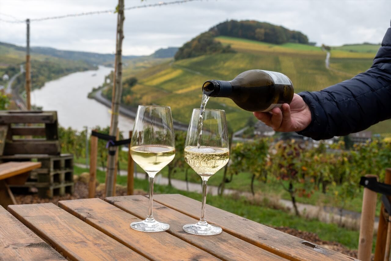
France officially has 35 rivers flowing directly into the sea or ocean, but four of them alone cover over 3,600 kilometers of waterways shaping landscapes, cities and entire civilizations. Behind this figure, an often little-known reality: the Loire, the longest French river at 1,006 km, whose valley is classified as UNESCO World Heritage as a 'living cultural landscape', remains the only major river in Western Europe never channeled on a large scale, with a largely wild course. The Rhône supplies drinking water to over 4 million people and produces more hydraulic electricity alone than all other French rivers combined. The Garonne sees its flow vary from single to sixfold depending on the season. Want to understand how these liquid arteries built France? This article explores them one by one: length, watershed, cities crossed, geographical anecdotes and good tips for discovering them from the banks. Several of these rivers run alongside cities covered by the Ryo application, with audio-guided tours to explore their banks and historic neighborhoods at your own pace.
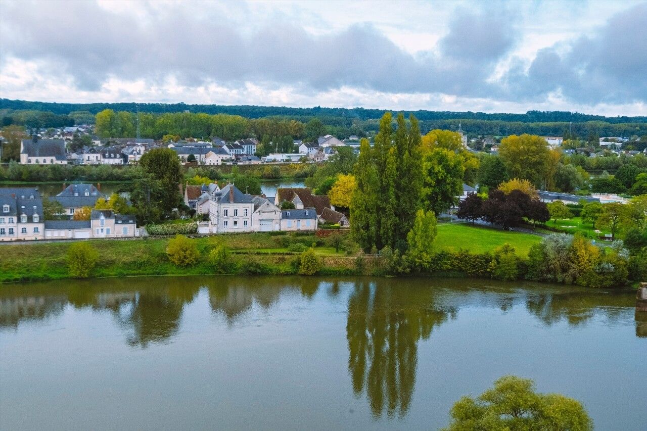
1. The Loire, 1,006 km, the Longest River in France
The Loire is born at 1,408 meters altitude, on the southeast slope of the Gerbier-de-Jonc massif in Ardèche, from a source that looks more like a muddy stream than a mythical river. It then crosses the Massif Central, goes north to Orléans, then heads west to reach the Atlantic at Saint-Nazaire after 1,006 kilometers, making it the longest entirely French river.
Its watershed covers 117,800 km², about one-fifth of the metropolitan territory. This figure gives an idea of its power: the Loire drains precipitation from twelve departments, from Cevennes rains to Aubrac snows. Yet its flow is capricious. At Orléans, it oscillates between 37 m³/s in summer low water and over 6,000 m³/s during major floods, a ratio of 1 to 160 making it one of Europe's most unpredictable rivers.
It is precisely this irregularity that made the fortune and misfortune of Loire cities. Orléans, crossed in its center by the river, was for centuries France's first commercial port thanks to Loire navigation. The city owes its medieval development as much to Joan of Arc as to the traffic of flat-bottomed boats called toues and gabares that carried salt, wine and cut stone upriver. Today, Ryo's Ryocity in Orléans lets you rediscover these traces in the historic center streets.
Further west, Blois and its Renaissance castles cling above the levees, these dikes built from the 16th century to contain the river's anger. Tours, nicknamed the 'Little Paris' of the Loire, concentrates the densest network of troglodytic tuffeau caves in the entire valley. Saumur and its sparkling wines, Angers with its Apocalypse castle, Nantes finally, former capital of the dukes of Brittany transformed into a creative metropolis, each owes its urban identity as much to the river as to its political history.
The Loire Valley was inscribed on UNESCO's World Heritage List in 2000 in the 'living cultural landscape' category. What strikes geographers is that unlike the Rhône or Seine, the Loire has never been rectified or channeled on a large scale. Its boires (secondary arms), mobile sand islands and gravel banks form an ecosystem of exceptional richness: over 2,000 animal species are recorded there, including the European beaver, Atlantic salmon and great egret.
To explore the Loire by bike, the Loire à Vélo route runs along the river for 900 km from source to mouth, ranked among Europe's ten best cycling routes. The Loire Castles Ryotrip designed by Ryo allows you to connect the valley's emblematic stages with an audio guide in your ear.
2. The Rhône, 812 km, France's Hydraulic Power
The Rhône is the only major French river that descends from the Swiss Alps before crossing France. It rises from the Rhône glacier in Switzerland at 2,208 meters altitude, crosses Lake Geneva and crosses the Franco-Swiss border at Geneva. Of its 812 kilometers total course, 522 kilometers flow through France before emptying into the Mediterranean, west of Marseille, via the Camargue delta.
What distinguishes the Rhône from all other French rivers is its exceptional average flow: 1,690 m³/s at its mouth, compared to 840 m³/s for the Loire and 450 m³/s for the Seine. This hydraulic power has been put to the service of electricity production: the Compagnie Nationale du Rhône (CNR) operates 19 dams and hydroelectric power stations on the French river, producing annually about 25 TWh, equivalent to the electricity consumption of the Île-de-France region.
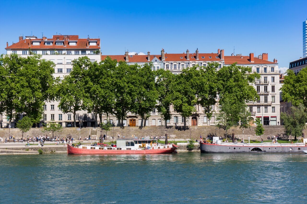
Lyon, city founded by the Romans at the confluence of the Rhône and Saône, remains the river's great metropolis. The Presqu'île, between the two waterways, concentrates in a few hectares an architectural and gastronomic density that few French cities equal. The Rhône flows there with perceptible vigor: during spring floods, the left bank quays sometimes disappear under one to two meters of water in a few hours. The Ryo audio guide of Lyon allows you to explore this territory going up from the river to the Croix-Rousse traboules.
Going down the Rhône from Lyon, you cross a succession of contrasting landscapes. Vienne and its Roman remains, an amphitheater carved in rock, an almost intact temple of Augustus, dominate the river from their granite spur. Valence, gateway to the South, marks the point where the Rhône changes character: the north winds (the mistral) are felt there for the first time, announcing Provence. Ryo's Ryocity of Valence traces these stages.
The Camargue, Rhône delta inscribed on the Ramsar Convention since 1971, is one of Western Europe's largest deltas with its 85,000 hectares of marshes, ponds and salt plains. Pink flamingos, black bulls, white horses: the delta has unique fauna, and the river's two arms, the Grand Rhône and Petit Rhône, create a landscape more associated with sub-Saharan Africa than southern France. Arles, gateway city to the Camargue, synthesizes two millennia of Rhône history.
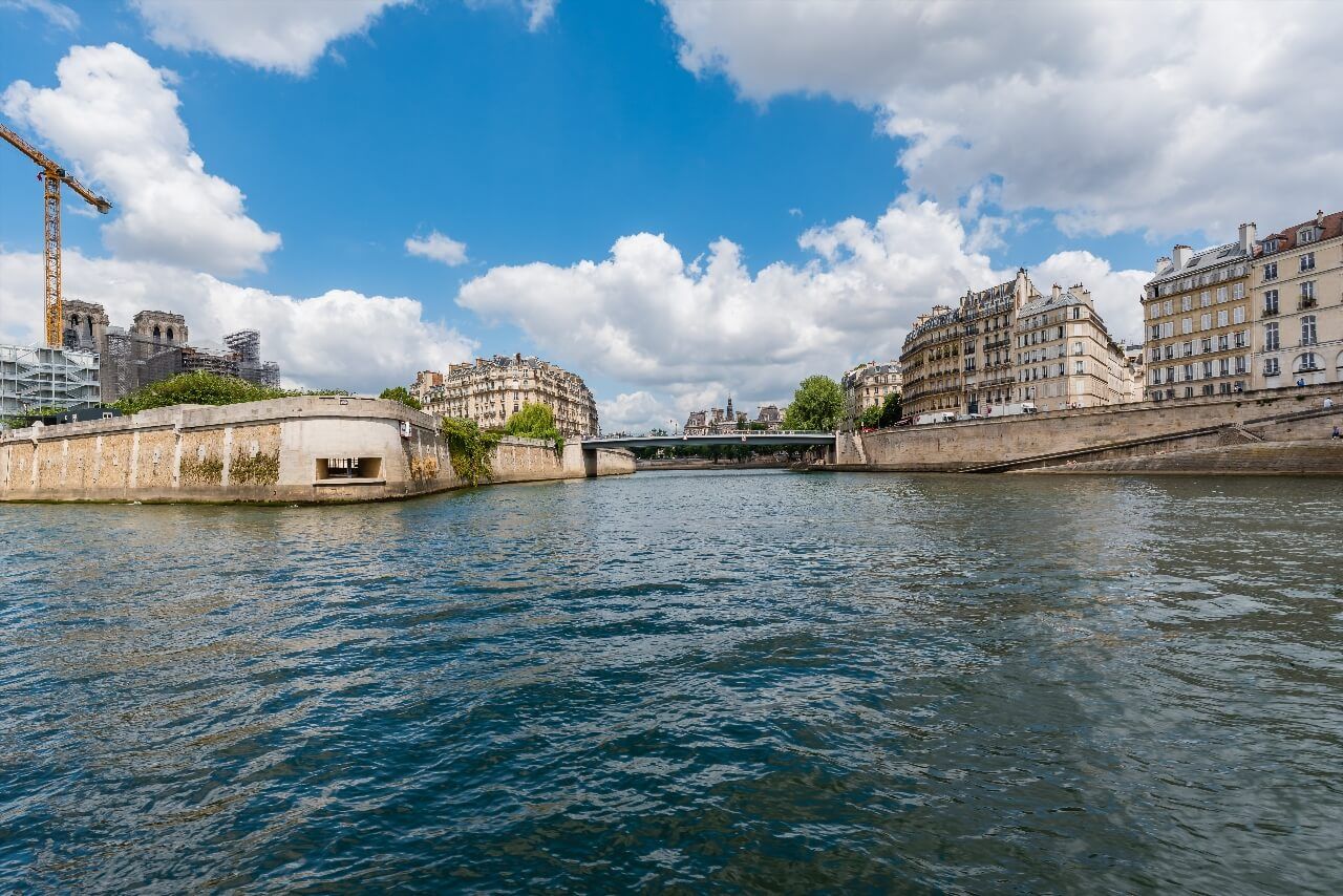
3. The Seine, 775 km, the River of the Capital
The Seine is probably France's most famous river, not because it is the longest - it ranks third with 775 kilometers - but because it crosses Paris, the capital, over 37 kilometers and carries France's symbol in the world imagination. Its source, a small resurgence in a wooded valley at Source-Seine (Côte-d'Or), is topped by a statue of a reclining nymph offered by the City of Paris in 1867, a gift from the metropolis to its own origin.
The Seine's watershed is France's fourth largest with 78,650 km², but it is by far the most populated: nearly 30% of the French population lives there, about 20 million people. This human concentration explains why the Seine is also the country's most monitored river: more than 300 monitoring stations continuously analyze its quality, flow, temperature and pollution levels.
The Seine crosses history-laden cities well before reaching Paris. Troyes, historic capital of Champagne with its half-timbered houses clustered around its Gothic cathedral, develops on the banks of the still young Seine. Sens, first city in France to build a Gothic cathedral in the 12th century, Saint-Étienne Cathedral, marks the river's middle course. Fontainebleau and its 25,000 hectare state forest then follow the meanders before the river plunges toward the Paris region.
In Paris, the Seine was classified as UNESCO World Heritage in 1991 with its banks and thirty-seven bridges. The Bouquinistes, these booksellers installed on the quays since the 16th century, constitute the world's largest open-air bookstore with their 240 green boxes deployed over three kilometers. Downstream from Paris, the river gradually widens. Rouen and its cathedral with facades painted by Monet, Vernon facing Giverny, Caudebec-en-Caux where the mascaret, a rising tidal wave, could once reach two meters high: the Seine valley is a concentrate of Norman heritage.
The Seine flows into the English Channel between Le Havre and Honfleur, forming France's largest estuary with 250 km² surface area. The Pont de Normandie, inaugurated in 1995, spans the river there with an 856-meter central span, the world's fourth longest cable-stayed bridge at its inauguration. Le Havre, entirely rebuilt by Auguste Perret after 1945, is inscribed on UNESCO for its reinforced concrete architecture. The Ryo audio tour of Le Havre tells this story of destruction and rebirth.
4. The Garonne, 575 km, the River of Southwest France
The Garonne is a geographical anomaly in French rivers landscape. It is born in Spain, in the Pyrenean Val d'Aran, at 1,872 meters altitude, crosses the Franco-Spanish border underground through the Trou du Toro and reappears on the French side in Haute-Garonne. Its 575 kilometers in France (total length including the Spanish section is 647 km) place it fourth among French rivers.
Its character clearly distinguishes it from other major rivers. The Garonne is a nivo-pluvial regime river: its most violent floods occur in spring, when Atlantic rains combine their effects with Pyrenean snowmelt. The 1875 flood in Toulouse remains the deadliest in French river history: 209 deaths in the Pink City and entire neighborhoods swept away by waters rising to 8.50 meters above normal level.
Toulouse, regional capital on the Garonne, is France's fourth city. It owes to the river its nickname 'Pink City', not for its terracotta bricks but because these same bricks, made from Garonne clay, redden at sunset in a light that 19th century painters came to capture from the banks. The Ryo audio guide of Toulouse explores these old neighborhoods between river and canal du Midi.
Downstream from Toulouse, the Garonne crosses a succession of medium-sized cities deeply marked by the river. Montauban and its old pink brick bridge, Agen famous for its prunes (a culture born from Garonne irrigation), Marmande and its tomatoes, Bergerac and its vines: the Garonne valley is one of the country's richest in agricultural production. In Bergerac, Ryo's Ryocity offers an immersion in this city on the nearby Dordogne.
Bordeaux marks the beginning of the estuary. From there, the Garonne receives waters from the Dordogne to form the Gironde, Western Europe's largest estuary with 75 kilometers long and 11 kilometers wide at its maximum. The estuary has been classified as UNESCO Biosphere Reserve since 2021. It still hosts populations of lampreys, shad and European sturgeon, the latter, nearly extinct, is the object of a reintroduction program of which the Garonne is one of the world pilot sites.
5. The Meuse, 486 km, the River of the Ardennes
The Meuse is born on the Langres plateau, at 409 meters altitude, and travels 486 kilometers in France before passing into Belgium then the Netherlands, where it reaches the North Sea. It is one of the few major rivers to flow northward in France, against the general slope of French terrain that orients most waterways toward the Atlantic or Mediterranean.
Its French watershed of 21,400 km² crosses Champagne, Lorraine and the Ardennes, a region historically marked by wars. Verdun is the symbol city of this conflict geography: the 1916 battle, the deadliest of World War I, was fought on both banks of the Meuse for 300 days with a toll of over 700,000 deaths. The Douaumont Ossuary (D913, 55100 Fleury-devant-Douaumont, rated 4.7/5 on Google for 8,937 reviews), visible from the river, contains the remains of 130,000 unidentified soldiers.
The Meuse is also a steel industry river: Lorraine iron deposits and Ardennes forests provided fuel and ore to blast furnaces that have lined its banks since the Middle Ages. Charleville-Mézières, capital of Ardennes, is the birthplace of Arthur Rimbaud, French literature's greatest vagabond poet, who spent his childhood watching the Meuse from the city quays.
6. The Moselle, 550 km, the River of Lorraine and Alsace
The Moselle rises in the Vosges massif, at 715 meters altitude near the Bussang pass, and travels 550 kilometers before joining the Rhine at Koblenz (Germany). In France, its 314-kilometer course structures Lorraine and borders Alsace.
It is a river with economic purpose par excellence. The Moselle canal, inaugurated in 1964, made the river navigable for large barges between Thionville and Koblenz, facilitating coal transport from the Ruhr to Lorraine steelworks and Lorraine ore in the opposite direction. Today, industrial reconversion has transformed its banks: the Metz industrial wasteland has become the Centre Pompidou-Metz, inaugurated in 2010 and welcoming 400,000 visitors annually.
Metz is the Moselle city par excellence. Its Saint-Étienne Cathedral, whose stained glass windows illuminate the nave with unique light intensity, possesses the largest stained glass surface of all French cathedrals with 6,500 m², earning it the nickname 'Lantern of God'. Ryo's Ryocity of Metz explores 3,000 years of history in a single walk.
Nancy, a little further south, was the capital of the dukes of Lorraine and preserves Place Stanislas, 18th century baroque architecture masterpiece classified by UNESCO. The Moselle passes there discreetly, but its influence on urban development is perceptible in the old tanner and weaver neighborhoods.
7. The Rhine, 190 km in France, a Border River
The Rhine is Europe's second river by average flow (2,200 m³/s at its mouth), but its French portion covers only 190 kilometers, from Bâle to Lauterbourg, along the Franco-German border. It is less a river crossing France than a river bordering Alsace, forming a natural border with Germany that history has made particularly symbolic.
In the 19th century and until 1945, the question of the 'left bank of the Rhine' was at the heart of all Franco-German wars. Today, the Kehl-Strasbourg bridge is crossed by thousands of daily commuters, tangible symbol of European reconciliation. Strasbourg, three kilometers from the river, is both capital of Alsace and seat of the European Parliament. Its Ryo Ryocity explores 'Petite France' and the old town canals.
The Grand Canal d'Alsace, built between 1928 and 1977 to divert part of the Rhine's flow, enables river navigation and hydroelectric production at the 10 power plants along the French section. This infrastructure has transformed the Alsace plain into one of France's most irrigated regions.
8. The Saône, 480 km, the Royal Tributary of the Rhône
The Saône is born in the Vosges, at 393 meters altitude near Vioménil, and travels 480 kilometers before joining the Rhône at Lyon. Technically it is a tributary of the Rhône, but its flow at Lyon (430 m³/s on average) often rivals that of the Rhône itself, which has led some geographers to propose reversing the hierarchy: isn't the Saône actually the main course, the Rhône the tributary?
This serious question rests on solid facts: the Saône is longer than the French Rhône (480 km versus 522 km in France, but the Rhône comes from Switzerland), its watershed is almost as large, and above all, its winter flow frequently exceeds that of the Rhône. But geographical tradition, established by the Romans who made their city at the confluence the crossroads of Gaul, decided in favor of the Rhône.
The Saône is a calm and slow river, very different from the torrential Rhône. It crosses Franche-Comté and Burgundy in wide meanders, watering Gray, Chalon-sur-Saône (former capital of Burgundian boating) and Mâcon before joining Lyon. Its banks are dotted with wine villages: Mâconnais and Beaujolais produce their wines on the hillsides overlooking the river.
Dole, in Franche-Comté, deserves special mention: this is where Louis Pasteur was born in 1822. The father of microbiology's birthplace is open to the public, and Ryo's Ryocity of Dole traces 1,000 years of a city that was long capital of Franche-Comté before being 'dethroned' by Besançon.
9. The Charente, 381 km, the Cognac River
The Charente is the great river of western France that we know less well. Its 381 kilometers rise in Limousin, at 286 meters altitude on the Millevaches plateau, and reach the Atlantic at Fouras, between Rochefort and Île d'Oléron. Henry IV spoke of it as the 'most beautiful stream of his kingdom', a formula that sums up its character: ample, placid, deep, this river never makes a spectacle of itself.
Its watershed of 9,900 km² is entirely agricultural. It is on its banks and in the clayey and limestone lands it irrigates that Charente viticulture developed, and therefore cognac, the world's most exported brandy. The cellars of Hennessy, Rémy Martin and Courvoisier line the banks at Cognac and Jarnac, and the sweet smell of distillation permeates the river in autumn during the harvest.
Angoulême, crossed by the Charente in its upper part, is known for its International Comics Festival, Europe's largest, and for its medieval ramparts overlooking the river from a limestone spur. Saintes, further downstream, houses a 1st century Roman triumphal arch and a Gallo-Roman amphitheater that could accommodate 15,000 spectators, vestiges of when the city, then named Mediolanum Santonum, was capital of the Roman province of Aquitaine. La Rochelle, at the mouth of the Charente Maritime, is one of the best-preserved cities on the French Atlantic coast. Its Ryo Ryocity explores the medieval towers of the old port.
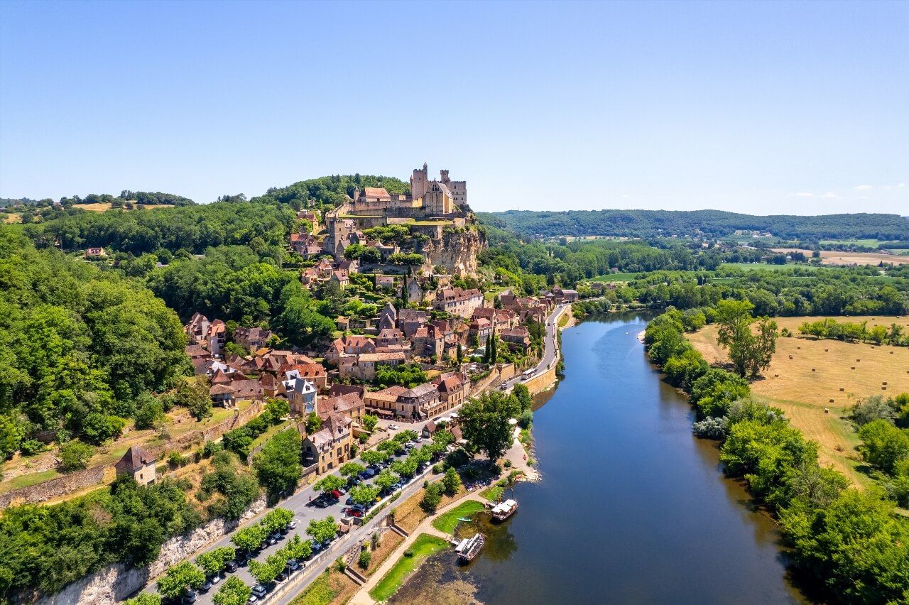
10. The Dordogne, 472 km, the River of Prehistory
The Dordogne is born from the confluence of the Dore and Dogne at 1,885 meters altitude, on the Mont-Dore plateau in the Massif Central. Its 472 kilometers take it to the Gironde estuary, where it joins the Garonne. Technically, the Dordogne is a river (it flows into another waterway, not the sea), but its breadth, cliffs and gorges give it river stature.
Its upper course, in Cantal and Corrèze, is wild and steep: the Dordogne gorges plunge in places 400 meters below the Massif Central plateaus, a depth comparable to great alpine canyons. The dam reservoirs of Bort-les-Orgues, Chastang and l'Aigle have transformed this sector into a chain of artificial lakes feeding southwestern France's most powerful EDF power plants.
It is in the Dordogne valley that Europe's densest collection of prehistoric sites is concentrated. The Vézère, tributary of the Dordogne, alone hosts 147 Paleolithic sites and 25 decorated caves classified by UNESCO, including Lascaux, whose aurochs and bison frescoes were painted 17,000 years ago and are considered the 'Sistine Chapel of prehistory'. Périgueux, capital of Périgord, preserves one of France's finest collections of Roman remains.
The Dordogne's middle course is the most romantic. Sarlat-la-Canéda and its medieval streets, Beynac and Castelnaud and their castles facing each other from each bank, La Roque-Gageac with its troglodytic houses golden in the setting sun: this 60-kilometer section concentrates a heritage density that few European valleys equal. At Bergerac, the Dordogne returns to the plain and takes on the character of a great plain river before joining the Gironde. The Ryo audio guide of Bergerac tells the story of the city and its wine hillsides along the river.
Summary Table: The 10 Longest Rivers of France
Here is a summary of the ten longest French rivers to find essential figures at a glance. Note: lengths vary slightly according to geographical sources; the figures below correspond to official measurements by SANDRE (National Service for Water Data and Reference Administration).
| River | Total Length | Length in France | Watershed | Sea of discharge | |---|---|---|---|---| | Loire | 1,006 km | 1,006 km | 117,800 km² | Atlantic | | Rhône | 812 km | 522 km | 98,000 km² (FR) | Mediterranean | | Seine | 775 km | 775 km | 78,650 km² | English Channel | | Garonne | 647 km | 575 km | 56,000 km² (FR) | Atlantic | | Meuse | 925 km | 486 km | 21,400 km² (FR) | North Sea | | Moselle | 550 km | 314 km | 15,800 km² (FR) | Rhine → North Sea | | Rhine | 1,230 km | 190 km | (border) | North Sea | | Saône | 480 km | 480 km | 29,900 km² | Rhône | | Charente | 381 km | 381 km | 9,900 km² | Atlantic | | Dordogne | 472 km | 472 km | 24,000 km² | Gironde |
Note: the Meuse (925 km total) exceeds the Garonne in total length if we include the Belgian-Dutch section. The Moselle (550 km total) is entirely counted as its French course represents the main portion. SANDRE 2025 data serves as official reference.
FAQ
What is the longest river in France?
The longest entirely French river is the Loire, with 1,006 kilometers from its source (Gerbier-de-Jonc plateau in Ardèche) to its mouth at Saint-Nazaire. If we include rivers that cross several countries, the Meuse totals 925 km but only 486 flow through France, and the Rhône measures 812 km total with 522 km in France.
What is the difference between a river and a stream in France?
In French, a fleuve (river) is a waterway that flows directly into the sea or ocean. A rivière (stream) is a waterway that flows into another waterway (river or larger stream). Thus, the Loire, Seine and Rhône are rivers, while the Dordogne and Saône are streams: the first joins the Gironde (arm of the Garonne), the second flows into the Rhône at Lyon. In common language, the boundary is often blurred.
What are the 5 longest rivers in France?
In order: Loire (1,006 km), Rhône (812 km, of which 522 in France), Seine (775 km), Garonne (575 km in France, 647 km total) and Meuse (486 km in France, 925 km total). These five waterways alone drain a large part of the metropolitan territory.
Which French river has the highest flow rate?
The Rhône is by far the river with the most powerful flow: 1,690 m³/s on average at its mouth. The Loire comes well after with 840 m³/s, the Seine with 450 m³/s, and the Garonne with about 650 m³/s at its mouth. The Rhône's flow allows it alone to produce about 25% of French hydroelectricity via the 19 CNR dams.
Which is the most polluted river in France?
The Seine concentrates the most documented pollution issues due to the population density of its watershed (20 million inhabitants). Considerable efforts have been undertaken since the 1990s: sewage treatment plants enabled the return of salmon to Paris in 2022 after 200 years of absence. The Garonne suffers from agricultural nitrate pollution in its upstream basin.
Can you swim in French rivers?
Swimming is allowed in certain sections of the Loire, Dordogne and Charente, but prohibited in the Seine in Paris for health reasons (this prohibition was temporarily lifted during the 2024 Paris Olympics for triathlon events). Prefectures publish swimming orders by sector each summer. Conditions vary greatly according to floods and precipitation.
Conclusion
From the torrential gorges of the nascent Loire to the vast meanders of the Seine in Normandy, passing through the Charente vineyards watered by the cognac river, France's great rivers are much more than geographical data: they are the arteries of a cultural and territorial identity built over millennia. Each of these ten rivers has shaped cities, irrigated cultures, delimited borders.
If you want to explore these river valleys in depth, the Ryo app offers audio-guided tours in the main cities that border them: from Nantes on the Loire to Strasbourg on the Rhine, passing through Toulouse on the Garonne and Marseille at the mouth of the Rhône. Each Ryo Ryocity immerses you in local history from your smartphone, with an audio guide that tells the river as much as the city.