Créé par Romane, le 20 juin 2026
Votre guide Ryo
The Most Beautiful Mountains in France: 18 Peaks to Discover in 2026
© Shutterstock
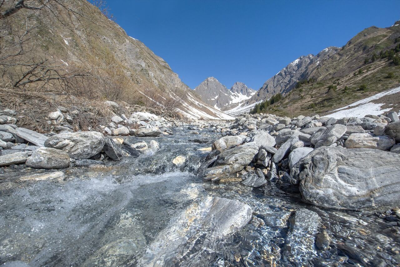
France is one of the few European countries to have five distinct mountain ranges on a single continental territory, plus an island whose relief surprises even those used to the Alps. From the 4,807 meters of Mont Blanc to the 1,247 meters of Ballon d'Alsace, France's most beautiful mountains don't resemble each other: some are carved from alpine granite, others rise from the volcanic base of the Massif Central, still others sculpted from Pyrenean limestone through millions of years of karstification. Before climbing towards the glaciers, many travelers settle in Chamonix and take half a day in town, the Ryo audio-guided tour of Chamonix Mont Blanc tells the story of mountaineering pioneers before looking up at the seracs.
This article lists eighteen peaks and massifs spread across the entire territory, from the roof of Europe to an astronomical observatory installed at 2,877 meters in the Pyrenees since 1873, via a supervolcano whose diameter exceeds 60 kilometers and a Corsican ridge perched less than 25 kilometers from the Mediterranean. It also includes peaks that the French themselves underestimate: the 'roof of the Jura' that many confuse with its Swiss neighbors, the sacred mountain of Catalans lit with torches every June 23rd, and a Basque peak hiding one of the world's deepest chasms under its limestone plateau. There's no hierarchy here, just a panorama of what French mountains can offer, according to your level, your season and your current desire.
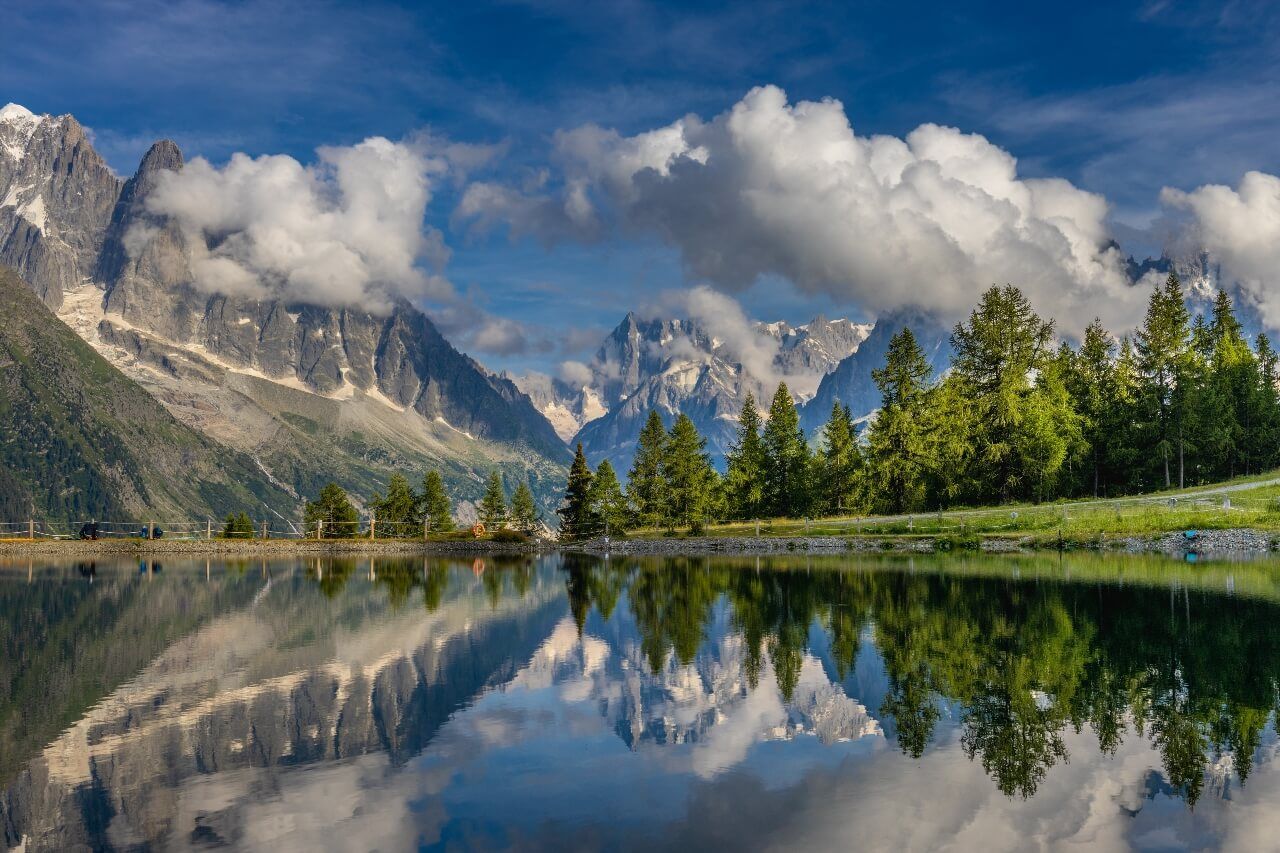
The Mont Blanc Massif: The Roof of Western Europe
Mont Blanc peaks at 4,807 meters and concentrates all that's most spectacular and accessible about mountains. The Franco-Italian border passes exactly through its summit, an invisible line that mountaineers cross in snowstorms without paying attention. The ascent via the normal route of Grands Mulets remains for experienced people only: two days, a certified guide, a night in a high-altitude refuge and impeccable physical condition. But the essence of the massif can be explored without crampons.
The Aiguille du Midi at 3,842 meters is the ideal antechamber. Twenty minutes by cable car from central Chamonix is enough to switch into a world where the sky takes on a midnight blue tint at noon and where glaciers below seem suspended in millennial torpor. The panoramic terrace embraces 400 kilometers of relief in clear weather, from the Matterhorn to the foothills of the Italian Apennines. The glass cabin 'Step into the void', inaugurated in 2013, gives the impression of walking in the void above 1,000 meters of vertical wall, a sensation that even seasoned mountaineers describe as destabilizing.
The Mer de Glace, France's first glacier at 7 kilometers long, descends from Mont Blanc to Chamonix losing about ten meters per year since the 1980s. The markers carved in the rock on the Montenvers path make this retreat visible to the naked eye, a striking reminder that these landscapes are changing beneath our feet. For families, the Plan de l'Aiguille at 2,317 meters (intermediate stop of the cable car) offers easy trails with direct view of the Bossons glacier seracs, one of the steepest glaciers in the Alps. The marmots have become so indifferent to hikers that they continue grazing less than two meters away.
Practical: the Aiguille du Midi pass costs €81 round trip (2025-2026 season, free reservation required). Plan warm clothing even in midsummer: between -5°C and -15°C at the summit depending on the day. In July-August, slots book out in hours, reserve at least a week in advance. The Goûter refuge at 3,817 meters, a stage of the normal route to the summit, was completely rebuilt in 2013 with a stainless steel and wood envelope that contrasts with the surrounding rock. Futuristic architecture that you can observe from Chamonix terraces in clear weather.
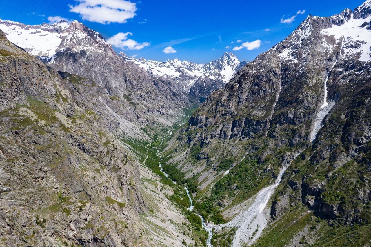
The Southern Alps: Écrins, Vanoise, Aravis
South of Mont Blanc, the alpine world changes in nature. Limestone gradually replaces granite, refuges become rarer, and attendance drops dramatically as you move away from the Arve valley. This is where some of France's most beautiful peaks are found, far from crowds.
The Barre des Écrins rises to 4,102 meters in the Écrins National Park, the largest national park in the French Alps with 91,800 hectares of protected territory. It's the only summit over 4,000 meters entirely located outside the Mont Blanc massif, a fact few people know. The ascent itself is for equipped mountaineers, glacier, crampons, rope, with two days' progression from the Écrins or Promontoire refuges. But for hikers without alpine experience, the Glacier Blanc cirque from Ailefroide is one of the most beautiful high mountain approaches without difficult technique: the trail goes up to 2,540 meters facing the Écrins north wall, and the seracs in direct view give an idea of the scale. Grenoble, at 80 kilometers, remains the natural gateway, the Ryo audio guide of Grenoble allows you to explore its alpine history before taking the Écrins road.
The Grande Casse peaks at 3,855 meters in Vanoise National Park, France's first national park created in 1963. Vanoise is home to more than 2,000 ibex reintroduced after their near-extinction in the 19th century, a population testifying to the remarkable success of this protected territory. From Pralognan-la-Vanoise, the hike to the Vanoise pass at 2,517 meters offers the best views of Grande Casse without requiring mountaineering equipment. The return via the Félix Faure refuge is one of the most frequented loops in the massif, and for good reason: the view of the Grande Motte glacier and limestone ridges is constant throughout the descent.
The Aiguilles d'Arves, three peaks rising between 3,513 and 3,514 meters above the Savoy valleys, offer one of the most recognizable silhouettes of the Grandes Rousses massif. From the Galibier pass at 2,642 meters (accessible by car from June to October), the frontal view of the rocky trident is striking. The Galibier itself is a mythical Tour de France pass, first crossed in 1911. Nearby, the Lautaret plateau houses the Alpine Garden of Lautaret, open since 1899 with 2,000 species of mountain plants cohabiting in the open air, an amazing place where Andean plants grow two meters from Himalayan plants.
The Pointe Percée (Pointe Percée, 74230 Thônes, rated 4.9/5 on Google for 36 reviews) at 2,750 meters closes this alpine chapter. The highest point of the Aravis massif, this limestone chain between Annecy and Chamonix, it rewards experienced hikers with a panorama of Mont Blanc, Beaufortain and Lake Annecy below. The ascent from Col des Aravis accumulates 1,200 meters of elevation gain for six hours round trip, a serious commitment, but without alpine technique.
The Pyrenees: From Vignemale to Canigou
The French Pyrenees have a paradox: on the Spanish side, cities and ski resorts have been attracting crowds for decades. On the French side, valleys often remain wild, refuges half-empty on weekdays, and lesser-known peaks contain landscapes that few European hikers have seen. Here are the must-sees.
The Vignemale at 3,298 meters is the highest point of the Pyrenees on the French side. Its Petit Vignemale glacier is one of the last active Pyrenean glaciers, barely, since it has lost 80% of its surface since 1850. The human history of Vignemale is as singular as its geography: Count Henry Russell, 19th-century Gascon mountaineer, loved this summit so much that he obtained the right to 'rent' it for a symbolic franc per year, and had seven caves dug in the rock to spend nights at altitude. Some of these cavities still exist. The hike from the Oulettes de Gaube refuge (accessible in 2h30 from the Pont d'Espagne parking) offers the best views of the glacier without requiring mountaineering equipment. For the summit, count two days with a night at the Bayssellance refuge at 2,651 meters, the highest guarded refuge in the Pyrenees.
The Pic du Midi de Bigorre at 2,877 meters houses one of Europe's most active astronomical observatories. The first meteorological measurements began there in 1873, and in the 1960s, NASA astronomers mapped the lunar surface there to prepare Apollo missions, a little-known fact that gives the summit an unexpected dimension. Today, Pic du Midi is open via a cable car from La Mongie, and a 'star bivouac' formula (June to September) allows staying after public closure to observe the sky with astronomers. Limited places, book several weeks in advance. The daytime view of the Pyrenees is also spectacular: in clear weather, the beaches of Biarritz at 100 kilometers and the Mediterranean coast in exceptional weather.
The Mont Canigou at 2,784 meters occupies a special place in Catalan culture. Every June 23rd, thousands of walkers carry torches lit from its summit to Barcelona, a tradition dating back at least to the Middle Ages. The classic ascent from Vernet-les-Bains accumulates 1,700 meters of elevation gain for seven hours round trip. A 4x4 track reduces the effort by reaching the Cortalets refuge at 2,150 meters, from where the final ascent takes 2h30. The panorama from the summit, Roussillon plain, Mediterranean, Spanish sierra, lives up to the myth. Perpignan, an hour's drive away, is the natural base: the Ryocity of Perpignan by Ryo allows you to discover the city's Catalan architecture before heading for the peaks.
The Pic de l'Anie (Pic de l'Anie, 64490 Lescun, rated 4.8/5 on Google for 115 reviews) at 2,504 meters is the best-kept secret of the Pyrénées-Atlantiques. Its summit overlooks the Lescun cirque, often called the 'most beautiful cirque in the Pyrenees', a subjective opinion, but defensible. Under the limestone plateau of Pierre Saint-Martin extends one of the world's deepest speleological networks: the Pierre Saint-Martin chasm descends to -1,302 meters, an abyss discovered in the 1950s that revolutionized world speleology. On the surface, the lapiaz offers a lunar landscape that nothing else in the Pyrenees really imitates.
The Massif Central: Volcanoes, Lakes and Supervolcanoes
The Massif Central is the part of French mountains most ignored by foreign travelers, and most underestimated by the French themselves. Yet some of its peaks deliver unique panoramas in Europe.
Puy de Dôme at 1,465 meters is Europe's most visited volcano, and its success owes as much to its history as to its panorama. Its summit houses the remains of a Gallo-Roman temple dedicated to Mercury, built in the 2nd century AD, from which archaeologists unearthed 6,000 bronze ex-votos during 19th century excavations. In clear weather, you can see up to 80 volcanoes of the Chaîne des Puys from the summit, a spectacle that UNESCO judged exceptional enough to list the Chaîne des Puys and Limagne fault as World Heritage in 2018. The Panoramique des Dômes, rack railway from the parking, goes up in 15 minutes for about €16. Walkers prefer the muleteer trail, about 1h15 from the base. More than 500,000 visitors take the train each year.
The Puy Mary at 1,783 meters is the exposed heart of Europe's largest supervolcano. Cantal, of which it represents the central point, was a stratovolcano 60 kilometers in diameter before erosion carried away its flanks over millions of years, leaving radiating valleys and sharp ridges. From the Pas de Peyrol pass at 1,589 meters (accessible by car), the summit is reached in 30 minutes, making it one of the most accessible peaks for families with children. In winter, the road closed by snow transforms the area into territory reserved for snowshoers.
The Mont Aigoual at 1,567 meters is one of the least glamorous peaks on this list, and one of the most endearing. It houses the last high-mountain weather observatory still active in France, opened in 1894 after ten years of work initiated by forester Georges Fabre. For 130 years, it has continuously measured temperature, humidity and pressure, a longevity that makes it one of Europe's most precious climate data deposits. The observatory can be visited freely, and the view in clear weather embraces both the Alps and Pyrenees, the Languedoc plains and the Gulf of Lion.
The Mont Gerbier de Jonc (Mont Gerbier de Jonc, 07510 Saint-Martial, rated 4.7/5 on Google for 929 reviews) at 1,551 meters owes its fame to a spring: the Loire springs at its feet, starting its 1,013-kilometer journey to Saint-Nazaire. Its sugarloaf silhouette in phonolite, volcanic rock that breaks into slabs, is recognizable among all. The ascent from the parking takes 20 minutes, but the path is steep and slippery in wet weather. Three streams claim the status of 'real' Loire source in the meadow at the foot of the mount, geographers agree on the one furthest from the sea.
The Vosges and Jura: The Forgotten Massifs of the East
The Vosges and Jura don't make people dream in the same proportions as the Alps or Pyrenees, but they have a rare quality: they are accessible to all, without special equipment, and their panoramas often hold surprises.
The Grand Ballon at 1,424 meters is the highest point of the Vosges. The white sphere of the weather radar that crowns it is visible from all of Alsace in clear weather. From the Haag parking, 45 minutes walking through the Vosges chaumes, these high-altitude pastures shaped by centuries of transhumance, is enough to reach the summit. The view over the Alsatian plain, Rhine meanders and Black Forest opposite constitutes one of the widest openings in the massif. The city of Strasbourg, 80 kilometers away, is often the starting point for visitors from Germany or Belgium: the Ryocity of Strasbourg with Ryo is an ideal entry point to Alsace before taking the ridge road.
The Ballon d'Alsace at 1,247 meters marks the southern limit of the Vosges massif at the junction of four historical regions. In clear weather, you can distinguish the Black Forest, Swiss Alps and Alsatian plain from the summit. The Virgin statue erected in 1863 has become a landmark for cyclists, as Ballon d'Alsace has been integrated several times into the Tour de France as a category summit. The summit is accessible by car from Saint-Maurice-sur-Moselle, making it the most accessible on this list.
The Crêt de la Neige (Crêt de la Neige, 01410 Lélex, rated 4.8/5 on Google for 160 reviews) at 1,720 meters is the highest point of the Jura, a fact most French people ignore. Located in Ain, this modest summit reveals around a forest ridge a sudden view of Lake Geneva and the Alps that stupefies those who don't expect it. The ascent from Lélex (accessible from Geneva in 45 minutes) takes 2h30 round trip, on trails crossing coniferous forests and limestone lapiaz characteristic of the Jura. In winter, snowshoes recommended.
Corsica: A Mediterranean Mountain Apart
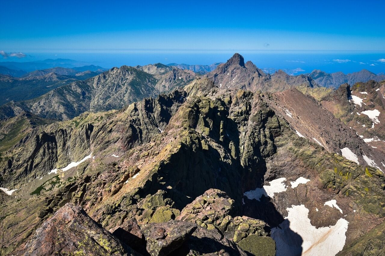
Corsica always surprises those who discover it from the sea: the island is higher than it is wide at its central part. Monte Cinto (Monte Cinto, 20224 Calacuccia, rated 4.6/5 on Google for 314 reviews) at 2,706 meters is its roof, less than 25 kilometers from the Mediterranean. The rock, granite and gneiss 300 million years old, contrasts by its dark color with the deep blue of the sea visible on both sides of the island in clear weather.
The classic ascent from Haut-Asco requires 8 to 9 hours round trip with 1,400 meters of elevation gain. The trail crosses high-altitude grasslands where Corsican mouflons observe hikers with sovereign indifference, a population of several hundred individuals reintroduced in the 1970s after centuries of overhunting. Snow can persist on the north face until June, requiring light crampons at the beginning of the season. Monte Cinto is also a stage of the GR 20, crossing the island in 180 kilometers with 13,000 meters of cumulative elevation gain, regularly ranked among Europe's most demanding long-distance hiking routes.
Other Peaks Not to Overlook
Two peaks complete this panorama without fitting into the previous massifs.
Apart from Mont Canigou (covered in the Pyrenees section), Mont Aigoual has its counterpart in the southern Alps with Mont Ventoux (Mont Ventoux, 84410 Bédoin, rated 4.8/5 on Google for 3,599 reviews) at 1,909 meters, nicknamed the 'Giant of Provence'. This isolated peak, visible from Avignon and Marseille on mistral days, is also one of the mythical passes of world cycling, 21 km of climb from Bédoin at an average gradient of 7.5%. At its summit, a weather station records winds exceeding 300 km/h several times a year. The landscape changes dramatically during the ascent: oak forests, cedar forests, then the white scree desert that composes the bald summit, limestone rock devoid of vegetation for the last 400 meters.
Apart from Monte Cinto, Corsica also offers Monte d'Oro at 2,389 meters, the island's second summit and main objective for those wanting a technical ascent without reaching Cinto level. Its northeast couloir, snowy until May, is one of the most traveled snow routes in Corsica in spring.
Choose Your Peak According to Your Profile
All these peaks don't address the same hikers. Here's how to find your way according to what you're looking for.
For families with young children: Puy de Dôme (rack railway or marked trail in 1h15), Puy Mary (30 minutes from the pass, accessible by car) and Mont Gerbier de Jonc (20 minutes from parking) are the three simplest options. Aiguille du Midi in Chamonix is spectacular but beware children sensitive to altitude, altitude sickness possible from 3,000 meters.
For hikers without alpine experience: Grand Ballon, Ballon d'Alsace, Crêt de la Neige, Mont Aigoual and Vignemale up to Oulettes de Gaube are serious objectives but without special equipment. Plan high hiking boots, warm clothing and plenty of water.
For experienced mountaineers: Barre des Écrins, Grande Casse, Vignemale summit and Mont Blanc require mastery of glacier, rope and crampons. Don't go without a guide or serious alpine experience, conditions can change in minutes.
For astronomy: Pic du Midi de Bigorre, with its star bivouac, is in a class of its own. The darkness at 2,877 meters in the Pyrenees, far from city lights, allows observing the Milky Way with the naked eye with rare clarity in continental Europe.
For families with teenagers: Monte Cinto in Corsica, a demanding day but without alpine technique if there's no snow, and Pic de l'Anie in the Pyrénées-Atlantiques for the unique karstic landscape.
Foothills Cities to Explore
A mountain stay rarely begins directly at the pass. Foothill cities deserve as much attention as summits, they carry the history of the massifs they border and offer convenient logistical bases.
Chamonix is the absolute reference for the Northern Alps. The town itself tells two centuries of mountaineering: the alpine museum traces the first Mont Blanc ascents since 1786, photographic archives of the glacier since 1860 document ice retreat with striking precision. The Ryocity of Chamonix Mont Blanc, the Ryo audio-guided tour where earth touches sky, is an excellent starting point before taking the cable car.
Grenoble, capital of the Alps, is the gateway to Vercors, Écrins and Chartreuse. Its situation at the crossroads of three massifs makes it the best positioned mountain city in France for varying itineraries. From the Bastille cable car (free for children), the view of the three surrounding massifs gives an idea of the hinterland's richness.
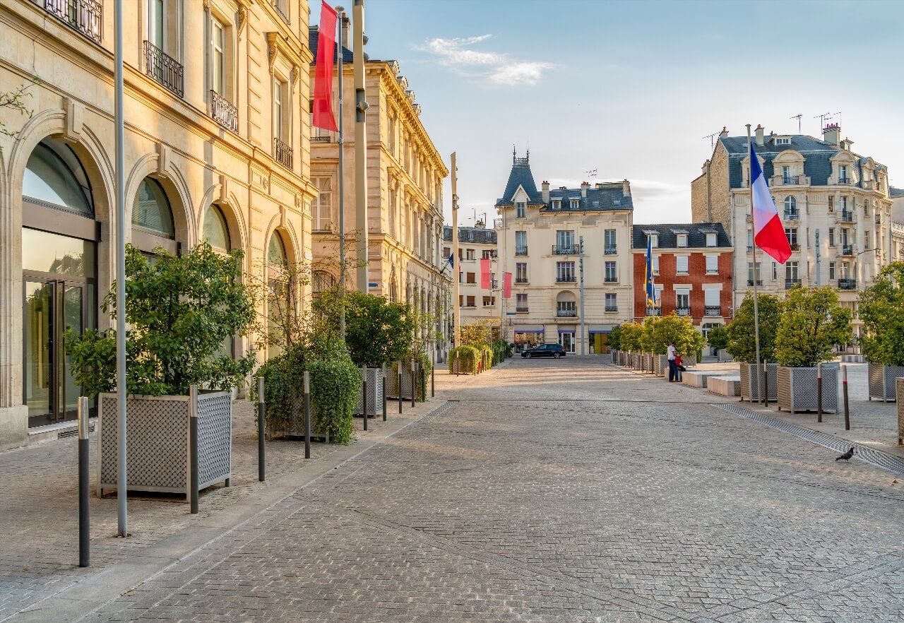
Perpignan plays this role for the Pyrénées-Orientales and Canigou. The city is 40 kilometers from the massif via the Têt valley, and its Catalan architecture, the Palace of the Kings of Majorca, Saint-Jean cathedral, constitutes a cultural prelude to the ascent.
Strasbourg is the natural base for exploring the Vosges: 30 kilometers from the Schlucht pass, it combines the historical heritage of the Alsatian center with real proximity to Vosges ridges. The audio-guided tour of Strasbourg with Ryo covers the medieval heart of the city before taking the ridge road.
Practical Tips Before Leaving
Some common-sense rules that make the difference between a successful outing and a bad experience.
Mountain weather is unpredictable. What's true in Chamonix is even more so on Pyrenees or Massif Central peaks, where convection storms can form in less than an hour. Check summit weather (not valley weather) the evening before and morning of departure. Météo France publishes a specific bulletin for each massif.
Altitude changes the equation. Altitude sickness (AMS) can affect anyone from 2,500 meters, even athletes in good condition. Symptoms: headaches, nausea, unusual fatigue. If symptoms appear, the only reliable solution is to descend.
Water is available but needs filtering. High-altitude springs are generally clean, but the presence of pastures and hikers increases contamination risk. A filter or treatment tablets cost less than mountain gastroenteritis.
Refuge reservation is mandatory in high season. Alpine refuges (CAF, SAC) are fully booked from June for July-August weekends. Book at least two months in advance for Barre des Écrins, Grande Casse or Mont Blanc normal route. Pyrenean refuges are less saturated but follow the same trend in recent years.
Bring a paper map. Mobile phone network is non-existent on many summits and exposed slopes. The IGN 1/25,000 map remains the reference, it's available at the park house or tourist offices in each valley.

Which Season to Visit French Mountains?
The answer varies according to massif and desired activity.
Summer (June-September): the main hiking season. In Corsica and the Pyrenees, passes often clear of snow from late May. In the Alps, some high-altitude routes remain snowy until July. Summer light at altitude, very clear and contrasted, is ideal for photography. Downside: maximum attendance at emblematic sites (Aiguille du Midi, Puy de Dôme).
Autumn (October-November): the least frequented period and often the most beautiful in terms of colors. Vosges and Jura forests take on remarkable golden hues. Weather instability increases. Above 2,000 meters, snow can fall from September.
Winter (December-March): massifs are transformed. Puy Mary and Mont Gerbier de Jonc remain accessible on snowshoes from passes. The Alps and Pyrenees attract skiers. Some cable cars (Aiguille du Midi, Pic du Midi) remain open but conditions can close access without notice.
Spring (April-May): a transition season to seize. Snow is still present at altitude, but valleys turn green again. Melting waterfalls are spectacular in Pyrenean gorges (Gavarnie) and in the Écrins.
FAQ
What is the highest mountain in France?
Mont Blanc is the highest mountain in France at 4,807 meters altitude. It is also the highest peak in all of Western Europe. Its summit lies on the Franco-Italian border in the Mont Blanc massif, in Haute-Savoie, near Chamonix-Mont-Blanc. The second highest mountain in France is the Barre des Écrins at 4,102 meters, in the Écrins National Park.
Which mountain to visit in France without mountaineering?
Several peaks on this list are accessible without technical skills. Puy de Dôme can be reached by cable car or marked trail, Pic du Midi de Bigorre by gondola, Puy Mary in 30 minutes' walk from the Pas de Peyrol pass. For a spectacular alpine mountain, Aiguille du Midi in Chamonix remains unmatched: the cable car goes up to 3,842 meters in twenty minutes. Mont Canigou is accessible with good hiking level, without alpine equipment.
What are the most beautiful mountains in the French Pyrenees?
The French Pyrenees offer several exceptional peaks: the Vignemale (3,298 m, highest point on the French side, with its retreating glacier and caves carved by Count Russell), Mont Canigou (2,784 m, sacred mountain of Catalans with its Sant Joan tradition), Pic du Midi de Bigorre (2,877 m, with its astronomical observatory opened in 1873) and Pic de l'Anie (2,504 m) for its Lescun cirque and record speleological abyss.
Can you see Mont Blanc from Chamonix without taking the cable car?
Yes, Mont Blanc is visible from central Chamonix in clear weather. However, distinguishing Mont Blanc from surrounding aiguilles (Goûter, Dôme du Goûter) requires some visual experience. To fully appreciate the scale of the massif, the Aiguille du Midi cable car remains the best option. The Mer de Glace, accessible by the Montenvers train from Chamonix station, offers another perspective on the massif without going to extreme altitude.
Which mountain in France is most accessible for a family?
Puy Mary (30 minutes from the Pas de Peyrol pass, accessible by car to the pass) and Mont Gerbier de Jonc (20 minutes from parking) are the two peaks most suitable for families with young children. Puy de Dôme is ideal via the Panoramique des Dômes rack railway, without physical effort. Ballon d'Alsace and Grand Ballon in the Vosges offer peaks reachable in less than an hour from the car, in a less vertiginous setting than the Alps.
What is the most beautiful 360-degree panorama in France?
The answer depends on criteria. Puy de Dôme delivers the most unique panorama, with 80 volcanoes visible from an ancient Gallo-Roman temple. Aiguille du Midi offers the most extreme vertigo, at 3,842 meters above glaciers. Pic du Midi de Bigorre is unbeatable for the astronomical quality of the night sky. Mont Canigou gives the most dramatic view towards the Mediterranean and Spain. Hard to decide, they complement rather than compete with each other.
Conclusion
From the 4,807 meters of the roof of Europe to the 1,247 meters of Ballon d'Alsace, France's most beautiful mountains cover a rare spectrum: alpine granite, volcanic lava, Pyrenean limestone, Corsican schist. There's no definitive ranking, a 1,500-meter peak in the Cévennes can deliver as strong an experience as an alpine giant, depending on light, season and angle of approach.
If you're planning a stay in the Alps, start with the city that is its historical capital: the Ryo audio-guided tour of Chamonix Mont Blanc tells two centuries of mountaineering by walking the city streets before looking up at the glaciers, a context that transforms the rest of the stay.