Créé par Emilie, le 20 juin 2026
Votre guide Ryo
The Most Beautiful Lakes in the Pyrenees: 20 Wonders to Discover in 2026
© Shutterstock
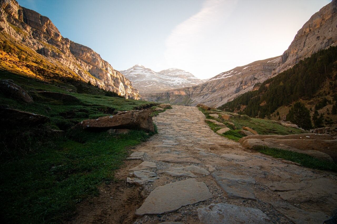
We're talking about over 1,000 high-altitude lakes scattered across the entire mountain range, from the Atlantic to the Mediterranean, and most don't appear on any tourist brochure. Glaciers carved these basins in granite over tens of thousands of years: filled by snowmelt between May and July, they form bodies of water that turn electric blue, jade green, or obsidian black depending on the time and season. Some are accessible by car or less than an hour's walk; others require a full day of hiking and two boxes of energy gels. This guide covers the most beautiful lakes in the Pyrenees, from Lake Gaube reflecting the north face of Vignemale to the forest calm of Lake Bethmale, passing through the electric waters of Lake Bleu de Lesponne and the artificial colossus of Cap de Long with its 67 million m³. Ryo offers you here a selection organized to prepare a stay worthy of the mountain range: field facts, detailed access, traps to avoid and best times for each lake.
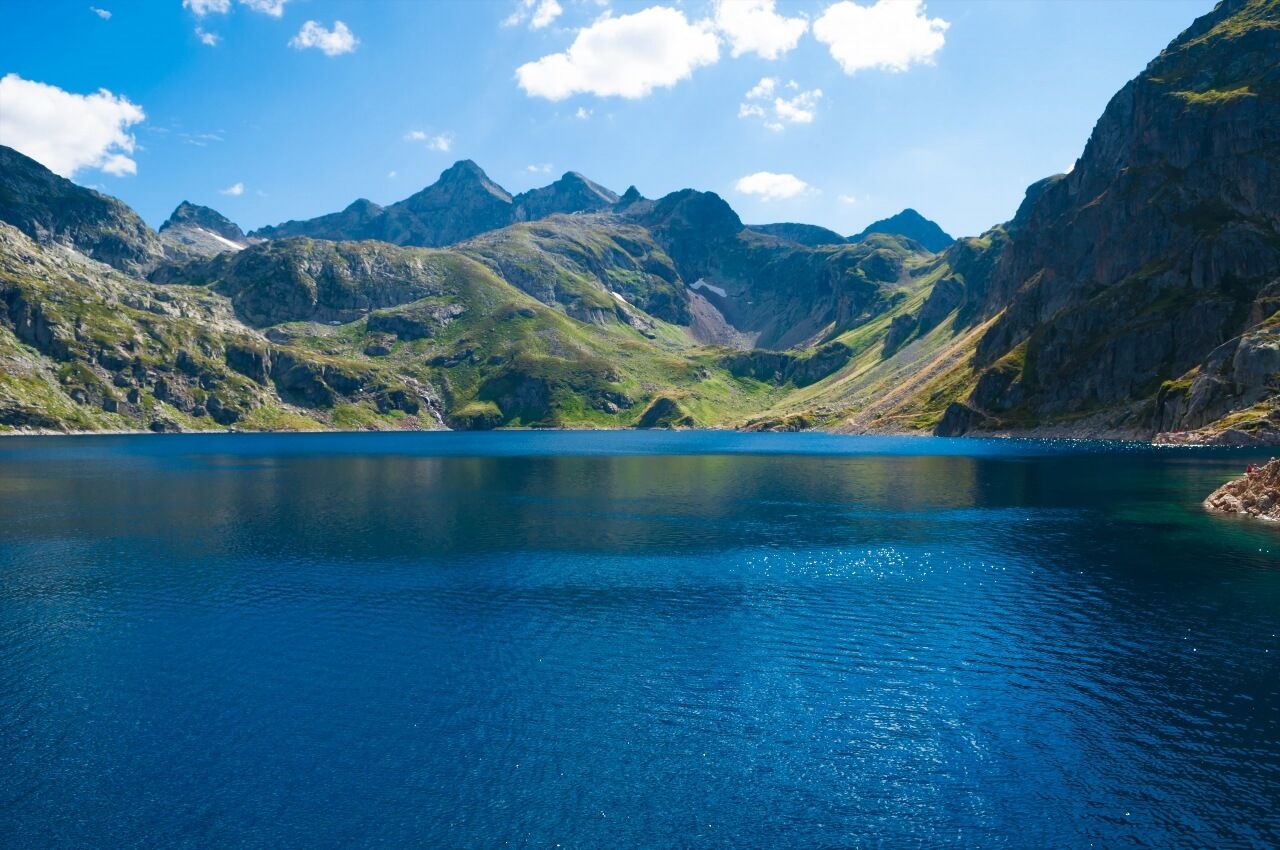
Lake Gaube, the Mirror of Vignemale
There's probably no Pyrenean lake that concentrates so many elements in a single frame. Lake Gaube (Pont d'Espagne, 65110 Cauterets, rated 4.7/5 on Google for 9,859 reviews) extends at 1,725 meters altitude, in the heart of the Pyrenees National Park, a few kilometers from Cauterets. Its waters oscillate between night blue and dark green depending on the light, and its 13-hectare surface reflects the north face of Vignemale (3,298 m), the highest point of the French Pyrenees, in calm weather. The scene is striking: a granite wall nearly 1,000 meters high is doubled in the black water of a glacial lake less than an hour from the resort.
Access is one of the easiest in this selection. From Pont d'Espagne (paid parking, about 8 euros per day in high season), the Puntas cable car rises to 1,840 meters, then the Gaube chairlift drops you near the lake. Fifteen minutes of walking on a flat path are enough to reach the shores. Hikers who prefer to walk up from Pont d'Espagne take 45 minutes on a well-marked trail that follows the Gaube stream through a forest of pines and firs.
But here's the catch: Lake Gaube is often crowded in July and August, especially between 10 AM and 3 PM. Arrive before 9 AM or in late afternoon to enjoy the tranquility and low-angle light on Vignemale. If you have two days, the GR10 goes around the lake and climbs to the Oulettes de Gaube refuge (2,151 m, staffed from June to September), from where the view overlooks the seracs of the Ossoue glacier. Plan to book several weeks in advance in high season.
Fishing is permitted with a license. The water remains cold year-round, between 4 and 12°C at the surface depending on the season, one of the lowest temperatures of accessible Pyrenean lakes without technical equipment. Local fishermen arrive early in the morning, when the lake surface is perfectly smooth and trout rise to create concentric circles in Vignemale's reflection.
Ayous Lakes, the Reflection of Pic d'Ossau
The hike to the Ayous lakes (Lake Gentau, 64440 Laruns, rated 4.9/5 on Google for 228 reviews) is one of the most emblematic in Béarn. It chains seven lakes, Roumassot, Miey, Bersau, Gentau, Aule, Ayguelongue and Ayous, in a cirque open to the Pic du Midi d'Ossau (2,884 m). This volcano-shaped peak is one of the most recognizable in the Pyrenees, and its reflection in Lake Gentau (2,047 m) is probably the most photographed image of the entire Pyrenean range. The lake surface acts like a natural mirror: at certain morning hours, the Midi d'Ossau seems to rest on the water rather than above it.
The departure is from Bious-Artigues (1,422 m), accessible by car from Laruns. Count 4 to 5 hours round trip for the complete seven-lake circuit, with a positive elevation gain of about 700 meters. The trail is well-marked, but some passages on rocky slabs require attention in wet weather. The Ayous refuge (2,185 m, staffed from mid-June to late September) is located just above Lake Gentau: sleeping there to see Pic d'Ossau at sunrise is an experience few hikers forget.
An important note: in July and August, the Bious-Artigues road is subject to mandatory shuttle from Gabas on weekends and holidays. Private cars are not allowed. Check dates on the Pyrenees National Park website before leaving, conditions change every year.
Each Ayous lake has its own character. Lake Roumassot, first encountered, is surrounded by pines and rhododendrons that explode in bright pink in early July. Lake Bersau, the largest in the cirque with its 17 hectares, offers a pebble beach where you can put down your pack for a break. Lake Gentau, higher up, is the one that hosts the famous Ossau reflection; to maximize your chances of a smooth surface, be there before 8 AM or after 6 PM, when thermal breezes calm down.
Lake Oô, the 275-Meter Waterfall
The Lake Oô (Granges d'Astau, 31110 Oô, rated 4.7/5 on Google for 1,071 reviews) first strikes with its glacial cirque setting. Perched at 1,507 meters in the Luchonnais valley (Haute-Garonne), it directly receives a 275-meter waterfall cascading down the rock wall from Lake Espingo above. This waterfall, the second highest in the Pyrenees after the great Gavarnie waterfall, creates a deep sound that accompanies the ascent long before the lake appears at the end of the path.
The trail starts from Granges d'Astau (1,130 m), 8 km from Bagnères-de-Luchon. The ascent takes 1 to 1.5 hours for 370 meters of elevation gain, a reasonable effort that makes it one of the most visited lakes in Haute-Garonne. The lake is artificial, a dam built in 1921 raises the natural level to supply the valley's power plants. This doesn't detract from the spectacle: the water is dark blue that turns silvery gray when clouds pass, and the waterfall thunders constantly.
A footbridge on the dam allows crossing and approaching the foot of the falls. If you have energy, continue 1.5 hours more to Lake Espingo (1,967 m) and its staffed refuge: the panorama over the Spanish range is worth every meter of additional elevation. The trail can be crowded on summer Sundays. Earn the place by leaving on a Tuesday morning.
Lake Cap de Long, the Néouvielle Colossus
With its 67 million m³ of water stored at 2,161 meters altitude, Lake Cap de Long (Réserve Naturelle du Néouvielle, 65170 Aragnouet, rated 4.8/5 on Google for 355 reviews) is the largest water reservoir in Hautes-Pyrénées. The arch dam built between 1947 and 1953 rises to 101 meters in height, an engineering feat that surprisingly blends well into this mineral landscape of pink granite and jagged ridges. The lake extends over 110 hectares in the Néouvielle nature reserve, surrounded by peaks exceeding 3,000 meters.
Access from the Aure valley goes up to Lake Orédon, then continues either on foot (45 minutes additional climb), or by a carriage road open to authorized vehicles. The view from the dam is frontal on the Néouvielle massif: the peaks of Trois Conseillers, Ramougn and Bastan form a granite wall that contrasts with the blue expanse of artificial water.
This lake holds a surprise for attentive hikers: the presence of mountain pines stunted by wind, survivors of the primeval forest that covered these altitudes before glaciation. Some of these trees exceed several hundred years. The reserve also hosts a population of Pyrenean desmans, this endemic semi-aquatic mammal that resembles a trunk shrew. You won't see it easily, but its existence in these cold waters is an indication of their exceptional chemical purity.
In winter, the access road closes with the first snow, generally in November. The reserve officially reopens in June, but snow can remain on the shores until July. Plan accordingly if you come early in the season.
Lake Estaing, the Green Pearl of Azun Valley
The Lake Estaing (Route du Lac d'Estaing, 65400 Estaing, rated 4.6/5 on Google for 2,100 reviews) is one of the few natural lakes in the Pyrenees easily accessible by car. At 1,161 meters altitude in the Azun valley (Hautes-Pyrénées), it is located 12 km from Argelès-Gazost by a winding but paved road. The banks are wooded with beech and fir trees, green reflections dominate there, and the surrounding mountains don't exceed 2,000 meters. This is precisely what makes it so relaxing, almost opposite to the mineral austerity of high-altitude lakes.
The water is remarkably clear, you can see the bottom several meters deep from the shores. Swimming is forbidden there: the lake borders the National Park and is located in a protected pastoral zone, which explains this prohibition intended to preserve a fragile ecosystem. However, paddleboarding and canoeing are tolerated. A lake tour trail (3 km, about 1 hour walk) runs along the shores through the woods. Trout fishing is allowed with a daily permit available on site.
For hikers, the valley above the lake opens onto routes to Pic de Merlheu (2,257 m) and the shepherd huts of the Sécuré plateau. Count a full day for this extension. It's the family lake par excellence: without imposing elevation gain on arrival, accessible to young children, with a refuge-restaurant offering simple meals in season.
Étang de Lers, the Ariège Surprise
The Étang de Lers (Route de l'Étang de Lers, 09320 Lers, rated 4.6/5 on Google for 158 reviews) (1,274 m) is one of the least known lakes in this selection. Located in the Ariège Couserans, accessible from Massat, it extends over about 7 hectares in a grassy basin framed by beech forests. The water is dark and tanned, a characteristic brown-green of high-altitude wetlands.
Unlike the glacial lakes of Hautes-Pyrénées, Étang de Lers has a pastoral character: the surrounding summer pastures host cattle herds in summer, and griffon vultures often circle above the surrounding ridges. Access is by carriage road from the D618. A tour trail (6 km, 2 hours) allows a complete tour passing by shepherd huts. For those visiting Ariège without wanting to embark on a major hike, it's the ideal stop, discreet, preserved, and rarely crowded even in midsummer.
Lake Bethmale, the Forest Charm of Couserans
The Lake Bethmale (Route du Lac, 09800 Bethmale, rated 4.5/5 on Google for 890 reviews) (1,074 m) is the 'gentlest' lake on this list. In the Ariège Couserans, it is surrounded by a forest of firs, beeches and maples that give it a romantic character very different from high-altitude glacial lakes. The water is dark, tanned by dead leaves, a deep brown-green that contrasts with the bright green of mosses on the banks.
The lake is directly accessible by car from the village of Bethmale, the road goes up to the dam. A tour trail (4 km, 1.5 hours) runs along the shores through the undergrowth. Local legend tells that a witch, chased from the village by inhabitants, jumped into the lake swearing never to disappear: her blue-green dress, remaining at the bottom, would give the water its special reflections. The story is still told in all Couserans villages. Ideal in cloudy weather, when altitude summits disappear in mist and the forest takes on Flemish painting tones.
Lake Aubert and Lake Aumar, Twin Gems of Néouvielle
In the Néouvielle nature reserve, Lake Aubert (2,148 m) and Lake Aumar (Réserve Naturelle du Néouvielle, 65170 Aragnouet, rated 4.8/5 on Google for 358 reviews) (2,192 m) are naturally visited together, the two lakes are separated by twenty minutes' walk. Aubert is often the first stop: it extends below Pic de Bastan in an open landscape of bilberry heaths and granite slabs, with deep blue almost opaque water that contrasts with the red tint of surrounding rock.
From the Hourquette d'Aubert parking (accessible from Fabian in the Aure valley), count 30 minutes of walking to reach Aubert. The trail descends slightly on the way there, which means a climb on return, anticipate this if you come with poorly trained hikers.
Aumar is slightly higher and smaller, but its appearance is different: less deep, its shores are gentler, with shallow areas where water warms slightly in summer. On the north shore of the lake, an unmarked trail leads to a small rocky viewpoint that offers a simultaneous view of Aumar, Aubert and Cap de Long, three lakes in the same frame, with the Néouvielle massif as backdrop. It's one of the densest panoramas of bodies of water in the entire range, and one of the least photographed.
Essential reminder for these two lakes: the Néouvielle reserve imposes camping forbidden, fires forbidden, dogs forbidden even on leash. These rules are monitored by guard-monitors in high season.
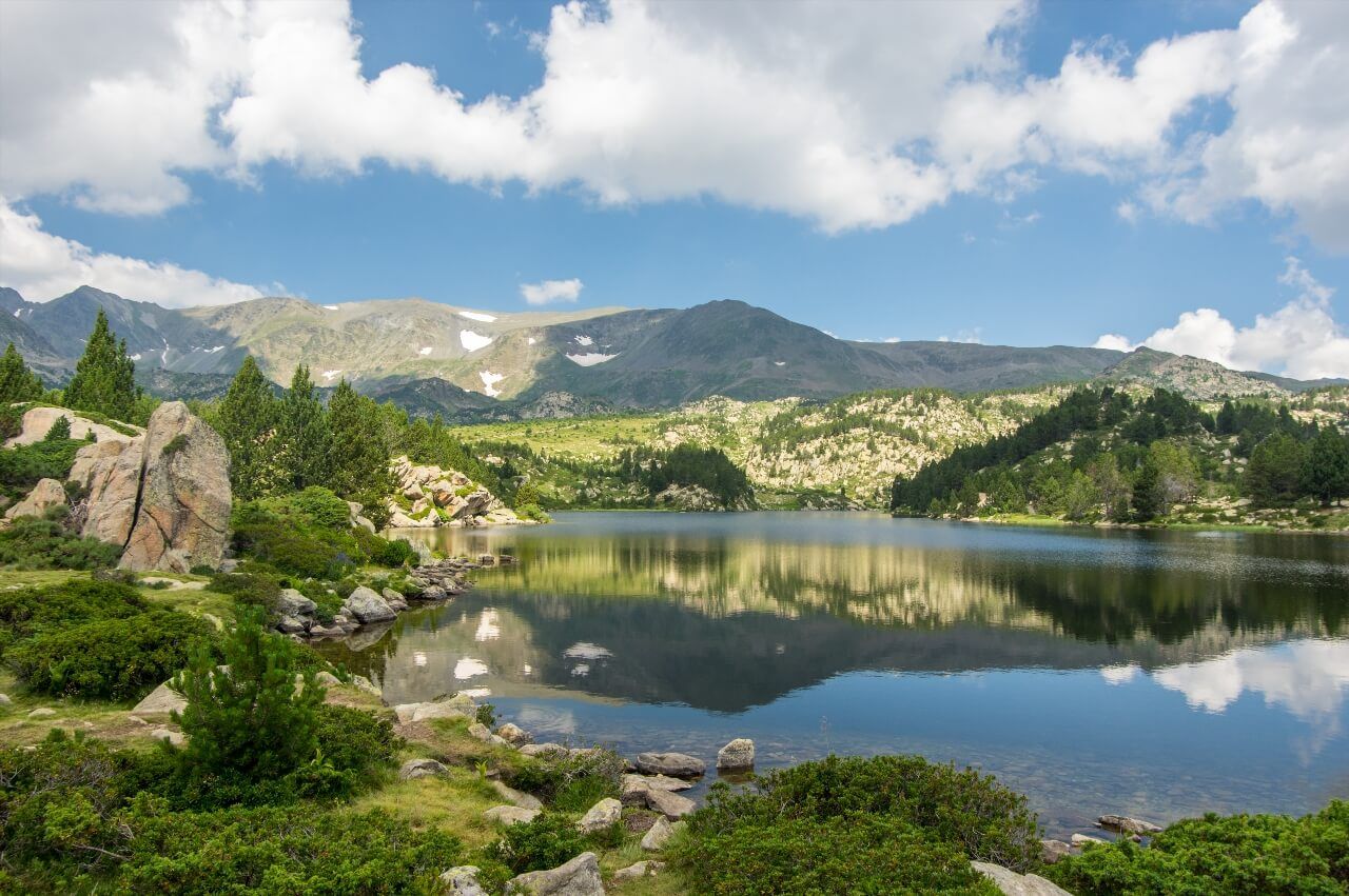
Lake Orédon, the Néouvielle Hub
The Lake Orédon (Barrage d'Orédon, 65170 Aragnouet, rated 4.6/5 on Google for 309 reviews) (1,849 m) is the base lake of the Néouvielle massif, the one through which all hikers pass who want to explore Cap de Long, Aubert or Aumar. Its access is exceptionally easy: the carriage road from the Aure valley goes up to its dam, with parking at water's edge. In high season, a shuttle is mandatory on weekends from the valley.
The lake itself is less spectacular than its higher neighbors, it's an artificial reservoir surrounded by mountain pines. But its crossroads location makes it an excellent starting point. The Néouvielle Park House is installed there, with exhibitions on the reserve's fauna and flora. At day's end, when hikers descend, the water takes on golden hues that contrast with the dark green of pines. It's the lake to photograph at golden hour, not at noon.
Lake Artouste, the Little Train Lake
The Lake Artouste (Chemin du Lac d'Artouste, 64440 Laruns, rated 4.8/5 on Google for 210 reviews) (1,990 m) owes its originality to its access mode: a narrow-gauge panoramic train that winds along cliff faces for 10 km from Fabrèges station (Pyrénées-Atlantiques), above the Ossau valley. This small train, often presented as the highest in Western Europe, offers vertiginous views over the Ossau gorges and Franco-Spanish border ridges.
From the arrival station, count another 30 minutes of walking to reach the lake shores. The whole is framed by steep slopes covered with scree and some persistent snow patches until August. The water is limpid and particularly luminous blue in good weather, geologists attribute this tint to the fineness of glacial particles in suspension. The little train operates from late May to early October; tickets should be reserved online several weeks in advance in high season.
The lake is located on the border with Spain: the trail that goes around it sometimes takes you to the Spanish side without materialized border. No legal worry, but remember to bring your ID if you plan to extend the hike on the Spanish side.
Lake Bleu de Lesponne, the Electric Azure of Bigorre
Its name says it all: the Lake Bleu (Vallée de Lesponne, 65710 Campan, rated 4.8/5 on Google for 58 reviews) (1,968 m), in the Lesponne valley above Bagnères-de-Bigorre, owes its reputation to the electric color of its waters. This almost unreal blue tint results from the mineral composition of rocks at the lake bottom, light schists that reflect light unusually. The spectacle is particularly striking in June, when surrounding snow patches contrast with the water's bright blue.
The ascent from Chiroulet parking (1,067 m) takes about 2.5 hours for nearly 900 meters of elevation gain, a sustained effort but without particular technicality. The trail crosses beautiful mixed forest before emerging onto summer pastures, then onto the lake's mineral basin. Going down, take time to stop at Chiroulet shepherd huts, where a shepherdess sometimes offers fresh cheese in season. It's a lake that rewards effort with a color you won't easily find elsewhere in the Pyrenees.
Lake Bouillouses, the Giant of Pyrénées-Orientales
The Lake Bouillouses (Route des Bouillouses, 66210 La Cabanasse, rated 4.7/5 on Google for 1,015 reviews) (2,016 m) is the largest lake in the French Pyrenees with its 149 hectares of surface area, dammed by a dam built between 1903 and 1910 to supply electricity to the famous Yellow Train of Cerdagne. Its shores are dotted with rounded granite rocks, gnarled mountain pines and sphagnum bogs, a landscape reminiscent more of Scandinavian moors than the Mediterranean mountain that dominates the region.
Access is from Font-Romeu or Mont-Louis by the Bouillouses road, open from May to November. In summer, traffic is regulated: mandatory shuttle from the Bouillouses chalet on weekends and holidays from June to mid-September. The hiking circuit around the lake (6 km, 2 hours, low elevation gain) is one of the most accessible in this selection, practicable with standard walking shoes.
For more ambitious walkers, the 12 lakes hike at the foot of Pic Carlit (2,921 m, highest point of Pyrénées-Orientales) starts from Bouillouses and chains ponds and lakes over 15 km. It's one of the most beautiful hiking days in Pyrénées-Orientales, with passages on granite slabs swept by wind and views to the sea in clear weather.
Lake Gloriettes, at the Foot of Cirque d'Estaubé
The Lake Gloriettes (Cirque d'Estaubé, 65120 Héas, rated 4.7/5 on Google for 227 reviews) (1,668 m) is little known outside Pyrenean hikers. This small artificial reservoir is located in the cirque d'Estaubé (Hautes-Pyrénées), one of the three emblematic glacial cirques of the Pyrenees with Gavarnie and Troumouse. The dam was built between 1948 and 1952, but it's the natural setting that takes precedence: the vertical walls of the cirque surround the lake on all sides, creating particular acoustics where every sound echoes several times.
The access road from Héas goes up to the dam, accessible by car. From the lake, the hike to the back of cirque d'Estaubé (2.5 hours one way, 650 m elevation gain) passes through meadows dotted with wild orchids in spring and leads to a panorama over the Roland breach on the Spanish side. This lake is often combined with a visit to Gavarnie cirque on the same day, the two sites are less than 20 km apart by road.
Lake Estom, the Secret Alternative to Cauterets
In the same valley as Lake Gaube, Lake Estom (Vallée d'Estom, 65110 Cauterets, rated 4.7/5 on Google for 6 reviews) (1,804 m) is often overshadowed by its more famous neighbor. This is unfair. Accessible from Cauterets in 2.5 hours of walking from Pont d'Héas, the trail crosses the magnificent Estom valley through pine and beech forests before opening onto the lake.
The lake is surrounded by impressive rock walls, with a waterfall flowing into it from the heights. The staffed Estom refuge (1,827 m) is installed on its shores, an excellent starting point for hikes to the valley's upper lakes, notably Lake Glère and Lake Embarrat. The setting is less mineral than Lake Gaube, more vegetal, more intimate. For those put off by Gaube's crowds, it's the best alternative less than an hour away by road.
Lake Ansabère, the Basque Country Cirque
The Lake Ansabère (Cirque d'Ansabère, 64490 Lescun, rated 4.9/5 on Google for 29 reviews) (1,670 m), in the cirque d'Ansabère (Pyrénées-Atlantiques), is dominated by granite rock needles reminiscent of the Dolomites. The departure from Lescun requires 3 hours one way for 750 meters of elevation gain.
This lake is not suitable for beginners, but it generously rewards the effort: the cirque is closed on three sides by vertiginous cliffs, the water is translucent green-blue, and solitude is almost guaranteed even in midsummer. The village of Lescun, classified among the most beautiful villages in France, deserves a night on site to prepare the ascent in the best conditions.
Néouvielle Nature Reserve: What You Need to Know Before Entering
The Néouvielle nature reserve, created in 1936, is one of France's oldest. It covers 2,313 hectares and concentrates a unique lake density in the Pyrenees: Cap de Long, Aubert, Aumar, Orédon, Bastan, Payolle and about fifteen other bodies of water succeed one another within a few square kilometers. This exceptional density makes it a territory apart in the range.
Its regulation is strict, and this explains its remarkable state of conservation after decades of tourist attendance. Here are the rules you absolutely need to know:
- Camping forbidden throughout the reserve
- Fires forbidden under all circumstances
- Dogs forbidden, even on leash
- Gathering forbidden (flowers, mushrooms, berries)
- Bivouacking tolerated only more than 1 hour's walk from roads
The fauna is protected and visible. Isards (Pyrenean chamois) graze on slopes above 2,000 meters. Ptarmigan (alpine lagopus) are extremely rare below 2,500 meters, but the reserve is one of the last refuges for the species in the French Pyrenees. In June and July, high-altitude meadows are covered with cotton grass, aquatic buttercups and gentians, a spectacle worth the trip alone.
The mountain pine forest at altitude, some specimens of which exceed 600 years of age, is the reserve's other treasure. These trees twisted by wind, which survive above 2,200 meters, are among the oldest trees on national territory. The Park House at Lake Orédon offers exhibitions and guided outings in season, a good option if you want to understand this ecosystem before crossing it.
Last practical note: in high season (July-August), on weekends, a shuttle is mandatory from the Aure valley. Plan your schedules accordingly. Reserve guard-monitors patrol regularly and fine violators of camping and fire rules.
Lake Bious-Artigues, the Easy Panorama on Ossau
The Lake Bious-Artigues (Barrage de Bious, 64440 Laruns, rated 4.7/5 on Google for 488 reviews) (1,422 m) is actually the starting lake for the Ayous lakes, but it deserves its own entry. This artificial reservoir, formed by the Bious dam built in 1947, extends at the foot of the Bious cirque in a forest of Scots pines. The view from the lake shores of the Pic du Midi d'Ossau is direct and clear, almost as beautiful as that from Lake Gentau, without the 700 meters of elevation gain.
The road from Laruns goes up to the lake in 40 minutes, but it's closed to cars on summer weekends (shuttle from Gabas). A lake tour trail (3 km, 45 minutes) is practicable with light shoes. It's the ideal lake for an evening from Pau or Bayonne, two hours by road: a spectacular Pyrenean panorama without requiring a full day of hiking.
Lake Génos-Loudenvielle, the Water Sports Base of Louron Valley
The Lake Génos-Loudenvielle (Base Nautique, 65240 Génos, rated 4.4/5 on Google for 212 reviews) (950 m) is the lowest in this selection, almost an anomaly. But its location in the Louron valley, surrounded by mountains that peak above 2,500 meters, makes it an impressive body of water for its setting. It extends over 32 hectares and is equipped with a water sports base offering kayak, paddle, light sailing and pedal boat.
Swimming is allowed in a supervised area in July and August. Developed beaches welcome families. In winter, the lake sometimes freezes completely, which offers a striking spectacle from the roads that overlook it. It's the lake designed for active relaxation rather than alpine contemplation, a good recovery stop between two major hiking days.
Preparing Your Stay: Bases, Periods and Practical Advice
The Pyrenees cannot be crossed from east to west in one week. If you want to chain several lakes from this list, here's how to organize your stay by geographical sector.
Cauterets / Gavarnie Valley Sector (Western Hautes-Pyrénées): ideal base for Lake Gaube, Lake Estom and Gloriettes. Cauterets is the most logical starting point, the town has a good network of summer shuttles to Pont d'Espagne. From Gavarnie or Gèdre, the Gavarnie cirque and Lake Gloriettes are less than 20 minutes away.
Aragnouet / Aure Valley Sector (Central Hautes-Pyrénées): base for the entire Néouvielle massif, Cap de Long, Aubert, Aumar, Orédon. The village of Saint-Lary-Soulan is the most practical logistical hub. Summer shuttles depart from Fabian or the Aure valley depending on the day.
Laruns / Ossau Valley Sector (Pyrénées-Atlantiques): base for Ayous lakes, Bious-Artigues and Artouste. Laruns is 30 km from Pau, easily accessible from the A64. Outside high season, the Bious-Artigues road is open to cars.
Luchon / Haute-Garonne Sector: base for Lake Oô and Lake Espingo. Bagnères-de-Luchon has complete hotel infrastructure and is connected to Toulouse by direct national road.
Ariège / Couserans Sector: base for Étang de Lers and Lake Bethmale. Saint-Girons is the closest town with complete services. This sector is less frequented than Hautes-Pyrénées and offers lakes often empty during the week.
Font-Romeu / Cerdagne Sector (Pyrénées-Orientales): base for Bouillouses and the 12 Carlit lakes hike. Font-Romeu has significant accommodation offerings linked to winter tourism, rates are often more affordable there in summer.
Best periods:
- June: waterfalls at maximum, mountain flowering, but trails still snowy above 2,000 m.
- July: optimal season in absolute terms. All trails open, staffed refuges. Crowds at the most known sites.
- August: same conditions as July, more marked heat in valleys. Weekends to absolutely avoid for lakes subject to shuttles.
- September: the favorite season for experienced hikers. Fewer people, golden light, ripe blueberries on slopes, first autumn colors. Check refuge closures before leaving.
Minimum equipment for altitude lakes (above 1,800 m): high hiking boots, waterproof windbreaker, SPF 50+ sunscreen minimum, 1.5 liters of water per person, and an emergency blanket in the bag. In the mountains, weather changes quickly, a blue sky in the morning can turn to storm before 2 PM. Systematically check Météo-France mountain forecasts before each outing.
The Ryo app allows you to prepare your visits to departure towns and villages before or after hiking. Audio-guided Ryo tours available in the Pyrenees and their surroundings cover historic valley towns, a way to combine high-altitude hiking and cultural discovery in valley bottoms. If you like mountain bodies of water, our selection of most beautiful lakes in the Jura naturally extends this guide to another mountain range.
FAQ
What is the Most Beautiful Lake in the Pyrenees?
The question is subjective, but Lake Gaube (1,725 m, Hautes-Pyrénées) consistently comes out on top: its reflection of Vignemale on a black and calm surface is one of the most striking spectacles in the range. The Ayous lakes, with Pic du Midi d'Ossau mirrored in Lake Gentau, are cited almost as often. For a lesser-known but equally impressive lake, Lake Bleu de Lesponne deserves mention - its electric color is unique in the French Pyrenees.
Which Pyrenean Lakes Are Accessible Without Long Hiking?
Several lakes in this selection are accessible by car or with less than an hour's walk. Lake Estaing (12 km from Argelès-Gazost, accessible by car), Lake Bethmale (road to the dam), Lake Bouillouses (road from Font-Romeu, shuttle on weekends), Lake Génos-Loudenvielle (accessible by car) and Lake Bious-Artigues fall into this category. For Lake Gaube, the Pont d'Espagne cable car reduces the hike to 15 minutes of flat walking.
Can You Swim in Pyrenean Lakes?
Swimming is authorized and supervised in summer at Lake Génos-Loudenvielle, which has developed beaches and a water park. Conversely, it's forbidden at Lake Estaing, located in a protected area bordering the National Park. In the Néouvielle reserve, swimming is tolerated but discouraged: the water is very cold (less than 10°C even in August) and the ecosystem is fragile. In national parks, check with rangers before entering the water. The general rule: the higher the lake and in a protected area, the more swimming is discouraged.
What is the Best Season to Visit Pyrenean Lakes?
July and August offer the best conditions: snow-free lakes, dry trails, open refuges. June is magnificent for mountain flowers and waterfalls fed by snowmelt, but some trails may still be snowy at altitude. September is the favorite season for experienced hikers: fewer crowds, golden light, ripe blueberries on slopes. Below 1,500 meters, some lakes like Bethmale or Estaing can be visited from May to October.
Do You Need Special Equipment to Visit These Lakes?
For easily accessible lakes (Estaing, Bethmale, Bouillouses, Génos-Loudenvielle), light walking shoes are sufficient. For altitude lakes, Gaube, Ayous, Cap de Long, Néouvielle, bring high hiking boots, waterproof windbreaker, SPF 50+ sunscreen minimum and 1.5 liters of water per person. In the mountains, weather changes rapidly: a blue sky in the morning can turn to storm in early afternoon. Check Météo-France mountain forecasts before each outing.
Can You Camp by These Lakes?
In the Néouvielle nature reserve, camping is strictly forbidden. In the Pyrenees National Park, bivouacking (one night, arrival after 7 PM, departure before 9 AM) is tolerated beyond 1 hour's walk from roads and parking lots. Outside protected areas, bivouacking is theoretically allowed on uncultivated land with the owner's agreement. The basic rule: leave no trace, and never light fires.
Conclusion
From the black waters of Lake Gaube to the deep green of Bethmale, from the 149 hectares of Bouillouses to the Ossau mirror on Lake Gentau, each Pyrenean lake tells a different geology and imposes its own rhythm. You won't need to do twenty to return with the feeling of having seen something exceptional - two or three, well chosen according to your level and schedule, are enough to understand why this range holds a special place in French natural heritage. Check Ryo audio guides to prepare your valley stages, and let the mountain do the rest.