© Shutterstock
 Votre guide Ryo
The 10 Highest Peaks in the World: Ranking, Altitude, and Secrets in 2026
The world's highest peaks form a breathtaking list: ten mountains all exceeding 8,000 meters in altitude, all concentrated along an arc of less than 2,500 kilometers between the Himalayas and the Karakoram. Nowhere else on Earth — not in the Andes, not in the Rockies, not even in other Asian mountain ranges — will you find a single summit approaching these altitudes. This is no geological coincidence: it is the result of a collision between the Indian and Eurasian tectonic plates that began 50 million years ago, and which continues to push these peaks upward by a few millimeters every year.
In this ranking of the world's highest peaks, you will find far more than numbers. Each mountain has its own story: a mortality rate that sometimes exceeds 25%, radically different approach routes, climbing windows as short as two weeks per year, and tales of exploration that transformed mountaineering into a global discipline. From Everest to Kangchenjunga and the formidable Nanga Parbat, here is everything you need to know about these giants of rock and ice, whether you are a seasoned alpinist or simply fascinated by the extremes of our planet. At Ryo, we believe that understanding these extraordinary places is the first step before setting out to explore them.
Everest (8,848 m): the Roof of the World
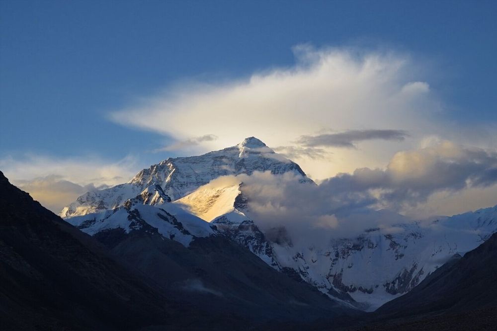
Everest is the highest mountain in the world, standing at 8,848.86 meters as measured in 2020 by a Sino-Nepali expedition that revised the official Chinese figure of 8,844 m and confirmed the Nepali measurement of 8,848 m. This precision down to a few decimal places may seem trivial, but it illustrates how this summit remains an object of scientific competition just as much as a sporting one.
The mountain is called Sagarmatha in Nepali ('forehead of the sky') and Chomolungma in Tibetan ('goddess mother of the world'). The name 'Everest' was assigned in 1865 by the Royal Geographical Society in honor of George Everest, former head of the Great Trigonometrical Survey of India — who, in a historical irony, opposed the use of his own name to designate mountains. The first documented attempt to climb it dates back to 1921, during the first British reconnaissance expedition. George Mallory, who took part in that expedition and again in 1922 and 1924, left behind the now-legendary phrase explaining his motivation: 'Because it's there.'
The first confirmed ascent was made by Edmund Hillary and Tenzing Norgay Sherpa on 29 May 1953, at 11:30 in the morning. Since then, more than 11,000 ascents have been recorded (in total, from all sides), by approximately 6,400 different climbers. Its popularization has transformed Everest: in 2023, more than 600 climbing permits were issued by the Nepali government for the spring season alone.
Two main routes are used. The South Col route (Nepali side), taken by Hillary and Tenzing, is today the most heavily trafficked. It passes through base camp at Khumbu (5,364 m), the Khumbu Icefall — one of the most dangerous sections, where seracs can collapse without warning — then Camps II, III, and IV before the final push. The North Face route (Tibet side) is longer and requires a separate permit issued by China, which has closed this side on several occasions for political or health reasons.
Everest's mortality rate is often misunderstood. It stands at around 1% of ascents (approximately 310 deaths since 1953), which is well below that of several other 8,000 m peaks. The primary cause of death is altitude itself (pulmonary or cerebral edema), followed by falls and avalanches. The 'death zone' begins above 8,000 meters: the body consumes more oxygen than it can absorb, even with a supplemental O₂ canister. Descending quickly is often the only survival option.
The cost of a commercial Everest expedition runs around €30,000 to €100,000 depending on the agency and level of service. The Nepali permit alone costs $11,000 per climber. The ideal season is concentrated in April–May (pre-monsoon), or more rarely September–October (post-monsoon), when the jet-stream winds temporarily withdraw from the summit.
K2 (8,611 m): the Savage Mountain
K2 (Karakoram, Pakistan, rated 4.7/5 on Google with 6,244 reviews), at 8,611 meters, is the second highest mountain in the world, and by far the most deadly among the Himalayan giants. Its historical mortality rate hovers around 25 to 30% of summit attempts, roughly one death for every four successful ascents. This figure has fallen slightly thanks to modern techniques and improved weather forecasting, but K2 remains fundamentally more difficult than Everest. Its nickname, 'the Savage Mountain,' is well earned.
The designation 'K2' is purely administrative: it was the second peak measured by the British survey commission of 1856. Its local name Chogori ('great mountain' in Balti) is little used outside Pakistan. The mountain straddles the border between Pakistan (southwestern face, Gilgit-Baltistan side) and China (northeastern face, Xinjiang side).
The first ascent was accomplished on 31 July 1954 by Italians Lino Lacedelli and Achille Compagnoni, during an expedition led by Ardito Desio. This ascent was marred by controversy: Walter Bonatti, a young climber on the expedition who had carried the oxygen bottles to the final camp, claimed for decades that Lacedelli and Compagnoni had moved the camp to prevent him from joining them and sharing the glory. This dispute lasted fifty years before being officially resolved in Bonatti's favor.
What makes K2 so different from Everest is the nature of its slopes. The mountain has no long, gradual itinerary: it rises quickly, steeply, with few places to establish rescue camps. The most feared section is the 'Bottleneck', a 50-degree couloir wedged beneath a massive hanging serac at around 8,200 meters. In August 2008, eleven climbers died over two days in and around this zone: the serac collapsed, severing the fixed ropes and sending several climbers into the void. It is one of the deadliest disasters in the history of high-altitude mountaineering.
K2 was also the last of the ten highest mountains to be climbed in winter. This extraordinary achievement was finally accomplished on 16 January 2021 by a Nepali team of ten climbers — Nirmal 'Nims' Purja, Mingma Gyalje Sherpa, Mingma David Sherpa, and seven others — who reached the summit together in temperatures of -65°C with wind. A historic moment for world mountaineering.
The season for attempting K2 is even shorter than for Everest: June and July offer the best window on the Pakistani side. The Pakistani permit costs around $1,800 per climber, significantly less than in Nepal, but the logistical conditions in Baltistan (Karakoram Highway, base camp trek from Skardu) make the expedition long and costly.
Kangchenjunga (8,586 m): the Sacred Mountain
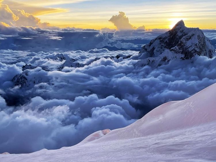
Kangchenjunga (Taplejung, Nepal, rated 4.5/5 on Google with 231 reviews) is the third highest peak in the world at 8,586 meters. It sits on the border between Nepal and the Indian state of Sikkim, and its name roughly translates to 'the five treasures of snow' in Tibetan, referring to its five main peaks. For the people of Sikkim, it is not a mountain to be conquered but a protective deity. This is why climbers who reach the summit honor a tradition: stopping a few meters short of the highest point, leaving the summit 'sanctuary' intact. The Sikkim government has requested this of expeditions since 1977.
The first ascent dates to 25 May 1955, by the British climbers George Band and Norman Hardie, during an expedition led by Charles Evans. Two other members, Tony Streather and Norman Hardie, followed the next day. Band and his rope team honored the Maharaja of Sikkim's request not to set foot on the absolute summit, a convention since adopted by all serious mountaineers on this peak.
Kangchenjunga is renowned for its particularly unpredictable weather conditions and its slopes laden with heavy snow, making them prone to avalanches. Its mortality rate is close to that of K2, around 20 to 22%. The main route passes via the southwest face (Nepali side), but the mountain has several secondary summits near 8,000 meters, including Kangchenjunga South (8,476 m) and Kangchenjunga Central (8,482 m).
What sets Kangchenjunga apart from the top two is its relative isolation. Expeditions depart from Taplejung, in eastern Nepal, via a multi-week trek through a region visited by very few tourists. The approach is long, infrastructure is limited, and encounters with other expeditions are rare. Some mountaineers consider that this relative solitude makes Kangchenjunga a more authentic experience than the crowded routes of Everest.
Lhotse (8,516 m): Everest's Neighbor
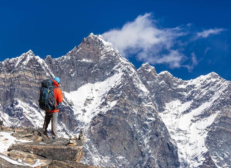
Lhotse (Sagarmatha Region, Nepal, rated 4.6/5 on Google with 2,207 reviews), meaning 'south peak' in Tibetan, reaches 8,516 meters and is the fourth highest peak in the world. Its defining characteristic is that it is directly connected to Everest by the South Col (7,906 m), to the point that the ascent routes of both mountains are shared up to Camp III. A practical consequence: most climbers attempting Lhotse simultaneously use it for Everest acclimatization, and vice versa. This 'twin summit' is a prime target for 8,000 m collectors.
The first ascent was made on 18 May 1956 by the Swiss climbers Ernst Reiss and Fritz Luchsinger, members of a Swiss expedition operating in parallel with another team on Everest. Since then, approximately 550 ascents have been recorded, with a relatively moderate mortality rate for an 8,000 m peak, around 3%.
The south face of Lhotse is one of the most impressive in the Himalayas: a near-vertical wall of 3,200 meters, regarded by many as the ultimate technical challenge at altitude. Its conquest was the subject of fierce rivalry in the 1980s and 1990s, and the direct line on the south face remains one of the most difficult routes ever traced in high-altitude mountaineering, still rarely repeated to this day.
Makalu (8,485 m): the Isolated Colossus
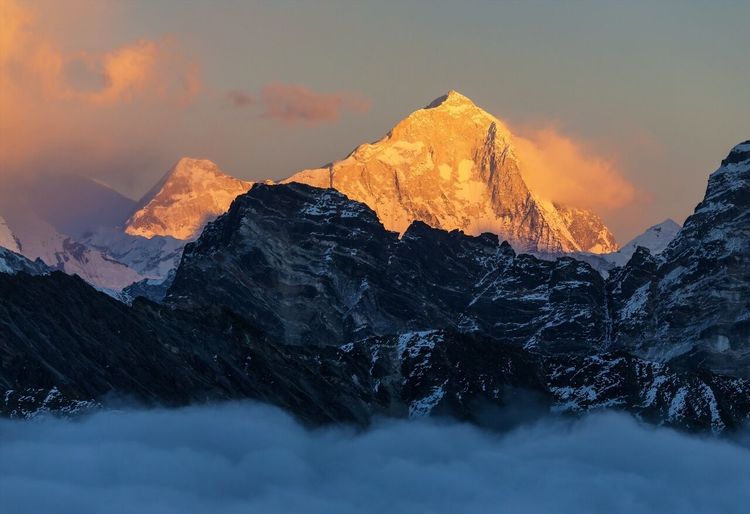
Makalu (Sankhuwasabha, Nepal, rated 4.8/5 on Google with 750 reviews) (8,485 meters) is the fifth highest peak in the world, located approximately 19 kilometers east of Everest on the Nepal-Tibet border. Its almost perfectly pyramidal shape, with four faces, makes it instantly recognizable. 'Makalu' is thought to derive from the Sanskrit Maha Kala ('great black one'), referring to the rocky walls that rise above the snow on its flanks.
The first ascent dates to 15 May 1955, achieved by a French expedition led by Jean Franco: Lionel Terray and Jean Couzy reached the summit together that day, followed the next day by Franco, Guido Magnone, and Sherpa Gyalzen Norbu, then by four more members on 17 May. This collective success, rare for an 8,000 m peak at the time, came after the ascent of Annapurna by Maurice Herzog in 1950 and Everest in 1953: France was then at the pinnacle of world mountaineering. The 1955 expedition is considered one of the best-prepared in Himalayan history.
Makalu is renowned for its exceptional technical difficulty relative to its rank. Its mortality rate historically hovers around 20 to 22%, close to that of K2. The reason: the mountain offers few easy passages, and the high-altitude sections are exposed to violent winds. The climbing window is very short, often limited to ten or fifteen days in May. Fewer than 600 people have managed to reach its summit.
Cho Oyu (8,188 m): the Accessible Summit
Cho Oyu (Khumbu Region, Nepal/Tibet, rated 4.3/5 on Google with 290 reviews) (8,188 meters) is the sixth highest peak in the world, on the Nepal-Tibet border approximately 20 kilometers west of Everest. Its Tibetan name means 'turquoise goddess.' Among the fourteen 8,000 m peaks, it is generally considered the most technically accessible, making it a popular target for mountaineers looking to gain high-altitude experience before attempting more challenging summits.
The first ascent was made on 19 October 1954 by Austrian Herbert Tichy, Swiss climber Sepp Jöchler, and Sherpa Pasang Dawa Lama, members of a small expedition that used no supplemental oxygen — a notable achievement for the era. Since then, approximately 3,800 successful ascents have been recorded, an exceptionally high figure for an 8,000 m peak, with a mortality rate of only around 1.5%.
The normal route runs via the Tibetan (northwestern) face, which requires passing through Lhasa and obtaining Chinese permits. This geopolitical dependency makes access subject to administrative closures decided by Beijing. The Tibetan route is nonetheless more direct and technically less committing than most other 8,000 m approaches.
Dhaulagiri (8,167 m): the White Massif
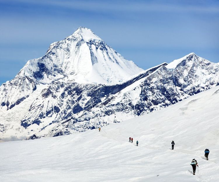
Dhaulagiri (Mustang, Nepal, rated 4.7/5 on Google with 354 reviews), meaning 'white mountain' in Sanskrit, reaches 8,167 meters and is the seventh highest peak in the world. Located entirely within Nepal, it dominates the Kali Gandaki valley, which separates its massif from that of Annapurna by one of the deepest canyons on the planet. For more than three decades in the early 19th century, before Everest was measured, Dhaulagiri was considered by European geographers to be the highest mountain in the world.
Its first ascent did not come until 13 May 1960, by an international expedition including Swiss, Austrian, German, Nepali, and American members. One of the team, Kurt Diemberger, would go on to become one of the most iconic mountaineers of his generation. The normal northeast route is the most frequently used, but the mountain is known for its sudden storms and frequent avalanches on several faces. Its mortality rate is around 15%, placing it among the most dangerous 8,000 m peaks.
Manaslu (8,163 m): the Mountain of the Spirit
Manaslu (Gorkha, Nepal, rated 4.4/5 on Google with 509 reviews) (8,163 meters) is the eighth highest peak in the world, located entirely in Nepal, in the Gorkha region. Its name derives from the Sanskrit Manasa ('spirit' or 'intellect'), and it is sometimes called the 'mountain of the spirit' in local traditions. The Manaslu Circuit trek, which circles the mountain through remote villages and high-altitude passes, has become one of Nepal's most sought-after trekking routes, rivaling the Annapurna Circuit for travelers looking to avoid the crowds.
The first ascent was made on 9 May 1956 by Japanese climber Toshio Imanishi and Sherpa Gyalzen Norbu, during a Japanese expedition. Japan sent several expeditions to this mountain, to the point that Manaslu is sometimes called 'the Japanese mountain' in the Himalayan community. Since then, the number of attempts on Manaslu has soared with the rise of commercial mountaineering: several thousand ascents in total, with a mortality rate of around 6 to 7%.
In 2012, a devastating avalanche killed 11 mountaineers at Camp III in a single night, a reminder that even the 'less difficult' 8,000 m peaks can be deadly. The normal route (northeast face) presents fewer pure technical challenges than K2 or Kangchenjunga, but altitude and weather remain constant risk factors.
Nanga Parbat (8,126 m): the Killer Mountain
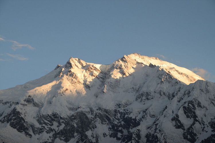
Nanga Parbat (Gilgit-Baltistan, Pakistan, rated 4.7/5 on Google with 1,464 reviews) (8,126 meters) is the ninth highest peak in the world and the highest point in the western Himalayas, in Pakistan. Its nickname, 'the Killer Mountain' (Killer Mountain), is well deserved: for decades, its mortality rate was among the highest of all 8,000 m peaks, sometimes cited at around 25 to 30% during the early decades of exploration. Since 1950, with improvements in technique and equipment, this rate has declined but remains significantly above average.
Nanga Parbat has three radically different faces. The Rupal Face (south side) is one of the highest walls in the world: approximately 4,600 meters from base to summit, far taller than the north face of the Eiger. The Diamir Face (west side) is the normal route most commonly used since the first ascent. The Rakhiot Face (northeast side) was the target of the first German expeditions of the 1930s.
The history of Nanga Parbat's exploration is a dark one. The German expedition of 1934 lost several climbers and porters in a high-altitude storm. The 1937 expedition was wiped out by a nocturnal avalanche that killed 16 people at Camp IV, one of the deadliest disasters in the history of Himalayan mountaineering before more recent accidents. The first ascent finally came in 1953, when Austrian Hermann Buhl reached the summit solo, without oxygen, after a forced bivouac at extreme altitude and more than 40 hours of continuous climbing from the last camp. This feat remains one of the most extraordinary in the history of mountaineering.
In 2013, an armed attack attributed to a group linked to the Pakistani Taliban killed ten foreign climbers and one local guide at the base camp on the Diamir side, in what was the deadliest attack ever carried out on a high-altitude base camp. Since then, security at base camp has been reinforced by Pakistani military personnel.
Annapurna (8,091 m): the Deadliest Summit
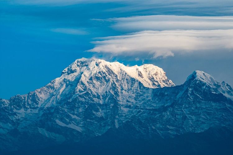
Annapurna (Kaski, Nepal, rated 4.8/5 on Google with 2.3K reviews) (8,091 meters) is the tenth highest peak in the world, but the one that holds the absolute record for danger in proportion of successful ascents to deaths. Its historical mortality rate, around 30% during the early decades, is among the highest of the 8,000 m peaks. Since 1950, a few hundred successful ascents have been recorded against several dozen deaths, a ratio long close to one death for every three summits reached. These figures have improved in recent years thanks to satellite weather forecasting and modern equipment, but Annapurna remains a fundamentally hostile mountain.
The story of its conquest holds a special place in world mountaineering: on 3 June 1950, the French climbers Maurice Herzog and Louis Lachenal reached the summit, the first 8,000 m peak ever climbed by humanity. The ascent was bold to the point of recklessness: Herzog and Lachenal reached the summit very late in the day, without oxygen, and the descent through a blizzard cost Herzog most of his toes and fingers. Herzog recounted this epic in his book Annapurna, First 8000, published in 1951, which became one of the best-selling adventure narratives in French publishing history, with several million copies distributed worldwide.
The Annapurna massif is also one of the most complex: it includes several high summits (Annapurna I being the highest point, followed by Annapurna II, III, and IV). The normal route passes via the north face, but several variant routes have been opened on the south and east faces, with extreme difficulty. Annapurna is also known for its particularly high avalanche risk, especially on the south face, which receives the monsoon directly from the Indian Ocean.
The Annapurna Circuit, which encircles the massif over approximately 200 kilometers, is considered by many trekkers to be one of the most beautiful treks in the world. It is distinct from the actual summit ascent, but allows you to get close to the massif, observe its faces, and understand why this mountain has haunted generations of mountaineers. If you are planning to visit Nepal, the Ryo app lists many sites and routes around the Himalayan regions to help you plan your journey.
Summary Ranking of the 10 Highest Peaks
Here is the complete table of the ten highest peaks in the world with their key data:
| Rank | Peak | Altitude | Country | First Ascent | Approx. Mortality Rate | |------|------|----------|---------|--------------|------------------------| | 1 | Everest | 8,849 m | Nepal/China | 1953 (Hillary, Norgay) | ~1% | | 2 | K2 | 8,611 m | Pakistan/China | 1954 (Lacedelli, Compagnoni) | ~25% | | 3 | Kangchenjunga | 8,586 m | Nepal/India | 1955 (Band, Hardie) | ~22% | | 4 | Lhotse | 8,516 m | Nepal/China | 1956 (Reiss, Luchsinger) | ~3% | | 5 | Makalu | 8,485 m | Nepal/China | 1955 (Terray, Couzy) | ~22% | | 6 | Cho Oyu | 8,188 m | Nepal/China | 1954 (Tichy, Jöchler) | ~1.5% | | 7 | Dhaulagiri | 8,167 m | Nepal | 1960 (international expedition) | ~15% | | 8 | Manaslu | 8,163 m | Nepal | 1956 (Imanishi, Norbu) | ~7% | | 9 | Nanga Parbat | 8,126 m | Pakistan | 1953 (Buhl, solo) | ~20% | | 10 | Annapurna | 8,091 m | Nepal | 1950 (Herzog, Lachenal) | ~30% |
All of these summits belong to the Himalayas or the Karakoram. No peak located outside this zone comes close to 8,000 meters: Cerro Aconcagua in Argentina, the highest point in the Americas, reaches 'only' 6,962 meters.
The Highest Peaks by Continent: What Other Records Exist?
The ten highest peaks in the world are exclusively Himalayan or Karakoram, but every continent has its own giants. The Seven Summits (Seven Summits) refer to the highest points on each continent, a coveted goal for ambitious mountaineers. Aconcagua (6,962 m) in Argentina dominates the Americas. Denali (6,190 m) in Alaska crowns North America. Kilimanjaro (5,895 m) in Tanzania is the roof of Africa, and one of the most accessible high points, reachable without technical equipment by well-prepared trekkers. In Europe, the debate remains open depending on whether one considers Mont Blanc (4,808 m) in the Franco-Italian Alps or Elbrus (5,642 m) in the Russian Caucasus as Europe's highest summit, with the geographical boundary between Europe and Asia varying by source.
In Oceania, Puncak Jaya (4,884 m) in Indonesia (New Guinea) is the highest point if one applies the broader boundaries of the Australasian continent (rather than Australia alone, whose highest summit, Mount Kosciuszko, reaches only 2,228 m). In Antarctica, Mount Vinson (4,892 m) in the Ellsworth Mountains is the highest, accessible only from the Union Glacier logistics base. On the African continent, beyond Kilimanjaro, the highest summits are concentrated in Kenya (Mount Kenya, 5,199 m), on the Uganda-DR Congo border (Rwenzori massif, with Margherita Peak at 5,109 m), and in Ethiopia (Ras Dashen, around 4,550 m).
This geography of records is at the heart of many exploratory features on the Ryo app: articles on the world's largest countries by area or on the most populous countries help complete this global vision of our planet's extremes.
Preparing an Expedition to an 8,000 m Peak: What You Need to Know
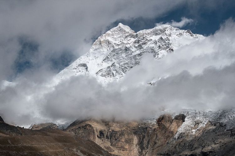
Beyond the heroic tales, attempting to climb an 8,000 m peak requires serious preparation and several years of prior high-altitude experience. Here are the steps and parameters to know if you are seriously considering such a project.
Acclimatization is the number-one factor for success and survival. The human body cannot adapt instantly to the reduction in atmospheric pressure: at 8,000 meters, the air contains only about one-third of the oxygen available at sea level. A climber who ascends too quickly develops acute mountain sickness (AMS), which can progress to fatal pulmonary or cerebral edema. The standard protocol requires advancing in stages, regularly descending to lower camps, and allowing a minimum of six to eight weeks for acclimatization before the final push.
Base physical fitness must be exceptional. Specialist coaches recommend hundreds of hours of specific training (intensive cardiovascular work, functional strength training, simulated altitude sessions in a hypoxic chamber) over two to three years before attempting an 8,000 m peak. Most commercial climbers who ascend Everest have spent several years on summits of 5,000 then 6,000 meters (Aconcagua, Denali, Cho Oyu first) before taking on the challenge.
Essential gear includes: a high-altitude down suit (comfort rating close to -40°C), 12-point crampons, appropriate ice axes, oxygen masks and cylinders (for the vast majority of modern ascents), tunnel tents able to withstand extremely strong winds, and satellite communication systems. The complete equipment kit for an 8,000 m climber easily amounts to €15,000 to €25,000 in gear alone, excluding food and permits.
The total budget for a commercial Everest expedition ranges from €30,000 to €100,000 depending on the agency. Pakistani peaks (K2, Nanga Parbat) cost less in permits but more in approach logistics. Less well-known Nepali peaks like Manaslu or Cho Oyu are often considered more affordable options for a first 8,000 m attempt (sometimes from as little as €15,000 to €25,000 all-inclusive).
High-altitude guides play a central role. Nepali Sherpas and high-altitude porters from Baltistan form the backbone of all commercial expeditions. Without them — establishing camps, fixing ropes, and carrying oxygen bottles — the vast majority of contemporary ascents would be impossible. Their pay and safety conditions are an increasingly debated topic in the international mountaineering community.
The climbing window is critical. For Nepali peaks, the spring window (mid-April to late May) is the most widely used: the jet stream shifts slightly northward, offering a few days of moderate winds. The autumn window (September–October) is less reliable. For Pakistani peaks, summer (June–August) is the right season — no monsoon, but frequent afternoon thunderstorms.
FAQ
Which is the most dangerous peak among the 10 highest in the world?
According to historical statistics, Annapurna (8,091 m) is the most dangerous in terms of the death-to-successful-ascent ratio, with a mortality rate of around 30% throughout its history. K2 and Nanga Parbat follow closely at around 25%. Everest, despite its fame, is among the least deadly thanks to its well-marked routes and the commercial industry surrounding it.
Can you climb Everest without prior mountaineering experience?
No. Reputable commercial agencies require several years of high-altitude experience before accepting a client on Everest. Most require a successful ascent of at least a 7,000 m peak (often Denali or Aconcagua) and experience on glaciers and ice. The Nepali government does not itself impose very strict criteria, but responsible agencies refuse unqualified climbers.
What is the best season to attempt the 8,000 m peaks?
For the peaks of the Nepali Himalayas (Everest, Lhotse, Kangchenjunga, Manaslu, Annapurna, Makalu), the spring window (mid-April to late May) is the primary one. For Pakistani peaks (K2, Nanga Parbat), June and July are the preferred months. Cho Oyu on the Tibet side is often attempted in September–October to avoid peak-season permits.
How much does a permit to climb Everest cost?
The Nepali government charges $11,000 per climber for an Everest climbing permit, valid for the spring season. This amount does not cover the rest of the expedition costs (agency, transport, equipment, Sherpas, oxygen), which bring the total bill to €30,000 to €100,000 depending on the level of service.
How many people have climbed all 14 peaks above 8,000 meters?
Since Reinhold Messner's achievement in 1986 (the first to climb all 14 peaks above 8,000 m, all without supplemental oxygen), several dozen mountaineers have accomplished what is known as the '8000ers Grand Slam.' Among the most notable, Nirmal Purja completed all 14 in just 189 days in 2019, shattering the previous record by nearly eight years.
Are there any peaks above 8,000 meters outside Asia?
No. All 14 peaks above 8,000 meters are located in Asia, exclusively in the Himalayas and the Karakoram (spanning Nepal, China/Tibet, India, and Pakistan). No peak on any other continent exceeds 7,000 meters: Aconcagua in Argentina, the highest summit outside Asia, tops out at 6,962 meters.
Conclusion
From the 8,849 meters of Everest to the 8,091 meters of Annapurna, these ten summits alone concentrate the greatest epics in world mountaineering, the most extraordinary records, and the most intense human stories. This ranking of the world's highest peaks is also an invitation to understand our planet: its geology, its climatic extremes, and the limits of human endurance.
Whether you dream of climbing or simply of traveling through the Himalayan regions, the Ryo app is here to help you explore these extraordinary destinations. Find audio guides, itineraries, and articles on Ryo to plan your adventures in Asia and beyond, from Katmandou to the massifs of Pakistan.