© Shutterstock
 Votre guide Ryo
Col de la Forclaz: Complete Guide to Hikes on the East Shore of Lake Annecy (2026)
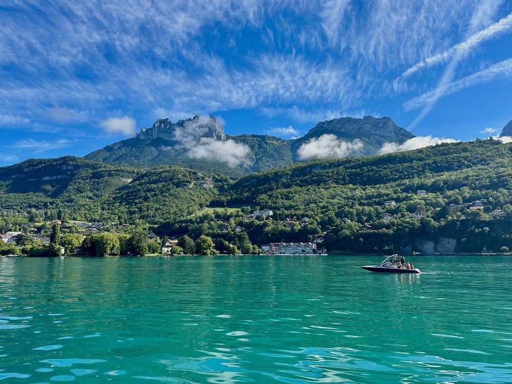
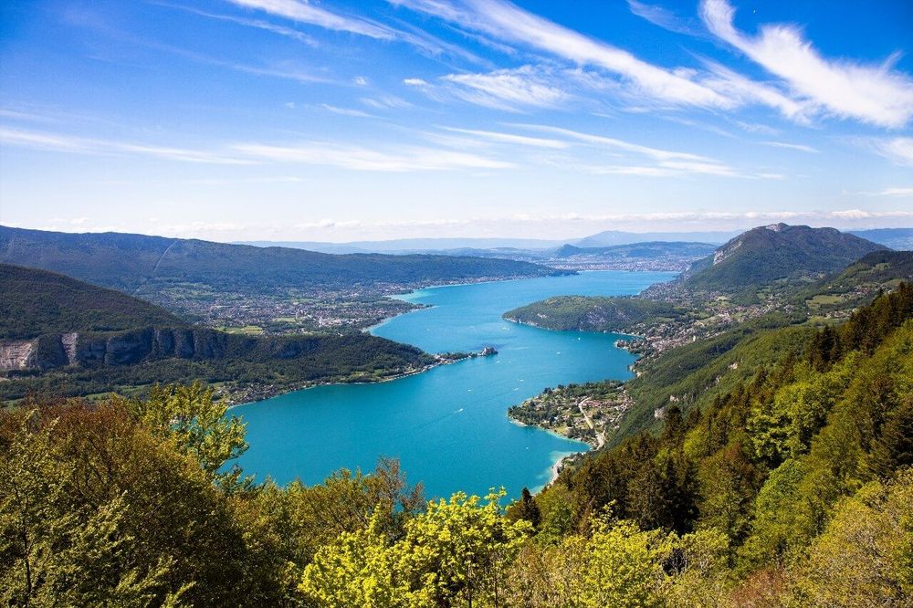
Some mountain passes are mere waypoints, and then there is the col de la Forclaz — the kind you reach and never want to leave. Search "col de la Forclaz hike" in any search engine and you will quickly understand why: at 1,150 metres above sea level, perched on the east shore of Lake Annecy, the pass offers one of the most photographed viewpoints in the French Alps — the turquoise lake below, the Bauges ridgelines opposite, and that particular silence found only in the mountains. But this pass is more than a viewpoint. It is the gateway to a network of hiking trails that stretches from lake level all the way up to the 2,351-metre summit of the Tournette.
In this guide, you will find 10 detailed itineraries for all levels: the short panoramic loop for families, the classic ascent from the southern tip of the lake via Verthier, the climb to the chalet de l'Aulp through the alpine meadows, and the long route to the pointe de Talamarche. Each itinerary includes elevation gain, estimated duration, required level and the key points you need to know to set off well prepared. Whether you arrive by car from Doussard or from Talloires, this corner of the Bornes-Aravis massif has surprises in store even for those who know the area well. To prepare your stay in Annecy beyond the trails, the Ryo audio guide accompanies you through the main historic and natural sites of the town and its shores.
The Col de la Forclaz: Panorama, Access and What to Know Before You Go
The col de la Forclaz (Route du Col de la Forclaz, 74290 Talloires-Montmin, rated 4.8/5 on Google with 1,550 reviews) is located in the commune of Talloires-Montmin, in the Bornes-Aravis massif, about twenty kilometres from Annecy along the east shore. Its elevation of 1,150 metres makes it a pass accessible by car from the valley — allow 20 minutes from Doussard or from Talloires, via two separate roads that meet at the summit. The pass is also one of Europe's largest paragliding launch sites: do not be surprised to see colourful wings taking off above the lake right next to the car park.
The pass has a free car park with around fifty spaces, which is often full by 9 a.m. on July and August weekends. Practical tip: arrive before 8:30 a.m. in peak season, or opt for a climb from below (from Verthier or from Doussard), incorporating the pass into the itinerary rather than using it as a starting point. Outside of peak season, the car park is almost always empty.
The pass has several restaurants and mountain chalets, some open year-round, where you can refill your water and take a break. Do not count on a reliable water source along the trails beyond the pass, however — bring at least 1.5 litres per person. Most itineraries start directly from the pass, with the exception of the hikes from Verthier and Doussard, which join the pass partway through.
General orientation: from the car park, the trail to the pointe de la Rochette heads due north, the one to the pointe de Talamarche heads north-east, and the trail to the chalet de l'Aulp follows the hillside in the direction of the lake. Waymarking is generally reliable, but a few junctions lack clarity — note down the main waypoints before setting off.
In terms of season, the ideal window runs from May to October. High-altitude routes (Tournette, Talamarche) remain snow-covered until June and require crampons or poles in May. In winter, the pass becomes a snowshoeing and ski-touring area.
The Short Panoramic Loop at the Col de la Forclaz: the Perfect Warm-Up Walk
Level: easy | Elevation gain: +80 m / -80 m | Distance: 3 km | Duration: 1 hour
If you are with young children or simply want to enjoy the panorama without intense physical effort, this short loop is made for you. It sets off from the pass car park, climbs briefly to the first alpine meadows above, then descends on the Doussard side before returning to the starting point via a shaded forest path.
The highest point of the loop sits at around 1,230 metres — 80 metres above the pass. That is enough to open up a full view of the lake: the Grand Lac to the left, the Petit Lac to the right, and the Aravis chain as a backdrop on clear days. Children particularly enjoy the alpine meadow area just before the flat section, where cows often roam freely in summer.
The trail is waymarked in yellow and presents no technical difficulty. The one catch: a short section through a fenced pasture with electric fences — follow the designated crossing points. The descent through the forest can be muddy after rain; closed-toe shoes are recommended even for this short walk.
This loop also makes a good starting point for hikers who then wish to move on to the more demanding itineraries described later in this guide.
The Hike from Verthier at the Southern Tip of the Lake: the Classic Ascent
Level: moderate | Elevation gain: +620 m / -620 m | Distance: 11 km | Duration: 4 hours round trip
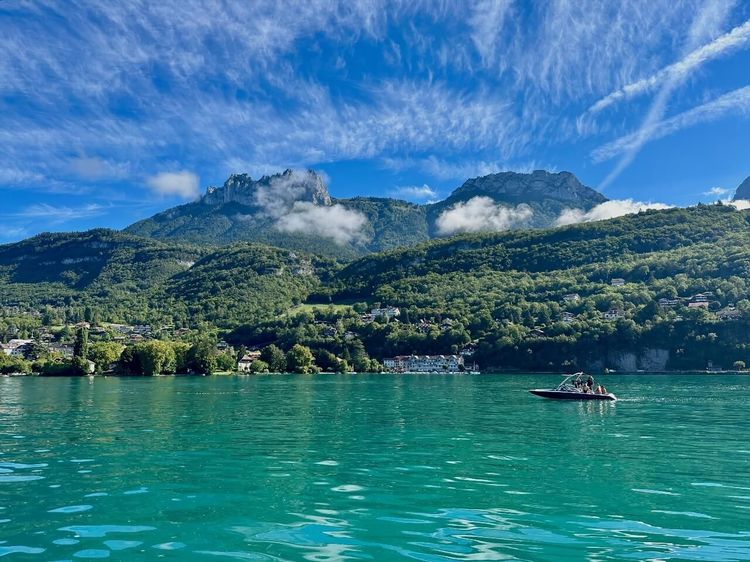
This is undoubtedly the most iconic itinerary in the area, and one of the most highly rated by hikers who know the east shore well. The starting point is Verthier, a hamlet on the lakeside belonging to the commune of Doussard, at the southern tip of Lake Annecy — the famous "bout du lac".
From the Verthier car park (Route de Verthier, 74210 Doussard, rated 4.3/5 on Google with 134 reviews) (free, around twenty spaces), the trail climbs through woodland for the first hour. The gradient is steady and sustained — expect around 350 metres of elevation gain in the first section before emerging into the first clearings with views over the lake. This is where the hike begins to reward the effort: the lake appears below, and the perspective over both shores gradually opens up as you gain altitude.
The second part of the climb crosses alpine meadows towards the pass itself. The going becomes gentler, the landscape opens up, and you start to encounter hikers heading in the opposite direction. The col de la Forclaz appears as a grassy horizon line before suddenly revealing the view over the opposite hillside.
At the pass, you can take a break at one of the chalet restaurants, then head back down the same way or choose a variant through the alpine meadows on the north flank — this variant adds about 45 minutes and a few extra metres of elevation but avoids retracing the same forest sections. If you are feeling energetic, combining this hike with the pointe de la Rochette from the pass is possible, adding 1h30 to your outing.
Logistics: Doussard railway station is less than 2 km from Verthier, making this itinerary accessible by public transport from Annecy (T72 bus line in summer). For families with pushchairs or people with reduced mobility, the lakeside walk from Verthier to the first wetlands is manageable without any hiking.
The Col de la Forclaz Hike from Doussard: the Direct Ascent via the Ridgelines
Level: moderate | Elevation gain: +680 m / -680 m | Distance: 12 km | Duration: 4h30 round trip
Less well known than the Verthier variant, the ascent to the col de la Forclaz from the centre of Doussard (Place de la Mairie, 74210 Doussard) follows a different route that passes over intermediate ridgelines and offers wider views over the valley and the massif. The hike starts from the village car park, and the first few kilometres cross agricultural land before the forest climb begins.
The distinctive feature of this itinerary is a flat section at around 900 metres, at the level of the alpine chalets in the Marlens area, which offers an unexpected head-on view of the lake. Most hikers on this route rush through this section without stopping — yet it is one of the least-visited photo spots in the area.
The final climb to the pass from this flat section is the steepest part of the itinerary, with a gradient of 20–25% over around 200 metres of elevation gain. The descent by the same route should therefore be planned carefully if your knees are sensitive. A gentler descent variant exists via Giez, but it requires a vehicle left in advance or a taxi.
This itinerary is poorly waymarked for the first few kilometres from Doussard — a navigation app or IGN map 3431 OT is strongly recommended to avoid losing the trail in the forest.
The 7 Fontaines Loop: the Nature and Water Itinerary
Level: easy to moderate | Elevation gain: +300 m / -300 m | Distance: 7 km | Duration: 2h30
The 7 Fontaines loop is one of the most popular hikes in the area among families and walkers looking for a well-structured itinerary with regular points of interest. It starts from the col de la Forclaz (Route du Col de la Forclaz, 74290 Talloires-Montmin, rated 4.8/5 on Google with 1,550 reviews) and follows a figure-of-eight route that passes through several natural springs and wetland areas in succession.
The name comes from the seven springs dotted along the route, some of which are tapped to supply water to the surrounding alpine chalets. It is one of the rare itineraries in the area where you will find water along the way — check the signs on site, which indicate whether a spring has been treated or not.
The route passes through areas of mixed forest (beech, spruce), clearings and several grassy flat sections with intermittent views of the lake. The lower part of the loop runs alongside a small stream for about 500 metres — a pleasant feature in summer. The steepest climb remains gentle, with a maximum gradient of 15%.
The loop is particularly beautiful in spring (alpine flowering, springs at peak flow) and in autumn (forest colours, very few people). In summer, opt for the early morning hours — the route is shaded in the morning but in full sun during the afternoon on the upper section.
From the Col de la Forclaz to the Chalet de l'Aulp (Prés Ronds): the Suspended Alpine Meadow
Level: moderate | Elevation gain: +300 m / -300 m | Distance: 8 km | Duration: 3 hours round trip
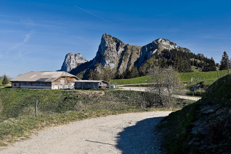
The chalet de l'Aulp (Prés Ronds, 74290 Talloires-Montmin, rated 4.5/5 on Google with 320 reviews) is one of the best-situated alpine refuges on the east shore of the lake. Perched at 1,424 metres, near the col de l'Aulp and the Prés Ronds plateau, it overlooks a vast grassy shelf where cows graze from June to September. The view from this area over Lake Annecy and the surrounding ridges is often described as even more impressive than the view from the pass itself.
The hike starts from the col de la Forclaz. The trail first climbs through pastures before tackling the steeper section towards the col de l'Aulp and the chalet. The elevation gain of around 300 metres remains manageable, though the gradient steepens on the final stretch. Allow 1h15 to 1h30 for the ascent at a moderate pace.
The chalet de l'Aulp serves food and drinks in summer (alpine cheeses, omelettes, hot drinks), but hours vary with the season. Call ahead if you plan to have lunch there — the wardens do not always remain on site in bad weather. Outside the summer grazing period (before mid-June, after mid-September), the chalet is generally closed.
From the chalet, it is possible to continue towards the pointe de la Rochette (see the following section) or to descend via another hillside towards Montmin, turning the outing into a traverse that requires two vehicles or a taxi back.
This is one of the itineraries that users of the Ryo Annecy audio guide often extend into a hike after discovering the lake shores: the east shore offers a wild and natural counterpart to the historic town.
The Pointe de la Rochette: the Family Hike with an Expert View
Level: moderate | Elevation gain: +350 m / -350 m | Distance: 8 km | Duration: 3 hours round trip
The pointe de la Rochette (Massif des Bornes-Aravis, 74290 Talloires-Montmin, rated 4.5/5 on Google with 35 reviews) peaks at 1,491 metres and offers one of the finest viewpoints on the east shore: Lake Annecy below, the imposing silhouette of the Tournette close at hand, the Bauges opposite and the Aravis in the background. It is the "summary" hike of the area — it distils everything the east shore has to offer into a single itinerary, and it remains accessible to a capable walker comfortable with a moderate amount of elevation gain.
The hike starts from the col de la Forclaz. The trail heads due north along a well-defined path, passes through the paragliding launch area and then follows the GRP waymarking (red and white) to the col de la Rochette, from where the summit is just a few minutes away. The final metres follow a narrowing path with a few sections that require a little care, but no specialist equipment or climbing skills.
At the top, settle on the flat rocks that form the highest point. On a fine late morning, Lake Annecy appears in an almost unreal shade of blue, the mountain slopes mirrored in the water, with the Tournette dominating the scene directly opposite.
The "family-friendly" label deserves some qualification: the hike is suitable for children aged 8–10 and above with experience of mountain walking. For younger children, opt for the 7 Fontaines loop or the short panoramic loop instead.
The Pointe de Talamarche: the Technical Ascent to the East Shore Summits
Level: difficult | Elevation gain: +700 m / -700 m | Distance: 13 km | Duration: 5–6 hours round trip
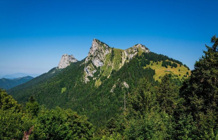
The pointe de Talamarche (Massif des Bornes-Aravis, 74290 Talloires-Montmin, rated 4.7/5 on Google with 42 reviews) is the itinerary that separates regular hikers from occasional walkers. At 1,852 metres, it demands around 700 metres of elevation gain from the col de la Forclaz over terrain that becomes noticeably more demanding in its upper section. In return, the views from the summit rank among the most open on this side of the massif.
The departure from the col de la Forclaz heads north-east. The trail initially climbs through forest on a relatively gentle path for the first hour, which can be misleading. Beyond 1,600 metres, the route shifts onto more rocky terrain, with exposed ridge sections open to the wind. This is where weather conditions become critical: a storm rolling in above 1,700 metres offers no shelter whatsoever.
The final section of the ascent follows a ridge that demands attention — not technical skills, but good balance and a sound sense of orientation on exposed terrain. Sturdy hiking boots with a gripped sole are essential; lightweight trainers are not appropriate.
From the pointe de Talamarche, the panorama opens up widely: Lake Annecy below, the Aravis massif, the Mont-Blanc range on clear days, and the imposing mass of the Tournette close by. It is one of the most complete viewpoints in the area without having to target a summit above 2,000 metres.
Plan to set off early in the morning to reach the summit before noon and descend before the afternoon thunderstorms, which are common in July and August. Bring warm clothing even in midsummer: the temperature at the summit is 5–7°C lower than at lake level. One walking pole per person is strongly recommended for the descent over rocky terrain. Down at lake level, our audio-guided tour of Annecy offers the gentler counterpart: 21 stops on the flat.
This hike is not suitable for children under 12 or for anyone prone to vertigo on ridge sections.
The Tournette from Talloires-Montmin: the Legendary Summit
Level: very difficult | Elevation gain: +1,200 m / -1,200 m | Distance: 18 km | Duration: 7–8 hours round trip
The Tournette is to the east shore what Mont Blanc is to the Alps: the reference summit, the challenge every hiker in the area wants to take on one day. At 2,351 metres, it is the highest summit overlooking Lake Annecy and the highest peak accessible on foot without mountaineering equipment (outside of winter conditions) in this area.
The classic route starts from the refuge de la Tournette (Montmin, 74290 Talloires-Montmin, rated 5/5 on Google with 8 reviews), accessible from Talloires-Montmin via a forest road. From the col de la Forclaz, you first need to reach Montmin by trail or by road, then head back up towards the refuge. Most hikers prefer to start directly from the car park near the refuge to avoid this detour.
From the refuge (at around 1,450 metres), the ascent to the summit first crosses open alpine meadows, then tackles a zone of rocky ridges with chains fixed on the most technical passages. These chains do not constitute climbing in the strict sense, but they do require using your hands and maintaining balance on inclined rock. The presence of chains reassures most intermediate hikers, but anyone prone to vertigo should think carefully before attempting this route.
The summit of the Tournette offers what hikers call an "exceptional panorama": the whole of Lake Annecy on one side, the Mont-Blanc massif on the other, with the Aravis and Bauges closing the horizon. Above all, there is that particular feeling of dominating the entire landscape you have travelled through from below.
A few essential points before you set off:
- Departure before 6:30 a.m. recommended in July and August to avoid afternoon thunderstorms
- Water: minimum 2 litres per person (no water source above the refuge)
- Equipment: sturdy hiking boots, warm layers, windproof jacket, sunglasses
- Children: not suitable under 14 years old, and only with experienced, physically fit young hikers
- Closed to standard hiking from November to late May approximately, depending on snow conditions
The Tournette is the hike you earn, and prepare for. Do not underestimate it just because you completed the pointe de la Rochette the previous week — the elevation gain and duration make it a full-day undertaking.
The Cascade d'Angon and Lanfonnet: the Area's Secret Alternatives
Level: easy to moderate | Elevation gain: +350 m / -350 m | Distance: 5–8 km | Duration: 2–3 hours
In the shadow of the major pass itineraries, two destinations remain largely overlooked by first-time visitors: the cascade d'Angon (Talloires, 74290 Talloires-Montmin, rated 4.5/5 on Google with 628 reviews) and the Lanfonnet area.
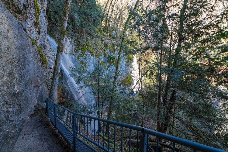
The cascade d'Angon is on the lakeside, in the commune of Talloires. It is reached via a trail that starts at the lake's edge and climbs through a two-tiered gorge — the lower tier is manageable in light shoes, the upper tier requires closed-toe footwear. Fed by runoff from the massif, the waterfall reaches its full power in May and June with the snowmelt. In summer, the flow is lower, but the coolness of the gorge makes it a welcome refuge in the heat.
The Lanfonnet area and the roche de la Murraz offer another little-frequented variant, starting from the col de la Forclaz. The path crosses poorly waymarked alpine meadows before reaching flat sections with surprising views over the valley and lake. This is an itinerary for those who want to escape the crowds and are comfortable navigating with a map — signs are sparse on this stretch.
Col de la Forclaz in Winter: What to Do When the Snow Arrives
The col de la Forclaz (Route du Col de la Forclaz, 74290 Talloires-Montmin, rated 4.8/5 on Google with 1,550 reviews) transforms into a winter outdoor destination as soon as the first snows arrive (generally in December). The summer hikes give way to two main activities: snowshoeing and ski touring.
Snowshoe circuits from the pass largely follow the same routes as the summer hikes, but in shortened versions adapted to snow-covered terrain. The loop to the chalet de l'Aulp and the Prés Ronds is particularly popular on snowshoes for its even terrain and open views. Snowshoe hire is available in Faverges or Annecy, and in some sports shops in Doussard.
Ski touring attracts a more technical crowd who venture onto snow-covered slopes towards the Tournette or Talamarche. These outings require full equipment (avalanche transceiver, shovel, probe) and a solid understanding of avalanche risk management — the area is covered by the avalanche risk bulletin (BERA) available on the Météo-France website.
Note: the pass road may be closed to traffic during heavy snowfall, and the closure and reopening dates vary from year to year. Check road conditions with the Talloires-Montmin town hall or via Haute-Savoie road information before planning an outing.
The Ryo Annecy audio guide remains a great option for exploring the town and its shores in winter, when the summits are out of reach — Ryo's audio guides cover the historic centre, the lake shores and cultural sites throughout the year.
Practical Information: Access, Parking, Equipment, Weather
Access
By car: from Annecy, two main routes lead to the pass. Via the east shore (D909 then D42 via Doussard): approximately 35 minutes. Via Talloires (D909A via Menthon-Saint-Bernard): approximately 30 minutes. The pass sits at the junction of these two roads. In high season, the D42 from Doussard is often congested in the morning — the Talloires route is preferable.
By public transport: the T72 bus line (Annecy–Faverges) stops at Doussard. From the stop, a walk of around 2 km leads to Verthier for hikers who wish to climb to the pass via the southern tip of the lake. There is no direct bus to the pass.
Parking
The car park at the pass is free and unattended. On July and August weekends it is full before 9 a.m. Alternatives: Verthier car park (starting point for the hike from the southern tip of the lake), Montmin car park (for the Tournette), Talloires car park.
Recommended Equipment
- Short/easy hikes (short loop, 7 Fontaines): closed-toe walking shoes, water, light windproof jacket
- Moderate hikes (Verthier, chalet de l'Aulp, Rochette): hiking boots, 1.5 L of water per person, poles recommended, waterproof jacket
- Difficult hikes (Talamarche, Tournette): sturdy hiking boots with gripped soles, 2 L of water per person, warm layers, poles essential, IGN map 3431 OT
Weather
The area is exposed to convective thunderstorms typical of the Alps in the afternoon between June and August. The rule of thumb: be back below 1,600 metres by 1–2 p.m. in midsummer. Check Météo-France (Northern Alps mountain bulletin) the evening before each outing. The weather at lake level does not predict the weather above 1,500 metres — two completely different conditions can coexist.
Recommended map: IGN 3431 OT "Lac d'Annecy" at 1:25,000.



FAQ
Can you drive to the col de la Forclaz?
Yes, the col de la Forclaz is accessible by car via two roads: from Doussard via the D42, or from Talloires via the D909A. Both roads are paved and suitable for any vehicle during the season (roughly May to November). The road may be closed in winter during heavy snowfall. A free car park with around fifty spaces is available at the pass. On summer weekends it fills up by 9 a.m. — arrive early or opt for routes that climb from the valley (Verthier, Doussard).
What is the easiest hike at the col de la Forclaz?
The easiest hike is the short panoramic loop from the pass car park: 3 km, 80 metres of elevation gain, 1 hour of walking. It is suitable for families with young children and people with little mountain experience. The 7 Fontaines loop (7 km, 300 m of elevation gain, 2h30) is an ideal step up for hikers who want a bit more. In both cases, closed-toe shoes are required.
How do you hike the col de la Forclaz from Verthier?
From Verthier (free car park in Doussard, at the southern tip of the lake), the trail climbs through woodland for about an hour before reaching the alpine meadows that lead to the pass. Allow 11 km round trip, 620 metres of elevation gain and 4 hours at a moderate pace. The path is waymarked. It is one of the most enjoyable ascents in the area, with a steady gradient and ever-widening views as you gain altitude. Accessible by public transport from Annecy via the T72 bus to Doussard.
What is the best time of year to hike at the col de la Forclaz?
The ideal window runs from mid-May to mid-October. In May and June, vegetation is at its most lush and springs are flowing at full capacity, but high-altitude routes (Talamarche, Tournette) may still be snow-covered. July and August are the busiest months — set off early in the morning to avoid the heat and afternoon thunderstorms. September is often the best month: fewer crowds, mild temperatures, and a golden light that makes the lake even more beautiful. In winter (December–March), the pass is used for snowshoeing or ski touring.
Is the hike to the Tournette suitable for beginner hikers?
No. The Tournette (2,351 m, +1,200 m of elevation gain, 7–8 hours round trip) is a hike for experienced walkers. It involves chain-assisted sections on exposed rocky terrain and a significant elevation gain that demands good physical fitness. Beginners should first build experience on the pointe de la Rochette or the chalet de l'Aulp before attempting the Tournette. If in doubt, the Annecy guide office offers guided outings.
What can you do at the col de la Forclaz when it rains?
When the weather at altitude is unfavourable, several alternatives are available. The cascade d'Angon in Talloires remains accessible and is particularly beautiful in the rain (steep gorge, abundant water). The village of Talloires itself is worth a visit: its former Benedictine abbey, founded in the 11th century, and its lanes can be explored regardless of the weather. In Annecy, the old quarter, the museums and the historic town are easily explored in the rain — the Ryo app also offers a Ryo audio guide of Annecy's historic centre that turns a rainy day into a full cultural visit.
Is there a restaurant or refreshment stand at the col de la Forclaz?
Yes, the pass has several restaurants and mountain chalets, some open year-round and others on a seasonal basis (hours vary depending on weather and season). They serve drinks, snacks and local food, often with a panoramic terrace overlooking the lake. The chalet de l'Aulp also offers food in summer (alpine cheeses, hot dishes) but with more variable hours — call ahead before heading up. On all other routes, no refreshments are available along the way.
Conclusion
The col de la Forclaz is one of those rare destinations that delivers on its promise at every level. Whether you are there for an hour's walk with the children or a full day's climb to the pointe de Talamarche, the east shore of Lake Annecy will always give something back in return for the effort: a view, a quality of light, an alpine meadow in bloom, or simply that mountain silence the town can never replicate.
Before or after your hikes, take the time to explore Annecy itself. Our Ryo app offers a complete audio-guided tour of the old quarter and the lake shores. The Ryo Annecy audio guide covers the historic centre, the island and the canals, which you can follow at your own pace.
Happy hiking on the east shore of Lake Annecy.
À lire également