© Shutterstock
 Votre guide Ryo
The Best Hiking Trails in Fontainebleau Forest: Complete 2026 Guide
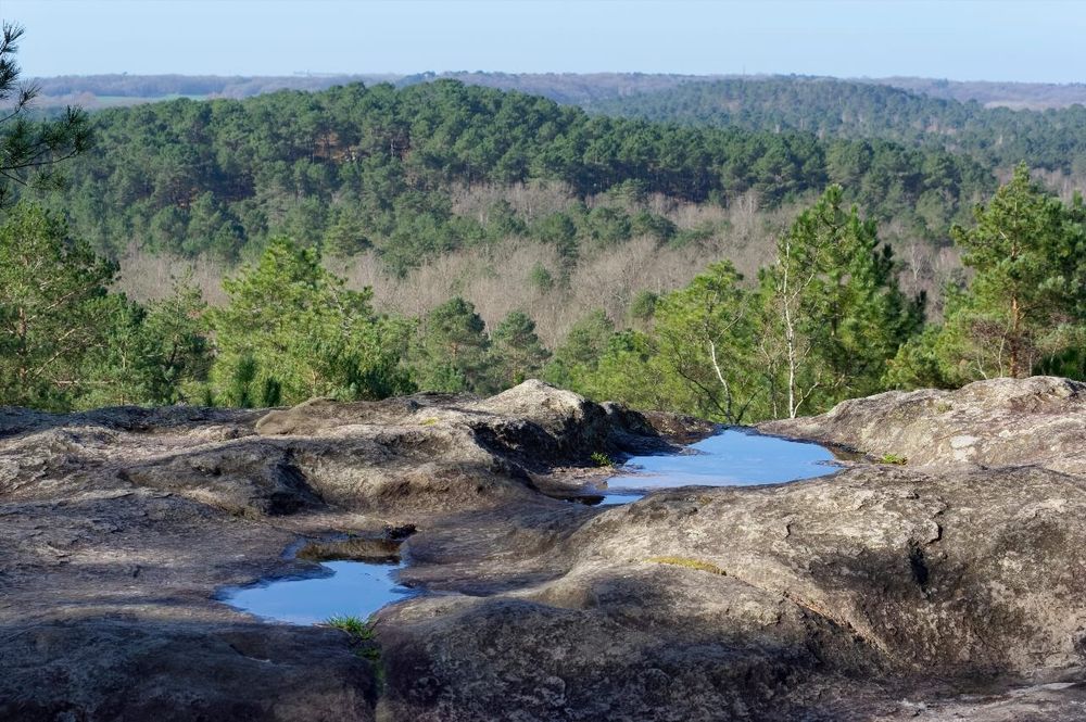
Fontainebleau hiking attracts thousands of walkers each year less than an hour from Paris: 25,000 hectares of white sand, sandstone chaos and bicentennial beeches, yet Fontainebleau forest remains systematically underestimated. You come for a two-hour walk, you leave wanting to return for two days. The massif has this particularity: it always resembles something different depending on the sector, season, and light. What the painters of the Barbizon school understood from the 19th century, hikers who really know "Bleau" rediscover on each outing.
This Fontainebleau hiking guide covers 16 itineraries, from 5km family trails to two-day long crossings, with concrete data for each: distance, elevation gain, difficulty, starting point, train access from Paris. You'll find the Circuit des 25 Bosses and its 850 meters of cumulative elevation gain on sandy terrain, the Franchard gorges and their sandstone blocks sculpted into animals by erosion, the secret massif of Trois Pignons where one wild orchid in five species grows in the Canche aux Merciers. And if you've never seen boulderers working three meters from the trail, Fontainebleau will surprise you: it's the world birthplace of bouldering, an art of short and technical climbing that the Ryo audio guide also tells from major cities. All 16 itineraries in this article have been selected for their distinct character, no point sending you twice to the same place with different markings.
Understanding the Forest Before Lacing Up
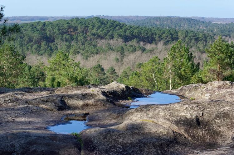
Before choosing your Fontainebleau hike, a few geographical landmarks change everything. Fontainebleau forest is not a homogeneous block: it consists of several distinct massifs, separated by plains, roads and villages. Knowing these massifs means understanding that the central massif (around Fontainebleau town) is the most frequented but not necessarily the most spectacular, that Trois Pignons (southwest, Milly-la-Forêt sector) offers the highest concentration of chaos per square meter, and that the Mont Aigu massif (north) is almost confidential despite its open panoramas.
The ground is the first surprise. Unlike a mountain forest with trails carved in compact earth, Fontainebleau is walked on pure sand, sandstone and inclined slabs. The loose sand absorbs each step, which tires the calves twice as fast as an ordinary path. Wet sandstone slabs slip. Chaos (accumulations of blocks) require attention for footing. Result: an "intermediate" circuit here can prove more demanding than an alpine hike rated the same way.
The marking is a system specific to the massif. Two networks coexist:
- The Denecourt-Colinet trails (marked in blue, numbered 1 to about twenty): the oldest marked hiking paths in the world, created from 1842 by Claude-François Denecourt. They cross the most picturesque sectors.
- The trails of the Association des Amis de la Forêt de Fontainebleau (AFF): several colors (orange, green, red), created to complete the Denecourt network on less covered sectors.
- The GR®1 (white-red): the tour of Île-de-France, which crosses the forest from north to south.
A paper map or downloaded GPX track remains essential. The phone network is unreliable in enclosed areas, and intersections can multiply without GPS. The AFF distributes its tracks for free on its website, and the IGN Top 25 n°2417OT (Fontainebleau) map covers the entire massif at 1:25,000.
The Circuit des 25 Bosses
Distance: 17 km | Duration: 6 to 8 h | Elevation gain: 850 m | Difficulty: difficult | Start: Croix Saint-Jérôme parking, Arbonne-la-Forêt
Few Fontainebleau hikes live up to their name so well. The "25 humps" designate the innumerable sandstone hills that dot this route in the Milly-la-Forêt massif, on the southwest side of the forest. With each descent, a climb awaits in the next fifty meters. With each climb, an inclined slab requires footwork adjustment. It's exhausting, it's magnificent, and it doesn't resemble any other hiking terrain in Île-de-France.
The departure is from the Croix Saint-Jérôme parking, in Arbonne-la-Forêt. From Paris by the R line (Gare de Lyon), get off at Bois-le-Roi then count 6 km by bike or taxi to reach the parking, it's the only itinerary in this article that is not directly accessible on foot from a station. Plan an early start: with 850 meters of positive elevation gain spread over very short climbs that follow each other without respite, the 17 km easily take 7 hours if you stop as you should.
The circuit follows red markings from the start, a mark painted on rocks and trees about every fifteen meters, making the route easy to follow despite countless intersections. Very quickly, the trail abandons flat undergrowth to climb the first chaos: gray sandstone slabs inclined at 30°, where footing is wide but where soft-soled shoes show their limits. Views open onto the heather moors below, dotted with Scots pines twisted by the southwest wind, the massif's prevailing wind.
The central part crosses the famous humps in rapid succession: white sand consolidated by pine roots, dark hollows, ridges burned by the sun. The high point of the Croix du Grand Veneur offers a 360° panorama over the massif, in clear weather, the Brie plain stretches east to the first Gâtinais reliefs. This is where you understand the true topography of Fontainebleau: it's not a flat forest pierced by a few rocks, it's a complex relief that the foliage conceals from the road.
The return descends along a sandy valley framed by sandstone walls where precariously balanced blocks seem placed by an invisible hand. Boulderers (the "bleausards") have been training here since the 1930s, you'll probably cross several teams a few meters from the trail, crash pad under arm, working millimetric routes. The cohabitation between hikers and climbers is one of Fontainebleau's particular flavors.
In autumn, wet sand makes slabs slippery. Choose dry days, and avoid trail shoes with studs that destabilize on inclined plates. Hiking poles are a real comfort on this circuit.
The Apremont Gorges and the Barbizon School
Distance: 10.5 km | Duration: 3 h 30 | Elevation gain: 220 m | Difficulty: intermediate | Start: Barbizon village parking
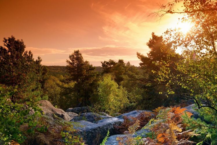
This Fontainebleau hike in the Apremont gorges alone explains why Théodore Rousseau set up his easel in this sector hundreds of times. The crossing of the gorges proper is done on a blue-marked trail between two sandstone walls rising 8 to 10 meters high, the enclosure is real, the bottom is sandy, and the atmosphere changes dramatically as soon as you enter the corridor. In autumn, the golden beeches covering the walls transform the place into a living watercolor. In winter, when trees are bare, the sandstone walls take on an almost orange hue under the low sun.
The departure from Barbizon village parking (10 km north of Fontainebleau via D64, accessible by taxi from Fontainebleau-Avon station) allows a useful combination: before or after the hike, the Barbizon School Museum (Grande Rue, entry €6) presents paintings made on these exact locations, some with side-by-side comparison with the current state of the landscape. A rare and concrete perspective to understand why these sandstones fascinated 19th-century painters.
After the gorges, the circuit climbs onto the Apremont plateau, which offers one of the longest views of the massif toward the northwest: in clear weather, the silhouette of Vaux-le-Vicomte castle is visible at 22 km as the crow flies. The descent toward Barbizon crosses the Belles-Croix plain, a bare moor plateau where horses from the local equestrian center sometimes graze, a striking contrast with the rocky environment of the gorges, two worlds separated by less than a kilometer.
The long variant extends to Rocher Cuvier-Châtillon (+4 km, +80 m elevation gain), whose views toward the south perfectly complement the Apremont panorama. If you do the Apremont Gorges on a spring or autumn weekend, arrive before 9 AM: it's one of the most photographed sectors of the forest, and the morning light there is unequaled.
The Franchard Gorges
Distance: 12 km | Duration: 4 h | Elevation gain: 280 m | Difficulty: intermediate | Start: Carrefour de Franchard (D409, 77300 Fontainebleau, rated 3.2/5 on Google for 87 reviews), D409 (7 km from Fontainebleau town)
This Fontainebleau hike is perhaps the most surprising for a walker expecting an ordinary forest. These are not gorges in the alpine sense, no vertical cliffs nor enclosed torrent, but a vast basin of white sand surrounded by sandstone chaos, as if a giant had overturned a box of blocks between the oaks. The surprise effect is total: you arrive by a flat trail under pines, and suddenly the ground opens onto this luminous mineral amphitheater.
The blue AFF markings guide from Carrefour de Franchard (large free parking, most convenient starting point) toward the bottom of the gorges, where the white sand takes on a golden hue in late afternoon. The first blocks emerge at the exit of a pine grove: some measure 4 to 5 meters high, sculpted by differential erosion into shapes that evoke animals or mushrooms. The Rocher de la Salamandre, an isolated block whose silhouette indeed evokes a sandstone lizard, is found mid-route 20 meters above the main trail. A 5-minute climb without equipment allows reaching its flat summit, from where the view embraces the entire amphitheater.
The second half climbs onto the Franchard plateau, covered with bare heather and broom. In spring (April-May), the yellow flowering and the morning's low light make this place one of the most photographed panoramas of the massif. The Ermitage belvedere, a former guard lodge transformed into romantic ruins in the 19th century, overlooks the gorges below. The final descent crosses the "sea of sand," an area of interior dunes stabilized by vegetation, where the ground yields slightly underfoot and steps make a characteristic muffled sound.
On the edge of this sector at dusk, wild boars are sometimes visible during the day, Franchard is one of the few places in the massif where they still come out before night. In October, deer rutting can be heard from the gorges at dawn.
Variant: by combining with Denecourt-Colinet trail n°16 (red marked), you extend to 16 km to reach Rocher des Potets, with its erosion potholes among the most impressive in the forest.
The Trois Pignons Circuit
Distance: 13 km | Duration: 4 h 30 | Elevation gain: 320 m | Difficulty: intermediate to difficult | Start: Croix Saint-Jérôme parking, Arbonne-la-Forêt
The Trois Pignons massif is the sector that Fontainebleau regulars rarely mention to strangers, not out of ill will, but because its low frequentation compared to the central massif is partly its value. Located at the southwest extremity, around Milly-la-Forêt, it concentrates more chaos, moors and reliefs than any other sector of equivalent surface. The three rocky spurs visible from the plain that give it its name dominate a broken, magnificent and demanding topography.
The departure from the Croix Saint-Jérôme parking in Arbonne-la-Forêt (same parking as the 25 Bosses, distinct itinerary) first engages the orange AFF markings toward the south, then switches to the blue Denecourt-Colinet trails. The first third crosses the "Vallée Close": a white sand hollow surrounded by pines and heather where silence is almost absolute on weekdays. The fauna is richer there than elsewhere in the massif, protection linked to low frequentation, the area hosts deer, roe deer and, since 2019, regular gray wolf tracks according to the French Office for Biodiversity.
The climb toward the first pignon is the most demanding section: 45 meters of elevation gain over 200 horizontal meters, with some non-exposed climbing moves (UIAA grade I-II, hands necessary). The summit offers a view over the Brie plain, the École valley and, in very clear weather, Paris's silhouette 50 km to the north. It's one of the few places in the forest where you physically understand how much the massif is enclosed in the plain.
The descent toward the second pignon crosses the Canche aux Merciers, a valley of white sand and broom that shelters a wild orchid blooming in May, five different species recorded in this sector by the ONF in 2023, including the Bee Orchid and the Goat Orchid. The junction with the third pignon passes through a flat trail along a wet meadow, last natural habitat of the marbled newt in the massif.
The final loop climbs back toward the plateau via boulder scrambling that constitutes the most technical passage of the circuit. No objective danger, but hands are essential and children under 10 may need help. Trois Pignons is also the windiest sector of the forest, exposed to the southwest: bring an extra layer even in summer. In winter, ice patches on rocks are treacherous, shade persists for hours on the north faces of blocks.
The Denecourt-Colinet Trail n°7: the Cuisinière Sector
Distance: 9 km | Duration: 3 h | Elevation gain: 180 m | Difficulty: intermediate | Start: Carrefour de la Reine Blanche (Route Nationale 7, 77300 Fontainebleau, rated 4.2/5 on Google for 58 reviews), 4 km east of Fontainebleau via N7
Claude-François Denecourt was a former non-commissioned officer of Napoleon's army who became a forest lover. From 1842, he spent more than forty years carving trails in the rock, painting the first markers and writing guides sold to Parisian strollers. The network bearing his name, more than 150 km of numbered paths, forms the world's oldest marked hiking network. The n°7, in the Cuisinière sector in the center-east of the massif, is one of the most spectacular of this entire network.
From the first hectometers, the trail engages between sandstone blocks with improbable shapes. The "Turtle," a 2.8-meter block balanced on a tapered base, and the "Mushroom," topped with a hard sandstone cap 40 cm thick on a stem thinned by erosion, illustrate the differential erosion process: silicified layers resist, sandy layers hollow out, producing sculptures that no human hand could imitate. These forms fascinated Barbizon painters long before they fascinated climbers.
Trail n°7 then climbs onto the Cuisinière plateau, whose clear view toward the southeast reveals, in limpid weather, the first reliefs of Gâtinais. The descent toward the Demoiselles valley crosses a grove of centuries-old oaks where the canopy is so dense that ground vegetation almost completely disappears, cathedral atmosphere, cloister silence. This is the oldest vegetation of the central massif, some oaks exceeding 250 years.
This trail is also one of the most frequented passages by climbers joining the Cuisinière boulder circuit, ranked among the best bouldering spots in Europe. On a spring weekend, you'll cross several dozen bleausards with crash pads under their arms, working millimetric routes. The atmosphere is good-natured.
Tip: download the AFF sector map before leaving. Intersections multiply and GPS alone can send you on the wrong trail number. The AFF website (aaff.fr) offers GPX tracks for free.
Bouldering in Fontainebleau: When Rock Becomes Playground
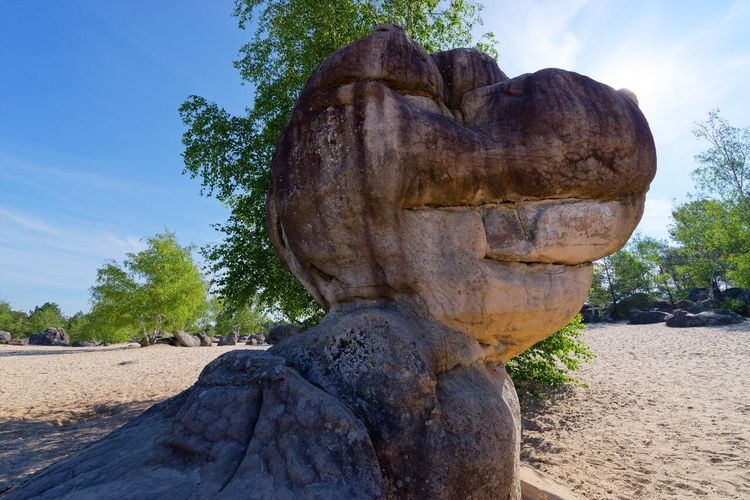
A Fontainebleau hike is not just about walking: the massif is also a vertical playground. It's literally the world birthplace of sport climbing. In the 1930s, Parisian alpinists began using sandstone chaos as winter training terrain, in the process inventing a ropeless technique, without height, with a mat to cushion falls: bouldering. Today, climbers from around the world come specifically to Fontainebleau for its boulders.
Fontainebleau sandstone has a particular grip. The rock is granular, sometimes rough enough to wear fingers in one session, sometimes smooth as soap on volumes polished by decades of hands. Sectors are listed in "Fontainebleau Climbs" (Jingo Wobbly), the bleausards' bible: more than 1,600 boulders graded from orange (beginner) to black (world elite). The most accessible sectors for curious hikers:
- Rocher Canon (family sector, low boulders, no exposure)
- Cuisinière Sector (orange and blue circuit, ideal for beginners)
- Rocher des Demoiselles (classic sector, beautiful boulders)
- Cuvier-Rempart (advanced level, emblematic Bleau boulders)
No rope equipment is necessary. A crash pad if you want to climb seriously, climbing shoes for friction on slabs. For hikers, just observe: watching a good-level climber work a 3-meter route for an hour is an experience in itself. The concentration, economy of movement, way of reading the rock, it's another way to inhabit the forest.
The Ryo audio guide, available on our app for major European cities, doesn't yet cover Fontainebleau directly, but if you arrive via Fontainebleau-Avon station, the Ryo audio-guided tour of some nearby cities already gives you a taste of how we tell a territory through its details. The forest, it tells itself better with your feet.
The Table du Roi
Distance: 8 km | Duration: 2 h 30 | Elevation gain: 120 m | Difficulty: easy to intermediate | Start: Rocher des Demoiselles Parking (Route Ronde, 77300 Fontainebleau), 3 km northeast of Fontainebleau town
The Table du Roi is an open-air sandstone plateau in the heart of the northern massif, from where the kings of France contemplated their stag hunts. Its name is not a metaphor: a few natural sandstone benches form a horizontal surface about 30 meters long, polished by passages and time, where generations of walkers have carved their initials. The oldest identifiable inscription would date from 1642. This detail, 380 years of human passage on the same stone, says something about the forest's permanence facing the ephemeral nature of visits.
Access is among the most convenient of the massif: Fontainebleau-Avon station is 1.3 km on foot from the start, making it one of the few truly "door to door" hikes from Paris. The trail first climbs toward the mare aux Fées before reaching the plateau via a succession of pleasantly technical rocky steps. On the plateau, the view is open in several directions, rare in Fontainebleau, where forest cover often masks horizons.
The descent follows the Solle valley, a sandy corridor invaded by calluna heather in August (intense purple hue, one of the most beautiful images of the massif). The red-marked variant leads directly back toward the station, without a car. Ideal as a first Fontainebleau hike, accessible from age 8 with good shoes.
Note: the plateau is an integral protection zone during nesting period (March 15 - July 31). Marked trails remain accessible, but off-trail is prohibited during this period.
Rocher Canon and the Bas-Bréau Grove
Distance: 6 km | Duration: 1 h 45 | Elevation gain: 80 m | Difficulty: easy | Start: Bas-Bréau Parking (Route du Bas-Bréau, 77300 Fontainebleau, rated 4.6/5 on Google for 142 reviews), 2 km north of Fontainebleau-Avon on D409
The Rocher Canon is the proximity hike of Fontainebleau: short, accessible from town on foot, surprising. The summit at 175 meters is reached in 20 minutes from the parking, and the view over the Brie plain amply rewards this short effort. Below, the Bas-Bréau is a former clearing of bicentennial pedunculate oaks classified as an integral biological reserve: no marked trail inside, but the perimeter is accessible and the density of venerable trees is striking. Some oaks reach 7 meters in circumference.
Perfect for an end-of-day hike: the descending light on the sandstones from September to November is remarkable.
The Wild Seine from Thomery
Distance: 10 km | Duration: 3 h | Elevation gain: 90 m | Difficulty: easy | Start: Thomery Station (Rue de la Gare, 77810 Thomery, rated 4.1/5 on Google for 16 reviews) (R line from Paris-Gare de Lyon, 55 min)
This itinerary is the big surprise of Fontainebleau hiking for those who imagine the massif only as an interior forest of rocks and sand. The Wild Seine runs along the river from Thomery to Moret-sur-Loing on a bank almost virgin of construction, between limestone sandstone cliffs and espalier vineyards, the famous chasselas grape vines of Thomery, classified as a "remarkable taste site." We're still in the Fontainebleau forest area, but the landscape has nothing in common with chaos and sand.
From Thomery station (accessible in 55 minutes from Paris-Gare de Lyon by R line), the trail descends toward the Seine in five minutes from the platform. It then runs along the bank for 5 km without any road, before climbing toward Moret-sur-Loing via the cliffs that dominate the river bed. The portion between kilometer 3 and kilometer 6 is the wildest: the bank is only 2 to 3 meters wide, trees plunge into the water, river boats create a rhythmic lapping. Apart from a few fishermen, solitude is almost guaranteed on weekdays.
The bird fauna is remarkable throughout the route: grey herons static at water's edge, elusive kingfishers, and in winter, goosanders from Scandinavia. The arrival at Moret-sur-Loing deserves a stop, the medieval village, its stone towers, its 12th-century Roman bridge constitute one of the most beautiful villages in Seine-et-Marne. The return is by train from Moret-Veneux-les-Sablons (R line, 12 minutes to Fontainebleau-Avon).
The hike can also be transformed into a 15 km loop by climbing via the heights of Montarlot village (+4 h 30, +150 m additional elevation gain).
The Trans'Bleausarde: the Great 2-Day Crossing
Distance: 52 km | Duration: 2 days | Elevation gain: 1,200 m cumulative | Difficulty: difficult | Start: Fontainebleau-Avon Station (Avenue Franklin Roosevelt, 77300 Avon, rated 3.6/5 on Google for 237 reviews) | Finish: Maisse (RER D)
The Trans'Bleausarde is the longest Fontainebleau hike in this guide, 52 km in one go from northeast to southwest, linking Fontainebleau-Avon to Maisse while crossing five distinct massifs and a dozen marked sectors. It's the itinerary for those who want to understand the entire forest in a single continuous experience, rather than knowing it sector by sector.
The classic two-stage organization:
- Day 1 (26 km): Fontainebleau-Avon → Franchard Gorges → Barbizon or Arbonne-la-Forêt. Accommodation in gîte (reservation essential in high season: supply is limited).
- Day 2 (26 km): Arbonne-la-Forêt → Trois Pignons Massif → Maisse. Return to Paris from Maisse by RER D (1 h 30 to Paris-Gare de Lyon).
The orange AFF markings are generally reliable over the entire route, but some intersections in the central massif can be confusing after several hours of walking. Download the GPX track from the AFF website before departure, it's free and avoids unwanted detours.
The Trans'Bleausarde is not a high mountain hike, but the cumulative 1,200 m elevation gain combined with the nature of the terrain (sand, rocks, overhangs) tires more than a mountain equivalent on packed trail. Plan 3 to 3.5 liters of water per day, resupply points are rare between stages. High waterproof boots and hiking poles are recommended.
This crossing also reveals a dimension of Fontainebleau invisible on one-day circuits: the depth of silence in the non-marked zones of the domain forest, the variation of light over two days between different vegetation types, and the astonishing floristic diversity of a forest that its Parisian proximity makes systematically underestimate.
The Bleau Diagonal: 35 km in One Day
Distance: 35 km | Duration: 9-10 h | Elevation gain: 550 m | Difficulty: difficult | Start: Fontainebleau-Avon Station | Finish: Milly-la-Forêt
The Bleau Diagonal is the ultimate Fontainebleau hike in a single day, the condensed version of the great crossing. It links Fontainebleau-Avon to Milly-la-Forêt diagonally northeast/southwest over 35 km, crossing the massifs of Mont Ussy, Tillaie, Franchard and Trois Pignons. It's the hike for regulars, those who already know several short circuits and want to link them in a total experience.
Departure from Fontainebleau-Avon station (45 min from Paris-Gare de Lyon), arrival at Milly-la-Forêt served by bus (line 34, return toward Melun, connection R line to Paris). No need for two cars or complicated logistics.
The Diagonal is not continuously marked, it's a compilation of AFF and Denecourt-Colinet sections connected with portions on non-marked forest paths. The official GPX track (available on AFF and Komoot) is essential. Plan complete resupply: only 2 water points on the route (Franchard spring at mid-way, Milly-la-Forêt fountain at end of route).
Required level: have already walked at least 25 km in one go on varied terrain. Fatigue accumulated at end of day makes rocky passages more risky than they are in the morning.
The Sentier des Carriers à Grès
Distance: 5 km | Duration: 1 h 30 | Elevation gain: 60 m | Difficulty: very easy | Start: Carrefour du Grand Maître (Route Nationale 7, 77300 Fontainebleau, rated 3.7/5 on Google for 289 reviews), 5 km south of Fontainebleau via D409
This thematic trail created by the ONF traces the history of Fontainebleau sandstone extraction, used to pave Paris roads until the 19th century. The route is entirely flat (except for a 10 m climb toward the main former quarry) and red-marked on explanatory panels. You can see traces of iron wedges planted in the rock to detach blocks, ruts carved in the sandstone by the passage of carts loaded to the brim, and a "rabière," a polished sandstone slide used to lower blocks toward the carts. Ideal with children, or for a 1 h 30 outing without any physical constraint.
The Fontainebleau Heights from Bois-le-Roi Halt
Distance: 11 km | Duration: 3 h 30 | Elevation gain: 200 m | Difficulty: intermediate | Start: Bois-le-Roi Halt (Rue de la Halte, 77590 Bois-le-Roi, rated 3.5/5 on Google for 2 reviews) (R line, 42 min from Paris-Gare de Lyon)
This Fontainebleau hike starts from Bois-le-Roi Halt, a railway stop on the R line between Fontainebleau and Melun. This little-known circuit starts directly from the station platform, no car, no shuttle, and immediately climbs into the high forest. In less than 45 minutes from Paris, you're on the Rocher des Demoiselles with the view over the Seine loop below.
The trail follows blue AFF markings toward the south from the station exit. The initial climb is sharp: 80 meters of elevation gain in 1.2 km. But the panorama from Rocher des Demoiselles amply justifies the effort, the Seine loop visible to the north, Bois-le-Roi rooftops below, the forest plateau stretching south as far as the eye can see.
The intermediate section crosses the Solle grove, a cathedral beech forest where trees reach 35 to 40 meters in height. The ground is carpeted with wood anemones in spring (March-April) and daffodils on the edge of open areas. It's one of the few portions of Fontainebleau where vegetation recalls Central European plain forest more than the characteristic heather moor of the massif.
The descent toward the Seine follows a shaded trail between isolated blocks, before rejoining the riverbanks for 1.5 km flat. The return to the Halt is via a short but steep climb (30 m elevation gain over 200 m horizontal).
The Green Escapade on the GR®1
Distance: 18 km (section) | Duration: 5 h | Elevation gain: 280 m | Difficulty: intermediate | Start: Bois-le-Roi Halt | Finish: Bourron-Marlotte-Grez (R line)
The GR®1 is the long-distance trail that goes around Paris crossing all the forest massifs of Île-de-France. Its Fontainebleau section, dubbed "Green Escapade" by regulars, crosses the forest from north to south over 18 km between Bois-le-Roi and Bourron-Marlotte, in white-red FFRandonnée markings.
The particularity of this section is crossing sectors little known to weekend walkers, notably the Tillaie grove, a beech forest classified as integral biological reserve since 1981, no human intervention for 45 years. Dead trees remain standing or on the ground, forming a rare forest environment in France. Rotting trunks on the ground, hollow trees inhabited by bats or great spotted woodpeckers, sphagnum vegetation in wet areas: it's what ecologists call a "naturally aged" forest, a particular and silent spectacle.
The arrival at Bourron-Marlotte, a village of winegrowers and painters, allows taking the train to Paris (R line, 1 h from Gare de Lyon). Doable year-round, with caution: portions in valley bottoms can be muddy from November to March, waterproof shoes essential in winter.
The Vadrouille Bleausarde
Distance: 15 km | Duration: 4 h 30 | Elevation gain: 200 m | Difficulty: intermediate | Start: Croix de Toulouse Parking (Route Ronde, 77590 Bois-le-Roi, rated 4.1/5 on Google for 37 reviews), Bois-le-Roi
Created by the AFF in the 2000s, the Vadrouille Bleausarde is the general discovery loop of the massif: it crosses five different sectors in a single day, sandy plains of the north, chaos of the Marlotte sector, domain beech grove of Mont Ussy, southern moors, Tillaie gorges. It's less a "favorite" itinerary than an exhaustive introduction to discover the forest's diversity in a single outing.
The orange AFF markings are continuous and well maintained. The profile is regular, without really difficult passage, the only delicate moment occurs at the climb on Rocher du Mont Ussy (358 m, highest point of the northern massif): a sandy overhang of about twenty meters where hands become useful. From the summit, the weather observation tower is visible but not accessible to the public.
The Vadrouille Bleausarde is the Fontainebleau hike to recommend to someone discovering the massif and wanting a single outing that makes them want to come back.
Preparing Your Fontainebleau Hike: Equipment, Seasons, Maps
A Fontainebleau hike forgives little haphazard preparation. Not because it's dangerous, it's a forest, not high mountains, but because the terrain is singular and "standard" hiking habits must be adjusted.
Shoes: choose hiking boots with rigid sole, not trail shoes with studs. Sandy terrain exhausts soft soles, and studs destabilize on inclined sandstone slabs. A mid-high upper provides welcome support on chaos.
Water: resupply points are rare in the forest. Plan minimum 1.5 liters per person for a 3-hour circuit, 2.5 liters for a full day. In hot weather, increase by a third. Some forest crossroads have fountains, but none are guaranteed working.
Navigation: download the GPX track before leaving, not after. The IGN Top 25 n°2417OT (Fontainebleau) paper map remains the reference for long days, and doesn't depend on phone networks, unreliable in enclosed areas.
Seasons:
- Spring (April-May): orchid, anemone and broom blooms, soft light, moderate attendance on weekdays.
- Summer: hot and often overcrowded on weekends. Prefer weekday outings or before 8 AM in the morning.
- Autumn (October-November): the flagship season. Golden beech foliage, deer rutting audible at dawn, low light on sandstone chaos. Attendance remains high on sunny weekends.
- Winter: nearly deserted forest, low light that magnifies rock silhouettes. Some areas in valley bottoms can be muddy or icy. Plan waterproof layer and waterproof shoes.
Hiking poles: recommended for circuits involving chaos (25 Bosses, Trois Pignons, Trans'Bleausarde). Useless on flat trails.
Access from Paris by Train: the Forest Without a Car
Fontainebleau hiking is one of the best served by transport among the large Île-de-France forests. The R line (Transilien, departure Paris-Gare de Lyon) serves several entry points in less than an hour:
- Fontainebleau-Avon: 40 minutes from Paris. Starting point for Bleau Diagonal, Trans'Bleausarde, GR®1, and Table du Roi circuit (1.3 km walk to start).
- Bois-le-Roi: 45 minutes. Access to Fontainebleau Heights circuit from the Halt.
- Thomery: 55 minutes. Wild Seine departure.
- Moret-Veneux-les-Sablons: 58 minutes. Wild Seine arrival.
- Bourron-Marlotte-Grez: 1 hour. Green Escapade (GR®1) and Trans'Bleausarde arrival.
From Fontainebleau-Avon, seasonal forest shuttles (generally April-October, information Île-de-France Mobilités) serve the main forest crossroads, including Franchard and Barbizon. Useful for reaching circuit starts not accessible on foot from the station.
A practical note: Carrefour de Franchard parking and Croix Saint-Jérôme parking (25 Bosses and Trois Pignons start) are not accessible by public transport without shuttle or taxi. These are the only two itineraries in this guide that require a car or specific organization.
FAQ
What is the Best Time to Hike in Fontainebleau?
Autumn (October-November) is the best season: golden beech foliage, deer rutting audible at dawn, low light on sandstone chaos. Spring (April-May) is the second best option, with orchid blooms at Trois Pignons and anemones in the Solle grove. Summer is technically doable but weekends are overcrowded, prefer weekday outings or before 8 AM. Winter offers a nearly deserted forest with unique low light, but muddy or icy areas in valley bottoms.
How to Access Fontainebleau Forest from Paris Without a Car?
The R line (Transilien from Paris-Gare de Lyon) serves Fontainebleau-Avon (40 min), Bois-le-Roi and its Halt (42-45 min), Thomery (55 min), Moret-Veneux-les-Sablons (58 min) and Bourron-Marlotte-Grez (1 h). Most hikes in this guide start directly or a few minutes walk from a station. Only the Franchard and Croix Saint-Jérôme departures require a taxi or seasonal shuttle from Fontainebleau-Avon.
Are Fontainebleau Hikes Suitable for Children?
Yes, provided you choose the route according to age. The Sentier des Carriers à Grès (5 km, entirely flat) is accessible from age 5-6. The Table du Roi circuit (8 km, easy) is suitable from age 8 with good shoes. The Franchard gorges are suitable from age 9-10. The Circuit des 25 Bosses, Trois Pignons and Trans'Bleausarde are reserved for adult hikers and trained young teenagers.
What Maps or Apps to Use for Navigation in Fontainebleau Forest?
The IGN Rando app (formerly Géoportail) covers the entire massif with 1:25,000 maps. Komoot has a large community track database including AFF and Denecourt-Colinet trails. The AFF website (aaff.fr) offers official GPX tracks of numbered trails, downloadable for free. For long outings, the IGN Top 25 n°2417OT paper map remains the reference: it doesn't depend on phone networks, often unreliable in enclosed areas.
Can You Bivouac in Fontainebleau Forest?
Bivouacking is strictly regulated. It is only authorized on three areas managed by the ONF: Grande Vallée in Bourron-Marlotte, Hippodrome de la Solle, Faisanderie. Outside these areas, wild camping is prohibited (prefectoral decree). On authorized areas: one night only, 20 tents maximum, no fires, leave with your waste. Overnight parking in forest car parks is also prohibited between 10 PM and 6 AM.
What are the Denecourt-Colinet Trails?
The Denecourt-Colinet trails form the world's oldest marked hiking network. Claude-François Denecourt, a former non-commissioned officer of Napoleon's army, spent forty years from 1842 carving paths in the rock and painting the first blue markers on rocks. Over 150 km of numbered trails traverse the most picturesque sectors of the massif. Colinet took over after his death. These trails are the only ones in the forest to offer true narrative coherence: Denecourt chose his routes for their views, sculpted rocks, and light effects, making them still today the most beautiful in Fontainebleau.
Conclusion
From the sandy humps of the 25 Bosses to the almost wild banks of the Seine between Thomery and Moret, Fontainebleau forest offers a palette of hikes that far exceeds what a single day can reveal. Each sector has its own personality: the sculpted chaos of Franchard, the motionless beech forest of Tillaie, the open Apremont plateau, the hand-drawn trails by Denecourt nearly two centuries ago.
Whatever Fontainebleau hike chosen among the 16 itineraries in this guide, one rule applies: leave early. Fontainebleau forest before 9 AM is a different experience from the afternoon forest, the silence, the oblique light on the sandstones, the mist in the gorges in autumn, it's what the Barbizon painters sought to capture. Our Ryo app accompanies heritage enthusiasts in other major destinations, but Fontainebleau, it tells itself better with feet on sand and eyes on rocks.