© Shutterstock
 Votre guide Ryo
Top 7 Most Beautiful Hikes to Do Around Toulouse
With its 118.3 km², Toulouse is the fourth most populated city in France, located in the southwest of the country. It's true that the pink city is full of monuments, for example the Basilique Saint-Sernin, the Couvent des Jacobins, the Canal du Midi…and many others. But sometimes, we need to disconnect from the city, stress, and daily routine. A study in Japan has proven that people spending time outdoors are more relaxed and happier. Walking in nature and exercising considerably helps reduce stress levels: slower pulse, lower blood pressure and cortisol levels…people thus tend to be more positive and optimistic about the future. Combined with better brain oxygenation, all this contributes to your well-being. The brain is stimulated by open spaces, the beauty of landscapes… And if you take the opportunity to turn off your phone, it will be even more beneficial.
The observation is quite simple: we are an integral part of nature, it's in it that we can feel good. Unfortunately, modern life has distanced us from what is essential, but in order to feel more alive and more joyful, it would be a good idea for everyone to organize a return to the roots, in order to regenerate the body and the mind, and to stimulate our senses. For this, we have prepared a list of hikes to do in the area…
What are the most beautiful hikes to do around Toulouse?
Hike #1: Garonne Bank and Amidonniers
- Duration: 1h10
- Distance to cover: 3.97 km
- Elevation gain: 15 m
- Highest point: 147 m
- Lowest point: 131 m
- Difficulty: Easy
Are you looking for a bucolic setting where silence reigns and it's good to sit and meditate? Head towards the EDF Bazacle space along the quai Saint-Pierre. From there, let yourself be lulled and drawn into a walk along the water. You'll find a spectacle for the eyes, as a viewpoint awaits you on the pont Saint-Pierre and the dome of the Chapelle Saint-Joseph de la Grave. For the less sporty and adventurous among you, this hike is perfectly suited. You just need to follow a simple path populated by birdsong, and the beauty of trees, as well as breathtaking landscapes.
Hike #2: Garonne and Canal du Midi via Toulouse cable car
- Duration: 4h50
- Distance to cover: 15.65 km
- Elevation gain: 122 m
- Highest point: 255 m
- Lowest point: 133 m
- Difficulty: Easy
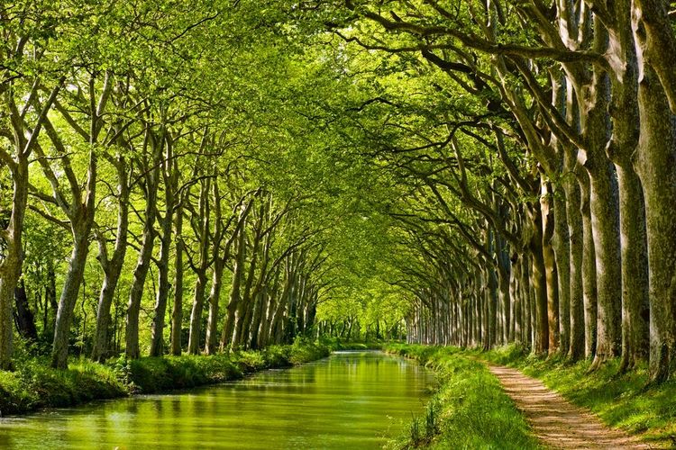
Well, put on your best pair of sneakers, check the weather just in case, take your backpack and a few liters of water, and let's go! Are you the marathon type? Do you like to make the pleasure of walking last? Then this hike is for you! The departure is at the corner of Pont Neuf, west side, Prairie des Filtres. You can easily access it by metro A. The route follows the Canal du Midi and passes through the Sentier nature, the Bois de Pouciquot, Cavaillé, the parc de Mange-Pommes… before returning to the starting point. The advantage? In summer or winter, this hike is easily accessible!
Hike #3: Nature loop at the gates of Toulouse: from Launaguet to Montberon
- Duration: 5h40
- Distance to cover: 17.98 km
- Elevation gain: 188 m
- Highest point: 212 m
- Lowest point: 141 m
- Difficulty: Moderate
Well. Here, it gets tougher in terms of difficulty. We reassure you though, it's not a Survivor challenge either, just there will be a minimum of exercise. Actually, you might slightly stick out your tongue during your journey. After all, you're here for adventure, aren't you? You just need to follow the chemin Cazalbarbier (South) and turn left to go up the Chemin de la Côte Blanche, which is paved. For trail fans, the slightly steep path with slight climbs will be perfect for you, and will work your legs and calves just as well. After all, a healthy mind in a healthy body! This hike is perfect if you're traveling with friends and looking for new challenges. It will work your muscles gently, and strengthen your cardiovascular system. However, during breaks, don't forget to enjoy the landscape panorama!
Hike #4: The Saint-Cyprien walk
- Duration: 2h
- Distance to cover: 7.09 km
- Elevation gain: 5 m
- Highest point: 140 m
- Lowest point: 132 m
- Difficulty: Easy
Generally, when Toulouse locals talk to you about the city of Toulouse, they don't forget to mention the town of Saint-Cyprien, known for its tranquility and where vegetation reigns. If you're building a photo album of the city of Toulouse, you absolutely must go on this path where a thousand and one wonders await you! A true natural museum, it's literally here that you clear your mind: the Jardin partagé des Micocouliers; the parc de Bourrassol; the Jardin des Fontaines… What artistic detours!
Hike #5: Loop between Blagnac to Gagnac via Fenouillet
- Duration: 7h20
- Distance to cover: 25.25 km
- Elevation gain: 32 m
- Highest point: 143 m
- Lowest point: 115 m
- Difficulty: Hard
There's something for all tastes and all levels! We can say that in 25 km, there are sites to discover: the Ruisseau de Riou, the bridges of Gagnac and Blagnac; the parc des Ramiers…all while peacefully following the Garonne. The departure is from the Place du Relais in Blagnac, near the tram and bus station. This hike will allow you to gain height to have front row seats to Mother Nature's show and discover all its colors and nuances, but also the purity of its flora and fauna.
Hike #6: Country route in Toulouse from Sesquières to the Garonne
- Duration: 3h10
- Distance to cover: 10.87 km
- Elevation gain: 7 m
- Highest point: 130 m
- Lowest point: 121 m
- Difficulty: Moderate
Among the whole list, it's clearly THE hike best suited for bikes and which will undoubtedly please children. Park at the South parking of lac de Sesquières and start your journey. Do you remember the cartoons with fairy-tale places you loved to watch as kids? Well, it's exactly the same style! A forest and water features straight out of a fairy-tale universe. Change of scenery guaranteed, you'd think you were in the countryside!
Hike #7: The Canal du Midi from Castanet Tolosan lock to Ayguesvives lock
- Duration: 7h10
- Distance to cover: 25.09 km
- Elevation gain: 9 m
- Highest point: 159 m
- Lowest point: 149 m
- Difficulty: Moderate
Start peacefully from the parking near the Écluse de Castanet. Although long, the hike is not complicated. It's also possible to turn back whenever you want. Alone or in a group, it gives you all the time needed to take a step back and refocus on yourself. It's known for pushing you to surpass yourself, or even to excel! Just for a moment, close your eyes and imagine that feeling of satisfaction and accomplishment once the hike is finished… Back in town, the Pink City audio walk unwinds over 6.5 kilometres.
À lire également