



Walk
A Town With Two Faces
Auray, France
Walk
A Town With Two Faces
Auray, France
2.4 km
Distance
1h00
Durée
19
Audios
Loop
Parcours
Ji-Elle, CC BY-SA 3.0 <https://creativecommons.org/licenses/by-sa/3.0>, via Wikimedia Commons
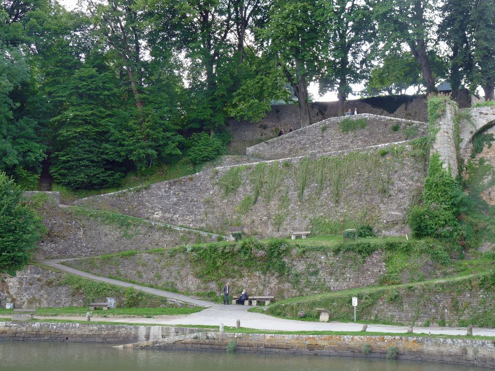
You’re now at the top of the Rampes du Loch. Try to picture this spot without the walkway, the gardens, or the houses around you, because this is where the castle of the Dukes of Brittany once stood. In other words, you’re not looking at its ruins from a distance…
you’re practically standing on top of them! And why is this place called the “Rampes du Loch”? It has nothing to do with the castle ramparts.
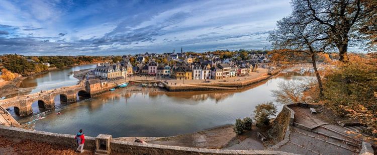
The word rampes simply refers to the sloping paths that zigzag down toward the Loch, the river below that eventually joins the Auray River. A fortress already stood here in the 11th century, overlooking the valley. From this height, it watched over the port, controlled the river crossing, and protected both parts of the town: Auray on the hill and Saint-Goustan below.
At the beginning of the 13th century, the old fortifications were extensively rebuilt and transformed into a true stone castle, complete with towers and walls. And it wasn’t used only for defense. When traveling through Brittany, the dukes could stay here with members of their court.
The castle had large halls, private apartments, a chapel, and stables. In 1442, Duke François even celebrated his marriage to Isabella of Scotland here. So this was far more than a small keep lost in the countryside!
But after the Duchy of Brittany was absorbed into the Kingdom of France, the fortress gradually lost its strategic importance and eventually fell into ruin. In 1558, King Henry II finally authorized its demolition. But there was no reason to waste all that carefully cut stone.
Some of it was shipped by boat to Belle-Île, where a new fort was being built. So Auray’s old medieval fortress actually helped provide the stone for the predecessor of today’s Vauban Citadel. Not everything was taken to Belle-Île, though.
As you make your way down the ramps, keep an eye out for three large buttresses projecting from the slope. These really did belong to the castle and once supported its main section, including the great halls and private apartments. You can also spot the remains of a round tower known as the Tour du Talus.
One word of caution, though: not every wall you see is medieval. The stairways, switchbacks, and some of the retaining walls were added much later, when the promenade was created over the castle ruins in 1821. So Auray’s fortress is still here, just scattered in pieces: a few remains on the hillside, stones reused on Belle-Île, and its name preserved in Rue du Château, which you walked along earlier.
For a monument that disappeared centuries ago, it certainly left plenty of traces behind.
Aucun avis pour le moment