© Shutterstock
 Votre guide Ryo
The Most Beautiful Breton Islands: A Complete Guide to Choosing and Visiting in 2026
The most beautiful Breton islands are strikingly disorienting in that no two resemble each other: there is something absurd about speaking of the "Breton coast" in the singular, given how Brittany multiplies its fragments of land carved by the Atlantic Ocean across more than 2,700 kilometres of coastline. Belle-Île-en-Mer, Bréhat, Ouessant, Groix, Sein: each Breton island has its own logic, its own colours, a personality you only truly understand when you step off the ferry and breathe in that first iodine-laden air. Between the Molène archipelago, classified as a UNESCO biosphere reserve, the turquoise waters of Houat that defy any Mediterranean comparison, the megalithic cromlechs of Gavrinis, and the hydrangeas of Bréhat that still bloom in the middle of January, the inhabited Breton islands concentrate a density of contrasts rarely found in metropolitan France.
This guide covers the 12 most visited and most distinctive Breton islands. For each one: surface area, crossing time, dominant character, must-see sites, and tips for organising your stay. Whether you are looking for the radical escapism of Ouessant in November, the white-sand beaches of Hoëdic in July, or the Neolithic engravings of Gavrinis in spring, you will find here everything you need to refine your choice without guesswork. The Ryo app also offers audio guides to explore the Breton departure cities — Vannes, Quiberon, Brest, Roscoff — and combine an island getaway with urban discovery.
Belle-Île-en-Mer: The Largest of the Breton Islands
With its 85 km² and some 5,500 permanent residents, Belle-Île-en-Mer is the largest island in Brittany and the largest in French Atlantic waters. Much of its fame rests on the Côte Sauvage, a ribbon of granite cliffs stretching for some twenty kilometres from the Pointe des Poulains to the beach at Donnant. The waves attack the rock with an energy that autumn storms transform into a truly physical spectacle.
But it is the landscape diversity that truly makes Belle-Île's reputation. The Aiguilles de Port-Coton (Côte sauvage, 56360 Bangor, rated 4.8/5 on Google from 2,335 reviews) — those jagged rocks that Claude Monet painted in series during his autumn 1886 stay (39 canvases in ten weeks) — can be reached on foot from the D25. The late-afternoon light there is genuinely dramatic; Monet did not invent it. The Plage de Donnant, two kilometres from the Aiguilles, is popular with surfers, but also with families seeking a dune-and-moorland setting with no visible beach resort infrastructure.
The contrast is total with the east coast, facing the Bay of Biscay, where the waters calm down and the fishing villages — Le Palais, the island's capital, and Sauzon with its pink and yellow façades — enjoy a quieter form of tourism. Le Palais retains the Citadelle Vauban, built in the 17th century on the orders of Louis XIV, which served as a military fort and later a prison. Today a museum and hotel, it offers one of the finest panoramas of the harbour on the island.
Belle-Île is manageable by bicycle and on foot. The coastal path circles the island in four stages (95 km in total). On an electric bike, the highlights can be covered in two days from Sauzon. The crossing from Quiberon takes 45 minutes (Compagnie Océane), with several departures daily throughout the year. Book tickets and accommodation from March for July–August, as the island fills up on high-season weekends.
Île de Bréhat: The Floral Anomaly of the Pink Granite Coast
Bréhat resembles no other Breton island, and this is down to a well-documented climatic anomaly. The Gulf Stream creates such a mild microclimate that palm trees, fig trees, and above all hydrangeas — thousands of plants in shades of violet and pink — bloom almost year-round. In January, when the mainland coast is grey and cold, Bréhat's bougainvilleas still defy the season.
The island measures barely 3.5 km long by 1.5 km wide, divided into two parts connected by a bridge near the Bois de la Citadelle. It is a car-free island — an absolute rule for visitors, with only a handful of service vehicles permitted. You travel on foot or by bicycle along paths that cross heather moorland, pink granite coves, and gardens overflowing with flowers.
The Phare du Paon in the north is the most photographed viewpoint: a structure perched on a chaos of pink rocks that the sea turns into an expressionist tableau at high tide. The Moulin à Marée du Birlot (17th century), one of the few tidal mills still in working order in France, is worth a stop. The crossing from the Pointe de l'Arcouest (Paimpol) takes 10 minutes — the shortest island crossing in Brittany.
Bréhat is home to around 350 year-round residents. In summer, several hundred thousand visitors descend on this tiny island. Opt for May or September: the vegetation is in bloom, and the paths are walkable without the crowds.
Ouessant: The Edge of Metropolitan France
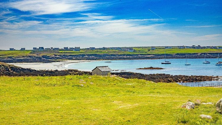
Ouessant is as much a concept as a geographical reality. Situated 20 km off the tip of Finistère, it is the westernmost point of metropolitan France. For centuries, Atlantic sailors said: "He who sees Ouessant sees his own blood." The phrase was not merely figurative — the Iroise currents, with tidal ranges reaching 7 metres, have sunk hundreds of vessels on the archipelago's rocks.
Even today, Ouessant lives in tension with the Atlantic. The cliffs on the north coast plunge vertically into a dark green sea that storms turn into white foam for dozens of metres around. The Phare du Créac'h, one of Europe's most powerful lighthouses and a listed historic monument, emits two white flashes every ten seconds, visible sixty kilometres out to sea in clear weather. It stands beside one of the world's busiest shipping lanes, the Ouessant rail, through which several hundred vessels pass each day.
Lampaul, the only village, lines its low houses around a calm harbour. The church of Notre-Dame-de-Bon-Voyage houses a unique funerary custom: the "proella," a small wax cross representing each sailor lost at sea whose body was never recovered. The Musée des Phares et Balises, housed in the former semaphore station, traces the history of maritime signalling in the roadstead of Brest.
The birdlife is exceptional: Ouessant is a major migratory stopover, and European ornithologists gather there in October to observe rare species. The island and the Molène archipelago form the Parc Naturel Marin d'Iroise, classified as a UNESCO biosphere reserve since 1988. Crossing from Brest: 2h15; from Le Conquet: 1h10 (Penn Ar Bed).
Île de Groix: The Convex Beach and the Vanished Tuna
Groix holds a curious geomorphological record: it is the only island with a convex beach — les Grands Sables — whose arched profile shifts with the currents instead of remaining straight. This curiosity, long presented as unique in Europe, has drawn geologists and curious visitors for decades. It is caused by a particular mechanism of littoral drift that shapes the beach inward.
The island covers 15 km² and has around 2,200 inhabitants. Its main town is home to a few shops, a lively Saturday morning market, and the Écomusée de l'Île de Groix (Rue du Général de Gaulle, 56590 Groix, rated 4.5/5 on Google from 24 reviews), housed in a former tuna cannery. Tuna fishing was long the island's main activity — the tuna-shaped weathervane on the church steeple still bears witness. The stocks collapsed in the 1960s, and the island shifted to a mixed agriculture-tourism economy.
Groix also has a mineralogical peculiarity: its soil contains glaucophane, a blue mineral characteristic of high-pressure metamorphic rocks, which can be found on certain beaches. The coastal path circles the island in one day (around 28 km). The Pointe de Pen Men to the west offers an open view of the Atlantic, reaching as far as Belle-Île on a clear day. Crossing from Lorient: 45 minutes (Compagnie Océane).
Île aux Moines: The Gentle Side of the Gulf of Morbihan
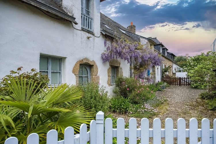
The Gulf of Morbihan is an inland sea, a sheltered arm of water protected from Atlantic winds that contains no fewer than 40 islands and islets. Île aux Moines is the largest and most populous, with around 700 year-round residents, and enjoys the mildest microclimate in Brittany after Bréhat: mimosas in bloom in February, lush vegetation, palm trees in gardens.
Its interior landscape is divided into moorland, oak woods, allées of stone pines, and coves where you can swim in calm, clear water. The Bourg with its colourful lanes, the Kergonan megaliths (a cromlech of 30 menhirs hidden in an oak grove), and the view over the archipelago from the Pointe du Trech — these are three good reasons to spend a night rather than just half a day.
The crossing from Port-Blanc (Arradon) or Baden takes less than 5 minutes. Île aux Moines is easily explored by bicycle or on foot and remains accessible almost year-round. To plan your stay in Morbihan, Ryo's audio guides for Vannes cover the medieval ramparts, the Cathédrale Saint-Pierre, and the lanes of the historic quarter — a good starting point before boarding the ferry.
Houat: The Turquoise Waters of the Breton Atlantic
In fine weather, the beaches of Houat create a perfect illusion: turquoise water, white sand, the seabed visible through the clarity. The Plage de Treac'h er Goured, on the northeast of the island, could appear in a Mediterranean travel catalogue without anyone noticing the deception. The Atlantic, some 6 to 8 degrees cooler depending on the season, nonetheless delivers a clarity that the Mediterranean has long since lost in its tourist zones.
Houat measures 5 km long by 1.2 km wide and has around 250 inhabitants. The single village lines its white and blue houses around a 19th-century church. The island is classified as a national nature reserve, which prohibits wild camping and limits motorised traffic in order to protect the seabed sought after by divers coming from Quiberon and Vannes.
Houat and its neighbour Hoëdic are served by the same line from Quiberon (Compagnie Océane) — the two can be combined in a long weekend. Crossing time Quiberon–Houat: 1 hour.
Hoëdic: The Authentic Little Sister
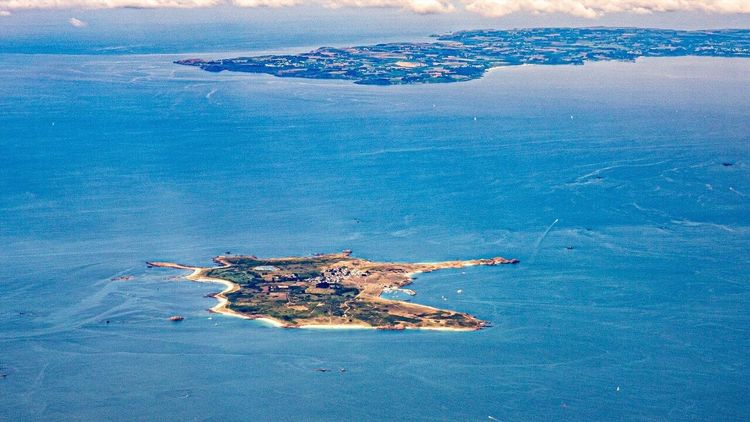
Hoëdic ("the little duck" in Breton) is the southernmost and most unspoiled of the inhabited Breton islands. Barely 2.5 km², 120 year-round residents, a single snack bar, and no official campsite on the island. The crossing from Quiberon takes 1h15.
This very bareness is precisely its appeal. Hoëdic is one of the few Breton islands where tourist pressure remains manageable even in high season, because the accommodation capacity mechanically limits the number of visitors. The southern beaches — Treac'h er Bonnac and Treac'h er Lan — rival those of Houat for clarity. A Vauban fort converted into tourist accommodation and the ruins of a Neolithic prehistoric village round out the curiosities.
Hoëdic suits travellers who want to truly disconnect from the mainland: no cars, unreliable phone signal, and Atlantic sunsets with not a single building on the horizon.
Île de Sein: The Island of the Brave
Île de Sein warrants a preliminary explanation of its geography. It peaks at 6 metres above sea level across its entire area of 0.56 km², and not a single tree can stand upright — the wind tears them out before they reach one metre in height. During major storms, the island can be partially submerged. Residents build their houses from unmortared stone so that water passes through without knocking them down.
This physical fragility contrasts with a well-documented history of resistance. In June 1940, 128 able-bodied men from the island — virtually every man of fighting age — sailed to England to answer General de Gaulle's call. De Gaulle is said to have declared: "Île de Sein alone is worth a quarter of France." The Musée du Pays de Sein (Rue du Mendenn, 29990 Île-de-Sein, rated 4.4/5 on Google from 16 reviews) recounts this episode with archives and testimonies that move even visitors with little interest in history.
The island is accessible from Audierne in 1h15 (Penn Ar Bed). It has fewer than 200 permanent residents and a handful of gîtes. The Phare d'Ar-Men, nicknamed "the hell of hells" for the conditions under which it was built between 1867 and 1881, is visible from the coast on clear days. The Chaussée de Sein, a submerged rocky plateau extending 50 km to the west of the island, makes these waters among the most feared by North Atlantic sailors. Back on the mainland, the Breton capital unfolds in 26 commented stops on our audio walking tour.
Île de Batz: The Exotic Garden of Finistère
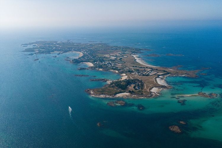
Île de Batz (pronounced "île de Ba") lies 15 minutes by boat from Roscoff, less than 2 km from the mainland. This proximity makes it one of the most easily accessible islands in Brittany, often incorporated into a visit to Roscoff without an overnight stay.
Its horticultural distinctiveness stems from the same microclimate as Bréhat. The Jardin Georges-Delaselle (Île-de-Batz, 29253 Île-de-Batz, rated 4.6/5 on Google from 2,082 reviews), created in the late 19th century on the ruins of a seaside estate, brings together more than 1,500 species of exotic plants: New Zealand palms, giant yuccas, agaves. Admission is pay-what-you-wish in the low season.
The island also has the Phare de Batz, standing 43 metres tall, with a 360-degree view over the Batz archipelago, the Léon coast, and on clear days as far as the English coast. The climb of 198 steps is open year-round. The island has 500 residents and several uncrowded beaches on its north-facing side, exposed to the wind but visually spectacular.
Île de Molène: The UNESCO-Listed Archipelago
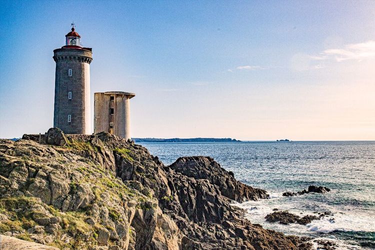
Molène is a small island of 75 hectares set at the centre of the archipelago of the same name, between Brest and Ouessant. It is home to around 200 inhabitants in a compact village of lanes so narrow that the houses seem to touch. Its geographical position, right in the middle of the Iroise currents, explains why it sheltered generations of wreckers and rescuers whose exploits feed the local museum.
Together with Ouessant, Molène forms the Parc Naturel Marin d'Iroise, classified as a UNESCO biosphere reserve. The archipelago's waters are among the richest in marine biodiversity in France: lobsters, abalones, kelp, grey seals, harbour porpoises. Scuba diving is practised here by regulars who come from across Europe, drawn by the exceptional visibility of the seabed.
Molène can be visited as a day trip from Brest (1h30) or Le Conquet (30 minutes). Too small for cycling, it can be explored entirely on foot in two hours. It is an island best understood in its maritime context — the Ryo audio guide available for departure cities such as Brest helps prepare this dimension before you set sail.
Île d'Arz: The Quiet One of the Gulf
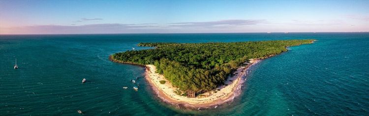
In the Gulf of Morbihan, île d'Arz plays the role of a tranquil alternative to île aux Moines — smaller, less well known, less crowded. It measures 3 km long, is home to around 280 inhabitants, and is reached in 10 minutes from Séné or 20 minutes from Vannes.
Its landscape is the gulf at its most intimate: restored salt marshes, polders, maritime bocage, small beaches facing the open sea. The Moulin à Marée de Berno (Berno, 56840 Île-d'Arz, rated 4.4/5 on Google from 290 reviews), one of the last working tidal mills in Brittany, built in the 15th century, uses the difference between high and low tide to drive its millstones.
Île d'Arz can be walked or cycled in under two hours. It lacks large hotels, but has quality bed-and-breakfasts. For travellers seeking the tranquillity of the gulf without the tourist pressure of île aux Moines in July, it is a hard choice to beat.
Gavrinis: The Island Carnac of Morbihan
Gavrinis is technically an islet in the Gulf of Morbihan, 200 metres from the shore at Larmor-Baden. Uninhabited and accessible only by guided tour boats from the port of Larmor-Baden, it contains just one monument — but what a monument: a Neolithic cairn built nearly 6,000 years ago — long before the Egyptian pyramids — whose interior stones bear the finest megalithic engravings known in Europe. Nicknamed the "Sistine Chapel of the Neolithic," it was inscribed in July 2025 on the UNESCO World Heritage List as part of the megalithic ensemble of Carnac and the shores of Morbihan.
The access passage, 14 metres long, is entirely lined with slabs decorated with spirals, serpents, axes, and geometric symbols whose meaning remains partially interpreted: 23 of the 29 slabs are engraved. The decorative density surpasses all the Carnac alignments, which lie some thirty kilometres away as the crow flies. The visit lasts 1h30, entirely guided, including the boat crossing.
Advance booking is mandatory, as places are strictly limited to protect the engravings. The passage stands 1.40 m high, requiring you to stoop throughout. The experience nonetheless ranks among the most memorable that Brittany offers to the prehistory-curious visitor.
Practical Information: Ferries, Season, Accommodation
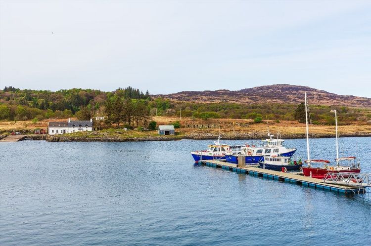
Ferries and Main Connections
Crossings to the Breton islands are operated by several companies depending on the area:
- Compagnie Océane (subsidiary of Région Bretagne): Belle-Île from Quiberon (45 min), Groix from Lorient (45 min), Houat and Hoëdic from Quiberon (1h and 1h15). Daily sailings year-round.
- Penn Ar Bed: Ouessant from Brest (2h15) or Le Conquet (1h10), Molène from Le Conquet (30 min), île de Sein from Audierne (1h15). Reduced frequency outside the season.
- Vedettes de Bréhat (from Pointe de l'Arcouest, Paimpol): Bréhat year-round, 10-minute crossing.
- Armein (from Roscoff): île de Batz, 15-minute crossing, very frequent sailings in season.
- Compagnies du Golfe: île aux Moines and île d'Arz from various landing points around the Gulf of Morbihan.
Booking crossings in advance is essential for July–August to Belle-Île, Groix, Houat, and Hoëdic: ferries sell out on weekends from spring onwards.
Which Season Should You Choose?
July–August offers maximum sunshine and the warmest sea (18–20°C), but crowds are at their peak on Belle-Île, Bréhat, and île aux Moines. May–June and September offer the best compromise: vegetation in bloom or still green, smaller crowds, lower prices. Off-season (October–March), only Belle-Île, Bréhat, île d'Arz, and île aux Moines maintain a genuine local life with restaurants open. Ouessant and Sein are magnificent in autumn but require good weather preparation — wind and cancelled crossings are part of the experience.
Accommodation and Budget
Belle-Île offers the full range: campsites, 3–4 star hotels, gîtes. Groix, Bréhat, and île aux Moines have bed-and-breakfasts. Houat, Hoëdic, and Sein are limited to a handful of gîtes — book 4 to 6 months ahead for the summer.
Indicative budget: adult return crossing from €9 to €19 depending on the island. Bicycle rental on-site: €8 to €18 per half-day. Accommodation: €40 to €130 per night depending on the island and the season.
FAQ
How Many Inhabited Islands Does Brittany Have?
Brittany has 9 year-round inhabited islands accessible by regular ferry: Belle-Île-en-Mer, Bréhat, Ouessant, Groix, île aux Moines, île d'Arz, Houat, Hoëdic, and île de Sein. Île de Batz, administratively part of Finistère, is often added to this count. Molène also has a permanent population of around 200 people. When seasonally inhabited islets are included, the alphabetical list of Breton islands exceeds fifty entries.
Which Is the Most Beautiful Island in Brittany for a First Visit?
Belle-Île-en-Mer is the most versatile answer: diverse landscapes, well-developed hotel infrastructure, activities for all profiles, and a direct crossing from Quiberon. Bréhat is ideal if you are looking for something more intimate and botanical. If you want tropical-style beaches in metropolitan France, Houat is the country's most surprising island for the colour of its waters.
Can You Visit the Breton Islands Without Taking the Ferry?
No, all inhabited Breton islands are only accessible by sea. Helicopter connections exist for Ouessant and Belle-Île, mainly for medical and freight use. Île Callot, near Carantec (northern Finistère), is an exception: it can be reached on foot at low tide via a submersible passage. This is the only notable exception in mainland Brittany.
Which Breton Island Is Best for Seeing Seals?
The Molène archipelago and the waters around Ouessant are home to France's largest colony of grey seals, numbering several hundred individuals. Zodiac trips departing from Le Conquet or Brest allow visitors to approach the rocks where they rest. The coasts of Groix and île de Sein also occasionally host seals, though they tend to be more discreet.
Are the Breton Islands Accessible in Winter?
Some islands maintain year-round connections: Belle-Île, Groix, Ouessant, and île aux Moines. Sein and Molène have irregular services depending on weather conditions. Les Glénan close completely from mid-September to early April. Winter is a powerful experience for those who want to see an island in its true face, but you must accept the possibility of cancelled crossings and very limited accommodation.
What Is the Connection Between the Breton Islands and Kaamelott?
Fans of Alexandre Astier's series Kaamelott often associate Brittany with Arthurian legends; the forest of Brocéliande and the tales of Merlin and Morgane have maintained this link since the Middle Ages. The series used various French castles and landscapes, but not the Breton islands as such. The search term "île de Bretagne kaamelott" is nonetheless one of the most frequent searches about the Breton islands, proof that popular culture amplifies the imaginary reach of the Armorican peninsula.
Conclusion
From the black cliffs of Ouessant to the turquoise waters of Houat, from the hydrangeas of Bréhat to the Neolithic engravings of Gavrinis, the inhabited Breton islands represent one of the densest concentrations of island identities in Western Europe. Each island has its own logic: some belong to a perpetual spring, others to the Atlantic winter in all its violence, and others still to a form of human epic that few places in France carry as clearly.
To prepare your exploration of the Breton coasts and departure cities — Quiberon, Vannes, Lorient, Brest, Roscoff, or Paimpol — our Ryo app accompanies you with Ryo audio guides and itineraries available for Breton mainland cities. If the Breton islands whet your appetite for other French archipelagos, also discover our guide to the Îles de Lérins off Cannes and the Îles du Frioul near Marseille. And for lovers of Mediterranean islands, the most beautiful Greek islands and the Croatian islands await you in our collection.
À lire également