© Shutterstock
 Votre guide Ryo
The Best Hikes in Alsace: 20 Itineraries in the Vosges and the Vineyards (2026)
Looking for the best hikes in Alsace means stumbling upon a contradiction that few visitors suspect: this region famous for its half-timbered villages and Christmas markets is also one of the richest walking destinations in France. More than 400 kilometres of marked trails cross its Vosges from end to end, from the granite massif of Donon to the pasture-covered ballons, passing through a vineyard where you walk between medieval châteaux and open wine cellars. Before lacing up your boots, the Ryo audio-guided tour of Strasbourg will give you a first reading of the territory, from Petite France to the banks of the Ill, to understand why this border city radiates across the entire region.
This guide covers twenty itineraries, from family loops around Vosges lakes to demanding traverses of the Hautes Chaumes. You will find a lac Blanc lying like a mirror among the spruces, ruined fortresses reclaimed by the forest, a Sentier des Roches clinging to cliffs 300 metres above the void, and a Ballon d'Alsace often saved for last, when the legs have found their rhythm. The most beautiful hike in Alsace? It depends on you: this guide brings together the finest hikes in Alsace so you can make an informed choice.
Why Alsace Is an Exceptional Hiking Destination
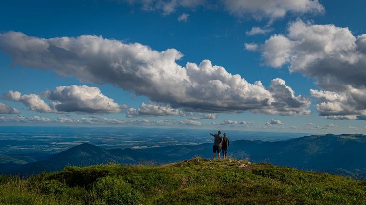
The finest hikes in Alsace owe much to the local geography, which works in the hiker's favour. To the west, the Vosges form a compact and accessible massif: summits range between 1,000 and 1,424 metres (Ballon de Guebwiller), without the alpine commitment of the Alps, yet with a genuine variety of landscapes. Forest covers nearly 40% of the regional territory — sessile oaks in the Northern Vosges, firs and spruces in the Hautes Vosges — and you can walk for entire days without crossing a road.
To the east, the Rhine plain provides a unique backdrop: on clear days, from the ridges, you can see the Swiss Alps and the Black Forest simultaneously. This doubly cross-border panorama makes the Alsatian Vosges an unrivalled balcony in central Europe.
Another asset: the density of resupply villages. The Wine Route runs at the foot of the Vosges and lines every itinerary with wine cellars, winstubs and mountain farm inns. Rarely does a hike in France offer such a reliable guarantee of craft beer and tarte flambée at the end.
When to Hike in Alsace?
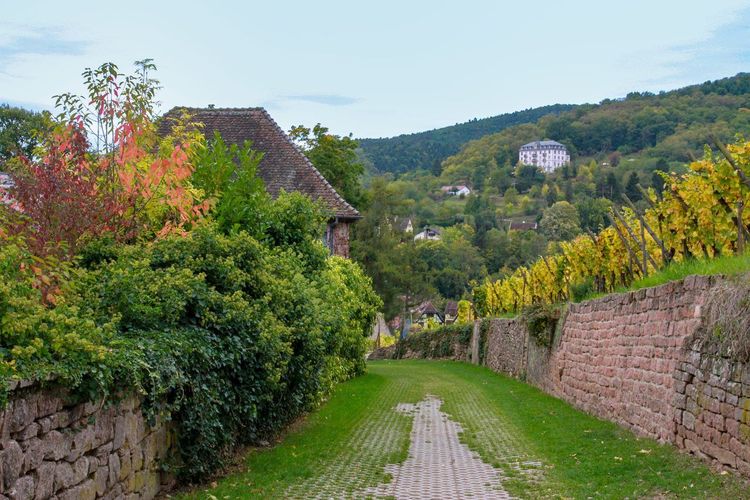
Alsace can be hiked twelve months a year, but each season has its own character.
Spring (April–June): the blossoming of orchards in the vineyard and daffodils in the Hautes Chaumes make this period a favourite among photographers. Trails often remain muddy until May; opt for waterproof boots.
Summer (July–August): the high pastures are clear and the lakes inviting, but the Hautes Vosges can be crowded at weekends. Setting off before 8 a.m. on the Sentier des Crêtes makes all the difference.
Autumn (September–October): the Alsatian foliage rivals that of Quebec. The beech forests of the Northern Vosges take on spectacular colours, and the vineyard enters harvest season. This is the universally recommended season.
Winter (November–March): snowfall transforms the Hautes Vosges into a nordic landscape. The Hohneck and Markstein open their cross-country ski runs. Snowshoeing on the Chaumes is possible from December to late March in some years.
The Donon, Sentinel of the Northern Vosges
The Donon (1,009 m) is one of the most emblematic summits of the northern Vosges. Its flat profile, crowned by a small neo-classical temple visible from below, gives it an instantly recognisable silhouette. The most direct ascent starts from the col du Donon (Route du Donon, 67130 Schirmeck, rated 4.5/5 on Google with 1.2K reviews) (727 m), with an elevation gain of 282 metres over approximately 2.5 km; allow 45 minutes of walking to reach the summit. This short yet panoramic ascent ranks among the finest hikes in Alsace that can be completed in half a day.
At the summit, the temple now houses an archaeological museum dedicated to Gallo-Roman excavations that unearthed sculptures of the goddess Diana and Mercury. The Donon was a major place of worship in antiquity; this historical dimension adds pleasantly to the hike. The view stretches eastward over the Alsatian plain and westward over the Lorraine Vosges.
For a fuller loop (12 km, 3h30), start from the village of Grandfontaine following the GR 5, climb to the Donon through the fir forest, descend on the Lorraine side to the Donon refuge, then return via the ridge. The trail is clearly marked in red and white, but the summit rocks can be slippery in wet weather; Vibram-soled boots are recommended.
The GR 53 between Lembach and Wingen: Châteaux and Forests of the Northern Vosges
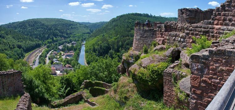
The Parc naturel régional des Vosges du Nord is home to the densest network of medieval châteaux in Europe, with more than 80 fortifications recorded within a 50 km radius. The GR 53 links them across a multi-day traverse, but the section between Lembach and Wingen-sur-Moder (approximately 18 km, one full day) concentrates most of the interest.
You will pass the château de Fleckenstein (Route du Château, 67510 Lembach, rated 4.6/5 on Google with 4,133 reviews), perched on a sandstone needle at 365 m, whose cave-like rooms were carved directly into the rock in the 12th century. Then the Loewenstein and the Wasigenstein, twin fortresses that once controlled the passage into Alsace. These ruins are freely accessible year-round.
The terrain is forested and gently undulating, on earth paths that are often muddy in spring. Bring good gaiters and a headlamp if you wish to explore the interior rooms of the châteaux.
The Étang de Hanau: a Hike on Calm Waters
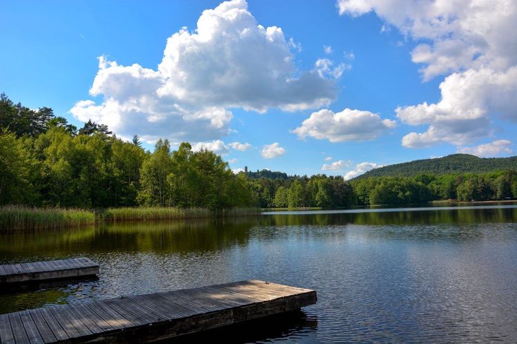
The étang de Hanau (Route de l'Étang, 67290 Philippsbourg, rated 4.5/5 on Google with 33 reviews) is an artificial lake dug in the 18th century to supply the Niederbronn forges. Surrounded by oak forests, it offers an easy, completely flat 5 km loop (about 1h15), accessible to pushchairs. In the morning, mist on the water and forest silence lend the place an atmosphere that Wagner himself, who stayed in Niederbronn-les-Bains, might have found inspiring. No elevation gain, no technical difficulty: this is the ideal recovery hike after a long day in the Northern Vosges.
The Nideck Waterfall and the Rocher de Mutzig
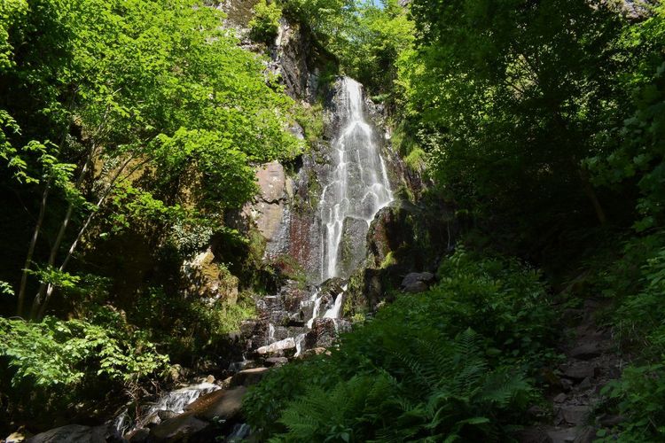
Two sites, one massif, a well-filled half-day. The cascade du Nideck (70 m drop) is one of the most spectacular waterfalls in the Vosges. The trail leading there from the pass of the same name is less than 2 km return, with an elevation change of 120 metres; allow 45 minutes. The lush vegetation and spray make it an incomparable photography spot.
The Rocher de Mutzig (Col de la Schleif, 67190 Grendelbruch, rated 4.8/5 on Google with 85 reviews) (1,010 m) can be hiked from the village of Grendelbruch or from the col de la Schleif. The classic loop via the cliff face is approximately 11 km with 350 metres of positive elevation gain. At the summit, a 360° panorama reveals the Rhine plain, the red-roofed Alsatian villages and, on clear days, the German Black Forest. Allow 3h30 to 4h of walking.
Both sites are close to Strasbourg, 40 km away, making them a perfect day trip from the Alsatian capital.
Mont Sainte-Odile and the Châteaux of Ottrott: Alsace in Majesty
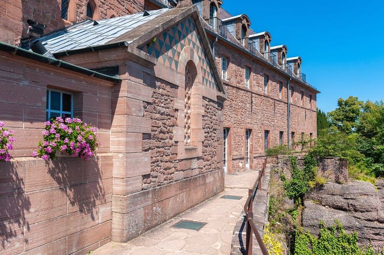
Mont Sainte-Odile (Couvent du Mont Sainte-Odile, 67530 Ottrott, rated 4.7/5 on Google with 684 reviews) (763 m) is the most visited religious site in Alsace with more than 300,000 visitors a year, but this does not mean the hiking experience is disappointing — provided you choose the right itinerary. The most popular trail is the Châteaux d'Ottrott–Mont Sainte-Odile loop: from the village of Ottrott, this 14 km circuit with 500 metres of positive elevation gain takes you successively to the ruins of the châteaux of Rathsamhausen and Dreistein before reaching the convent perched on its rocky spur. Many count it among the finest hikes in Alsace, as it packs heritage and panorama into a single outing.
The Mur Païen, a cyclopean enclosure 10 km long and 1.20 m thick that girdles the mount, is one of the region's great archaeological mysteries. Built in all likelihood during the Iron Age (around 600 BC), its defensive, religious or calendrical purpose has never been formally established. Several hundred metres of it run alongside the path; its dry-stone walls, laid without mortar, have withstood two and a half millennia.
Allow 4h30 to 5h for the full loop from Ottrott, including breaks. The final climb to the convent through the pine forest is striking; the pink sandstone walls of the monastery appear suddenly between the trees. The Gallo-Roman baths unearthed in the gardens are worth a stop.
A few practical tips: arrive before 9 a.m. or after 4 p.m. to avoid the pilgrim coaches on the esplanade. The trail is marked in red and white (GR 5D). The rocky sections around the châteaux are slippery in wet weather. In winter, north-facing slopes often remain icy until March.
The Champ du Feu: the Viewpoint of Central Alsace
At 1,100 metres, the Champ du Feu (Route du Champ du Feu, 67130 Bellefosse, rated 4.6/5 on Google with 426 reviews) is the highest point in the Bas-Rhin Vosges. Its metal panoramic tower offers a 360° view that locals call "the view over five countries": France, Germany, Switzerland, the outlines of the Alps in very clear weather, and the Black Forest in the foreground. The simplest hike starts from the summit restaurant and makes an 8 km loop across the open high pastures, with modest elevation changes (250 m gain) and very clear yellow waymarking.
For something more demanding, the Hohwald–Champ du Feu traverse (return, 18 km, 650 m gain) passes through the Hohwald bog, a rare ecosystem in Alsace that is home to sphagnum mosses, sundews and adders. Observe them from the trail without getting close.
The Sentier des Crêtes of the Vosges: the Great Traverse
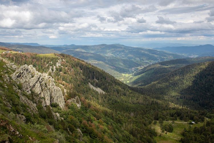
This is the founding itinerary of Alsatian hiking, the backbone of the finest hikes in Alsace. Stretching 175 km from Donon to the Ballon d'Alsace, the Sentier des Crêtes runs along the watershed between Alsace and Lorraine. It was laid out during the First World War to conceal French troop movements from German observers on the Rhine plain — an origin that lends this long-distance trail a rare historical presence.
The most spectacular section is that of the Hautes Chaumes, between Markstein and Grand Ballon (Route du Grand Ballon, 68380 Wattwiller, rated 4.7/5 on Google with 1,445 reviews) (25 km, 800 m gain, a long day). The chaumes — altitude pastures worked since the Middle Ages by cattle farmers — roll their gentle curves above the sea of forests. Here you encounter the famous chalets-chaumes, mountain farm inns where a glass of munster cheese and a Meteor beer are well earned.
For a more accessible version, the Markstein–Grand Ballon loop (8 km return, 350 m gain) captures the essence of the Hautes Chaumes in half a day. It is also one of the finest panoramas in the region: the Grand Ballon (1,424 m), the highest point in the Vosges, offers a dizzying gaze over the Alsatian plain, the silver Rhine and, on clear days, the Bernese Alps.
The Sentier des Crêtes is particularly popular between July and September. Out of season, some shelters close; check opening times on the Club Vosgien website before setting off. Winds are frequent and strong on the ridgeline; a windproof waterproof jacket is essential even in summer.
To extend your Alsatian stay from the Hautes Chaumes, the Ryo audio guide of Colmar, 21 audios, 4.7 km, will take you into the "little Venice" of Alsace just 30 km from the ridges.
The 3 Châteaux de Ribeauvillé: the Must-Do Hike of the Vineyard
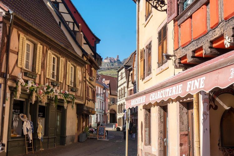
Ribeauvillé is the unofficial capital of vineyard hiking in Alsace, and its 3 Châteaux circuit stands out among the finest hikes in Alsace on the vineyard side. The 3 Châteaux loop — Saint-Ulrich, Girsberg and Haut-Ribeaupierre — is by far the most popular in the southern Vosges, and for good reason: the three medieval fortresses succeed one another along the same rocky spur, with 15 to 20 minutes of walking between them.
The classic loop from the centre of Ribeauvillé covers 12 km with 580 metres of positive elevation gain. Allow 4 to 5 hours including stops at the ruins. The château de Saint-Ulrich (Route du Château, 68150 Ribeauvillé, rated 4.7/5 on Google with 1,678 reviews) (12th–14th centuries) is the best preserved of the three: its pink sandstone walls rise 20 metres above the forest, and the view from its paired windows over the vines below is vertiginous. The Haut-Ribeaupierre at the summit is more austere but offers the most open panorama over the Rhine plain.
In September and October, you will walk through the early harvest: golden Riesling and Gewurztraminer vines contrast with the reddish sandstone of the ruins. The descent to Ribeauvillé along the vineyard paths gives you the chance to visit a few cellars that open their doors to walkers at the end of the day.
The Château du Haut-Koenigsbourg from the Vineyard
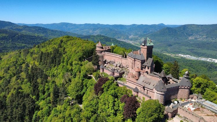
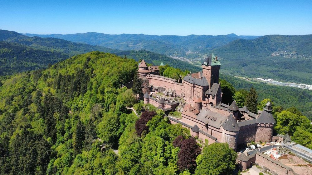
The château du Haut-Koenigsbourg (Route du Haut-Kœnigsbourg, 67600 Orschwiller, rated 4.7/5 on Google with 42,490 reviews) (757 m) is the most visited medieval fortress in Alsace, with more than 500,000 visitors a year. The standard car approach from Orschwiller misses the real experience. On foot from Thannenkirch, the ascent changes everything: a 5 km trail (about 2h, 400 m gain) brings you up through the wooded slopes, avoiding the flow of coaches.
Arriving via the moat and drawbridge, with the imposing silhouette of the hexagonal tower, is one of the most striking approaches in the region. The château was fully restored between 1900 and 1908 by architect Bodo Ebhardt on the orders of Wilhelm II: controversial among historians, the result gives an exceptionally clear reading of medieval military architecture.
For those wishing to combine hiking and vineyard, the descent to Bergheim via the vine path (6 additional kilometres) crosses Grand Cru Riesling plots before reaching this medieval village still enclosed within its ramparts.
The Alsace Wine Route on Foot: from Marlenheim to Thann
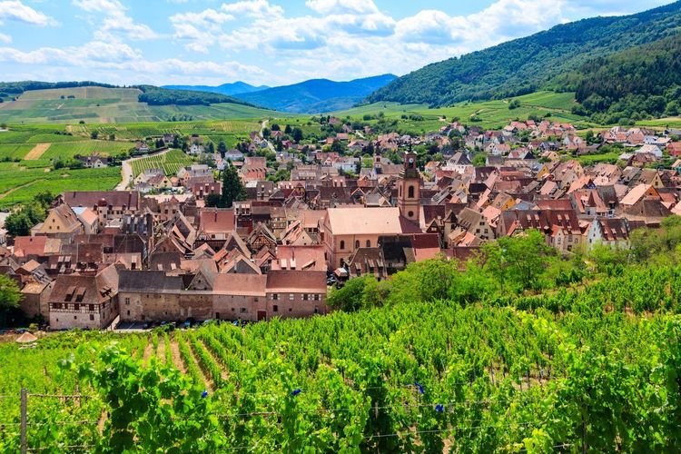
The Alsace Wine Route stretches 170 km between Marlenheim in the north and Thann in the south. Walking it in full would take a week, but several segments lend themselves to day hikes through the vines.
The most appreciated stretch runs between Dambach-la-Ville and Sélestat (15 km, flat terrain, 3h30). The section between Kaysersberg (Grand'Rue, 68240 Kaysersberg, rated 4.7/5 on Google with 8.4K reviews) and Riquewihr is shorter (8 km) but offers views over two of Alsace's most beautiful villages. In Riquewihr, the Dolder (13th-century medieval tower) marks the end of the route.
These vineyard hikes are accessible year-round, with special mention for the autumn harvest season and winter when the villages are preparing their Christmas markets. Consult our Ryo selection of the most beautiful Alsatian villages to round out your stay programme. And for Strasbourg itself, our audio-guided tour links Petite France to the European institutions in 33 stops.
The Sentier des Roches: Verticality in the Vosges
The Sentier des Roches (Parking du Gaschney, 68380 Muhlbach-sur-Munster, rated 4.8/5 on Google with 953 reviews) is the most spectacular itinerary in the Alsatian Vosges, and probably one of the most demanding in the entire Vosges range. It appears on every list of the finest hikes in Alsace, and for good reason. It follows the rocky ledge that dominates the Soultzeren valley at 300 metres height, over a length of 4 km. Fixed ropes secure the most exposed passages, but the hike remains physically demanding and is not recommended for those prone to vertigo.
The classic loop from Muhlbach-sur-Munster covers 12 km with 700 metres of positive elevation gain. Allow 4h30 to 5h of active walking. Access is via the Gaschney car park (free): from there, climb towards the Tête des Faux, join the Sentier des Roches ridge following the yellow Club Vosgien waymarks, then descend through the Wormsa valley.
The views over the Munster valley, the Hohneck as a backdrop and the beech and fir forests are truly breathtaking. It is on this trail that you understand why the Alsatian Vosges have earned their reputation among European hikers. One caveat: the trail can be closed by prefectoral order in the event of rockfall risk or snow accumulation; check before setting out.
The Hohwald Waterfall and the Chaume des Veaux
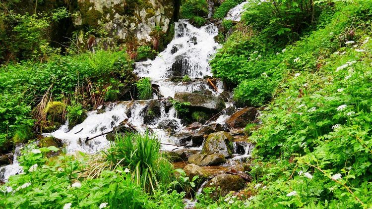
The Hohwald is a resort village perched at 570 metres in a wooded cirque of the Alsatian Vosges, 50 km from Strasbourg. The waterfall that bears its name, a 17-metre drop in a deep woodland setting, is reached in 25 minutes from the village centre along a yellow-waymarked trail.
But the itinerary that locals recommend is the full Hohwald–Chaume des Veaux loop: 16 km, 600 m gain, approximately 5 hours. After the waterfall, the trail climbs through the beech forest until it reaches the open plateau pastures, with a sweeping view over the Alsatian plain. The Chaume des Veaux itself is an altitude grass plateau where herds graze in summer, one of those timeless places that give the Vosges their soul.
The circuit is possible year-round, but the plateau section can remain snow-covered from December to March. Descend via the ridges then return to Hohwald along a trail under forest cover.
Lac Blanc and Lac Noir: the Mirrors of the Hautes Vosges
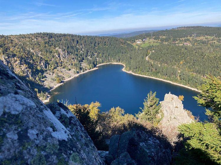
These two glacial lakes rank among the most beautiful bodies of water in the Alsatian Vosges and represent one of the finest hikes in Alsace on the high-mountain side. Lac Blanc (1,055 m) is the larger, with its 29 hectares of blue-tinged surface ringed by spruces and granite boulders. Lac Noir (Chemin du Lac Noir, 68370 Orbey, rated 4.7/5 on Google with 4.1K reviews) (954 m), darker and deeper, is dominated by granite walls reflected in its still waters.
The hike linking them is a classic: from the Lac Blanc car park, a 7 km trail (approximately 3h, 350 m gain) descends to Lac Noir along a forest path, climbs back up to the Chaumes du Lac Blanc for a panorama, then returns to the starting point. Combining both lakes in a single loop is a complete sensory experience; shades of green, granite grey and deep blue succeed each other at every bend.
For a longer immersion, the lac du Forlet (also known as lac des Truites) and the lac Vert complete the four-lake quartet in this sector. A long 18 km loop links them all from the col du Calvaire; the itinerary requires 6h of walking and 600 metres of elevation gain. Reserved for fit and properly equipped walkers.
The Lac Blanc car park is one of the busiest in the Vosges in July and August; arrive before 8:30 a.m. or take the seasonal bus from Orbey. Our Ryo guide to Alsatian mountain farm inns lists the altitude establishments serving farm-made munster and vigneronne tourte; expect 18 to 22 euros for a full menu.
The Belvédère des Trois Lacs: High-Altitude Panorama
Less well known than its neighbours, the belvédère des Trois Lacs offers one of the most generous viewpoints in the Hautes Vosges. From this promontory at 1,200 metres, you can simultaneously make out the lac de la Lauch, the lac du Fischboedle and, in fine weather, the lac de Kruth in the Thur valley.
Access is from the col du Platzerwasel (Route du Col, 68380 Metzeral, rated 4.6/5 on Google with 42 reviews) via a 3 km return ridge trail — the shortest hike on this list, accessible to everyone in one hour. It combines well with an ascent of the Markstein or a descent to the lac de la Lauch.
The Lac de Kruth: the Pearl of the Thur Valley
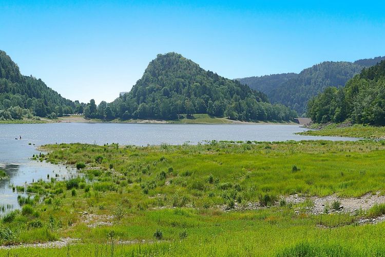
The lac de Kruth-Wildenstein (Route du Lac, 68820 Kruth, rated 4.5/5 on Google with 702 reviews) is a reservoir lake at 395 metres altitude nestled in the Thur valley between fir forests and steep rock faces. Its surface area of 78 hectares is the largest among the Vosges lakes accessible on foot.
The lake loop (8 km, almost flat terrain, 2h) is the easiest in the Thur valley and perfectly suited to families with young children. On fine days, the reflections of the dam and wooded ridges in the water turn the circuit into a succession of Alsatian postcards.
For more active hikers, the lac de Kruth–Breitfirst combination (600 m gain) climbs from the lake to the Breitfirst pastures before descending via the other side of the valley.
Burgertsmatt to Fischboedle: the Secret Hike of the Munster Valley
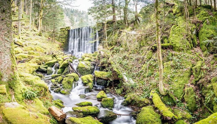
Rarely mentioned in mainstream guides, the Burgertsmatt–Fischboedle itinerary is a favourite among locals of the Munster valley. It connects an altitude meadow (the Burgertsmatt, 990 m) to a small forest lake (the Fischboedle) via a 6 km return trail. The elevation gain does not exceed 280 metres, and the setting — giant fir forest, miniature waterfalls, sunken stream — is of a rare quietude. It is the ideal hike when you want to escape the crowds of lac Blanc on a summer weekend.
The Hohneck and the Lac du Schiessrothried
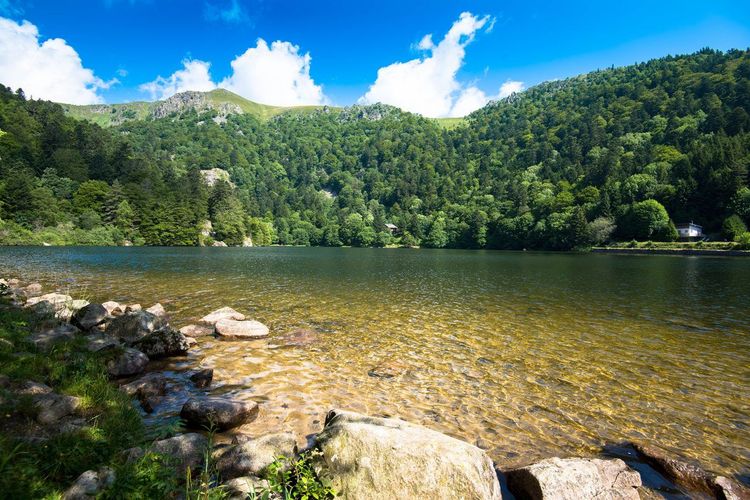
At 1,363 metres, the Hohneck is the third highest summit in the Vosges and one of the few to offer an unobstructed 360° view. The ridge is so bare and exposed that winds regularly exceed 100 km/h in winter; French military telecommunications installed a relay station there as early as the 1950s. The approach hike from the col de la Schlucht (7 km return, 380 m gain) is physically accessible, but summit winds can surprise you at any time of year.
The most rewarding itinerary passes via the lac du Schiessrothried (Chemin du Lac, 68380 Metzeral, rated 4.6/5 on Google with 332 reviews): from the col de la Schlucht, descend to the lake (a glacial gem at 1,060 m nestled in a granite hollow), then climb back along the ridge to the Hohneck. The loop covers 13 km with 600 metres of cumulative elevation gain; allow 5 hours including breaks. For many hikers, this is simply one of the finest hikes in Alsace.
The particular light on the lake in the morning, when the first rays strike its rocky shores, alone justifies departing before 7 a.m. Optional descent to Metzeral via the Wormsa valley, with the option of returning by bus. Hot summers sometimes bring violent thunderstorms in late afternoon on the ridges; consult Météo-France before setting out.
The Ballon d'Alsace from the Lac d'Alfeld
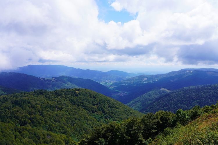
The Ballon d'Alsace (Sommet du Ballon d'Alsace, 90200 Lepuix, rated 4.7/5 on Google with 546 reviews) (1,247 m) marks the southern boundary of the Alsatian Vosges and the border between Alsace, Lorraine and the Territoire de Belfort. It is a summit steeped in history: in 1871, this was where the Franco-German border ran, and the Virgin statue at the summit dates from 1862 and survived two world wars.
The approach via the lac d'Alfeld is the finest. From the lake car park (Sewen, 900 m), a forest trail of 4 km (400 m gain, about 2h) climbs gradually through beech woods before emerging onto the summit pastures. The lac d'Alfeld itself, a reservoir lake surrounded by forests, is worth a stop both on the way up and on the way back.
From the summit, the panorama encompasses the Jura, the Alps, the Black Forest and, in exceptional conditions, the Eifel. In winter and spring, the Ballon is often snow-covered and ski touring is a serious option.
The Vieil Armand (Hartmannswillerkopf): Hiking and Memory
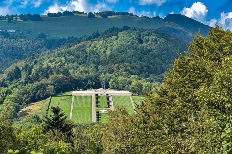
The Vieil Armand (or Hartmannswillerkopf (Monument National du Hartmannswillerkopf, 68700 Wattwiller, rated 4.7/5 on Google with 339 reviews), 956 m) is a mountain that changed hands 20 times during the First World War. French and German soldiers fought here in an underground war of position; the trenches cut into the sandstone are still visible. A national monument inaugurated in 1932 and an ossuary containing the remains of 12,000 unidentified soldiers make the Hartmannswillerkopf a memorial site as powerful as Douaumont.
The hike from Wattwiller (8 km, 580 m gain, 3h) climbs through the forest to the ruins of trenches, concrete blockhouses and shell craters still visible in the rock. The summit offers a view over Cernay, the Rhine plain and the Vosges ridges. This is a hike undertaken with a particular awareness: every bend may reveal a tunnel dug by men who never came back down. A recently opened museum retraces the history of these battles; visiting on a weekday is preferable.
Preparing Your Hike in Alsace
Essential equipment
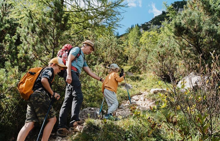
The Alsatian Vosges are unforgiving of equipment lapses. Weather can change very rapidly above 800 metres; waterproof hiking boots with grippy soles (Vibram or equivalent) are essential on most itineraries. A waterproof windproof jacket, even in July, is advisable on the ridges. Trekking poles help noticeably on the steep slopes of the Sentier des Roches and the Hohneck.
Waymarking and mapping
All Alsatian trails are waymarked by the Club Vosgien with a precise colour code: red rectangles for long-distance routes (GR), yellow triangles and rectangles for local trails. The Visorando app or IGN 1:25,000 maps (blue series) are the reference tools. On the Hautes Crêtes, mobile coverage can be patchy; download offline maps before setting off.
Resupply and accommodation
The mountain farm inn network of the Vosges is unique in France: around fifty altitude establishments serve traditional Alsatian farmhouse cooking — hot munster, baeckeoffe, forest tourte. Some offer dormitory accommodation. Booking is mandatory in July and August. Club Vosgien refuges supplement the offer for multi-day itineraries.
Environmental respect
The Parc naturel régional des Vosges du Nord and the high Vosges massifs are subject to enhanced protection. Stay on marked trails, do not pick protected plants (génépi, arnica), and do not approach the cattle herds grazing on the summer pastures. Dogs are tolerated on most trails but must be kept on a lead.
FAQ
What is the most beautiful hike in Alsace?
It is hard to single out one itinerary when the landscapes vary so greatly. The Mont Sainte-Odile loop with the châteaux of Ottrott remains the most complete: historical heritage, pink sandstone forest and a viewpoint over the Alsatian plain all in a single 14 km outing. Mountain purists will prefer the Hohneck via the lac du Schiessrothried for its wildness and glacial light. And history lovers should not miss the Sentier des Roches, vertiginous and technically demanding, which hugs a clifftop ridge 300 metres above the Munster valley.
What is the best month for hiking in Alsace?
September and October are unanimously considered the best months: summer crowds have left the trails, beech forests turn ochre and russet, mountain farm inns are still open and the weather is stable. May and June offer flowering meadows and the most abundant waterfalls. Avoid July and August weekends on popular routes (lac Blanc, Sentier des Crêtes): car parks fill up by 9 a.m.
Are there easy hikes in Alsace for families?
Yes, several itineraries are suitable for families with children. The étang de Hanau loop (5 km, flat terrain) is ideal for young children. The tour of lac de Kruth (8 km, less than 100 m elevation gain) is doable with an inflatable-wheeled pushchair. The botanical trail of Mont Sainte-Odile (2 km around the convent) is accessible to everyone. For families with children aged 8 and over, the 3 Châteaux de Ribeauvillé loop, with ruins to explore and vineyards to cross, is always a hit.
How can I get around for hiking in Alsace without a car?
It is entirely possible from Strasbourg and Colmar. The Bas-Rhin coach network serves several popular trailheads: the line to Ottrott for Mont Sainte-Odile, the line to Hohwald for the waterfall and the Champ du Feu. The Strasbourg–Molsheim train is useful for hikes in the Mutzig–Nideck area. In summer, a special shuttle service runs to lac Blanc from Orbey. For everything you need to know about transport and activities from the regional capital, consult our Ryo guide to activities in Strasbourg and its surroundings.
What shelters and accommodation are available on Alsatian trails?
The Vosges has a network of around fifty altitude mountain farm inns, open mostly at weekends and in season. Club Vosgien refuges punctuate the long-distance routes: the Rotenbrunnen refuge in the Northern Vosges, the Haag farm inn near the Hohneck, the Markstein chalet refuge on the ridgeline. Expect to pay 12 to 18 euros per night in a dormitory at trail lodges. Booking is strongly advised in July–August and over major spring bank holiday weekends.
Is the Sentier des Crêtes difficult?
The difficulty varies greatly depending on the section chosen. The Markstein–Grand Ballon loop (8 km, 350 m gain) is manageable for a regular hiker. The full Donon–Ballon traverse (175 km, 7 to 10 days) requires good physical fitness and long-distance hiking experience. The most exposed sections are on the bare ridges between Markstein and Grand Ballon, where winds can exceed 100 km/h in winter. The trail is generally well marked and easy to follow.
Across these twenty finest hikes in Alsace, the region reveals an unsuspected inner geography: glacial lakes set in their granite cirques, ancient forests partly preserved by the castles of prince-bishops, and high pastures open simultaneously onto two countries. To extend each stage in the city, the Ryo audio-guided tour of Strasbourg (32 audios, 6.6 km, 2h40) and the Ryo audio guide of Colmar (21 audios, 4.7 km, 2h10) will accompany you in decoding the region's two capitals between ridge-top outings.
À lire également