© Shutterstock
 Votre guide Ryo
Walking in Aurillac: 13 Routes on Foot and Hiking for 2026
In Aurillac, all it takes is walking down from the Place du Gerbert parking lot to stumble upon a 15th-century half-timbered facade, then heading back up five minutes later toward a medieval castle that overlooks the entire city. It is this constant interplay between urban heritage and nature that makes every walk in Aurillac so special: the prefecture of Cantal is one of the rare mid-sized French cities where you can leave the historic center on foot to reach a forest, and where you can, in less than an hour's drive, find yourself at the summit of a volcano. Just as with its audio-guided tours elsewhere in the world, such as the Ryo audio-guided walk in Central Park in New York or its discovery of Strasbourg by boat, Ryo loves cities that tell their story on foot.
In this guide, we explore old Aurillac and its cobblestone alleyways, the Jordanne that runs right through the city of Aurillac, the Bois de la Sablière where locals come to run after work, and the Château de Conros nestled fifteen minutes away by car. We also climb up to Puy Mary, the emblematic summit of the Aurillac area accessible without technical equipment, then on to Puy Griou and the Plomb du Cantal, the two other volcanic giants that dominate the agglomeration. Not forgetting the gorges, waterfalls and lakes of Cantal, or cycling routes along the river. Enough to build, according to your mood, a one-hour outing in the city center or a full day of hiking around Aurillac.
Old Aurillac on Foot: Alleyways, Half-Timbered Facades, and Hidden Squares
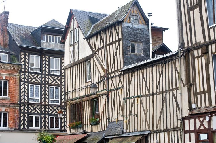
Start at the Place du Gerbert (Place Gerbert, 15000 Aurillac), the beating heart of Aurillac since the Middle Ages. The statue of Pope Sylvester II, born Gerbert d'Aurillac around 946, is a reminder that this city of 25,000 inhabitants gave the Church its first French pope, a man passionate about science and astronomy. From there, head into the Rue du Consulat: half-timbered facades from the 15th and 16th centuries line the street one after another, some leaning several degrees, almost all listed or registered as historic monuments.
The walk continues naturally toward the Rue des Frères Chambon, with its arcades and artisan shopfronts, before opening onto the Place Saint-Géraud, dominated by the abbey church of the same name. Don't miss the Maison Consulaire, a former 14th-century town hall with an ornate facade, which speaks to the influence the consuls held in medieval Aurillac. One thing always surprises visitors passing through: the old center of Aurillac can be covered entirely in 45 minutes on foot, yet every street corner reveals a change of scenery, from elegant 18th-century townhouses to the most raw medieval buildings. Food and drink shops occupy a good portion of the ground floors of these old buildings, and it is not unusual to spot a cutlery shop or an umbrella workshop — Aurillac having built part of its industrial reputation on these two crafts since the 19th century.
Then make your way to the Halles, the covered market in the center, before walking along the Jordanne on the street that overlooks it. This is where the urban walk shifts into something else: fewer than ten minutes separate the Halles from the first direct access to the river, without needing to leave the city. This old Aurillac is ideally suited to a discovery through its alleyways, exactly the kind of route that Ryo brings to life elsewhere, such as during a walk through the elegant neighborhoods of Buenos Aires. Allow a good hour and a half if you stop at every shopfront or terrace, or just under an hour if you head straight for the castle.
Along the Banks of the Jordanne: a Refreshing Walk Right in the City Center
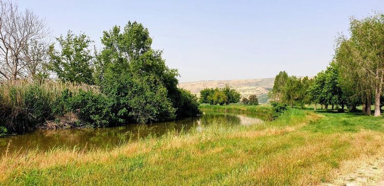
The Jordanne flows at the foot of old Aurillac from the heights of Puy Mary, and the city has developed several kilometers of riverbanks accessible on foot or by bike. The most pleasant stretch starts near the préfecture bridge and follows the river south, shaded by plane trees and dotted with benches.
In summer, the water stays cool even when the city center swelters in the heat — a contrast that the residents of the Aurillac basin know well, and which explains why this stretch of riverbank is often busier in the late afternoon than in the middle of the day. You'll come across joggers, families out for a stroll with pushchairs, and on some summer evenings, groups picnicking directly on the grass.
If you continue upstream, the path becomes wilder and runs alongside allotment gardens before reaching the first wooded foothills that announce the Bois de la Sablière. Allow 40 minutes for the urban section there and back, double that if you continue into the woods. It is one of the easiest walks to improvise without any preparation: no elevation gain, a stable surface, and an exit possible at almost any point along the river.
Château Saint-Étienne and the Maison des Volcans: the Walk with the Best Panorama
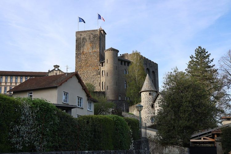
Perched on a rocky outcrop above the city, the Château Saint-Étienne (Rue du Château, 15000 Aurillac) is one of the few remaining vestiges of the fortifications that protected Aurillac in the Middle Ages. Its original keep dates back to the 9th century, but the current main building was reconstructed after a fire in 1868, in a style inspired by the Palace of the Popes in Avignon. It is reached via a short but steep climb that rises about fifty meters in a few minutes from the neighborhood of the same name.
The castle today houses the Maison des Volcans, a museum space that explains the formation of the Cantal stratovolcano, the largest in Europe by surface area according to geologists who study it. The explanations of the successive eruptions that shaped the landscapes visible from the castle give a whole new dimension to the rest of the walk, particularly if you plan to head up to Puy Mary or Puy Griou afterward.
But the main attraction remains the panorama from the castle grounds, whose gardens stay open: from there, the view takes in the entire historic center of Aurillac, the slate rooftops of the old quarter, and on a clear day, the line of Cantal summits on the horizon. Many visitors linger there at sunset, when the raking light highlights the relief of the old rooftops. Allow 30 to 40 minutes for the ascent, exploring the site, and the descent.
The Bois de la Sablière: the Favorite Green Escape of Aurillac Locals
Less than fifteen minutes' walk from the center, the Bois de la Sablière (Chemin de la Sablière, 15000 Aurillac, rated 4.1/5 on Google with 736 reviews) is the green lung that the residents of Aurillac use every day, far more than passing tourists. This wooded area of several dozen hectares climbs like a balcony above the city and offers a network of marked trails suited equally to a gentle walk or a more demanding trail run.
The main path winds through oaks and chestnut trees, with a few clearings offering open views over the Aurillac agglomeration below. The elevation gain remains moderate, never more than 100 meters of cumulative climb on the classic loops, making it accessible to families and Sunday morning joggers alike.
What strikes you most is the silence. Ten minutes from the Place du Gerbert, you can no longer hear the traffic — only the wind in the leaves and occasionally a woodpecker tapping on a dead trunk. Allow an hour for the full loop, slightly less if you take the shortcut that cuts through the central valley. In autumn, the colors of the chestnut trees are worth the trip on their own.
Jardin des Carmes and Square Marie-Roudet: a Peaceful Break
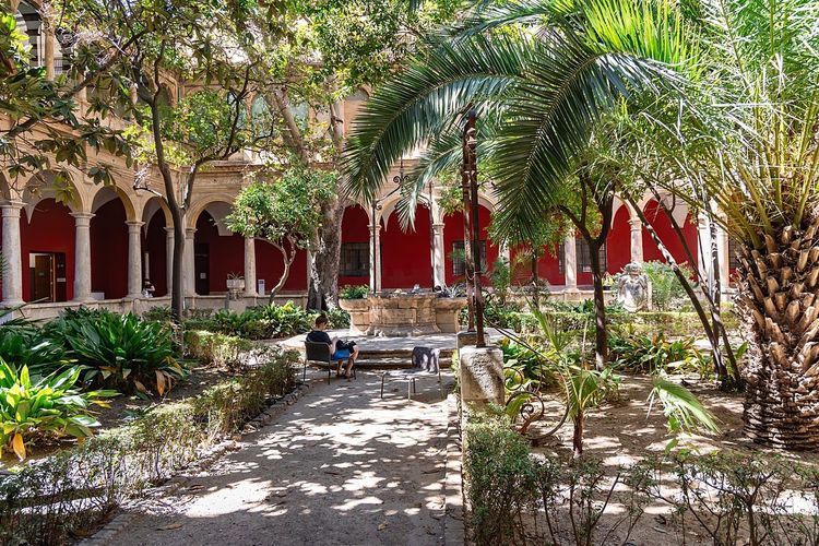
Less well known than the Bois de la Sablière, the Jardin des Carmes (Rue des Carmes, 15000 Aurillac, rated 4.1/5 on Google with 210 reviews) occupies the former site of a convent and offers a structured green space, with gravel paths and benches in the shade of tall trees. It is the ideal spot for a twenty-minute break between two visits in the center, especially if you are traveling with young children who need to run around a bit.
Nearby, the Square Marie-Roudet completes this green interlude with its flowerbeds maintained by the municipal services. Nothing spectacular, but a welcome breath of fresh air when you've been covering kilometers of cobblestones through old Aurillac.
In the Footsteps of Gerbert d'Aurillac: the Abbatiale Saint-Géraud and the Old Religious Quarter
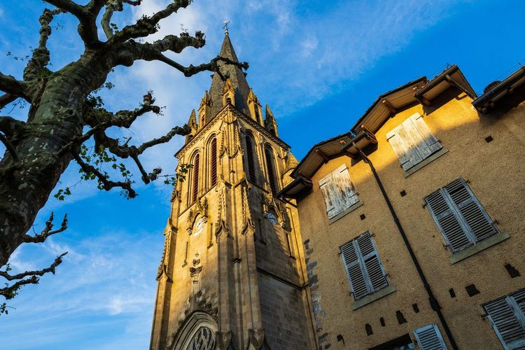
The Abbatiale Saint-Géraud (Place Saint-Géraud, 15000 Aurillac, rated 4.5/5 on Google with 18 reviews), founded on the remains of a 9th-century Benedictine abbey, remains the oldest religious monument in the city of Aurillac. Its architecture blends preserved Romanesque elements with later reconstructions, following the fires and destructions that marked its history. Inside, don't miss its great organ from 1779, with nearly 2,440 pipes — one of the most remarkable historic instruments in the region.
Around the abbey church, the neighborhood has retained a different atmosphere from the rest of the center: narrower alleyways, more austere houses, a few remnants of the old cloister visible from the street. This is where Gerbert d'Aurillac, the future Pope Sylvester II, is said to have completed his early studies at the abbey school before leaving for Spain and then Reims. A commemorative plaque recalls his journey, as unlikely as it has remained little known to the general public outside Cantal.
The walk through this neighborhood pairs well with a stroll along the nearby Rue des Carmes, where several convents once stood and which now houses the Museum of Art and Archaeology, before heading back down to the banks of the Jordanne. Allow 25 minutes for this heritage detour, longer if you go inside to visit the abbey church.
Fifteen Minutes Away: the Château de Conros Along the Cère
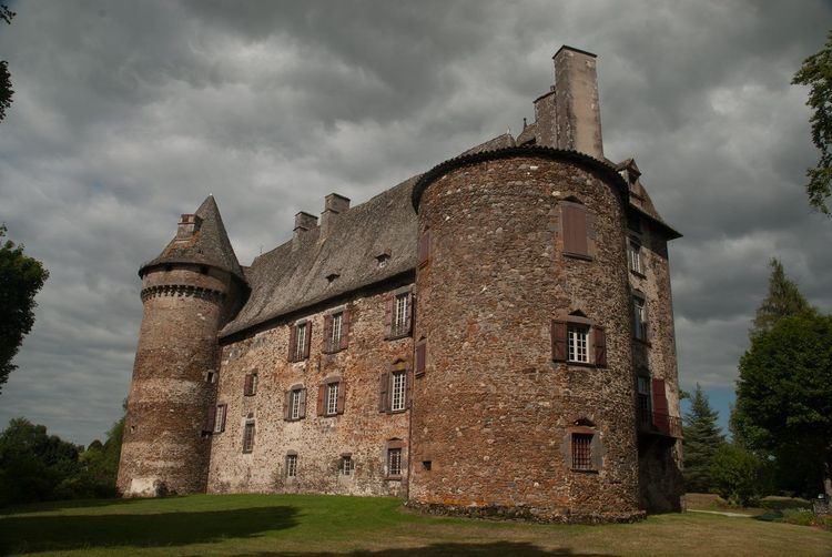
Located in the neighboring commune of Arpajon-sur-Cère, the Château de Conros (Arpajon-sur-Cère, 15130 Arpajon-sur-Cère) is worth the short detour by car from Aurillac. Built from the 12th century onward and remodeled through to the Renaissance, this fortified complex dominates the Cère valley from a rocky spur, with its round towers and access bridge spanning the former moat.
The park surrounding the castle lends itself to a family walk of about an hour, between shaded lawns and views of the towers from various angles. Interior visits are offered during certain times of the year, generally in summer, but the exterior remains freely accessible for much of the time. It is also a good pretext for an educational outing: children love spotting the arrow slits, guessing the location of the original drawbridge, and following the outline of the old moat.
If you want to extend the outing, a path follows the Cère below the castle and allows for a longer loop toward the village of Arpajon-sur-Cère. It is a good option for varying the strictly urban walks of Aurillac while remaining less than a quarter of an hour from the center.
Around Aurillac: Gorges, Waterfalls, and Lakes of Cantal
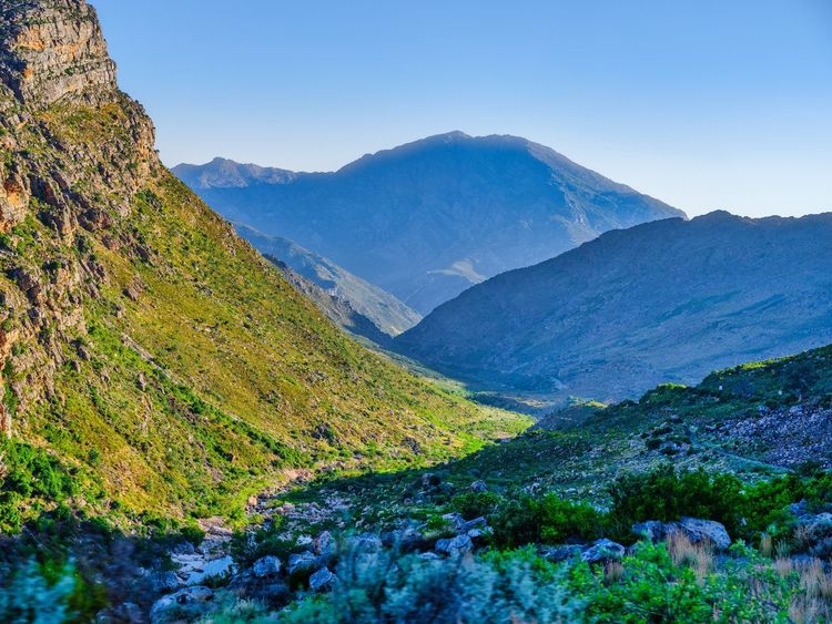
Less than half an hour's drive to the east, the Cère valley offers some of the finest nature walks in the area. The Gorges du Pas de Cère (D59, 15800 Thiézac, rated 4.6/5 on Google with 216 reviews), between Vic-sur-Cère and Thiézac, are discovered via a short but spectacular trail that descends to the bottom of a wooded gorge down to a deep waterfall. Allow three-quarters of an hour there and back on a well-marked path, slippery after rain but accessible to any reasonably equipped walker. The protected site owes its atmosphere to its dark walls and the permanent coolness that prevails by the water, even in the height of summer.
A little further up in the same valley, the Cascade de Faillitoux, near Thiézac, tumbles down a wall of basalt columns left by the Cantal volcanism. The waterfall is visible from the road, but a short trail allows you to get closer to better appreciate the regularity of the stone columns — a geological phenomenon found on a larger scale throughout the massif. Those who want to continue can push on to the Grande Cascade de Salins, another well-known waterfall in the area, to put together a half-day entirely devoted to water and forest.
On the lakeside, the surroundings of Lioran shelter several small mountain lakes, such as the Lac des Graves, accessible via family trails that circle the lake in about an hour. In summer, these lakes offer a shaded and refreshing walk, far from the crowds at the main summits, and make an excellent warm-up before a more serious ascent toward the Plomb du Cantal or Puy Griou.
Heading for the Monts du Cantal: the Walk up to Puy Mary
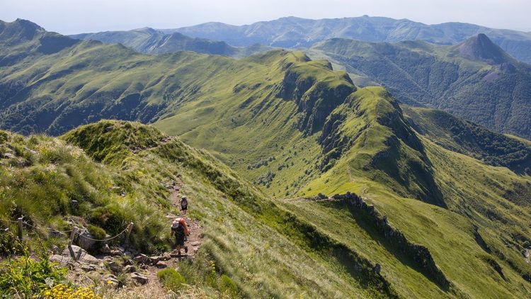
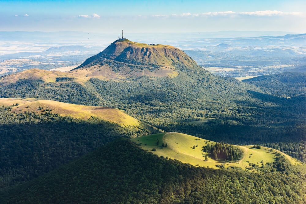
Just under an hour's drive from Aurillac, Puy Mary (Pas de Peyrol, 15400 Mandailles-Saint-Julien, rated 4.5/5 on Google with 354 reviews) is without doubt the most spectacular hike accessible from the city. This volcanic summit reaches 1,787 meters and dominates a landscape of radiating valleys — remnants of a giant stratovolcano that collapsed millions of years ago. Listed as a Grand Site de France under the name "Puy Mary - Volcan du Cantal," it is among the most visited panoramas in Auvergne. It is reached from the Pas de Peyrol pass, the most frequented starting point and often described as the highest road pass in the Massif Central.
From the Pas de Peyrol parking lot, the ascent follows a purpose-built staircase that climbs roughly 130 meters of elevation over just under a kilometer. It is not a long distance, but the gradient is steep and the wind can blow hard on the final meters before the summit. Allow 30 to 40 minutes to climb for an average walker, and about twenty minutes to descend.
Once at the top, the reward far exceeds the effort: on a clear day, the view stretches to the Monts Dore, the Puy Griou as a dark pyramid directly opposite, and sometimes as far as the Pyrenees on the horizon. It is also one of the few places in Cantal where you grasp at a single glance the scale of the volcanic massif and the logic of its star-shaped valleys.
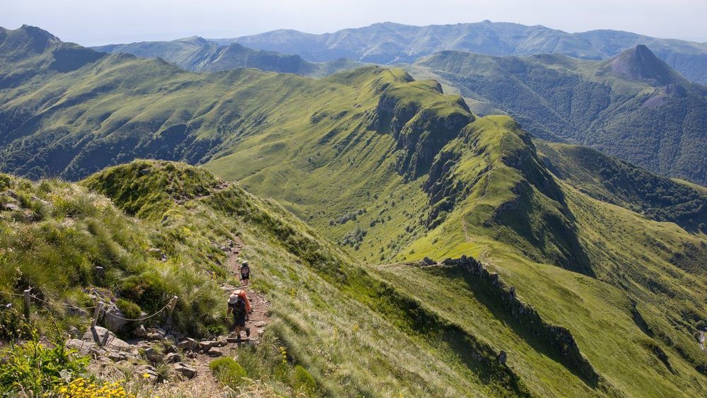
If you prefer to avoid the crowds, set out early in the morning or in the late afternoon, particularly in July and August when the Pas de Peyrol parking lot fills up by 10 a.m. A shuttle service is put in place on days of heavy traffic to limit the pressure on the site — a system designed to preserve both the landscape and the hiking experience around Aurillac. For more seasoned walkers, a ridge path links Puy Mary to the Puy de Peyre Arse, a possible extension of about two additional hours, before rounding off the trip in Clermont-Ferrand with Ryo's audio-guided tour, the Black Diamond of Auvergne.
Puy Griou and Plomb du Cantal: Two Summits, Two Different Experiences
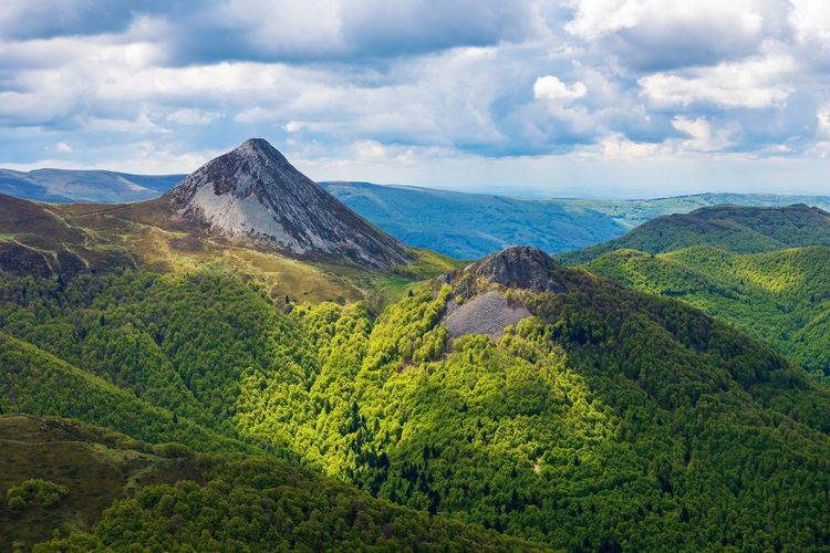
Less accessible than Puy Mary, Puy Griou attracts hikers looking for a genuine physical challenge. This pyramid-shaped volcanic peak, visible from much of the Aurillac area, is generally climbed from the hamlet of Mazoire or from the Puy Griou refuge, with an elevation gain that often exceeds 500 meters depending on the chosen route.
The final stretch, in the last few meters before the summit, sometimes requires placing your hands on the rock, though it does not involve technical climbing. Many local guides recommend it mainly for walkers already accustomed to mid-mountain terrain, or accompanied by a professional for a first attempt. The panorama from the summit, at nearly 1,690 meters, extends across the entire Cantal massif and easily rivals that of Puy Mary.
The Plomb du Cantal (Station du Lioran, 15300 Laveissière, rated 4.3/5 on Google with 102 reviews), the highest point in the department at 1,855 meters, offers a very different experience. From the Lioran ski resort, a cable car allows you to reach the area near the summit without any effort — a practical option for families or visitors who want to enjoy the view without a demanding hike. The more motivated can also climb on foot from the resort, allowing for about two good hours of ascent.
The combination of Puy Mary, Puy Griou, and Plomb du Cantal makes it possible to plan a multi-day stay around Aurillac, alternating demanding hikes with more relaxed outings depending on the weather and how you feel. Each of these summits can be climbed in half a day, leaving time to stroll around the city in the evening.
The Glacial Valley of the Jordanne and the Hamlet of Falgoux
Heading up the road that follows the Jordanne upstream, you pass through a landscape typical of a Cantal glacial valley, with its steep slopes and hamlets clinging to the mountainside. The village of Falgoux, about forty minutes from Aurillac, marks a natural stopping point before the ascent of Puy Mary via its northern face, less frequented than the Pas de Peyrol side.
This valley is worth a walk even without any intention of climbing to the summit. Several short trails set off directly from the village of Falgoux and allow you to reach waterfalls or viewpoints in one to two hours of walking, without the imposing elevation gain of the major summits.
Cyclists also appreciate this road for its profile — a long, steady climb rather than a brutal ramp — very popular with touring cyclists preparing for an ascent of the Pas de Peyrol from Aurillac. Groups are regularly spotted in summer, early in the morning, before the heat settles into the valley.
Aurillac by Bike: Cycle Paths, Mountain Biking, and Cantal Passes
Exploring Aurillac is not just for walkers. Along the Jordanne, a cycling route links the city center to the southern neighborhoods over several nearly flat kilometers. Several rental shops in the center offer hybrid bikes and electric-assist bicycles by the day, perfect for exploring the area around Aurillac without a car.
More experienced cyclists will find a well-regarded playground in the Aurillac area. The climb to the Pas de Peyrol pass, the starting point for Puy Mary, is one of the legendary ascents of the Massif Central and draws cycle tourists from all over France every summer. Other passes, such as the Col de Curebourse or the Col d'Entremont, offer more modest elevation gains for a first mountain outing.
For mountain biking, the Aurillac agglomeration and nearby resorts have marked numerous off-road routes, from family green trails to demanding descents from the ridges. The Bois de la Sablière and the wooded foothills above the city offer excellent training ground, just a few minutes from the center. The local hiking app lists most of these loops, both on foot and by bike, with GPS tracks and difficulty ratings.
A Foodie Walk: the Saturday Market and Aurillac Specialties
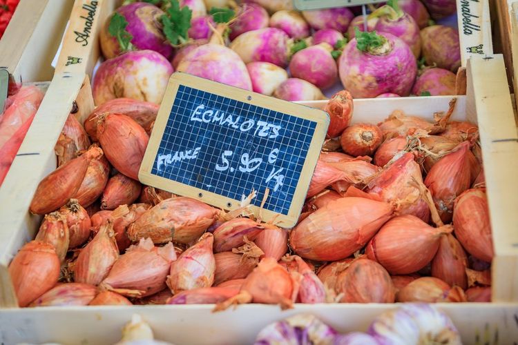
The Saturday morning market, set up around the Place du Gerbert and the Halles, naturally completes a walk through old Aurillac. You'll find produce from the Aurillac area: mountain cheeses, cured meats, honey from the high pastures, and seasonal vegetables sold directly by Cantal producers.
A few stalls also offer truffade or aligot to take away — two emblematic dishes of Cantal cuisine made from potatoes and fresh tome cheese. On the cheese front, the Aurillac area sits at the crossroads of several prestigious PDO products, from cantal to salers and bleu d'Auvergne: enough to fill a picnic basket before heading to the banks of the Jordanne (Quai des Carmes, 15000 Aurillac, rated 4.4/5 on Google with 1,236 reviews) or the Bois de la Sablière. A gourmet break that pleasantly extends a morning spent walking through the historic alleyways.
Family Walks: Short Routes, Pushchairs, and Children
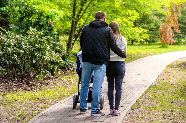
With young children, opt for the banks of the Jordanne in the city center — flat and pushchair-friendly for several kilometers — or the Jardin des Carmes for a shorter break. The Bois de la Sablière is also suitable for all-terrain pushchairs on its main trail, although some steeper sections should be avoided with a young child.
For slightly older children, the climb to the Château Saint-Étienne works well as a first experience of a walk with some elevation: the effort is short, and the visual reward is immediate. The Château de Conros, with its park and towers to explore, generally appeals more to younger children than a long mountain hike. Also consider the waterfalls in the Cère valley, whose "falling water" goal often motivates small legs better than a simple viewpoint.
When it comes to summits, Puy Mary remains feasible as a family outing from the age of 7 or 8, provided you set out early and pack warm clothing even in summer. The Plomb du Cantal, accessible by cable car from Lioran, on the other hand allows younger children to enjoy the panorama without the demands of a real ascent.
Practical Tips: Season, Weather, Equipment, and Getting There
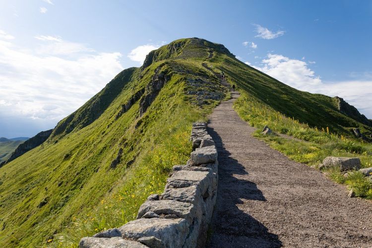
Urban walks in Aurillac can be done year-round, but spring and early autumn remain the most comfortable periods for long outings, before the intense heat of July and August and the first high-altitude snowfall. In the mountains, the ideal window runs from June to September, with snow sometimes persisting on the upper reaches of Puy Mary until late May in some years.
Wear closed hiking shoes for any outing lasting more than an hour, even on the trails of the Bois de la Sablière. In the mountains, always add a windproof jacket: the Cantal climate changes quickly, and the wind at the top of Puy Mary can catch you off guard even when the valley is sunny. A little water, a snack, and an offline map are enough for most of the loops described here; on the summits, add sunscreen, as altitude is deceptive when it comes to the sun's intensity.
In terms of access, Aurillac has a train station and a small airport with connections to Paris, but a car remains essential for reaching the summits of the Cantal massif. Allow about 45 minutes for the Pas de Peyrol, a little less for the Château de Conros or Falgoux (15380 Le Falgoux). In the city, the parking lots around the Place du Gerbert and the Halles allow you to explore all the walks in the historic center on foot. Finally, most of these routes are well suited to an outing with a dog on a leash, provided you respect the high pasture areas where herds graze in summer.
Aurillac as a Base Camp: Planning Several Days of Walking
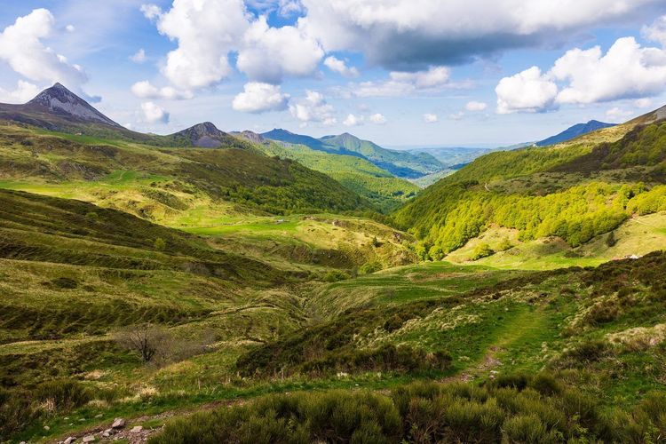
Spending just one day in Aurillac means barely scratching the surface. The city is best used as a base camp for day trips: mornings in the Monts du Cantal, afternoons by the Jordanne or in old Aurillac once the fatigue sets in. This star-shaped organization works all the better because most of the sites described here are reachable in under three-quarters of an hour's drive.
A weekend is enough to combine a major hike, such as Puy Mary or Puy Griou, with a relaxed exploration of the urban heritage and a gourmet break at the Saturday market. Over three days, you can add the gorges of the Cère valley, a morning cycling along the river, and an evening watching the sunset from the heights of the Château Saint-Étienne. By varying each day between high-altitude effort and leisurely strolling in the city, you avoid monotony and spare the legs of the less seasoned walkers in the group.
It is also the best way to make peace with the unpredictable Cantal weather: when the summits cloud over, you switch to an urban walk or a waterfall tucked deep in the valley, sheltered from the wind. This flexibility, rare for a mid-mountain destination, is what gives a stay around Aurillac its charm — you are never stuck for want of an alternative.
FAQ
What is the most beautiful walk to do in Aurillac?
The combination of old Aurillac and the Château Saint-Étienne remains the benchmark for a first visit: it blends medieval heritage with panoramic views over the city in under two hours. For a more spectacular experience, the ascent of Puy Mary from the Pas de Peyrol offers one of the most striking panoramas in all of Cantal.
How long does it take to visit Aurillac on foot?
The historic center can be covered in an hour and a half to two hours while strolling, including the squares, alleyways, and the Halles. Adding the climb to the Château Saint-Étienne and a break along the banks of the Jordanne, plan on a full half-day to make sure you don't miss anything essential.
Where to park to tour old Aurillac?
The parking lots around the Place du Gerbert and the Halles are the most convenient starting points, just a few minutes' walk from all the main sites in the center. On Saturday mornings during the market, it's best to arrive early or fall back on the slightly more outlying parking areas.
What walks can you do around Aurillac with children?
The banks of the Jordanne, the Jardin des Carmes, and the park of the Château de Conros are well suited to families with young children, without any significant elevation gain. The Bois de la Sablière also works very well for a first forest walk of about an hour, as do the waterfalls in the Cère valley.
When is the best time to hike in the Monts du Cantal?
The period from June to September remains the most reliable, with stable conditions and snow that has generally melted from the summits. The beginning and end of the season can bring pleasant weather surprises, but also sudden changes, so it's best to check the forecast before setting out.
Do you need to book to climb Puy Mary?
The ascent itself requires no reservation, but access to the site is regulated on days of heavy summer crowds via a shuttle system. It is advisable to check the current access arrangements before setting out, especially on a weekend in July or August.
What is the easiest hike near Aurillac?
The Bois de la Sablière loop from the town center remains the most accessible option, with no significant elevation gain and just fifteen minutes' walk from the Halles. For a mountain outing with minimal effort, the Plomb du Cantal via the Lioran cable car allows you to enjoy a true high-altitude panorama without a demanding hike.
Aurillac ultimately lends itself to every kind of walk, from a gentle stroll through half-timbered alleyways to a demanding traverse of the volcanic ridges. This diversity, rare for a city of this size, deserves more than a simple stopover. And if you feel like turning your next Aurillac walk into a real story, let yourself be guided through your headphones: in the same way as its audio-guided tours like the walk in Central Park in New York or the cycling tour in Amsterdam, the Ryo app narrates every street and every panorama, city by city, so that walking becomes a real story.
À lire également