© Shutterstock
 Votre guide Ryo
Around Chambéry: 14 Tourist Gems to Explore in 2026
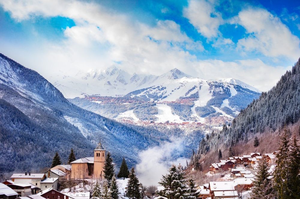
Chambéry is a city people often pass through without stopping, tucked into an alpine basin between Grenoble and Geneva. It is a mistake that comes at a high cost, because within the area around Chambéry there are 14 tourist gems to explore without delay, all gathered within a 60-kilometre radius. Within this modest perimeter, Savoie unfolds an inventory of landscapes and curiosities that would easily fill two weeks of itinerary: a lake covering 44 km², three ski resorts among the most renowned in Europe, a limestone cave set along the old royal road to Turin, a funicular that holds the world record for gradient, and panoramas that are literally breathtaking.
This article takes you to discover these 14 tourist gems around Chambéry, from must-sees like Lac du Bourget and the Croix du Nivolet, to lesser-known spots: the Mollard Noir where the sun sets over the entire Belledonne range, the Grottes de Saint-Christophe and their Voie Sarde carved in the 17th century, and the Saint-Hilaire-du-Touvet funicular, the world's steepest, whose 1924 cabin awaits its reopening after the floods. Before setting off to explore the region, it is well worth soaking up the atmosphere of the Savoyard capital with the Ryo audio guide tour of Chambéry, which reveals 23 points of interest in a 1.5-hour walk through the historic heart. After that, the region awaits.
The Lakes That Define the Region's Character
Savoie around Chambéry enjoys a rare privilege: two lakes of contrasting character within less than 30 kilometres of the city centre. The first is vast and romantic, the second is intimate and crystal-clear. Together, they define much of the region's tourist identity.
Lac du Bourget
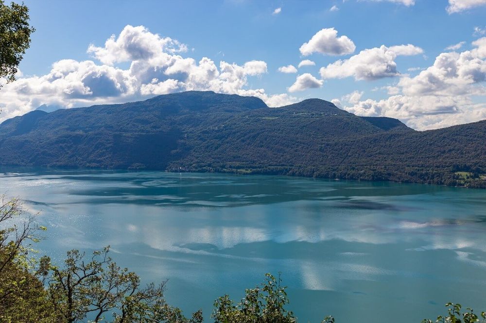
The Lac du Bourget is the largest natural lake in France, with its 44.5 km² of water occupying a glacial depression carved approximately 15,000 years ago. It is naturally associated with Aix-les-Bains, the spa town that lines its eastern shore, but Chambéry is only 15 kilometres from its beaches. The quickest access from the city centre runs along the D1201 to Brison-Saint-Innocent, a fishing village that has retained a human scale despite the pressure of summer tourism.
Lamartine immortalised this lake in his poem "Le Lac" (1820), as a tribute to a love story with Julie Charles. A commemorative plaque on the northern shore recalls this affair. But what strikes you when you first arrive at the water's edge is above all the quality of the light in the late afternoon: the Alps are reflected in a milky blue-green that shifts with the weather — steel grey under cloud cover, vivid turquoise on a sunny day.
To explore the shores without a car, the cycling tour of Lac du Bourget covers 60 km combining the eastern and western shores. The northern section, between Conjux and Hautecombe, follows a quiet road with a direct view of the Abbaye de Hautecombe, a Cistercian abbey founded in 1135 that served as the necropolis of the kings of Sardinia. The boat crossing from Aix-les-Bains to the abbey takes 25 minutes and costs around €16 return.
In summer, the Plage du Centre in Aix-les-Bains can accommodate up to 8,000 swimmers a day. If you prefer peace and quiet, head towards Chatillon or La Chambotte on the cliff side: lesser-known pebble beaches with cleaner water and reduced crowds even in August.
Lac d'Aiguebelette
Twenty-five kilometres west of Chambéry, Lac d'Aiguebelette (Riva-Bell, 73610 Aiguebelette-le-Lac, rated 4.1/5 on Google with 724 reviews) is the exact opposite of the Bourget: small (550 hectares), intimate, and almost entirely free of motorised boats, which have been banned since 1992. This decision transformed the lake's character. The water is among the warmest of the alpine lakes in summer, regularly reaching 28 °C in late July, and above all among the clearest, with visibility reaching 5 to 7 metres.
Paddleboarding is the activity of choice here. Several rental operators offer boards and kayaks on the northern and western shores, at rates ranging between €10 and €15 per hour. The straight-line crossing of the lake is barely 2 km, which allows even beginners to complete a full circuit in 1.5 hours without excessive effort. For a bird's-eye view of the two islands (Île Verte and Île Bleue, both privately owned), head up to the Lépin-le-Lac viewpoint: fifteen minutes of climbing from the car park, a view worth ten times the effort.
Out of season, Aiguebelette is even more beautiful. Morning mist sometimes traps the lake in September and October, creating a smoky mirror unlike anything else in the region — one more reason not to save this lake for summer alone.
The Vertiginous Summits Around Chambéry
Three high points dominate the horizon from Chambéry's centre and each deserves a dedicated trip. The Passerelle du Revard for its spectacular staging above the Bourget, the Croix du Nivolet for the effort rewarded by a circular panorama, and the Mollard Noir (Chemin du Mollard Noir, 73160 Saint-Cassin, rated 4.7/5 on Google with 91 reviews) for the understated beauty of a sunset that few tourists know about. You can hardly see all three in a single day, but nothing stops you from dedicating an entire weekend to these heights.
La Passerelle du Revard
The Mont Revard rises to 1,537 metres and looks directly down over Aix-les-Bains and Lac du Bourget from its western face. What visitors have been coming for over the past decade is less the summit itself than the series of walkways installed along the ridgelines from 2018 onwards. The most impressive, a metal structure suspended on the cliff face, offers a 180° panorama over the lake and the Belledonne range.
The road to the Revard climbs from Aix-les-Bains (D913) in 30 minutes along a relatively narrow forest road. In summer, free shuttle buses run from the centre of Aix-les-Bains at weekends — check the timetables on the agglomeration community website before setting off, as the summit car park fills up quickly on fine days. In winter, the Revard hosts a small cross-country ski resort with 40 km of groomed trails through a setting of snow-covered forests.
From the main viewpoint, on a clear day, you can make out Mont Blanc to the north-east. The straight-line distance is around 85 km. On fine autumn days, visibility can exceed 100 km towards the Vercors.
La Croix du Nivolet
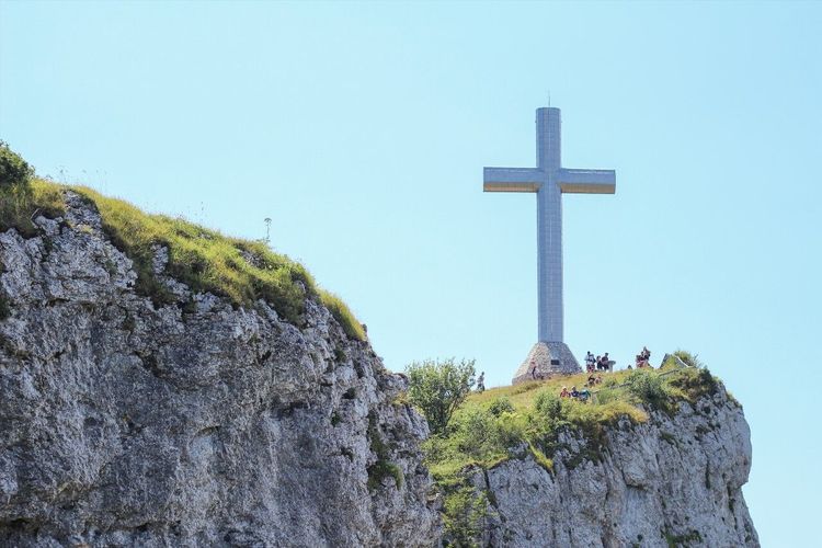
At 1,547 metres above sea level, the Croix du Nivolet is the silhouette that identifies Chambéry from the valley below. The current metal cross, completed in 1910 and inaugurated in 1911 thanks to a public subscription and the transport of materials by the residents of Les Déserts, is illuminated on certain evenings — visible from the windows of the old town, it punctuates every clear night with a bright signal on the ridge.
The most classic hike starts from Jacob-Bellecombette (the neighbouring commune to the south of Chambéry) along the marked trail. Allow 2 to 2.5 hours for the ascent, with around 700 metres of positive elevation gain and a final exposed ridge section that requires a minimum of mountain experience. The reward at the summit is a circular panorama taking in Lac du Bourget, the Massif de Belledonne, Mont Blanc and, on a clear day, the Vercors to the south.
Set off early if you go in July or August. The trail is popular and the last few metres before the cross can become crowded by mid-morning. On weekdays, you will find more peace and better photographic light from 7 a.m. onwards.
Le Mollard Noir
Less well known than its two neighbours, the Mollard Noir (1,454 m) deserves special attention for sunset enthusiasts. Its due-west exposure on the shady slope of the Chartreuse massif makes it one of the best viewpoints in the region at golden hour. Access is from Saint-Cassin along a forest track driveable to around 1,100 metres altitude, followed by about an hour's walk.
What sets the Mollard Noir apart is above all the tranquillity. You will not encounter crowds here. The panorama down towards Chambéry below is striking when the raking evening light transforms the rooftops of the old town into a coppery checkerboard, with the Grésivaudan plain stretching away towards Grenoble.
This is the kind of place the residents of Chambéry keep to themselves. Make the most of it.
Massif des Bauges: Between a Nature Park and Canyoning
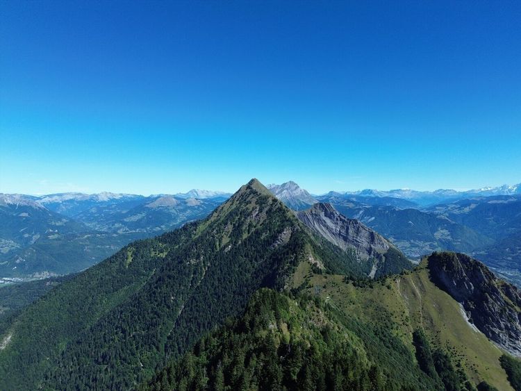
Situated between Chambéry, Annecy and Albertville, the Massif des Bauges covers 85,000 hectares of forests, alpine meadows and limestone cliffs designated as a Regional Nature Park since 1995. It is one of the least developed massifs in the French Pre-Alps: no major ski resort, little heavy tourist infrastructure, and one of the lowest population densities in Savoie. That emptiness is its greatest asset.
Its wildlife is exceptional for a massif so close to large cities. The Bauges ibex population exceeds 1,200 recorded individuals, one of the largest in France. They can be spotted fairly easily from the alpine meadows of La Tournette or the Col de Chérel, particularly in the late afternoon. Chamois, golden eagles and other birds of prey complete a wildlife tableau that surprises on every visit.
For hikers, the GR96 crosses the massif from end to end, passing through little-visited villages such as Aillon-le-Jeune or Jarsy. Allow 3 days for a full crossing with nights in mountain huts. For a day trip from Chambéry, the Semnoz circuit from Annecy (drive to 1,700 m, then 1 hour on foot to the ridgelines) offers views across both sides of the massif without excessive effort. Beginners will find their footing on the signposted walks starting from Aillon-le-Jeune, with reasonable elevation gain and views of the alpine meadows from the very first minutes.
Canyoning in the Bauges
The torrents descending from the massif have carved gorges and pools perfect for canyoning. The Chéran canyon (Route de Lescheraines, 73340 Lescheraines, rated 5/5 on Google with 527 reviews), accessible from Lescheraines, is considered one of the finest in Savoie for beginners: abseil descents of 5 to 15 metres, natural slides and emerald-coloured pools set within dense forest.
The season runs from May to September, with peak activity from June to August when water temperatures are more comfortable. Several operators based in Chambéry and Aix-les-Bains offer half-day sessions led by a state-certified guide, with equipment provided, for around €40 to €50 per person. The minimum age generally required is 8 for family circuits. For experienced practitioners, the Arlettes canyon (Jarsy area) offers more demanding vertical sections with abseils reaching 30 metres.
A half-day of canyoning in the Bauges is easily combined with a hike or a visit to the village of Aillon-le-Vieux on the same day, provided you make an early start.
Waterfalls and Caves: the Hidden Treasures of Savoie
The Cascades de Jacob-Bellecombette
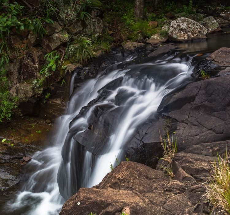
Just 5 kilometres from Chambéry's centre, the Cascades de Jacob-Bellecombette are one of the city's best-kept secrets. The Bens stream tumbles down a series of falls through a wooded gully that locals use as a decompression zone after work — making it an almost confidential spot, barely mentioned in mainstream tourist guides.
The access path starts from the car park at the Jacob-Bellecombette village hall and follows the valley floor for about 1.5 km. The first waterfall, a main drop of around fifteen metres, appears after 20 minutes of easy walking. Further upstream, smaller falls surrounded by moss-covered rocks are worth a stop. The area is accessible year-round, but the flow is at its peak in spring during the snowmelt: April and May are the best months to see the falls in full spate.
Access is free and open, with no interpretation panels or heavy tourist infrastructure. That is precisely what makes it charming: an unspoilt landscape just a few minutes' walk from the city.
La Grotte de Saint-Christophe
About twenty kilometres south-west of Chambéry, along the RD1006 towards Les Échelles and Voiron, the Grottes de Saint-Christophe (Voie Sarde, 73360 Saint-Christophe-la-Grotte, rated 4.6/5 on Google with 1,198 reviews) open into the limestone cliffs overlooking the Guiers gorges, on the edge of the Chartreuse massif. This is a historically charged site: it overlooks the famous Voie Sarde, the ancient road carved in the 17th century on the orders of the Duke of Savoie Charles-Emmanuel II to link Paris to Turin, which then ran along the border between France and the Duchy of Savoie.
Now set up for guided visits, the cave gives access to several underground chambers adorned with limestone formations (stalagmites, stalactites) and is accompanied by a trail that combines underground exploration with the historic site: the Voie Sarde, the Roman bridge and the Charles-Emmanuel II monument. Allow around 1 hour for a full visit, through galleries and passages laid out along the waterway.
Open from 1 April to 1 November, the caves are accessible to all visitors, including children. The adult admission price is around €9. Bring a warm layer even in summer: the interior temperature hovers between 10 and 12 °C regardless of the outside season.
Cross-Country Skiing at La Féclaz and the Slopes of the 3 Vallées
Winter transforms Chambéry's hinterland into a playground for snow sports enthusiasts. Two destinations stand out with radically different profiles: the understated Nordic setting of La Féclaz (Route du Revard, 73230 La Féclaz, rated 4.5/5 on Google with 870 reviews) and the vast scale of the 3 Vallées.
La Féclaz
Perched on the high plateaus of the Revard at 1,400 metres altitude, La Féclaz is the most frequented cross-country ski resort in Savoie. It forms part of the Savoie Grand Revard domain, which totals 150 km of marked and groomed cross-country trails, plus a dedicated snowshoeing and biathlon area. No chairlifts, no big-resort atmosphere: here, you come for the silence of the snow-covered woodland and the steady rhythm of the classic stride.
The village is 25 minutes from Chambéry by car. In winter, a shuttle bus serves La Féclaz from Chambéry station at weekends. Day passes are around €15 for adults, making it one of the most financially accessible options for a mountain day out in the region.
For families with young children, La Féclaz offers well-laid-out green trails and instructors available for beginners. For competitive skiers, the Grand Revard trail is part of the regional cross-country competition circuit.
Les 3 Vallées
At the opposite extreme from La Féclaz in every sense, the 3 Vallées form the world's largest interconnected ski area, with 600 km of pistes spread across the communes of Courchevel, Méribel, Val Thorens and their satellites. Access from Chambéry takes 1 hour 15 minutes along the A43 motorway to Moûtiers, then a mountain road to one of the gateway villages.
The domain spans from 1,100 to 3,230 metres altitude (Pointe de Thorens), guaranteeing reliable snow cover from December to April. Val Thorens, at 2,300 metres, is the highest resort in Europe in terms of base altitude — an advantage that ensures enviable snow conditions even in March when other resorts are closing.
Courchevel 1850 concentrates the upmarket offering (5-star hotels, Michelin-starred restaurants, luxury boutiques), but Saint-Martin-de-Belleville or Les Menuires give access to the same ski area at considerably lower prices. Day passes for the 3 Vallées exceed €65 in high season — factor this into your budget if you are planning from Chambéry.
Annecy, a Lakeside Interlude 45 Minutes Away
It would be a shame to be in Chambéry and not make the journey to Annecy. The capital of Haute-Savoie is 45 minutes away via the A41 motorway, and what it offers — a medieval old town threaded by canals, a 27 km² lake reputed to be among the cleanest in Europe, and a remarkably coherent Savoyard architecture — unquestionably justifies the trip.
Annecy's old town is entirely walkable. The historic heart is organised around the Thiou, the canal connecting the lake to the downstream river. The Palais de l'Île, a 12th-century former prison converted into a cultural space, rises from the middle of the canal at a crossroads of alleyways — it is the most photographed image in Annecy, for reasons you understand immediately upon arriving.
Above the rooftops, the Château d'Annecy dominates the old town from a rocky promontory. The permanent collection traces the history of the kings of Piedmont-Sardinia (Annecy was Savoyard until 1860), and an entire wing is devoted to the alpine environment. Allow around 1 hour for a full visit; the adult admission price is around €7. From the castle terraces, the view over the old town rooftops with the lake as a backdrop is worth the entrance fee on its own.
The Jardins de l'Europe, laid out along the lakeside on the town side, provide a transition between the bustle of the alleyways and the calm of the water. In summer, they host concerts and events. The view from the garden towards the Aravis range behind the lake is one of the finest postcards the region has to offer.
For swimming, Annecy's municipal beaches are accessible and well equipped, with marked swimming areas. Lake water reaches 22 to 24 °C in July and August. The Plage d'Albigny, slightly set back to the north, is quieter than the central beaches, with a mountain backdrop that gives the impression of having the place to yourself even in the height of summer.
The Cycling Path Around Lac d'Annecy
The Tour du Lac cycling path (Chemin du Crêt du Maillet, 74000 Annecy, rated 4.2/5 on Google with 92 reviews) covers 42 km around the full perimeter of the lake. Entirely asphalted and with no significant elevation gain, it is suitable for families with children. It can be completed in 3 to 4 hours without particular effort. Several bike rental operators are located near Annecy station and at the lakeside, with options for standard bikes, electric bikes (ideal for the slightly hillier eastern section) or cargo bikes for younger children.
The western section, between Annecy and Duingt, follows a steeper shore with cliffs dropping directly into the lake. Duingt itself, a village with a medieval castle on a peninsula, is worth a stop. To the east, the route passes through lakeside resorts such as Talloires or Menthon-Saint-Bernard, with varied dining options. If you only have half a day, opt for the western shore (Annecy to Duingt, around 20 km one way): the beauty-to-effort ratio is unbeatable.
The Saint-Hilaire-du-Touvet Funicular: an 83% Gradient Ascent
About thirty kilometres from Chambéry in the direction of Grenoble, the Saint-Hilaire-du-Touvet funicular holds a world record for a passenger transport system: its maximum gradient reaches 83%, an inclination close to 40° from horizontal. Opened in 1924, it connects the hamlet of Montfort in the Grésivaudan plain (260 m altitude) to the plateau des Petites Roches at Saint-Hilaire-du-Touvet (around 960 m), covering nearly 700 metres of elevation gain and passing through what its operators describe as the world's most steeply inclined tunnel. The full ascent takes around twenty minutes.
An essential point before planning your visit: the funicular has been closed since the torrent flood of 29 December 2021, which buried its lower station at Montfort under metres of debris. The Grésivaudan community of communes has taken over the facility and launched a reconstruction project estimated at around €6 million, funded with support from the Région and the Département. The reopening is hoped for by the end of 2027. Until then, the installation carries no passengers, but the original 1924 cabin, which is listed, has been placed in storage ahead of the reopening.
In the meantime, the area remains a fine escape from Chambéry. In the Grésivaudan valley, the Château du Touvet and its spectacular French-style water gardens (open to the public from May to September, adult admission around €10) are well worth the detour, with an open view over the Chartreuse and the Vercors. Higher up, the plateau des Petites Roches, accessible by road, remains one of France's premier paragliding destinations and the starting point for numerous hiking trails towards the surrounding summits. Back at base, our Chambéry audio walking tour loops the old town in 3.4 km.
Chambéry: Your Base Camp for Adventure
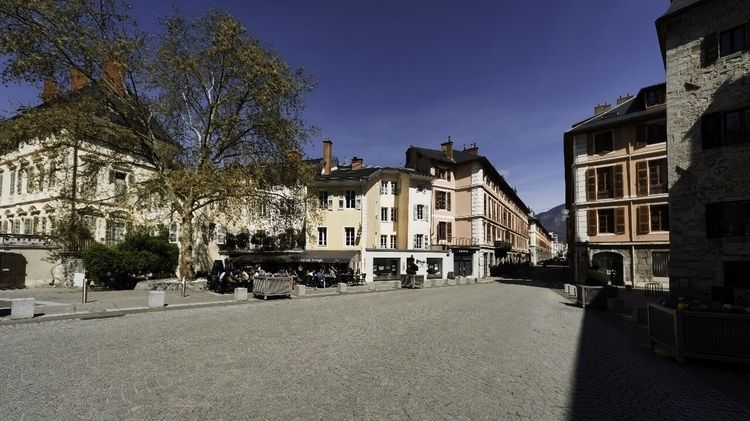
Before heading back out to the lakes and summits, set aside half a day for Chambéry itself. The city is well worth this investment of time, and it will also function as a natural logistical base for all excursions in the region.
The historic centre is organised around the Château des Ducs de Savoie, a medieval fortress that served as the main residence of the House of Savoie from the 14th to the 16th century. The Sainte-Chapelle adjoining the castle housed the Turin Shroud for several decades, before its final transfer to Turin in 1578. Guided tours are offered several times a week by the city's heritage services.
A few minutes' walk from the castle, the Fontaine des Éléphants (Place des Éléphants, 73000 Chambéry, rated 4.5/5 on Google with 4,773 reviews) has been the symbol of Chambéry since 1838. It was erected in honour of General Benoît de Boigne, who made his fortune in India in the service of the Marathas and bequeathed a portion of his wealth to his home city. The four bronze elephants supporting the column earned Chambéry the nickname "City of Elephants".
The Portiques district — the covered arcades lining the Rue de Boigne for several hundred metres — is an urban feature rarely found elsewhere in France. These arcades allow you to stroll sheltered from rain or sun, and house independent shops, cafés and second-hand bookshops that continue to resist the homogenisation of city centres.
The Ryo audio guide "The Historic Capital of Savoie" offers a 23-stop itinerary through Chambéry, lasting 1.5 hours and covering 3.4 km on foot. The ideal format for building a solid understanding of the city before setting off to explore the region. The Ryo app lets you move at your own pace, revisit a stop or skip one depending on your interests.
For museums, the Musée Savoisien, reopened in 2023 after eight years of renovation and housed in a 13th-century former Franciscan convent, traces Savoyard history from the Palaeolithic to the present day through more than 2,000 objects spread across 4,000 m². The Musée des Beaux-Arts, housed in an 18th-century former grain exchange, holds a collection of Italian paintings from the 16th to 18th centuries that is relatively little known, but of genuine quality.
Savoyard Gastronomy Around Chambéry

The area around Chambéry produces some of the most highly regarded cheeses in France. Beaufort (PDO since 1968), originating from the alpine meadows of Tarentaise and Beaufortain, requires around 400 kg of milk to produce a single 40 kg wheel, which explains why its price remains high even in the production zone. Tomme de Savoie, more accessible, comes in dozens of versions depending on the cheesemaker and the season. Abondance and Reblochon complete the quartet of protected designations.
To buy directly from producers, the Saturday morning market on Place de Genève in Chambéry brings together several local cheese producers and market gardeners. A few fruitières (cheese cooperatives) in the Bauges also open their doors to visitors by appointment during the season.
Savoie wine deserves special attention: local grape varieties such as Mondeuse (tannic red) or Jacquère (dry white, ideal with fondue) are rarely distributed outside the region. To explore Savoyard flavours and the best addresses in depth, our guide to the culinary specialities of Chambéry will point you in the right direction.
How to Organise Your Stay Around Chambéry
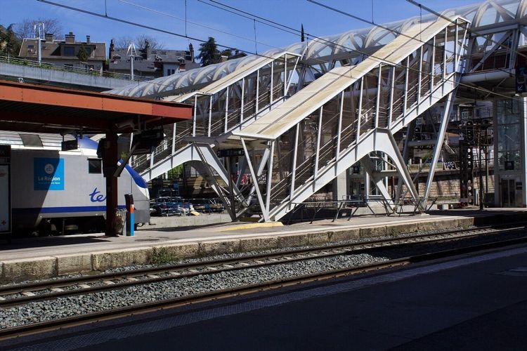
Chambéry is ideally positioned for a 3 to 5-day stay combining the city and the surrounding region. By train, the station is connected to Paris-Lyon in 3 hours 10 minutes by TGV, to Lyon in 1 hour and to Grenoble in 50 minutes.
For excursions to natural sites, a car is almost indispensable. Public transport covers Aix-les-Bains well (bus, 20 minutes) and Annecy (direct train, 45 minutes), but access to the Croix du Nivolet, the Massif des Bauges, La Féclaz or the Cascades de Jacob-Bellecombette requires a personal vehicle or a rental available from Chambéry station.
The best season depends on what you are looking for. From June to September, the priority goes to the lakes, hiking and canyoning. From December to March, the 3 Vallées and La Féclaz take over for winter sports. Chambéry itself and its cultural sites (Château des Ducs, museums) are accessible year-round, while the Grottes de Saint-Christophe open from April to November.
The average daily budget for an active stay (excluding accommodation) ranges between €40 and €80 per person depending on the activities chosen. Allow more for skiing days in the 3 Vallées (lift pass + equipment rental). For accommodation, Chambéry offers significantly better value for money than the surrounding mountain resorts. If you wish to stay in Savoyard villages, our selection of the most beautiful villages to discover in Savoie will give you some good ideas for stopovers.
FAQ
What is the best season to explore the area around Chambéry?
The region around Chambéry has the rare advantage of being interesting all year round. In summer (June–September), you can enjoy the lakes for swimming and paddleboarding, high-altitude hiking trails, and canyoning in the Bauges. Autumn transforms the Massif des Bauges into a canvas of golden foliage, with less-crowded hikes. Winter (December–March) activates the ski resorts — La Féclaz for cross-country skiing, the 3 Vallées for alpine skiing. Spring (April–May) is the best time for waterfalls thanks to snowmelt, and alpine meadow blooms begin as early as May at altitude.
Do you need a car to visit the surroundings of Chambéry?
For natural sites and higher elevations, a car is strongly recommended. Public transport covers Aix-les-Bains well (bus from Chambéry, 20 minutes) and Annecy (direct train, 45 minutes), but access to the Croix du Nivolet, the Massif des Bauges, La Féclaz or the Cascades de Jacob-Bellecombette requires a personal vehicle or a rental. The Saint-Hilaire-du-Touvet funicular is currently closed for reconstruction, with a hoped-for reopening at the end of 2027.
Can you visit Lac du Bourget and Lac d'Aiguebelette in the same day?
Technically yes, but it makes for a very packed day. The two lakes are roughly 40 km apart via Chambéry. If you have a car, one option is to start the morning at Aiguebelette (paddleboarding or swimming, quieter atmosphere) and finish the afternoon on the shores of the Bourget at Aix-les-Bains. Avoid trying to do everything at once: each lake deserves at least 3 hours to be truly appreciated.
Is the Saint-Hilaire-du-Touvet funicular currently operating?
No, not at the moment. The funicular has been closed since the torrent flood of 29 December 2021, which destroyed its lower station at Montfort. The Grésivaudan community of communes is overseeing a reconstruction project estimated at around €6 million, and the reopening is hoped for by the end of 2027. Until then, the installation carries no passengers. The area is nonetheless worth visiting: in the valley, the Château du Touvet and its water gardens can be visited from May to September, and the plateau des Petites Roches, accessible by road, remains a premier paragliding destination. Before any trip related to the funicular, check the progress of the construction work with the Grésivaudan.
Is Annecy easily accessible from Chambéry?
Yes, without any difficulty. The simplest connection is the direct train from Chambéry station (TER line), with a journey of 40 to 50 minutes depending on the service and frequent departures throughout the day. By car, allow 45 minutes via the A41 in good conditions. Annecy makes for an excellent day trip from Chambéry: morning for the old town and the castle, afternoon for the lake. If you arrive in July or August, weekdays are preferable to weekends, as the centre of Annecy is very busy during high season.
Are the hikes around Chambéry accessible to beginners?
In part. The Croix du Nivolet (700 m of elevation gain, an exposed ridge section) is not recommended for beginners or very young children. On the other hand, the Cascades de Jacob-Bellecombette (30 minutes of easy walking), the Mont Revard viewpoint (accessible by car to the summit car park, then a few minutes on foot), and the Tour du Lac d'Annecy by bike are suitable for all levels. For beginner hikers looking to progress in the Bauges, several marked circuits of 2 to 4 hours start from Aillon-le-Jeune without excessive elevation gain.
Conclusion
Around Chambéry, each direction holds a different surprise. To the west, the calm waters of Aiguebelette. To the north, the vast mirror of the Bourget. To the south, the ridgelines of the Nivolet. To the east, the gorges of the Bauges and, further on, the giant of the 3 Vallées. What makes the region special is the density of experiences within a modest perimeter: 60 kilometres is enough to cover the 14 gems in this article, from the depths of the Grottes de Saint-Christophe to the snow-covered ridges of Courchevel.
If you are not sure where to begin, start with Chambéry itself. The Chambéry audio-guided tour on the Ryo app offers a 24-stop itinerary through the Savoyard capital — the best way to set the scene before venturing out into the region. After that, let the geography dictate the order. Savoie around Chambéry rewards the curious, not the impatient.
À lire également