© Shutterstock
 Votre guide Ryo
Cirque de Gavarnie: The Complete Hiking Guide in Occitanie (2026)
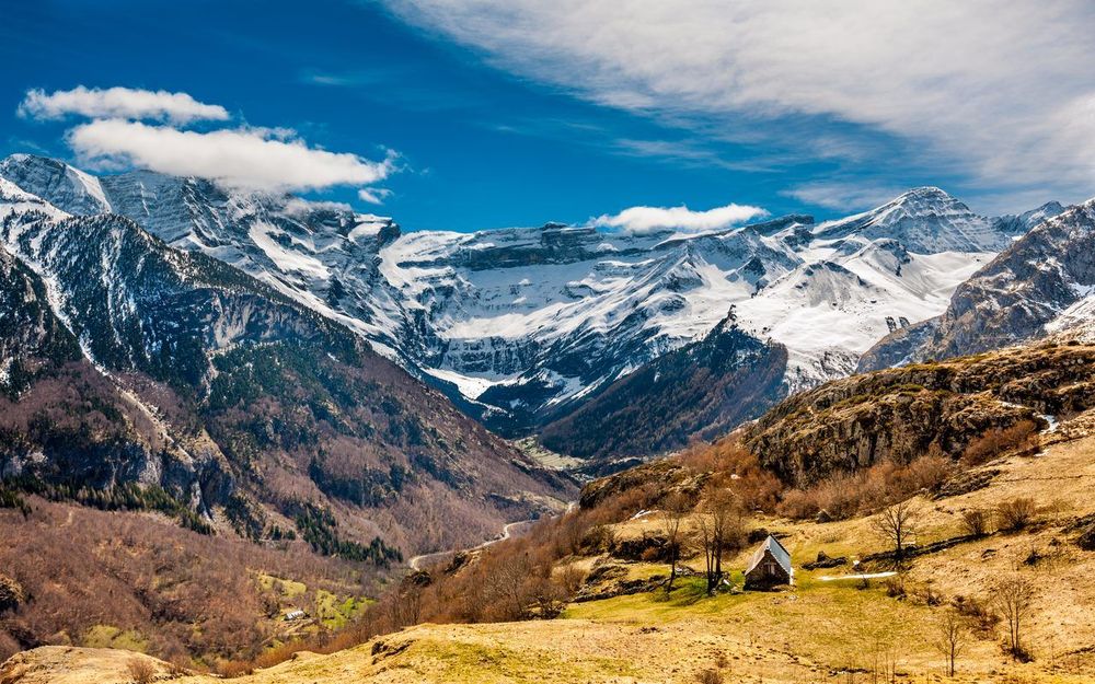
Planning your visit to the Cirque de Gavarnie hiking in Occitanie? This complete guide has everything you need: routes, distances, elevation gains, recommended timings, and pitfalls to avoid. Imagine a granite wall rising vertically over 1,500 metres, forming a natural amphitheatre 14 kilometres in circumference, crowned by permanent glaciers and crossed by the highest waterfall in France. The Cirque de Gavarnie, in the Hautes-Pyrénées, is one of the most breathtaking natural sites in Europe, and yet the main route remains accessible to any hiker in good physical condition.
Listed as a UNESCO World Heritage Site since 1997 as part of the Parc national des Pyrénées, this glacial cirque attracts between 400,000 and 500,000 visitors every summer. But not everyone experiences it the same way: some ride on horseback up to the Hôtellerie du Cirque, others walk the full 9 kilometres round trip to see the Grande Cascade up close, and seasoned hikers cross the Brèche de Roland at 2,807 metres to descend into Spain. This guide covers all these levels — distances, elevation gains, recommended timings, and pitfalls to avoid — as well as the neighbouring cirques of Estaubé and Troumouse, less crowded but equally grand.
From the Ryo audio-guided tour of Toulouse, the natural gateway to the Pyrenees, the Cirque de Gavarnie is less than 2.5 hours by road. For those exploring Occitanie in depth, a section is dedicated to the region's iconic cities — Carcassonne, Albi, Perpignan, Montpellier — which pair naturally with a mountain stay.
The Cirque de Gavarnie: An Extraordinary Natural Amphitheatre
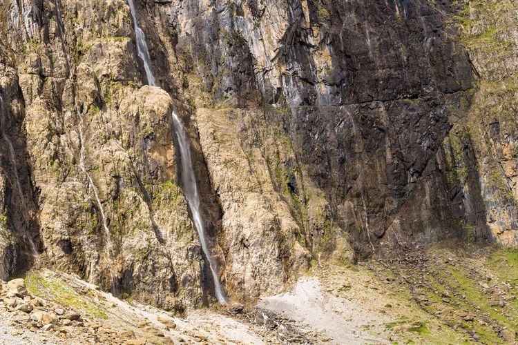
The Cirque de Gavarnie is no ordinary panorama. To grasp the scale, consider that the Grande Cascade that plunges into it stands more than 100 metres taller than the Eiffel Tower. The walls surrounding the cirque reach 3,248 metres at the Pic du Marboré and up to 3,355 metres at the nearby Mont-Perdu on the Spanish side. The Glacier du Casque, perched on the upper rim, feeds a network of torrents that flow across the basin floor before tumbling down towards the village of Gavarnie, 7 kilometres below.
Geologically, this cirque is the result of intense glacial erosion during the Quaternary period. The glaciers carved this horseshoe-shaped basin into a mosaic of limestone and granite formations, visible to the naked eye on the cliff faces. The horizontal strata striping the walls like lines on a page correspond to marine deposits 300 million years old: at 3,000 metres above sea level, you are reading the floor of a vanished ocean.
The Franco-Spanish border runs along the upper rim of the cirque. To the north lies the French Parc national des Pyrénées; to the south, the Spanish Parque nacional de Ordesa y Monte Perdido. Together they form the International Pyrenees Park, one of the rare protected natural areas straddling two countries. It is on this basis that the site received its UNESCO listing in 1997 — not for the cirque alone, but for the entire Mont-Perdu geographical ensemble, which includes portions on the Spanish side.
In practice, the site is entirely free to access. There is no ticket booth, no barrier, and no reservation required to hike. That said, parking and shuttle services operate differently depending on the season — we cover this in the practical section. The key thing to remember is that Gavarnie remains a wild site: services end at the Hôtellerie du Cirque at 1,570 metres, and beyond that, you are in the mountains.
History and Pyreneism: The Legacy of the Pioneers
Before becoming a tourist destination, Gavarnie was a place of passage. Pilgrims heading to Santiago de Compostela from the east used the Col de Gavarnie and the Brèche de Roland — the only natural gaps in this 3,000-metre wall. Pyrenean herds had crossed them since the Middle Ages to reach the Spanish summer pastures, a transhumance practice that shaped the pastoral landscape of the valley.
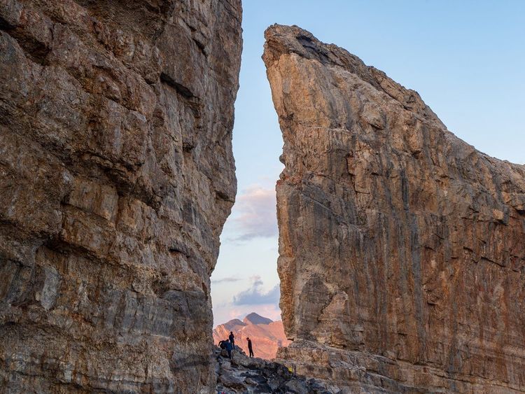
Arthurian legend took hold of the place long before tourists did. The Brèche de Roland takes its name from the Chanson de Roland, a medieval epic recounting how Charlemagne's paladin supposedly split this cliff face with a blow from his sword Durandal to prevent it from falling into Saracen hands. Historically unverifiable, but topographically compelling: the breach measures 100 metres wide and 40 metres high — a notch in the ridge that does indeed resemble a sword cut through the granite.
In the 19th century, Gavarnie took on a modern dimension with the rise of thermal tourism in the Pyrenees. In 1820, guide Payrou led the first alpinists to the base of the waterfall. Victor Hugo visited the site in 1843 and wrote in his travel journals: "It is a mountain and it is a city." In 1864, Charles Packe and Franz Schrader made the first precise measurements of the cliff faces. Then came Henry Russell, the Irish count who had seven caves carved into the flanks of the Vignemale for bivouacking, and who gave Pyreneism its noble credentials.
Pyreneism differs from classical alpinism through its more poetic and philosophical relationship with the mountains. Several local associations keep this memory alive today, and the Parc national's refuges remain places where this mountain culture is perpetuated over a hot bowl of soup at the end of the day.
Wildlife, Flora, and Geology: The Natural Riches of the Cirque
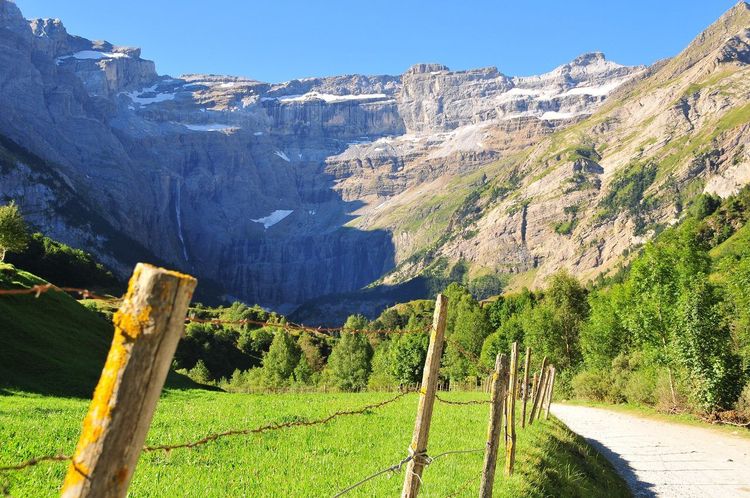
Hiking the Cirque de Gavarnie means passing through several vegetation zones in just a few hours. Starting from the village (1,357 metres), the damp meadows shelter in spring the Pyrenean fritillary — a purple wild tulip virtually unmatched elsewhere in France — and wild orchids colonising the banks of the mountain stream. Higher up, the subalpine grasslands are covered in June with gentians and blue rampions. Above 2,000 metres, vegetation thins and gives way to scree colonised by saxifrages.
The wildlife is generous for those who look carefully. Isards (Pyrenean chamois) are visible almost year-round on the upper slopes, particularly in early morning. Marmots, reintroduced to the Pyrenees in the 1970s, have thoroughly colonised the boulder fields and whistle as hikers approach. In summer, griffon vultures spiral on thermal currents above the cliffs — the Parc national is home to one of the largest colonies in France, with more than 300 breeding pairs.
On the geology visible to the naked eye: look for the dark zones midway up the Grande Cascade. These are ferruginous conglomerates that stain the rock orange-red when in contact with moisture. The pale zones at the base of the cirque correspond to dolomitic limestone slowly undergoing karstification — which is why the cirque floor is strewn with collapsed blocks that geologists call "croulants" (crumblers). If you hear a deep rumble from the cliff face, don't be overly alarmed: it's the cirque at work.
The Classic Route: The Main Trail (9 km Round Trip)
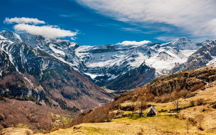
This is the hike that the vast majority of visitors do, and it fully deserves its reputation. Allow 9 kilometres round trip with a positive elevation gain of 450 metres, totalling 3 to 4 hours depending on your pace. The starting point is the village of Gavarnie (Route de Gèdre, 65120 Gavarnie, rated 4.8/5 on Google from 1,818 reviews) or the Prairie car park (1.5 km further up in season, reachable by shuttle or on foot).
The Start and the Plain
From the village, the path first follows the Gave de Gavarnie along a wide, well-marked trail. The first few kilometres cross meadows where horses and donkeys offer guided rides. In high season, it is best to set off before 8:30am to avoid the crowds: the trail becomes very busy between 10am and 4pm, and passing the horse convoys can significantly slow your progress.
The Hôtellerie du Cirque
Four kilometres from the start, the Hôtellerie du Cirque marks the classic resupply point. Open from mid-June to the end of September, it serves hot meals and drinks at 1,570 metres above sea level. Many families choose to make this their turnaround point: the panorama of the cliff faces is already striking from the terrace, and this is where you truly begin to grasp the scale of the cirque.
To the Base of the Waterfall
From the hôtellerie, about 1 kilometre remains to reach the base of the Grande Cascade. The trail becomes rockier and crosses several névé zones (persistent snow) into July in some years. Hiking boots with grippy soles are essential on this section — a slippery terrain that is unforgiving in regular shoes.
At the base of the waterfall, the permanent mist created by the water's impact keeps things pleasantly cool in the height of summer. The noise is deafening at 50 metres. For photography, a polarising filter or a waterproof cover for your camera is recommended. Rainbows in late morning, when the sun clears the western cliff face, offer a first-rate photographic reward.
The Return
Returning by the same path is the simplest and safest option. Some hikers extend their route via the right-bank variant, which is less busy and offers different angles on the northern walls of the cirque. This path is less well marked and can be muddy after rain: only take it in favourable conditions and with a GPS or map.
Difficulty and Equipment
The route is rated easy to moderate. No hiking experience is required for the standard ascent to the waterfall. The terrain becomes slippery in rain and some late snow patches require caution before mid-July. Pack hiking or sports shoes with grippy soles, waterproof layers (the Pyrenees can switch from sun to thunderstorm in 30 minutes), water and snacks, and sunscreen — the glare is intense at this altitude.
The Grande Cascade de Gavarnie: 422 Metres of Free Fall
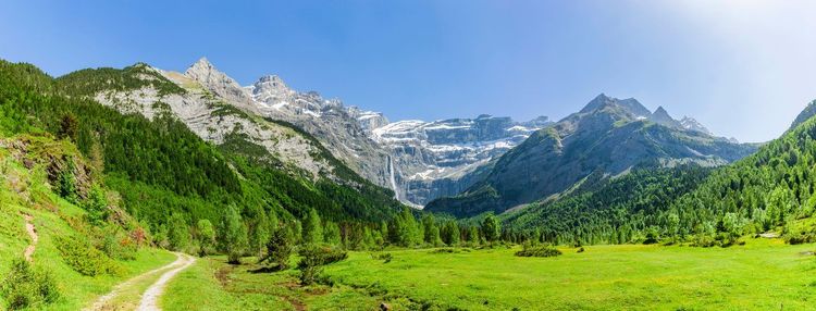
The Grande Cascade de Gavarnie (Cirque de Gavarnie, 65120 Gavarnie, rated 4.8/5 on Google from 192 reviews) is the highest waterfall in France and the third highest in Europe, with a total drop of 422 metres (422.9 metres according to official measurements by the hydrographic service). It originates at the Glacier du Casque, at over 3,000 metres above sea level, and joins the Gave de Gavarnie after a vertical descent that has fascinated visitors since the 18th century.
In March and April, the flow of the waterfall peaks thanks to snowmelt: it becomes a thundering mass of water visible from the village 7 kilometres away. In July and August the flow decreases but remains spectacular. In winter it can partially freeze, a rare phenomenon that transforms the cliff face into a sculpture of turquoise ice. Exceptionally cold winters occasionally allow an ice-climbing ascent — a pursuit reserved for equipped and experienced alpinists.
What surprises you when you arrive at the base is less the height (difficult to perceive when looking straight up) than the echo and the humidity the waterfall generates. Within 100 metres of its base, a permanent mist soaks clothes and cameras within minutes. A historical curiosity: during the winter of 1788–89, the waterfall froze so completely that a group of shepherds crossed it on foot to reach Spain. The event is recorded in the communal archives of Gavarnie, which describe it as one of the coldest winters in local history.
The waterfall is also a reliable indicator of climate change: scientists from the Parc national have measured its flow every year since 1920. The data shows a progressive decrease in summer flow since the 1980s, in direct correlation with the retreat of the Glacier du Casque, which has lost approximately 40% of its surface area over a century.
The Brèche de Roland: For Experienced Hikers (2,807 m)
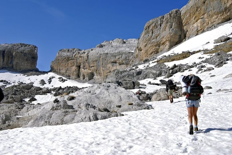
The Brèche de Roland is a gap in the border ridge at 2,807 metres above sea level, accessible from Gavarnie via a high-mountain route. It is one of the most spectacular hikes in the Pyrenees and one of the most committing achievable without technical climbing equipment.
The Route
From the village of Gavarnie, the route climbs the Pouey Aspé valley to the Port de Boucharo (2,270 m), then heads beneath the north face of the Taillon to the Refuge des Sarradets (Gavarnie, 65120 Hautes-Pyrénées, rated 4.4/5 on Google from 269 reviews) (2,587 m), also known as the Refuge de la Brèche de Roland. From there, a steep slope crosses the upper part of the Taillon glacier — crampons recommended before the end of July — before reaching the breach via a final scree step. With a car, you can significantly shorten the day by starting from the Col des Tentes (2,208 m).
Technical Data
- Distance: 16 km round trip from Gavarnie
- Elevation gain: +1,450 metres
- Duration: 7 to 9 hours
- Difficulty: difficult, mountain hike with glacier crossing early in the season
- Best period: July to mid-September
What You See at the Top
From the breach, the panorama tips over onto the Spanish side: the Ordesa canyon opens up 1,000 metres below, the colours change (Mediterranean vegetation replaces the French Pyrenean meadows), and the air carries a different quality. Many hikers descend the Spanish side to the Refuge de Góriz for lunch before climbing back up on the French side — a day traverse for the fittest hikers, and a memorable one for everyone.
On the French side, the view plunges down into the cirque itself, with the Grande Cascade below and the village of Gavarnie lost in the valley. It is one of the rare vantage points from which you can truly perceive the architecture of the cirque as a whole.
Important Precautions
The Taillon glacier is shrinking each year due to climate change. In 2026, it remains large enough to require crampons until early August in most years. Do not attempt the ascent without crampons, even if the snow appears firm: a slip on this type of terrain is always serious. The Parc national provides daily weather information via its website and its Gavarnie office — essential checking before any departure towards the summits.
For hikers wishing to extend their exploration of the Pyrenees, the article on the must-see things to do in the Pyrenees in Occitanie usefully complements this guide with other itineraries in the region.
The Cirque d'Estaubé and the Lac des Gloriettes
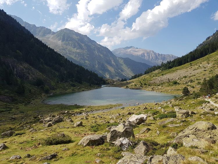
Twelve kilometres east of Gavarnie, the Cirque d'Estaubé is one of the best-kept secrets of the Hautes-Pyrénées. Less visited, it offers a more austere and wilder setting — grey limestone walls plunging directly into the Lac des Gloriettes (Gèdre, 65120 Hautes-Pyrénées, rated 4.7/5 on Google from 235 reviews), a reservoir built in the 1950s whose natural surroundings have remained intact.
The main hike from the lake climbs directly to the back of the cirque over approximately 5 kilometres (elevation gain +500 m, 3 hours round trip). The trail is far less busy than at Gavarnie and the solitude is total: expect fewer than 20 hikers on any given day, compared with several hundred on the main Gavarnie path in high season.
For birdwatchers, Estaubé is a prime observation post for the bearded vulture (lammergeier), Europe's largest raptor with a wingspan of 2.8 metres. The Pyrenees harbour one of the last native bearded vulture populations in France — one that never entirely disappeared, unlike in the Alps — and the bird nests in the cirque's cliff faces. Spotting a bearded vulture in flight, recognisable by its diamond-shaped silhouette and russet underparts, remains one of the most striking experiences the Pyrenees have to offer.
Access: from the village of Gèdre (12 km north of Gavarnie), take the D922H towards the Barrage des Gloriettes. Free parking at the lakeside. The road is suitable for a standard car as far as the car park.
The Cirque de Troumouse: The Wild Alternative
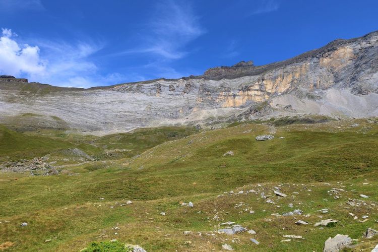
If Gavarnie is the most famous cirque, Troumouse is the one that leaves the most lasting impressions on those who venture into it. Even vaster, with an exceptional cirque diameter, it is accessible via a narrow toll road from the village of Héas.
What sets Troumouse apart is its high starting altitude: the car park sits at 2,100 metres, meaning the surrounding summits (la Munia, the Pic de la Sède, the Astazous) are reached quickly without the long climbs of the lower cirques. The main hike circles the cirque over approximately 8 kilometres with modest elevation gain (2 to 3 hours), offering constant views of peaks exceeding 3,000 metres. At the centre of the cirque, a statue of the Virgin Mary — the "Dame de Troumouse" — has stood on a rocky plinth since 1889, a testament to Pyrenean pastoral traditions.
Note the access road from Héas: the D922 is a toll road (approximately €5 per vehicle in 2026), very narrow and without crash barriers in places. Not recommended for motorhomes or drivers uncomfortable on mountain roads. In return, the road itself offers stunning panoramas over the Barousse valley and the Néouvielle peaks.
Pic de Piméné: Views Over Three Cirques at Once
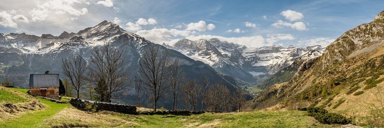
The Pic de Piméné (Hautes-Pyrénées, 65120 Gavarnie, rated 4.8/5 on Google from 6 reviews) (2,801 m) is the insiders' hike. This summit offers something unique in the Pyrenees: a simultaneous bird's-eye view over all three great glacial cirques of the massif — Gavarnie, Estaubé and Troumouse — as well as the Mont-Perdu massif on the Spanish side.
The route departs from the Col des Tentes (2,208 m, accessible by car from Gavarnie in July–August), which considerably reduces the climbing effort. From the col, allow 3 hours round trip to reach the summit on a marked trail, with 590 metres of elevation gain from the col. Without a car to the col, add 1.5 hours from Gavarnie.
Save this hike for clear days: the view disappears into cloud as soon as the weather closes in, which happens frequently on summer afternoons. Setting off in the morning to be at the summit before 11am is the golden rule. The 360° panorama from the top — on a clear day, taking in all three cirques and the Vignemale to the north — is well worth every step of the ascent.
Lac de Gaube and Vignemale: From Pont d'Espagne
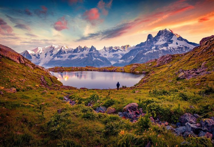
Fifty kilometres north of Gavarnie, Pont d'Espagne is the second major hiking hub of the Hautes-Pyrénées. From this starting point (at 1,496 metres), a gondola climbs to the Lac de Gaube (Cauterets, 65110 Hautes-Pyrénées, rated 4.8/5 on Google from 1,406 reviews) (1,725 m), or you can walk up in 45 minutes along a shaded path beside a succession of cascades.
The Lac de Gaube is a 900-metre-long glacial lake whose dark green waters reflect, on clear days, the north faces of the Vignemale (3,298 m), the highest summit entirely within France in the Pyrenees. It is one of the most reproduced views in the Pyrenees: the Ossoue glacier cascading down the north faces towards the lake's waters is a reminder that the mountains are changing faster than we might imagine.
From the lake, it is possible to continue to the Refuge des Oulettes de Gaube (2,151 m) in an additional 2 hours — the classic base for climbing routes on the Vignemale. The full hike from Pont d'Espagne to the lake and the refuge represents 12 km round trip with 660 metres of elevation gain — a full and memorable day out, with moderate difficulty throughout.
The town of Cauterets, 8 kilometres from Pont d'Espagne, is worth a stop: its thermal baths have been operating since the 19th century and its Belle Époque streets tell of the era when European aristocracy came to treat their respiratory ailments in the Pyrenean sulphurous waters. In winter, the Pont d'Espagne cross-country ski area adds to the appeal.
Gavarnie with Children: Family-Friendly Walks
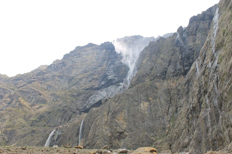
The Cirque de Gavarnie is one of the most family-friendly mountain hikes available, provided you tailor the route to the age and fitness level of your children. The classic climb to the Hôtellerie du Cirque (3 km from the Prairie car park (D923, 65120 Gavarnie, rated 3.4/5 on Google from 220 reviews), 150 metres of elevation gain) is manageable from around ages 6–7 for children who are normally active.
The final kilometre from the hôtellerie to the base of the waterfall is more demanding: rougher terrain, rocky sections, and sometimes snow before mid-July. For children under 10 without mountain experience, the Hôtellerie du Cirque makes an excellent turnaround point — the view from its terrace is already fully rewarding.
A few practical tips for families:
- Hiring horses and donkeys in the village lets younger children (from ages 4–5) take part in the ascent without physical effort. Expect to pay €25–35 per child to the hôtellerie depending on the operator in 2026.
- Running water is available at several marked springs along the path — no need to carry more than one litre per person.
- Avoid peak hours (10am–2pm in August): setting off at 8am means reaching the hôtellerie by 10am, just as the crowds are beginning to head up.
- The hôtellerie terrace has tables with a panoramic view — ideal for a picnic lunch break before the descent.
For children who are very confident in the mountains, the variant towards the Plateau du Bellevue (visible from the main trail, a 30-minute detour) offers a different angle on the cirque with fewer people and a welcome sense of solitude.
Gavarnie in Winter: Snowshoeing and Snowy Landscapes
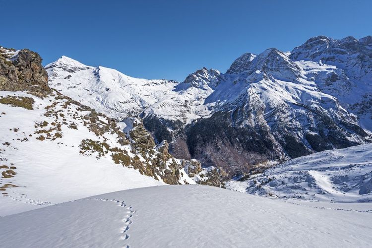
The Cirque de Gavarnie transforms completely between November and March. Snow covers the meadows from 1,400 metres upwards, the village empties of its summer tourist population — from 1,000 inhabitants in the height of summer to around a hundred in winter — and the atmosphere becomes that of a deep, silent Pyrenees.
Snowshoeing to the Hôtellerie du Cirque remains possible in winter, with important adjustments. Snow covers the marked trail: you need to be able to follow natural landmarks (the stream line, the meadow contours) or navigate with a map and compass. Avalanche risk is real between mid-January and the end of March — always check the Météo-France avalanche risk bulletin (BRA) before setting out, and do not stray from the valley floor when the risk is rated significant or high.
In return, winter offers images impossible in summer: the Grande Cascade partially or fully frozen in some years, frost-dusted cliff faces, isard tracks in fresh snow, and an absolute silence that the hundreds of thousands of summer visitors have permanently banished from the site. The village of Gavarnie offers a handful of accommodations open in winter, including two hotels and the municipal campsite with heated cabins. The Luz-Ardiden ski resort, 12 kilometres away, provides a ski area for low-cloud days.
When to Go: Weather and Best Periods
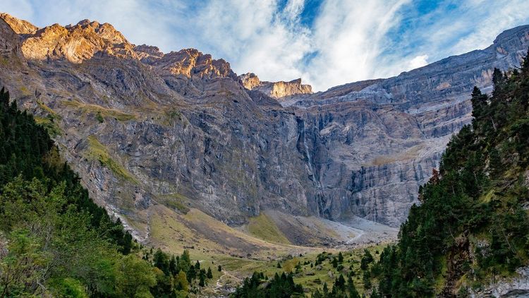
June and September are the ideal months for hiking the Cirque de Gavarnie. Late snow has melted on the main trails, the cliff faces are clear, temperatures remain cool (15–22°C in the village) and visitor numbers are 40–50% lower than in July–August. In June, the rhododendrons in bloom give the slopes extraordinary purple hues.
July and August are peak season with the corresponding crowds. The Gavarnie car park fills up from 9:30–10am on fine days. A paid shuttle (approximately €3 return in 2026) operates from the lower car park to the Prairie from mid-June to ease congestion on the road. In July, setting off at 7am from the village allows you to reach the hôtellerie before the first horse groups.
Pyrenean weather is notorious for its instability. Thunderstorms can build rapidly in the afternoon, sometimes from 2pm in summer, with genuine violence at altitude. The local rule: be back below 2,000 metres by 2pm if cumulus clouds are forming in the morning. For the Brèche de Roland, setting off at dawn (5–6am from Gavarnie) allows you to be at the summit by 10am and descend before any potential storms.
The month of May is special: snow is still present on the upper trails, but the flowering of the Pyrenean fritillaries in the lower meadows is a unique spectacle worth the trip even for a short walk. October often brings stable days with autumn colours on the valley's beech forests and an almost total absence of other visitors. Pack warm layers for the early morning hours in October.
Snow can fall in Gavarnie from late October through to May. The D921 road climbing from Lourdes generally remains passable year-round as far as the village, but the Col des Tentes road closes with the first significant snowfall (usually October to June).
Getting There, Parking, and Accommodation in Gavarnie
How to Reach Gavarnie
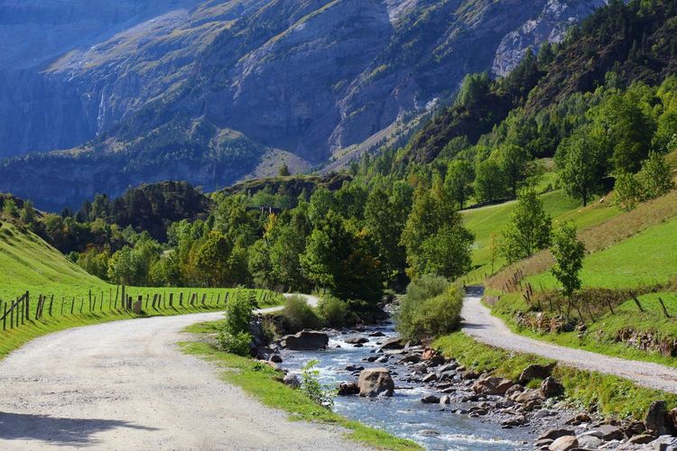
Gavarnie is accessible by road only. From Toulouse, allow 2.5 hours via Tarbes (A64 then N21 towards Lourdes, then D921). From Pau, allow 1 hour 45 minutes via Lourdes. From Lourdes itself, the D921 follows the Gavarnie valley for 53 kilometres along the Gave de Pau through spectacular gorges — a scenic road that rewards taking it slowly.
A bus service runs in summer between Lourdes and Gavarnie via Luz-Saint-Sauveur. The Hautes-Pyrénées Transport line offers daily departures from mid-June to mid-September with schedules suited to hiking (early departure, late-afternoon return). Check updated timetables on the Conseil Départemental des Hautes-Pyrénées website before setting out.
Car Parks
Two main car parks serve the cirque:
- Village Car Park (free year-round): at the entrance to the village, 1.5 kilometres before the trail. Starting point for summer shuttles.
- Prairie Car Park (paid in high season, approximately €5): closer to the trailhead, open and accessible in July–August on a rotation basis. Generally closes at the end of October.
Outside high season (before mid-June and after mid-September), both car parks are free and rarely full, even at weekends.
Accommodation
The village of Gavarnie has around ten accommodation options open in summer:
- The Hôtel le Marboré (3 stars) is the most comfortable in the village, with a terrace and views of the summits. Expect €90–140 per night in high season.
- The Gîte d'étape Les Espuguettes offers the classic dormitory format of Pyrenean staging villages, from €20 per person.
- The Municipal Campsite (open May to October) has shaded pitches with hot showers, as well as heated cabins for hikers without a tent.
For a more comfortable stay or when accommodation in Gavarnie is fully booked, the towns of Luz-Saint-Sauveur (12 km, thermal baths, several hotels) and Argelès-Gazost (30 km) offer a much wider choice. Lourdes (53 km) has thousands of beds thanks to its mass religious tourism — a practical option if you arrive late the evening before.
Occitanie Beyond the Pyrenees: Cities and Heritage
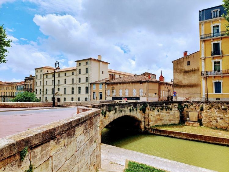
Occitanie is the largest region in France by area, and the Cirque de Gavarnie represents only a fraction of its riches. If you are planning a stay of several days, the region's cities are well worth one or two additional days.
Toulouse, the regional capital and gateway to the Pyrenees, is unmissable. The Pink City packs ten centuries of architecture into a compact area: the Basilique Saint-Sernin (the largest Romanesque church still standing in Europe), the Couvent des Jacobins with its Gothic stone palm tree, and the pink brick façades that shift in colour with the time of day. The Ryo audio guide of Toulouse covers 23 points of interest over 6.5 kilometres in 2 hours 40 minutes — ideal for a morning before or after your mountain stay.
Carcassonne, 2 hours by road from Gavarnie, is the most famous fortified medieval city in Europe. Its 3 kilometres of ramparts and 52 towers were restored in the 19th century by Viollet-le-Duc — a restoration that historians have debated but which saved the ensemble from ruin. The walled city remains a timeless experience even in the height of tourist season. The Ryo audio-guided tour of Carcassonne offers 28 audio stops over 5.7 kilometres to explore the city and the lower town.
Albi, 1 hour from Toulouse, is home to the Cathédrale Sainte-Cécile — the world's largest brick Gothic cathedral, a massive and defensive structure that reflects the city's role at the heart of the Cathar conflicts in the 13th century. The Toulouse-Lautrec Museum, housed in the former episcopal palace, holds the world's largest collection of the painter's work. The Ryo audio walking tour of Albi traces 27 audio stops over 3.5 km through the red city.
Perpignan and the Catalan coast mark the transition towards the Mediterranean Roussillon. The city retains a strongly Catalan identity in its architecture, gastronomy, and festivals. Forty minutes to the south, Collioure is the fishing village that inspired Matisse and Derain in the summer of 1905, giving birth to the Fauvist movement. The Ryo audio-guided tour of Collioure: La Cité des Peintres follows in the painters' footsteps over 3 kilometres. The audio walking tour of Perpignan covers 20 audio stops over 2.4 km.
Montpellier, Occitanie's Mediterranean capital, combines a medieval historic centre with bold contemporary architecture (Ricardo Bofill's Antigone district). The Ryo audio-guided tour Montpellier la Surdouée offers 21 audio stops for a 1.5-hour visit.
To structure a complete itinerary across Occitanie, the article Top 10 Must-See Things to Do in Occitanie provides the broad outlines of a regional itinerary.
FAQ
Is the Hike to the Cirque de Gavarnie Difficult?
The main hike to the base of the Grande Cascade is rated easy to moderate. The 9 km round trip involves 450 metres of elevation gain spread over a comfortable distance, with a wide and well-marked trail for the most part. However, the final kilometre before the waterfall is more technical (rocky terrain, snow patches before mid-July) and requires hiking boots. For the Brèche de Roland at 2,807 metres or the Pic de Piméné, the difficulty is significantly higher and solid mountain hiking experience is required.
How Much Time Should I Plan to Visit the Cirque de Gavarnie?
Plan a full day to enjoy the cirque properly. The drive from most towns in Occitanie takes between 2 and 3.5 hours depending on your starting point, and the hike itself takes 3 to 4 hours round trip. If you want to combine the main cirque with the Cirque d'Estaubé or Troumouse, plan 2 days in the valley with an overnight stay in Gavarnie or Luz-Saint-Sauveur.
Can You Visit the Cirque de Gavarnie Without Hiking?
Yes, partially. Guided horse convoys depart from the village throughout the day in high season and ride up to the Hôtellerie du Cirque at 1,570 metres. The price is approximately €25–35 per adult depending on the operator in 2026. From the hôtellerie, there is still 1 kilometre on foot to approach the waterfall — this section cannot be done on horseback. People with reduced mobility can enjoy the panorama from the village car park or the lower meadows of the trail, with no need to go higher.
What Is the Best Time of Year to Hike the Cirque de Gavarnie?
June and September are optimal: snow has melted on the main trails, temperatures are pleasant (15–22°C in the village), and visitor numbers are half those of high season. In July–August, setting off before 8am helps avoid pedestrian congestion on the trail and queues at the car parks. Avoid afternoons in summer (risk of thunderstorms above 2,000 m after 2pm). The Pyrenean fritillaries of May and the autumn colours of October are seasonal bonuses that make these less obvious periods genuinely excellent options.
Is the Cirque de Gavarnie Accessible for Children?
Yes, with a few adjustments. The climb to the Hôtellerie du Cirque (3 km from the Prairie car park, 150 metres of elevation gain) is suitable for children aged 6–7 and above who are normally active. For younger children, the horse rides available in the village remain an excellent option. The final kilometre to the waterfall is not recommended for children under 10 without mountain experience. The most remarkable scenery is accessible from the hôtellerie without needing to go all the way to the back of the cirque.
Do You Have to Pay to Enter the Cirque de Gavarnie?
Access to the cirque is entirely free. No entry fee is charged. However, the Prairie car park is paid in high season (approximately €5 in 2026), and shuttles from the lower car park cost around €3 return. Horse rides are paid (€25–35 per adult, €20–25 per child). The Hôtellerie du Cirque charges standard mountain prices (hot meals between €12 and €18). The Brèche de Roland and the Cirques d'Estaubé and Troumouse are also free to access; only the road to Troumouse has a toll of €5.
Conclusion
The Cirque de Gavarnie is one of those sites that resists tourist banality because nature here is so disproportionate that no amount of development can diminish its impact. Whether you choose the family walk to the hôtellerie, the athletic climb to the Brèche de Roland, or the quiet exploration of Estaubé and Troumouse far from the summer crowds, the Pyrenees will give you days you remember for a long time.
Occitanie as a whole offers that rare blend of high mountains and millennia-old historical heritage. From Gavarnie to Carcassonne, from the Brèche de Roland to the arenas of Nîmes, the contrasts are striking and the kilometres between these two worlds are often as rewarding as the destinations themselves. To continue your exploration of the region beyond the Pyrenean trails, the Ryo audio-guided tours available in Toulouse, Albi, Carcassonne, Perpignan, Collioure and Montpellier let you discover each city at your own pace, with or without a human guide.