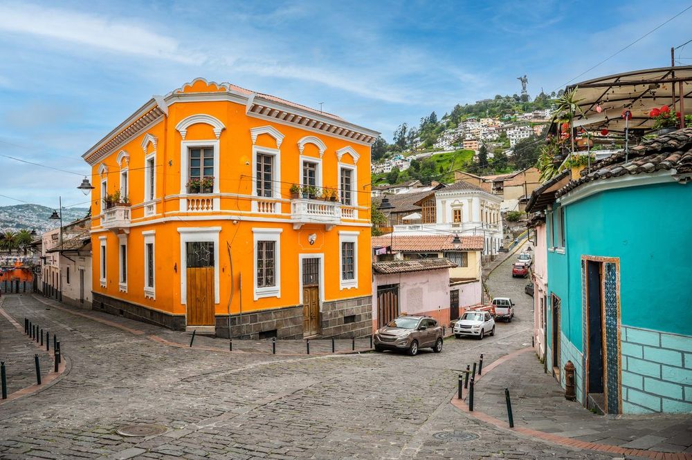
© Shutterstock
 Votre guide Ryo
Quito Without a Car: A Complete Guide to Getting Around in 2026
Exploring Quito without a car is not just possible, it is often faster than driving. The city stretches nearly 50 kilometers along a narrow Andean valley, squeezed between volcanoes, so the one question that shapes your whole trip is simpler than you think: north or south? Colonial one-lane streets and daily traffic jams can turn a 10-minute drive into a 40-minute crawl, while the fully underground metro that opened in December 2023 crosses the valley in about 34 minutes. Red trolebús buses have worked the same north-south corridor since 1995, and a ride-hailing app will usually get a car to your door in a few minutes. Most visitors start on foot, on the cobblestones of the historic center, which is exactly the ground the Ryo audio-guided tour of Quito covers, plaza by plaza. This guide walks you through the metro, the Trolebús, Ecovía and Metrobús corridors, the new Tarjeta Ciudad, taxis and Uber, airport transfers, the cédula question, and bus day trips to hot springs at 3,300 meters or a cloud forest two hours away, none of which require you to rent a car.
Getting Your Bearings: Quito's Vertical, North-South Geography
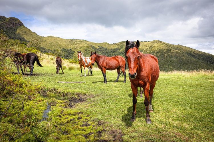
Quito sits at about 2,850 meters in a valley so tight that the city had nowhere to grow except along its length. The result is a metropolis roughly 50 kilometers long and, in places, barely 5 kilometers wide, with the slopes of Pichincha volcano rising to the west. There's no real east-west axis to worry about: almost everything that matters for you as a visitor runs along the same spine, from the colonial center in the middle to the business districts of La Carolina in the north and the residential south.
That's why transit maps, bus placards and station signs keep repeating a handful of names you should learn on day one: Quitumbe in the deep south, El Labrador at the northern end of the metro, near the old airport, and Ofelia and Carcelén, the bus terminals further north still. Check a bus's destination sign against those names and you'll almost always know which way you're heading, even before the neighborhoods in between mean anything to you.
Walking Quito's Compact, Walkable Neighborhoods
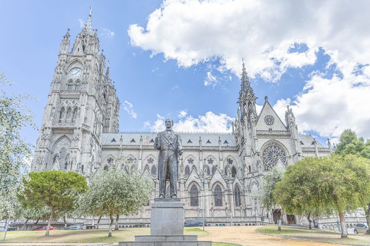
Despite its length, the parts of Quito a first-time visitor actually wants to see are tightly packed. The Centro Histórico, the first city inscribed on the UNESCO World Heritage List in 1978 alongside Kraków, is one of the best-preserved colonial centers in the Americas, and La Mariscal, the hotel-and-restaurant district where many visitors sleep, sits about a 30-minute walk or a short bus ride to the north.
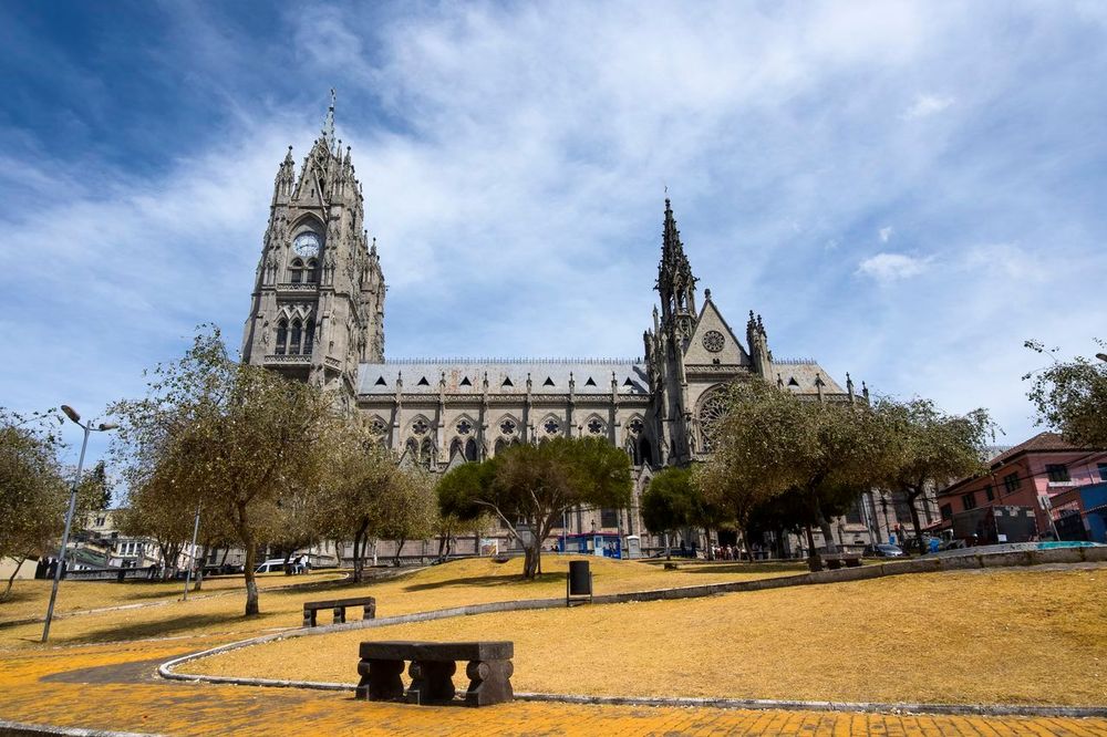
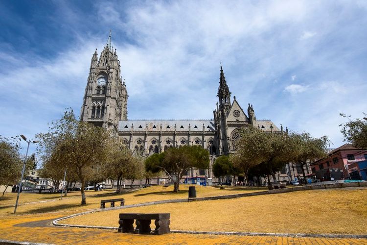
You can walk between Plaza Grande), the Basílica del Voto Nacional and the string of churches along Calle García Moreno in a single unhurried morning.
The narrow colonial street known as La Ronda (García Moreno, Centro Histórico, Quito, Ecuador, rated 4.5/5 on Google (4 629 avis)) is worth doing on foot in the early evening, when its cafés and craft workshops open their doors.
Pace yourself, though. At nearly 2,900 meters, stairs and steep cobblestones hit harder than at sea level, and most people need a day or two before a brisk uphill walk feels normal. Stick to busy streets and daylight hours for long walks, and take a taxi or app ride after dark rather than crossing empty blocks.
Walking also beats transit for short hops within the same neighborhood, when a bus wait would take longer than the walk itself. If you'd rather not puzzle out the route alone, the Ryo audio guide for Quito is built around exactly this pace: you follow the historic center stop by stop and hear a story at each square and church along the way.
Quito Metro: Riding Line 1 from Quitumbe to El Labrador
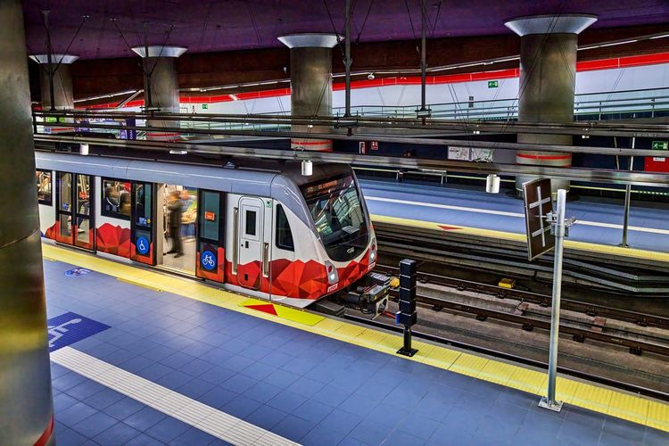
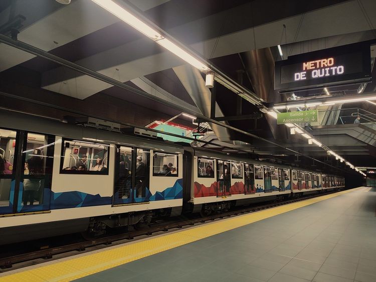
Quito's metro, officially Línea 1, opened to paying passengers in December 2023 after roughly a decade of construction and immediately became the fastest way to cross the city. The 22.5-kilometer line runs entirely underground, at more than 2,800 meters above sea level, linking 15 stations between Quitumbe in the south and El Labrador in the north in about 34 minutes. For you as a visitor, it solves the problem every other mode struggles with: getting from one end of this very long city to the other without sitting in traffic.
Finding Stations and Buying Your Ticket
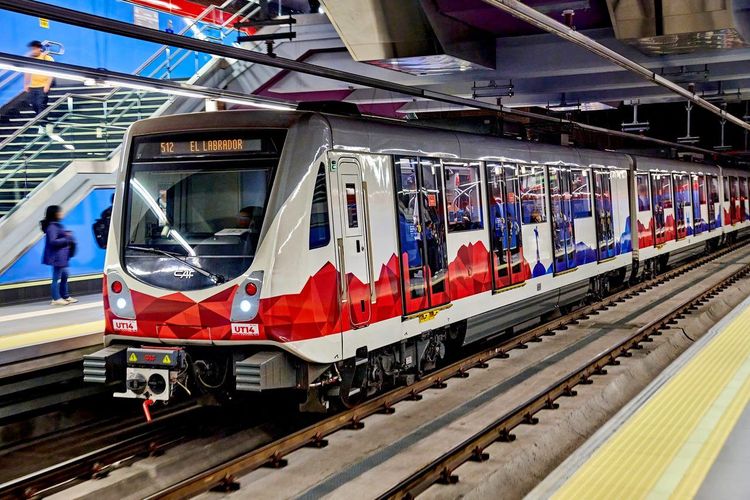
Station entrances carry the Metro de Quito logo and stand out as modern glass pavilions next to the surrounding colonial or mid-century buildings, which makes them easy to spot. The general fare is a flat $0.45 per ride, whether you go one stop or the whole line. Since April 2026 the city's integrated payment system lets you pay the metro, Trolebús and Ecovía with the same rechargeable Tarjeta Ciudad, and cash is still accepted for those who don't have one.
The official Metro de Quito app and website show the line map and service updates, useful when underground signal is patchy. Reduced fares exist for seniors, minors and people with disabilities; ask at the station whether you qualify, since conditions depend on the documents you can show.
Riding the Metro: Etiquette, Safety and What You Can Bring
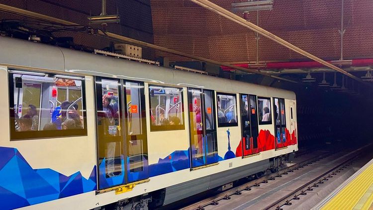
The metro runs on the same etiquette as any big-city subway, with a few local habits worth knowing. Priority seats are for pregnant passengers, older riders and people with small children, and they're genuinely respected. Let passengers off before boarding, and during the weekday morning and evening crush, wear your daypack on your chest rather than your back.
Normal luggage and daypacks are fine, but large suitcases and bulky packages are a nuisance at peak hours, and eating inside cars is frowned upon. Rules on bikes and oversized items can vary by time of day, so check the station signage before you roll anything through the gates.
Key Stations to Know: Quitumbe, San Francisco and El Labrador
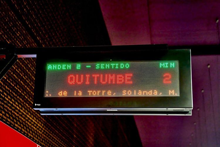
Three stations matter most if you're stitching the metro together with buses or your own two feet. Quitumbe sits right next to the Quitumbe inter-city bus terminal in the far south, the natural transfer point if you arrive by bus from the coast or the southern highlands.
San Francisco drops you beneath the plaza of the same name, a few minutes' walk from Plaza Grande and La Ronda, which makes it the station for the historic center. El Labrador anchors the northern end, beside the old airport grounds of Parque Bicentenario and a short ride from the Ofelia and Carcelén bus terminals.
One name that often confuses visitors: Río Coca is not a metro station but the northern terminal of the Ecovía and a hub for buses to the eastern valleys, covered in the next section. If you get off at San Francisco, several stops of the Ryo audio-guided walk through Quito are within a few minutes' walk, so you can step out of the metro straight into a story rather than hunting for the next corner on a paper map.
Buses, Trolebús and Ecovía: Quito's Surface Transit Network
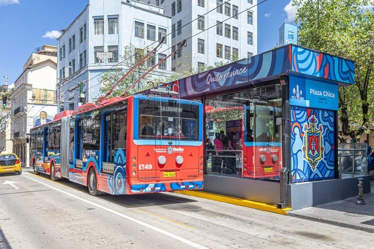
Long before the metro existed, Quito already had a rapid-bus network, and it still carries a huge share of the city's commuters. The municipal Trolebús and Ecovía charge $0.35 per ride, a fare the city council voted in September 2026 to raise to $0.40 from January 2027. All three corridors share the same basic idea: dedicated lanes running the length of the valley, with the colonial center as the hinge between north and south. Knowing which one covers your route saves you real time.
Trolebús and Ecovía Corridors
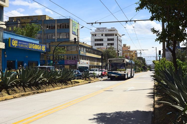
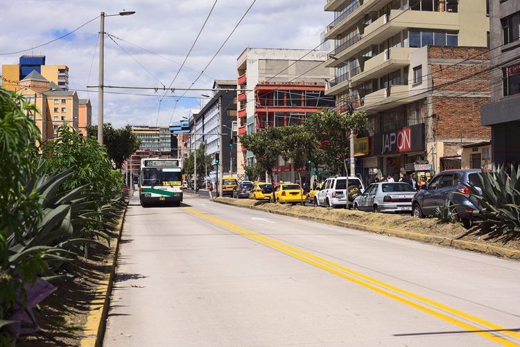
The Trolebús, running since December 1995 along Avenida 10 de Agosto, was Quito's original mass-transit backbone and still connects the south of the city to El Labrador in the north, roughly shadowing the metro. Its electric trolleybuses come every few minutes on weekdays, with longer waits on Sundays and holidays.
The Ecovía runs along Avenida 6 de Diciembre, east of the Trolebús corridor, from its northern terminal at Río Coca down toward the south, serving neighborhoods such as La Mariscal. Both systems load through enclosed platform stations rather than curbside stops, so you pay at the turnstile, by card or cash, before the bus arrives, which keeps boarding fast even on a crowded platform.
Several Trolebús stops sit within easy walking distance of the historic center's plazas, and the Ryo audio guide's downtown stops run close enough to the line that you can listen to the story of a church or square between one bus and the next.
Metrobús and Local Feeder Routes
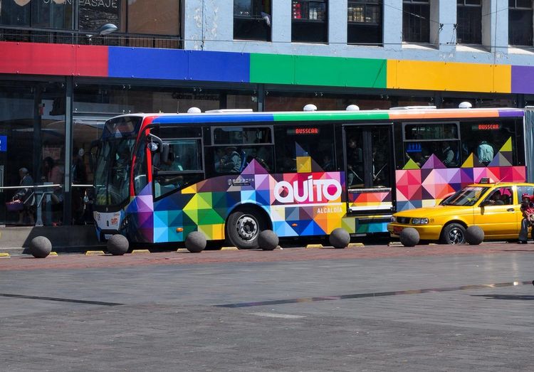
The Metrobús, or Corredor Central Norte, covers the northwest along Avenida América and La Prensa up to the Ofelia terminal, filling a gap the other two corridors don't reach. Beneath all three run dozens of feeder buses, called alimentadores, that loop through residential side streets to the nearest trunk station.
You'll rarely need feeders for sightseeing, but they matter if your accommodation sits on a hillside a long, steep walk from the main avenue, since the connecting bus usually beats the climb back up.
Major Bus Terminals: Quitumbe, Ofelia, Carcelén and Río Coca
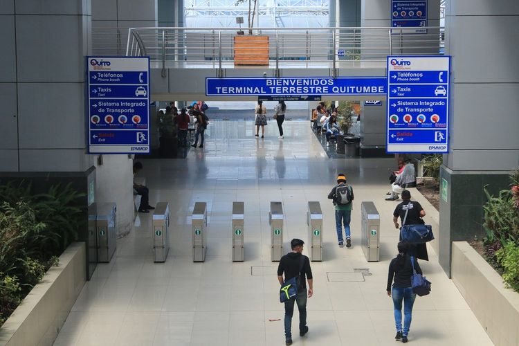
Four terminals anchor the system and double as departure points for regional buses. Quitumbe, in the south, handles inter-city buses toward Cuenca, Guayaquil, the coast and the Amazon. Ofelia, in the north, serves city lines and buses toward Mitad del Mundo and Mindo.
Terminal Terrestre Carcelén (Av. Eloy Alfaro, Carcelén, Quito, Ecuador, rated 3.8/5 on Google (11 840 avis)), further north again, is where most buses toward Otavalo, Ibarra and the Colombian border leave from.
Río Coca links the Ecovía with buses to the eastern valleys of Cumbayá and Tumbaco and with the public bus to the airport. None of the four looks like much from the outside, but all are busy and well signed during daylight; keep an eye on your bags in the crowds.
Taxis and Ride-Hailing Apps in Quito
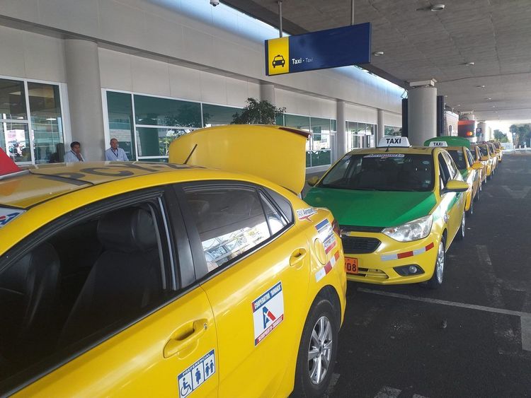
Official taxis in Quito are yellow, metered and easy to flag down almost anywhere outside rush hour, with a daytime minimum fare around $1.50 and most short hops costing $2 to $4. The catch isn't availability, it's knowing which cars to trust, since an unlicensed car painted the right shade of yellow is a known trick in several Andean capitals.
Taxi Safety: What to Check Before You Get In
Before you get in, look for an orange license plate, the mark of a commercial vehicle in Ecuador, a visible unit number on the door and a working taxímetro. If the driver says the meter is broken and quotes a flat price, you can simply step out and wait for the next one.
At night, or from a quiet street, it's safer to have your hotel or restaurant call a radio taxi than to hail one off the curb. Keep your phone and bag on the side away from the door, and if something feels off before you've even sat down, trust that instinct.
Uber and Other Ride-Hailing Apps
Uber operates in Quito, alongside Cabify and InDrive, and for many visitors it's simply easier: the price is shown before you confirm, the driver's name, photo and plate are in the app, and the ride is logged by GPS. Expect fares close to an honest metered taxi at normal hours and higher with rush-hour surge pricing.
Solo travelers often value that digital trail, a saved trip with the driver's name and route. Tipping isn't expected for taxis or ride-hailing in Ecuador; rounding up or leaving a dollar for help with bags is appreciated but optional.
Getting To and From Quito's Airport Without a Car
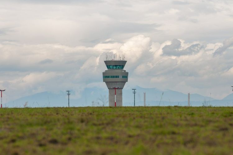
Mariscal Sucre International Airport (Av. Teniente Hugo Ortiz, Tababela, Quito, Ecuador, rated 4.6/5 on Google (16 004 avis)) sits in Tababela, about 40 minutes east of the city center on a good day and well over an hour at rush hour, linked to Quito by highway only, with no rail connection.
You have three realistic options without a rental. Public buses, around $2, leave from outside the terminal toward Río Coca in central Quito, Quitumbe in the south and Carcelén in the north; from there you connect to the Ecovía, the metro or a short taxi. It's by far the cheapest choice, but plan on 90 minutes or more and avoid it late at night with heavy luggage. The Aeroservicios shuttle that long ran to Parque Bicentenario has been reported suspended, so don't count on it without checking at arrivals.
Official airport taxis queue at a counter past baggage claim, with fixed fares, typically $25 to $30 to La Mariscal or the historic center, agreed before you get in. It's the most comfortable option after a long flight.
Uber and InDrive also serve the airport, usually from a pickup point a short walk from arrivals, and tend to land between the bus and the official taxi on price. Whichever you pick, allow extra time on the highway in both directions: the airport, which replaced the old downtown one in 2013, trades convenience for space, and road access is the one real bottleneck of a car-free trip.
Paying for Transport: Cards, Cash and the Cédula Question
Here's the question that trips up a lot of visitors: do you need a cédula, Ecuador's national ID card, to ride public transport? No. Cash is still accepted on the metro, Trolebús and Ecovía, and the free Tarjeta Ciudad, in use since 1 April 2026, can be picked up at Ecovía and Trolebús stations. Foreigners without a cédula can open the linked account with a passport or home-country ID, so you can travel without a cédula and still enjoy faster boarding.
On private city buses and feeders, bring exact change. Drivers and fare collectors routinely can't break a $5 or $10 bill, and a flustered search for coins while the bus idles is one of the most common small frustrations visitors report. Keep a pocket of coins and $1 bills just for transit.
DeUna, the mobile payment app backed by Banco Pichincha, is widely used by Ecuadorians at small shops and by some taxi drivers, but for a short stay you don't need to set it up. Bank cards work in Uber and in most hotels and restaurants, while taxis and buses remain largely a cash world.
Staying Safe on Public Transport in Quito
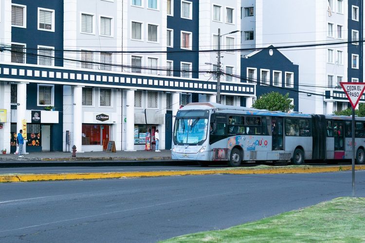
Quito's public transport is safe for the vast majority of rides, but like any big-city system it has one well-known risk: pickpocketing at crowded times. The worst windows are weekday rush hours, roughly 7 to 9 a.m. and 5 to 7 p.m., when the Trolebús and the busiest metro trains pack in tight enough that a hand in a bag goes unnoticed.
The fix is mostly common sense: wear your bag in front in a crowded car, keep your phone in a zipped pocket, and don't flash cash at the turnstile. It's the same advice you'd follow on the Paris Métro or the New York subway, worth repeating because a newcomer's guard is lowest exactly when it should be highest.
The other factor is altitude. Climbing station stairs or standing through a long bus ride can leave you more winded than expected in your first 48 hours. Carry water, slow your pace slightly, and don't be surprised if a short transfer feels like more effort than the distance suggests.
Using Offline Maps and Navigation Apps in Quito
Your phone signal can drop in two places: deep inside metro stations and in parts of the hilly valleys east of the city. Downloading an offline map of Quito before you set out costs nothing and solves most of the problem.
Google Maps handles walking directions and many transit routes, while Moovit often gives better detail on Trolebús, Ecovía and Metrobús lines. Load both at your hotel, not when you're already standing at a stop wondering where the bus went.
A free paper map from your hotel desk is still a smart backup: it never runs out of battery, and it helps the north-south logic of the city click into place on your first morning.
Should You Rent a Car in Ecuador Instead?
Is it safe to rent a car in Ecuador? On the main highways, generally yes: the roads linking Quito to the rest of the country are in decent shape, and international agencies operate at the airport. Safety isn't really the argument against renting here. Logistics are.
Inside Quito, a rental is close to a liability. The historic center's steep, narrow one-way streets, scarce parking and the city's plate-based driving restrictions on weekdays, known as Pico y Placa, mean a car often sits in traffic next to a bus moving faster in its own lane. Many visitors who rent a car in Quito end up paying for parking they barely use.
Where a rental earns its cost is beyond the bus network's easy reach: the back roads of the Quilotoa loop, remote stretches of the Avenue of the Volcanoes, or itineraries chaining several small villages in one day. The sensible approach is to stay car-free in Quito and pick up a rental only for the days you head deep into the countryside.
If you do rent, bring an International Driving Permit with your home license, confirm the insurance deductible for theft and collision before signing, and never leave valuables visible in a parked car.
Day Trips From Quito Without a Car
Ecuador's inter-city buses, cheap, frequent and leaving from the terminals covered above, make day trips easy without a car. Fares on the routes below are a few dollars each way, and you rarely need to book ahead except around major holidays.
Papallacta's Hot Springs by Bus
Papallacta, a village of thermal pools fed by volcanic springs at about 3,300 meters, sits roughly an hour and a half east of Quito on the road to the Amazon.
Buses heading for Baeza, Tena or Lago Agrio from the Quitumbe terminal (Av. Cóndor Ñan y Moraspungo, Quitumbe, Quito, Ecuador, rated 4.2/5 on Google (21 341 avis)) pass through Papallacta; tell the fare collector where you want to get off, since it's a roadside stop rather than a terminus. From the village, the main springs are a short taxi ride uphill.
Plan for a full day: count up to two hours each way with city traffic, plus three or four hours of soaking. Bring a swimsuit, towel and warm jacket, since the air at that altitude cools fast once the sun drops. Flag a return bus at the same roadside stop and ask locally about the last departure rather than assuming a fixed schedule.
Other Easy Bus Day Trips From Quito
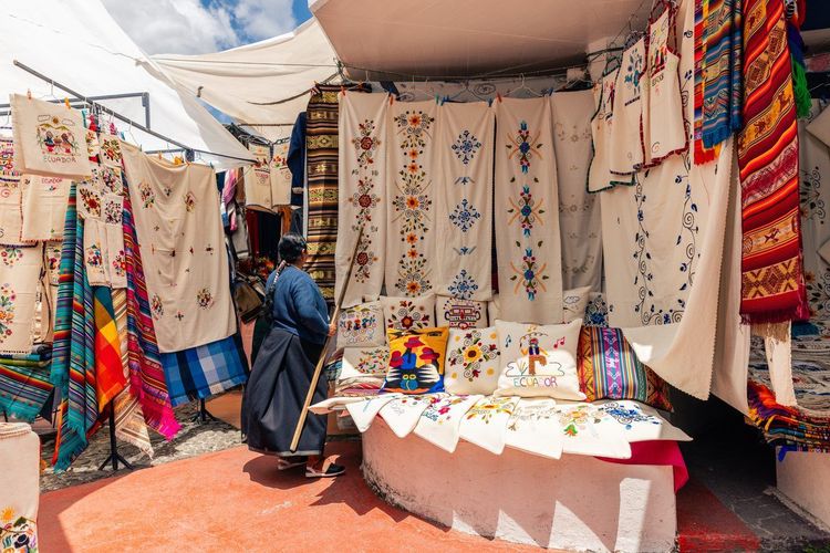
Otavalo, home to one of South America's best-known indigenous craft markets, is about two hours north from Terminal Terrestre Carcelén, with frequent departures through the day. Saturday is the big market day, but stalls open daily on Plaza de los Ponchos.
Mindo, a cloud-forest town known for birdwatching, waterfalls and chocolate tours, sits roughly two hours northwest, with buses from the Ofelia terminal. Closer still, the Mitad del Mundo equator monument is reachable by bus from Ofelia in under an hour.
For a mountain escape that needs no bus at all, the TelefériQo cable car climbs the slopes of Pichincha from the edge of the city to around 3,900 meters. Back in town, the Ryo audio guide for Quito gives you the stories behind the volcanoes and churches you've just seen from above, a good way to round off a day without a car.


FAQ
Can I use Uber in Quito, Ecuador?
Yes. Uber operates throughout Quito alongside Cabify and InDrive, and for many visitors it's simpler than hailing a street taxi, since the price, driver details and route are shown in the app before you get in.
Is Quito good for tourists?
Yes. A UNESCO-listed colonial center, nearby volcanoes and cloud forest, and a transit network that reaches most sights without a rental car make it a rewarding city, as long as you plan around the altitude and keep an eye on your belongings in crowds.
Is it safe to rent a car in Ecuador?
Generally yes on the main highways, but inside Quito a rental is more hassle than help, with narrow streets, scarce parking, Pico y Placa restrictions and heavy traffic. Renting makes more sense for countryside trips beyond the bus network.
How much does public transport cost in Quito?
The metro costs $0.45 per ride and the Trolebús and Ecovía $0.35, rising to $0.40 in January 2027. Taxis start around $1.50, and the public bus to the airport costs about $2.
Is the Quito Metro safe for tourists?
Yes, it's one of the safer ways to move around, with staffed stations and security cameras. The main risk is the same as on any crowded system: pickpocketing at rush hour, which basic precautions largely prevent.
Do I need cash for buses in Quito?
On private city buses and feeders, yes, and small change helps. On the metro, Trolebús and Ecovía you can pay cash or use the free Tarjeta Ciudad, which foreigners can register with a passport.
Getting Around Without the Rental
Put it together and Quito turns out to be one of the easier Andean capitals to see without a car: an underground metro that crosses the valley in about half an hour, bus corridors that have done the same job since the 1990s, taxis and apps for the gaps, and regional buses reaching far enough to add hot springs, a craft market or a cloud forest to your stay. The only real case for a rental is the deep countryside, and even then it works best as a side trip.
For a structured first morning before you tackle the metro map, the Ryo audio-guided tour of the historic center walks you through Quito on foot, stop by stop, with the kind of local detail no bus schedule can give you.