© Shutterstock
 Votre guide Ryo
Ajaccio Neighborhoods in 2026: Identity, Atmosphere, and Best Addresses, District by District
A closer look at Ajaccio's neighborhoods, 2026 edition: the city is not defined by a single center, but by a dozen districts with well-defined identities, from the historic heart to the residential ridges of Mezzavia. You only need to walk down the Cours Napoléon on a market morning to see it — ochre facades on one side, umbrella pines and modern towers on the other. Understanding the neighborhoods of Ajaccio means accepting that the city reads in three dimensions: the coastline, the hills, and the heights. The Ryo audio-guided tour of the Imperial City crosses a good portion of this patchwork, from the Place Foch to the alleyways of the old town.
This guide details each district of Ajaccio: the Quartier des Étrangers, where Belle Époque villas stand alongside a former municipal casino; Aspretto, a former military base now undergoing full transformation; and the Casone, an affluent neighborhood perched above the bay. You'll also find an in-demand real estate golden triangle, a candid take on the districts sometimes cited as areas to avoid, and a mental map explaining why Ajaccians locate everything relative to the port or the Sanguinaires rather than any administrative boundary. You'll also learn what the priority urban policy neighborhood classification actually means, and how to read the map of Ajaccio's districts so you can place every name you hear on the ground. All you need to choose where to stay, where to wander, or simply to better understand the city before you arrive.
The City Center and Old Town: Ajaccio's Historic Heart
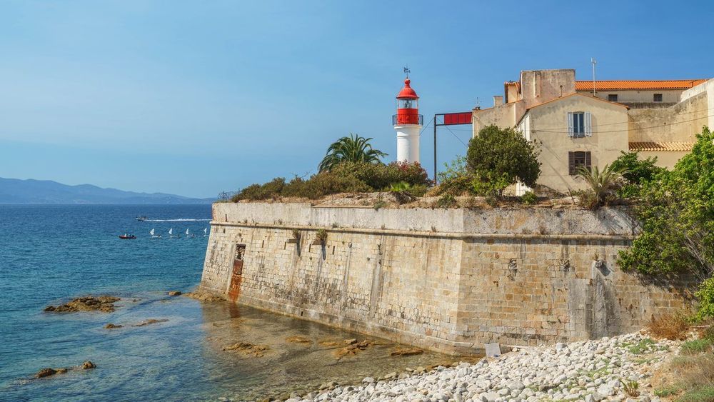
The city center and the old town form the logical starting point for any exploration of Ajaccio's neighborhoods. Wedged between the port and the Place de Gaulle, this district concentrates shops, administrative offices, and the city's oldest buildings, inherited largely from Genoese rule and the urban planning of the 19th century. This is where the city reveals its dual identity: a modern commercial axis to the north, narrow shaded alleyways to the south. If you were to explore only two neighborhoods in Ajaccio, this would be one of them — along with the Quartier des Étrangers.
The Cours Napoléon and the Place Foch
The Cours Napoléon (Cours Napoléon, 20000 Ajaccio) runs through the city center for nearly a kilometer, connecting the train station to the edges of the port. Lined with Haussmann-style buildings and shops, it concentrates the bulk of Ajaccio's retail activity and serves as a reference point for almost every resident when giving directions.
The Cours Napoléon owes its straight alignment to a major urban planning project launched under the Second Empire, designed to modernize a city that had until then been clustered around the Genoese port. Today it remains one of the busiest commercial streets in Corse-du-Sud, with a retail vacancy rate well below the regional average.
Midway along it opens the Place Foch, planted with palm trees and enlivened by a lion fountain dating from the 19th century. Ajaccians still often call it the "place des Palmiers." It is a classic meeting point before heading to the port, just steps away.
The covered market sets up every morning on the neighboring square and remains one of the best vantage points for observing everyday Ajaccio life: Corsican charcuterie, sheep's milk cheeses, fresh fish of the day. If you try the Ryo audio-guided tour of the Imperial City, this stretch of the city center is one of the first commented stops, with anecdotes about the city's Napoleonic urban heritage.
The Old Town and the Saint-Jean Quarter
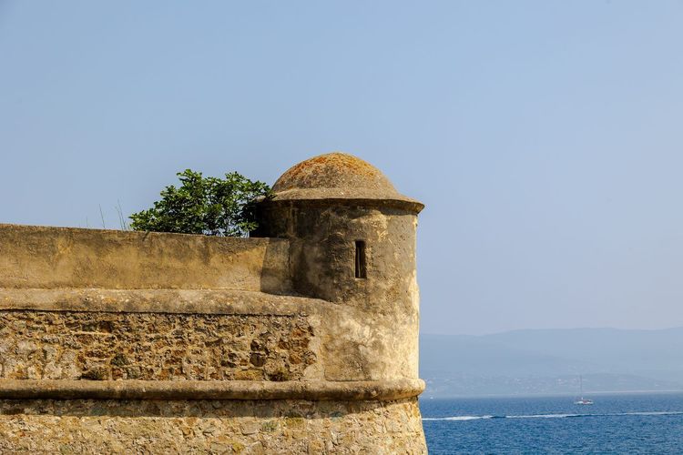
Below the Place Foch, the old town unfolds a network of narrow lanes, some covered, climbing toward the citadel. The Saint-Jean quarter, the historic core of this district, has preserved an almost intact medieval street pattern despite successive renovation projects.
The Cathédrale Notre-Dame-de-l'Assomption d'Ajaccio, where Napoleon Bonaparte was baptized, is tucked away at the end of an unassuming alley far from the main squares. Its baroque facade contrasts with the sobriety of the surrounding neighborhood.
A few steps further, the Maison Bonaparte occupies the family home where the emperor was born in 1769. The house-museum traces the family's rise and gives a vivid picture of middle-class Ajaccian life before the Revolution.
The Saint-Jean quarter remains inhabited year-round, which sets it apart from other museified Mediterranean old towns: laundry hanging from windows, neighborhood grocery stores, bar terraces filling up at the end of the day. Shopkeepers here have often run their businesses for several generations, giving the area a less frozen feel than its ancient buildings might suggest. Fine food shops, wine merchants specializing in Corsican wines, and artisan workshops sit side by side within a few hundred meters, without the museification seen in other tourist-heavy old towns along the Mediterranean coast. Allow one to one and a half hours to explore the entire district at a relaxed pace, including the cathedral and the Maison Bonaparte.
The Casone: The Bourgeois Heights of the Former Winter Resort
About fifteen minutes on foot from the center, the Casone occupies the southern heights of the city, above the boulevard Pascal Rossini. Contrary to what many online descriptions suggest, this is not a beach neighborhood: it is a well-heeled residential district that grew out of the late 19th-century winter resort, its villas forming a natural extension of those in the Quartier des Étrangers.
Its emblem is the bois du Casone, an urban pine forest overlooking the bay that serves as the neighborhood's green lung. This is where you'll find the so-called Grotte de Napoléon, where tradition holds that the young Bonaparte would come to dream, and just below it the Place d'Austerlitz with its imperial monument described later in this guide. Few cities offer such a shortcut between scrubland, Napoleonic memory, and upscale buildings within a few hundred meters.
It is also one of the Ajaccio neighborhoods most frequently mentioned by families who have settled there: schools nearby, genuine quiet once you leave the main roads, and quick access to the southern beaches — Saint-François and Trottel chief among them — just a few minutes downhill. The Casone remains primarily a residential neighborhood rather than an entertainment hub: shops are concentrated on the surrounding thoroughfares, and the nightlife happens elsewhere.
Parking is easier here than in the city center, particularly around the pine forest, making it a convenient base from which to reach the historic center on foot via the cours Grandval. The urban bus network connects the area to the center in a few minutes, a credible option even without a car — Ajaccio has never had a tram despite projects regularly floated by the municipality.
Outside the summer season, the Casone settles into an almost village-like rhythm: early-morning joggers beneath the pines, retirees seated on benches overlooking the gulf, schoolchildren making their way up the sloping streets. This is probably the best time to understand why this neighborhood long housed Ajaccio's bourgeoisie, far from the bustle of the waterfront in July and August.
The Quartier des Étrangers and the Jardins de l'Empereur: Belle Époque Soul
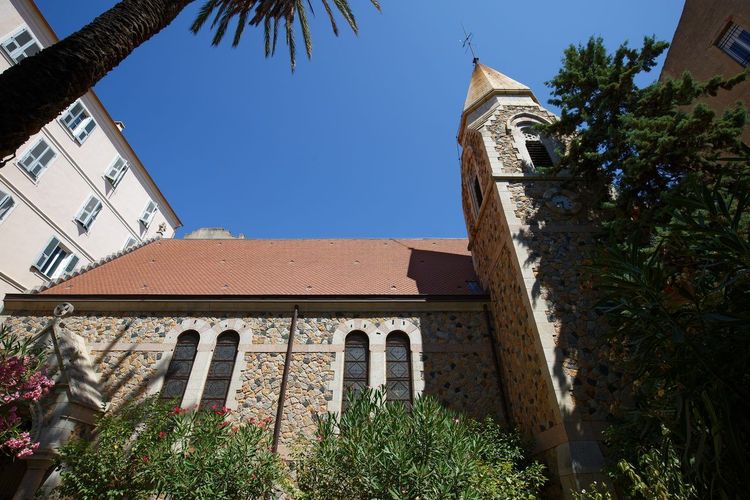
North of the city center, the Quartier des Étrangers takes its name from the British and continental winter visitors who, from the late 19th century onward, came to Ajaccio to nurse their lungs in the mildness of the Corsican winter. The district developed around the Cours Grandval and the boulevard Lantivy, away from the bustle of the port, along an open urban plan inherited directly from this discerning clientele. Even today, the British presence in Ajaccio can be read in certain street names and in the eclectic architecture of the villas — a blend of English neo-Gothic and colonial styles.
It is estimated that some ten luxury hotels operated in this district between 1880 and 1930, before winter tourism declined in favor of summer stays from the 1950s onward. Many of these establishments have since been converted into residential apartment buildings, which explains the density of remarkable facades within a relatively compact perimeter.
The Belle Époque Villas and Grand Hotels
The Grand Hôtel, opened in the late 19th century, remains the most visible symbol of this era. Its listed facade now houses apartments and a few shops, but the grandeur that once attracted high European society on their winter retreats is still easy to imagine.
Around it, some thirty private villas — often hidden behind high walls and gardens of palm trees — create a residential urban landscape unique in Corsica. Many still belong to Ajaccian families; others have been bought and divided into upscale apartments.
The Quartier des Étrangers is entirely walkable: allow 45 minutes one way from the city center, heading up via the boulevard Lantivy. The slope is gentle, making it an accessible stroll even in the late afternoon, when the low light catches the ochre and white facades.
The Jardins de l'Empereur and the Casino
The Jardins de l'Empereur extend the neighborhood to the west, laid out as a public park around a former municipal casino that has since been repurposed. For a long time the site concentrated the city's winter social life, with gaming rooms and open-air concerts.
Nearby, the Place d'Austerlitz (Cours du Prince Impérial, 20000 Ajaccio, rated 4.4/5 on Google based on 798 reviews) keeps the Napoleonic memory of the area alive with a monumental statue of the emperor in coronation robes, erected in 1938. It is one of the rare spots in Ajaccio where the imperial story is told on such a grand scale, the statue dominating the bay from an open promontory.
The Quartier des Étrangers remains above all a residential area: few shops, some medical practices, and a quietness that contrasts sharply with the city center. It is also one of the most sought-after Ajaccian neighborhoods on the local property market, particularly for sea-view villas, which command prices well above the city average.
The Route des Sanguinaires: Le Trottel and the Pointe des Sanguinaires
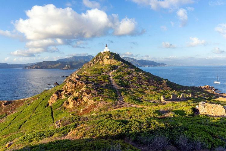
Leaving the center via the boulevard Pascal Rossini, the road hugs the bay for nearly twelve kilometers all the way to the pointe de la Parata. This coastal ribbon brings together several residential and tourist neighborhoods, all oriented toward the same vista: the Sanguinaires islands turning red at sunset.
Le Trottel and the Waterfront
Le Trottel is the first area you pass through leaving the Casone — a residential neighborhood built on the waterfront in the 1970s and 1980s. The beach of the same name, smaller and less crowded than the Casone beach, draws mainly local regulars.
The area mixes holiday homes and permanent residences, with a majority of small 1970s apartment blocks now in demand for their immediate proximity to the water. Prices climb sharply as soon as a property offers an open sea view, far above those of neighborhoods set back from the road.
Traffic on this single road remains heavy in summer, as it is the only route serving the entire Parata peninsula. Allow plenty of time if you are driving between 5 p.m. and 7 p.m. in July and August, when everyone converges on the point for the sunset.
The Point and the Sanguinaires Islands
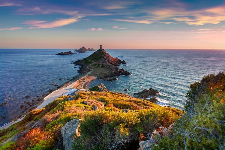
At the end of the road, the pointe de la Parata and its Genoese tower, built around the turn of the 17th century, mark the entrance to the classified Sanguinaires site. The Sanguinaires area of Ajaccio is sparsely inhabited apart from a handful of isolated villas, with most of the land belonging to the Conservatoire du littoral.
The Sanguinaires islands — four granite islets, the largest of which still carries a working 19th-century lighthouse — can be reached in about twenty minutes by boat from the port of Ajaccio. The tourist shuttle runs year-round, with increased frequency in season.
The sentier des Crêtes, which follows part of the headland, allows you to extend the visit on foot away from the road, with open views over the entire gulf. Allow around two hours for the round trip; walking shoes are recommended as the terrain is rocky and exposed to the wind on the final stretch.
This area is nothing like a residential neighborhood in the traditional sense: it is above all a protected natural space, where the only real neighborhood life revolves around two or three restaurants open in season, popular for watching the sunset. To extend the visit, the Ryo guide dedicated to the Sanguinaires islands details shuttle timetables and the best viewpoints along the route.
Les Salines and Cannes-Binda: Between Family Beach and Residential Neighborhood
South of the center, heading toward Porticcio, the neighborhoods of Salines and Cannes-Binda occupy a stretch of coastline quieter than the route des Sanguinaires. Here you'll find a family beach bordered by pine trees, less crowded than the Casone beach on weekdays. If you're looking for neighborhoods in Ajaccio where you can lay down a towel without fighting for space in July, start your search here.
The district, sometimes referred to as the quartier des Cannes in Ajaccio, was gradually developed from the 1980s onward with low-rise residential buildings and a few individual houses. Unlike the Quartier des Étrangers, the atmosphere here is deliberately understated, with no grand hotels or notable monuments.
Residents particularly appreciate the proximity to everyday shops, grouped around a small neighborhood shopping center, and the ease of reaching both the city center and Porticcio without crossing the entire city. It is a sensible choice for those seeking a peaceful setting without straying far from the beach, midway between urban life and the waterfront.
The name Cannes-Binda comes from an old farming estate that occupied the entire area before the war, when this stretch of coastline was still marshland and reed beds. All traces of that activity have since disappeared, replaced by residential housing developments built over the decades.
In terms of transport, the bus line serving Porticcio passes regularly through les Salines, making it a well-connected neighborhood despite its distinctly residential character. Many Ajaccian families who work in the city center choose this area as their first preference, for its balance of quiet, a more accessible budget than the Quartier des Étrangers, and direct access to the sea. Some residents do regret the absence of shops open in the evening, a deliberate choice by the municipality to preserve the residential character of the district in the face of the growing tourist pressure seen along the rest of Ajaccio's coastline.
Mezzavia, Finosello, and Pietralba: The Residential Neighborhoods on the Heights
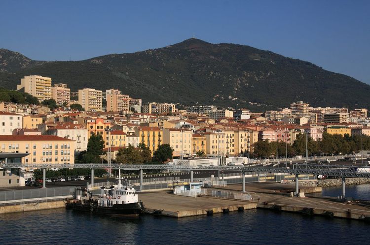
Climbing toward the hills that overlook the city, the neighborhoods of Mezzavia, Finosello, and Pietralba form Ajaccio's main residential hub at altitude. Developed progressively since the 1970s, they now account for a significant share of Ajaccio's housing stock, combining large apartment blocks and suburban housing estates.
Mezzavia has grown around the retail zone of the same name — the largest in the metropolitan area — with supermarkets, DIY stores, and a multiplex cinema. It is an almost unavoidable stop for everyday shopping, reachable by car in around ten minutes from the center.
Finosello, more residential, mixes 1980s apartment towers with newer housing estates built on the heights. Views here often extend all the way to the gulf of Ajaccio, an argument local estate agents never fail to mention.
Pietralba completes the picture with more recent housing, marked by several new-build developments delivered over the past fifteen years. Property prices here remain broadly more accessible than on the waterfront, which explains the area's consistent appeal among young working adults and first-time buyers. If you're thinking in terms of floor space rather than sea view, this is where your budget will go furthest. The name Pietralba, meaning "white stone" in Corsican, is said to come from an ancient rock outcrop identified by the first developers in the area during the 1970s. Since then, the hillside has been almost entirely built up, apart from a few patches of scrubland preserved between the residential blocks.
The school groups in Mezzavia and Finosello are among the most attended in the metropolitan area, which has justified several expansions in recent years. Families who settle there regularly cite the ease of combining school, nursery, and supermarkets without leaving the neighborhood, a significant advantage compared to the sometimes heavy traffic in the city center at rush hour.
These three Ajaccian neighborhoods share a common characteristic: they depend heavily on the car for daily journeys, with public transport connections more limited than in the city center. In return, local amenities — schools, nurseries, shops — are generally well distributed, making them a practical choice for settling in Ajaccio long-term without the budget required for the waterfront.
Ajaccio's Priority Neighborhoods: What the Urban Policy Actually Says
Behind the everyday neighborhood names lies a second, far more administrative framework: the priority urban policy neighborhoods, a national zoning system calculated solely on residents' income levels. Ajaccio has two, both away from the tourist waterfront: the Jardins de l'Empereur and the Salines — two large housing estates built mainly between 1960 and 1980, the latter including the Cannes district.
This classification says nothing about an area's safety, contrary to what many assume. It unlocks enhanced resources: social housing renovation, reduced class sizes in the relevant schools, the presence of community organizations and mediators, and support for setting up local shops. The Jardins de l'Empereur in particular is the subject of a major urban renewal program, with partial demolitions, tower block renovations, and a complete overhaul of public spaces and pedestrian routes to the city center.
For a visitor, the subject remains largely invisible: nothing on the ground signals that you are entering or leaving a priority perimeter, and the atmosphere in these Ajaccian neighborhoods feels more like a working-class Mediterranean district than an isolated housing estate. If you are considering a purchase, however, this zoning is worth checking before any viewing: price-per-square-meter is noticeably below the city average, specific tax incentives apply to some new-build schemes, but renovation works stretch over several years and resale is less fluid than on the waterfront.
One detail worth knowing before comparing listings: the priority neighborhood perimeter never covers an entire neighborhood as residents understand it. The same street can be classified on one side and not the other, which explains the sometimes puzzling price differences between two neighboring buildings on the Ajaccio heights.
Aspretto: A Neighborhood in Full Transformation

Aspretto occupies the southern shore of the bay of Ajaccio, facing the city center, accessible via the route de Porticcio or by a seasonal maritime shuttle that crosses the gulf in a few minutes. The neighborhood long lived to the rhythm of Ajaccio's military life: its naval air base, occupied for decades by the Navy and then by maritime gendarmerie units, durably shaped its urban form, with service quarters and facilities closed to the public.
This identity as a neighborhood in full transformation stems from the gradual conversion of former military land into residential and leisure areas. A family beach and a water sports center have opened in recent years on sites previously closed to the public, significantly changing the face of the district.
Ongoing redevelopment projects plan the gradual opening of new green spaces and sports facilities on former military land, a movement comparable to what other former bases along the Mediterranean coastline have undergone. For residents, this transformation is making a tangible difference in daily life: easier access to the waterfront, new cycle paths, and a housing offer set to continue expanding in the coming years.
The neighborhood also hosts a maritime trades training institute, inherited from its military past, which continues to bring a young population and a particular energy to the area, far from the sometimes austere image associated with former military sites. Aspretto remains less dense than the central neighborhoods, with predominantly detached housing and a smaller population. If you are staying on the Porticcio side, take the seasonal maritime shuttle at least once: it is one of Ajaccio's most picturesque crossings, with an unobstructed view of the whole city from the water, and a welcome shortcut on days when the gulf road is congested.
The Port District: Dynamism and Modern Urban Planning
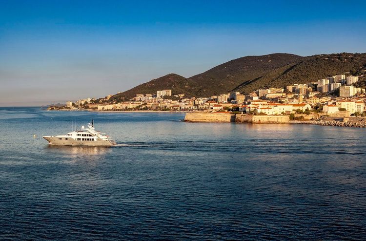
The Port district concentrates the bulk of the city's economic and logistics activity: the commercial port, the ferry terminal for crossings to the mainland and Sardinia, and business zones recently redesigned. It is also the convergence point for most of the metropolitan area's road connections and transport links: Ajaccio's train station, operated by the Chemins de fer de la Corse rather than SNCF, is located on the square Pierre-Griffi just steps from the quays, with the coach station nearby and the airport a few minutes away by car.
The area's urban landscape has changed considerably since the 2010s, with the renovation of the quays and the arrival of new office developments. The port Tino Rossi, dedicated to leisure boating, contrasts with the neighboring commercial port through its more tourist-oriented atmosphere, with waterfront terraces and boutiques.
For visitors arriving by boat, the Port district is often the very first image of Ajaccio: the colorful facades of the port buildings, the statue of Napoleon in Caesar's robes on the Place du Diamant, and an immediate view of the citadel. It is more of a transit point than a place to stay, but the best anchor for subsequently locating all the other Ajaccian neighborhoods.
This neighborhood remains above all functional rather than residential: few homes apart from some recent apartment blocks, but a constant flow of travelers, dock workers, and pleasure boaters that gives the area a particular energy, especially at ferry arrival times in summer. Ongoing urban renovation projects plan to extend pedestrian spaces along the quays, with the aim of better connecting the commercial port to neighboring residential districts before the end of the decade — a project closely watched by residents frustrated by through traffic.
Porticcio and the Surroundings of Ajaccio
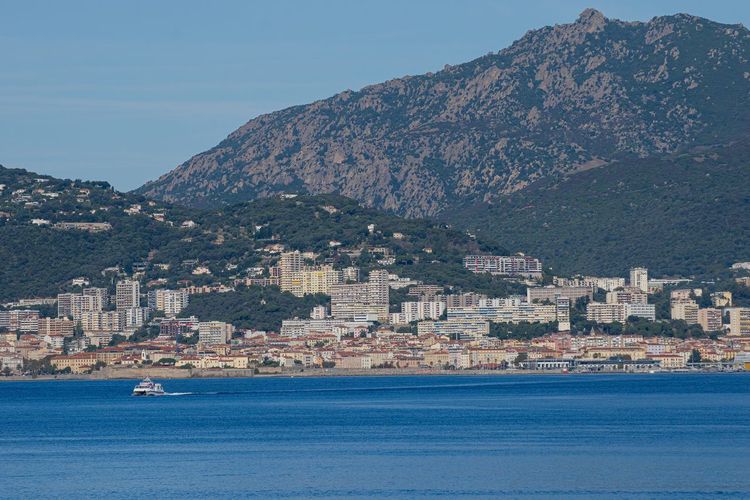
On the other side of the gulf, Porticcio functions almost as a seaside extension of Ajaccio, around twenty minutes by car or ten minutes by seasonal maritime shuttle. A long sandy beach, a marina, and a lively shopping area make it one of the Ajaccians' own preferred summer destinations.
Administratively, Porticcio belongs to the commune of Grosseto-Prugna, but its continuous urban fabric with Ajaccio makes it a natural extension of the metropolitan area rather than a distinct neighboring municipality. Tourist footfall there far exceeds that of Ajaccio's own neighborhoods in summer, with a significantly more developed hotel and restaurant offering.
A little further north, the Baléone district, attached to the commune of Sarrola-Carcopino, completes this peri-urban ring with a rapidly expanding area of detached housing. This sector draws families looking for a plot at a more accessible price than in Ajaccio itself, while remaining less than fifteen minutes from the city center.
The neighboring communes of Ajaccio — Alata, Sarrola-Carcopino, Afa, and Villanova — are thus absorbing a growing share of Ajaccio's population as land within the city becomes increasingly scarce. At peak season, footfall in Porticcio far surpasses that of Ajaccio's own beaches, to the point that some city-center residents then retreat to quieter spots like les Salines. This seasonal shift perfectly illustrates the complementarity between the two shores of the gulf. To explore this wider area, the Ryo guide to the surroundings of Ajaccio lists several easy excursions that pair well with a walk through the historic neighborhoods.
Where to Live in Ajaccio: the Golden Triangle, the Best Neighborhood, and Areas to Avoid
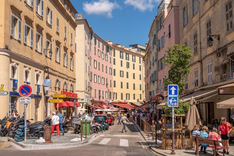
The question comes up every time someone considers settling in Ajaccio: among all the neighborhoods in Ajaccio, which one should you choose to live in? The answer depends primarily on three factors — budget, need for quiet, and distance to the sea — which Ajaccians themselves weigh differently depending on their stage of life.
The Ajaccio golden triangle generally refers to the area between the Quartier des Étrangers, the Cours Grandval, and the surroundings of the Jardins de l'Empereur. This is where price-per-square-meter is highest in the city, driven by sea proximity, upscale architecture, and residential calm. Properties here rarely find buyers below the top end of the Ajaccio market, especially sea-view villas.
According to local property professionals, the price gap between the golden triangle and a neighborhood like Mezzavia can exceed 40% per square meter for a comparable surface — one of the widest gaps in the whole of Corse-du-Sud. This disparity is less about distance from the center, which is minimal at city scale, than about immediate sea proximity and the scarcity of available land in the historic districts.
Beyond this triangle, several districts compete for the title of best neighborhood in Ajaccio depending on the profile. For families with children, le Trottel and les Salines combine a beach within walking distance, nearby schools, and a more reasonable budget than the historic center — part of the Salines falling within the priority neighborhoods mentioned above, with prices well below average. For buy-to-let aimed at tourists, the city center and old town remain unbeatable thanks to their immediate proximity to shops, public offices, and the port.
On the question of a potential neighborhood to avoid in Ajaccio, the reality is more nuanced than some online forums suggest. No area of the city concentrates the kind of obvious insecurity found in large mainland cities. The few reservations expressed by residents mainly concern certain housing estates on the heights, where the social housing stock from the 1970s and 1980s has aged less well and where a sense of isolation — rather than genuine insecurity — leads some to prefer other districts. It is more a question of commercial vitality and transport connections than any objective risk.
To sum up the most common trade-offs: the city center and old town suit anyone who wants everything on foot, with no need for a car. The Quartier des Étrangers and the golden triangle appeal to a comfortable budget in search of peace and heritage. Le Trottel and les Salines remain the preferred compromise for families wanting beach access, while the Casone plays more on the card of elevated calm. Mezzavia, Finosello, and Pietralba offer the best price-to-space ratio for those willing to rely on a car. Porticcio and Baléone round out the options for those prioritizing space, even if it means stepping outside strictly Ajaccian boundaries. None of these Ajaccian neighborhoods ticks every box at once: the real trade-off comes down to budget, travel time, and distance to the sea.
Before signing a lease or a purchase offer, it is worth visiting the neighborhood at two different times of day: late morning to assess commercial activity, and in the evening to gauge the actual level of quiet. Many properties that look perfect in photos lose their appeal once confronted with the summer traffic on the route des Sanguinaires or the nocturnal bustle of the city center in July and August.
Map of Ajaccio's Neighborhoods: How to Find Your Way Around the City
On a map, Ajaccio's neighborhoods read almost like a fan opening around the gulf: the city center and old town at the apex, the route des Sanguinaires heading west, and the residential neighborhoods of Mezzavia and Finosello climbing to the northeast. This arc-shaped geography explains why most journeys within the city pass almost inevitably through the center.
A word on the location, often vague for first-time visitors: Ajaccio sits on the western coast of Corsica, at the head of the gulf of the same name, facing the mainland. Prefecture of Corse-du-Sud and seat of the Collectivité de Corse, the city has around 76,000 inhabitants spread across a very large municipality, which explains the presence of near-rural areas just ten minutes by car from the center. The Napoléon Bonaparte airport sits a few kilometers to the southeast of the center, on the plain of Campo dell'Oro between the gulf and the mouth of the Gravona: it is often the first geographical landmark for visitors.
The city's urban form remains shaped by its geography: a narrow coastal strip, squeezed between the sea and the hills, which long restricted expansion and concentrated density along the waterfront. More recent neighborhoods have logically developed upward, for lack of available space by the sea.
For a quick orientation without constantly checking your phone, a simple reference point works well for most visitors: the port and the Cours Napoléon mark the city's center of gravity. Everything to the west of this axis belongs to the broad Sanguinaires area (Trottel, Scudo, pointe de la Parata), with the Casone on the heights just above. Everything heading north corresponds to the Quartier des Étrangers, then Mezzavia and Finosello as you climb further. To the south, the gulf leads toward Porticcio and its neighboring communes.
Property listings, for their part, readily use terms like "Ajaccio west neighborhoods" or "northern sector" — convenient shortcuts that correspond to no official perimeter: always check the exact local name before making the trip. Municipal planning documents use yet another breakdown, with statistical zones that do not match the names you hear in the street. For a visitor or a future resident, however, the everyday names described in this guide are far more useful than any INSEE code.
Before heading out to explore one neighborhood after another, the Ryocity Ajaccio short version is a solid starting point: its route already covers the essential landmarks of the historic center before continuing, on foot or by car, to the other districts described in this guide.
FAQ
What is the best neighborhood to stay in Ajaccio?
It depends on what you're looking for. The golden triangle and the Quartier des Étrangers suit a comfortable budget in search of tranquility and heritage, with the highest price-per-square-meter in the city. Le Trottel and les Salines remain the most practical choice for families, with a beach within walking distance and nearby schools. For a car-free lifestyle, nothing beats the city center and the old town, where everything is accessible on foot.
Where is the golden triangle in Ajaccio?
It refers to the area between the Quartier des Étrangers, the Cours Grandval, and the surroundings of the Jardins de l'Empereur, north of the city center. This is where price-per-square-meter reaches the highest levels in the city, driven by proximity to the sea and the upscale Belle Époque architecture.
Is there a neighborhood to avoid in Ajaccio?
No area of the city presents insecurity comparable to that of large mainland cities. The few reservations expressed by residents concern mainly certain housing estates on the heights, more for their isolation and limited public transport connections than for any proven real risk.
Why is the Quartier des Étrangers called that?
The name comes from the British and continental winter visitors who, from the late 19th century onward, stayed in Ajaccio to enjoy the mildness of the Corsican winter. Their presence shaped the urban layout and eclectic architecture of the area, with private villas and former converted grand hotels.
How do you navigate the map of Ajaccio's neighborhoods?
The port and the Cours Napoléon mark the city's center of gravity. To the west stretches the broad Sanguinaires area, to the north the Quartier des Étrangers, then Mezzavia and Finosello as you climb higher, and to the south the gulf leads to Porticcio and its neighboring communes.
Which neighborhood should you choose to be close to the Sanguinaires?
Le Trottel and le Casone, overlooking the boulevard Pascal Rossini, offer the most direct access to the route des Sanguinaires, a few minutes by car from the pointe de la Parata. The city center remains a viable alternative for those who prefer to combine urban life with regular excursions to the islands.
How many neighborhoods does Ajaccio have?
No single official division fixes the number of neighborhoods in Ajaccio, but residents and urban planning documents generally distinguish around ten identifiable districts: city center and old town, Casone, Quartier des Étrangers, Sanguinaires, Salines, Mezzavia-Finosello-Pietralba, Aspretto, and the Port district, with Porticcio and Baléone in the near periphery.
What are Ajaccio's priority neighborhoods?
The city has two priority urban policy neighborhoods: the Jardins de l'Empereur and the Salines, including the Cannes district. This designation is based solely on residents' income levels and triggers enhanced resources for housing, education, and community activities. It is in no way an indicator of insecurity.
Ajaccio is rarely discovered in one go. Each neighborhood serves a different purpose: strolling through the old town, swimming at le Trottel, seeking the calm of the golden triangle, or simply passing through the port before heading to Porticcio or the Sanguinaires. Understanding this geography in advance truly changes the way you visit, or settle into, the Imperial City, as Ajaccio's neighborhoods are so different from one shore of the gulf to the other.
To continue exploring on the ground, the Ryo audio-guided tour of Ajaccio is the simplest way to connect several of these neighborhoods in a single outing, with historical commentary along the way. A great way to end this overview with a walk rather than just a read.
À lire également