© Shutterstock
 Votre guide Ryo
Walking in Antibes: the Most Beautiful Walks and Trails in 2026
Planning a walk in Antibes always starts with a choice: follow the ramparts of the Vieil Antibes along the sea, or head out to explore the Cap and its hidden coves. Between the two, the town never follows a straight line: each neighbourhood calls for its own walking pace, from the Provençal market to the umbrella pines along the shore, all while keeping the Mediterranean in sight. For a first introduction, the Ryo audio-guided tour of Antibes starts right in the Vieil Antibes and guides your first steps through the winding streets.
This walk in Antibes unfolds across several distinct itineraries: the 16th-century ramparts pierced by fortified gates, a coastal path that runs alongside the superyachts of port Vauban all the way to the fort Carré, the Tire-Poil trail carved into the rock of the Cap, and, for more energetic walkers, the Baou des Blancs reaching 673 metres above Vence. Further afield, two inland villages, several forest parks and an island in the Lérins accessible by boat complete this 2026 guide to the most beautiful walks in Antibes.
The Vieil Antibes: Ramparts, Alleyways and the Provençal Market
It is impossible to walk around Antibes without starting with its historic heart. The ramparts of Antibes border the old town on the sea side: built from the 16th century onwards and later modernised by Vauban at the end of the 17th century, they are the only surviving remnants of the enclosure, whose landward section was demolished at the end of the 19th century. Today, the promenade Amiral-de-Grasse follows their line facing the Mediterranean: you walk above the waves, with the rocks below where fishermen cast their lines at dawn.
In the morning, head to the Provençal market on cours Masséna, a 19th-century covered market hall where stalls of flowers, fruit and goat's cheese line up under the arcades until 1pm. Regulars come early: after 11am, the aisles become crowded with tourists and it becomes difficult to appreciate the tapenade or courgette flowers offered by the local market gardeners.
Heading towards the sea, the château Grimaldi, the former residence of the lords of Antibes, became the Musée Picasso in 1966. The artist set up his studio there for two months in the autumn of 1946, an exceptionally productive period, a large part of whose works remained on site. The museum's terrace looks directly out over the bay.
The Ryo audio-guided tour places its first stops in this very neighbourhood: the audio stops on the Ryo route connect cours Masséna and the ramparts, and tell the story of how this frontier stronghold on the border with Savoy armed itself against threats from the sea.
The alleyways leading from cours Masséna towards the place Nationale are worth a detour for their ochre façades and blue shutters, typical of Provençal architecture. Take a moment to look up: sculpted lintels, niches with small statues and wisteria overflowing from balconies punctuate even the narrowest passages.
Along the way, the cathédrale Notre-Dame de la Platée (Rue du Saint-Esprit, 06600 Antibes, rated 4.6/5 on Google based on 367 reviews) surprises with its massive bell tower, a former medieval watchtower converted into a campanile. The former cathedral of the diocese of Antibes until 1244, the building preserves inside the altarpiece of Notre-Dame du Rosaire, painted by Louis Bréa in 1515.
Port Vauban and the Fort Carré Along the Coastal Path
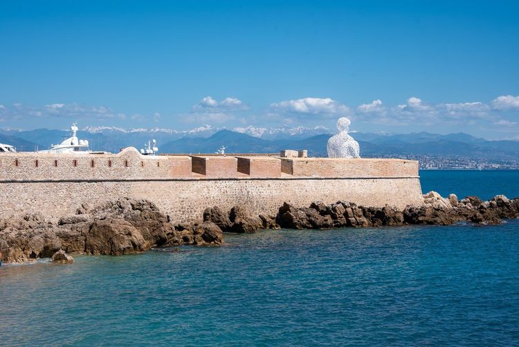
From the ramparts, a paved promenade leads directly down to port Vauban, Europe's largest pleasure port by tonnage, with around 1,500 berths across 25 hectares. The quai Camille-Rayon, nicknamed the 'Billionaires' Quay', can accommodate yachts of up to 160 metres, moored opposite fishermen repairing their nets at the other end of the same pontoon: the contrast sums up the spirit of Antibes rather well — a fishing town that has become a stopover for the Mediterranean elite.
The coastal path continues northward along the breakwater, with the fortified town visible to the right and the Alps appearing in the background on clear days. Allow around 25 minutes on foot to reach the fort Carré (Avenue du 11 Novembre, 06600 Antibes, rated 4.3/5 on Google based on 3,261 reviews), a star-shaped fortress perched on a 26-metre rock above the sea. Construction began around 1550 with the Tour Saint-Laurent, and Vauban, who inspected it in 1679 and 1682, proposed its modernisation. According to local tradition, the young General Bonaparte was briefly detained here in 1794, after the fall of Robespierre.
Owned by the town and open to the public since 1998, the fort can be visited for a small entrance fee. The view from the bastions takes in the entire gulf, from the Cap d'Antibes to the baie des Anges. Wear sturdy shoes: the rock is slippery in wet weather.
This stretch between the port and the fort is part of the route followed by users of the Ryo audio guide, which shares an anecdote about the superyachts moored just metres from the path and another about the military history of the fort, told just before the climb up to the bastion.
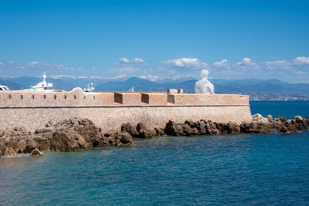
On the way back, you can walk along the anse Saint-Roch and stop in front of Le Nomade by Jaume Plensa, an 8-metre silhouette seated facing the sea on the bastion Saint-Jaume. More motivated walkers can continue on to Juan-les-Pins along the coast: the full loop from the fort then reaches around twelve kilometres.
The Coastal Trail and the Cap d'Antibes via the Tire-Poil Trail
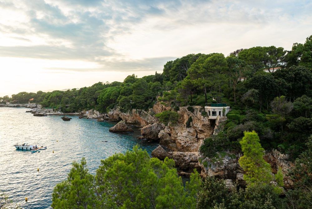
The coastal trail, also known as the customs officers' path and, on its most spectacular section, the Tire-Poil trail, circles the tip of the Cap d'Antibes starting from the Garoupe beach. The full loop, returning via the small roads of the Cap, covers around 4.8 km. It is the most photographed walk in town, and for good reason: the route alternates between pebble coves and umbrella pines clinging to the red rock, with sudden glimpses of the deep blue at every turn.
The Tire-Poil section, which runs from la Garoupe towards the anse de l'Argent Faux (Boulevard du Cap, 06160 Antibes, rated 4.3/5 on Google based on 6 reviews), owes its name to the wind that sweeps this exposed face and 'pulls the hair' of walkers. Allow 1h30 to 2h to complete the circuit around the Cap: the elevation gain remains modest (around sixty metres), but steps and narrow passages come one after another. Closed shoes are recommended; flip-flops are not suitable.
Along the way, the trail passes below the villa Eilenroc, designed by Charles Garnier and completed in 1867 for the Dutchman Hugh Hope Loudon; its current name, given by the Scotsman James Wyllie, is an anagram of his wife Cornélie's first name. A few minutes into the interior of the Cap, the botanical garden of the villa Thuret, created in 1857 by botanist Gustave Thuret, brings together some 1,600 species from Mediterranean climates around the world across 3.5 hectares.
The anse de l'Argent Faux, a small cove tucked between two rocky headlands, got its name from the smugglers who frequented this stretch of coast, hence the nickname 'smugglers' path' given to this section of the trail. It is also known as the 'Billionaires' Bay', owing to the properties that overlook it. It is one of the rare spots along the trail where you can slip down for a swim in complete privacy, far from the busier beaches in the town centre.
For this particular section, the Ryo audio sub-tour Cap sur la French Riviera accompanies the walk over 3 km with 22 audio stops and around 1h15 of listening: each cove and each villa is described at the exact moment you pass it, without having to look anything up on a paper map.
The most convenient starting point is the Garoupe beach, with free parking on chemin de la Garoupe and avenue Sella. The trail is closed in strong winds and rough seas: waves can wash over the lowest sections, so check conditions before setting out. The best time to venture out is early in the morning, before 9am, when the low light enhances the red rock and groups have not yet filled the narrowest passages.
The Garoupe Plateau and Woods: the Balcony of the Côte d'Azur
At the far end of the Cap, a wooded road climbs up to the Garoupe plateau, often dubbed the balcony of the Côte d'Azur. The 360-degree panorama takes in the golfe Juan, the Lérins islands, the Esterel massif and, on a clear day, the still snow-capped Alpine peaks as late as May.
Two monuments share the summit. The Garoupe lighthouse, inaugurated in 1837, blown up by the German army in August 1944 and rebuilt in 1948, stands at 103 metres above sea level and projects its light approximately 28 nautical miles, or about fifty kilometres. Right next to it, the chapelle Notre-Dame-de-Bon-Port (Route du Phare, 06160 Antibes, rated 4.7/5 on Google based on 904 reviews) has for centuries welcomed the ex-votos of rescued sailors, including some naïve paintings dating back to the 17th century that tell of near-shipwrecks off the Cap.
The Garoupe woods, which surround the plateau, form a network of shaded paths beneath the pines. A short loop of 2.1 km, around half an hour's walk from the chapel, is enough to explore them. From the Salis beach, you can also walk up via the chemin du Calvaire, lined with wayside chapels: it is one of the three walks highlighted by the local tourist office.
If you are following the Ryo audio-guided tour, save an earful for this promontory: the story of the sailors and their ex-votos takes on a different dimension when facing the open sea, between the lighthouse and the chapel. Plan to head up at the end of the day: the sunset over the Lérins islands, seen from this viewpoint, is one of the most sought-after scenes by photographers in the region, despite the lack of dedicated parking during summer peak hours.
The Baou des Blancs: a Hike in the Heights Above Antibes
A change of scenery for this more demanding outing, about forty minutes' drive away: the Baou des Blancs (06140 Vence, rated 4.7/5 on Google based on 112 reviews), a limestone promontory at 673 metres that overlooks Vence, within the Parc Naturel Régional des Préalpes d'Azur. The trail is only 1.6 km long but climbs nearly 180 metres of elevation through garrigue scrubland before emerging onto an open rocky plateau.
The trail, rockier than the coastal routes, requires good walking shoes and particular care in summer: the final stretch offers no shade, and temperatures rise quickly in the middle of the day. In return, the view is completely different from that of the Cap: the entire coastline, from Antibes to Nice, stretches out below, while the pre-Alpine ridges close off the horizon to the north.
Allow around 1 hour for the loop. Far less busy than the coastal trail, the Baou des Blancs offers a genuine moment of quiet after the bustle of the Vieil Antibes or the quays of port Vauban.
A Day Trip to the Lérins Islands and Île Sainte-Marguerite
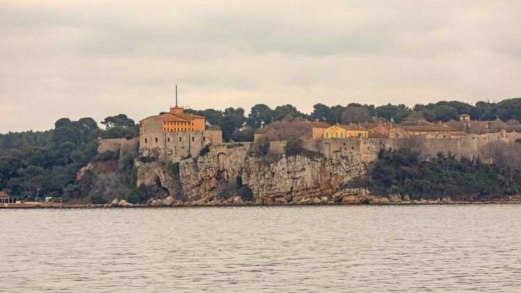
To reach île Sainte-Marguerite (Îles de Lérins, 06400 Cannes, rated 4.6/5 on Google based on 963 reviews), the most practical option from Antibes is to board a boat at Golfe-Juan, a quarter of an hour's drive away, or at Cannes, from where the crossing takes about fifteen minutes year-round. The largest of the Lérins islands, around 3 km long, can be explored entirely on foot in half a day.
The fort Royal, built in the 17th century and reinforced under Louis XIV, dominates the island. It was in its dungeons that the mysterious Man in the Iron Mask was held between 1687 and 1698, before his transfer to the Bastille. The Musée de la Mer, housed within the same walls, traces this history as well as that of ancient shipwrecks discovered offshore.
Beyond the fort, the island is explored via a network of shaded forest paths lined with Aleppo pines and eucalyptus trees. The full circuit covers just over 7 km, around 2 hours of easy walking, with accessible coves for a swim in clear water, less crowded than those on the mainland in high season.
Allow half a day for the round trip by boat and the visit, a little more if you plan a picnic facing the baie de Cannes. In summer, seasonal shuttles also depart from Juan-les-Pins: check the timetables the evening before, as the last departures in the evening leave early.
Nature Walks Around Antibes: Vaugrenier, la Valmasque and the Roman Camp
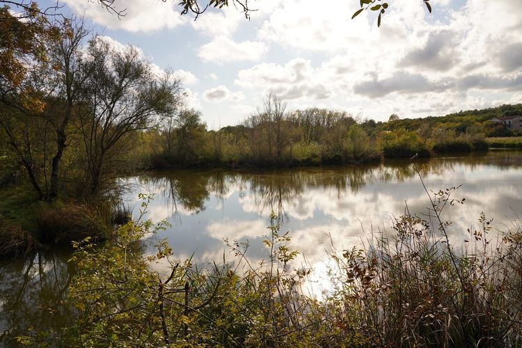
Between 5 and 40 minutes' drive from the centre, several nature walks are worth the trip for those wanting to escape the summer crowds along the coast.
The Parc Départemental de Vaugrenier, in the commune of Villeneuve-Loubet 5 km from Antibes, covers around a hundred hectares around a pond. A 5.8 km loop, roughly 1h45, winds through oak and pine woods punctuated by reedbeds along the water's edge, with several observation points for spotting grey herons and mallards.
Further north, the Valmasque loop, starting from Valbonne, covers 12.6 km of forest trails (3h45, moderate elevation) within the departmental park of the same name. On its southern edge, near Mougins, the étang de Fontmerle is covered with lotus flowers from July to mid-September: a detour not to be missed if you visit in summer.
On the historical side, the Roman camp is tucked away in the hills above le Rouret, about thirty minutes from Antibes. The 6.9 km loop (2h15, around 240 metres of elevation gain) climbs to 479 metres among the dry-stone walls of an ancient fortified site, with open views over the coastline.
The canal de la Siagne, a 19th-century hydraulic structure that still supplies water to the Cannes basin, can be followed from Plan-de-Grasse: 6.1 km almost entirely flat, around 2 hours, along the old maintenance track. Closer by, in Sophia Antipolis, the piste des Tamarins joins the sentier de la Brague for a 7.9 km loop (2h30) along the river, all the way to the cascade du Bruget: an easy, shaded option, ideal for families.
These itineraries require a car, as public transport does not serve the starting points well. Bring water and a hat: shade can be scarce on certain stretches in the height of summer, even though most trails remain covered by vegetation.
Biot and Valbonne: Two Villages to Discover on a Day Trip from Antibes
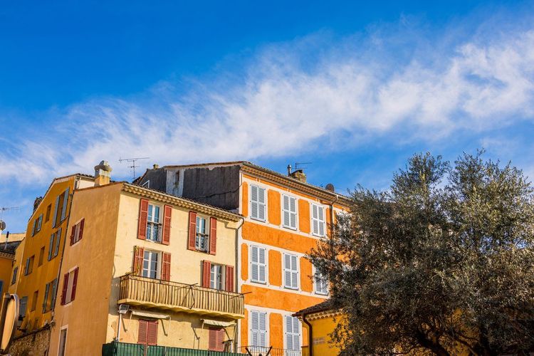
Two hilltop villages make a useful addition to a walk in Antibes for those with an extra half-day to spare.
Biot, a village once known for its pottery and later for its glassblowing, is best explored by wandering through its cobbled lanes lined with medieval arcades. The Verrerie de Biot, founded in 1956, keeps alive a tradition of bubble glass visible from the studios open to the public: some glassblowers still work in front of visitors, with furnaces at 1,200 °C in the background. From the Antibes bus station, the bus takes around twenty minutes to reach the village.
The Musée National Fernand Léger (Chemin du Val de Pome, 06410 Biot, rated 4.5/5 on Google based on 1,179 reviews), at the entrance to the village, houses one of the most important collections of the artist's work, in a building instantly recognisable by its monumental mosaic façade, visible from the road well before the museum entrance.
About twenty minutes' drive away, Valbonne displays a town layout unique on the Côte d'Azur: a grid of straight streets laid out in 1519 under the direction of Don Antoine Taxil, a monk from the abbey of Lérins and prior of Valbonne, centred on a main square lined with arcades and café terraces. Keen walkers can also link Biot to Valbonne via the sentier de la Brague: 20.4 km and around 6 hours of walking, with 460 metres of cumulative elevation gain, best saved for cooler days.
These two villages, less busy than the Vieil Antibes in the height of summer, retain a more authentically Provençal atmosphere, shaped by morning markets and craftspeople installed in the old workshops. The Valbonne market, held on Friday mornings in the old village, remains one of the favourite local gatherings in the area, far from the tourist crowds along the coast in high season. To explore the surroundings of Antibes beyond these two stops, the Ryo guide to the surroundings of Antibes lists further options within about thirty minutes' drive.
The Most Beautiful Beaches to Reach on Foot Around Antibes
A walk in Antibes would not be complete without a detour to its beaches, nearly all accessible on foot from the town centre or the coastal trail.
The plage de la Salis, a long stretch of fine sand between the Cap and the Vieil Antibes, offers one of the finest views of the old town with the Alps as a backdrop. It is also the most convenient starting point for joining the coastal trail towards the Cap.
In the town centre, the plage de la Gravette (Quai Henri Rambaud, 06600 Antibes, rated 4.3/5 on Google based on 3,415 reviews), nestled at the foot of the ramparts at the entrance to port Vauban, is the smallest but the most sheltered from the wind, with generally calm and shallow water well suited to families.
Just south of the ramparts, the plage du Ponteil extends la Salis towards the old town, with fine sand and a direct view of the ramparts. Finally, the coves of the Cap, accessible only via the coastal trail such as the anse de l'Argent Faux, attract those looking for more peace and quiet, at the cost of a 20 to 30-minute walk depending on the starting point.
In high season, aim for la Salis or le Ponteil before 10am: after that, parking nearby becomes the main obstacle, far more so than the crowds on the sand itself. For a complete overview, including the nearby Juan-les-Pins beaches, the Ryo guide to the most beautiful beaches in Antibes details each option with its peak hours.
Practical Information: Getting to Antibes and Planning Your Walk

Antibes is easy to reach by train: the station, a 10-minute walk from the Vieil Antibes, is served by TGV OUIGO trains from Paris in just under 6 hours direct, as well as by TER trains on the coastal line: Cannes is about ten minutes away, Nice around twenty, and Monaco less than an hour. For a car-free walk, this is by far the simplest option: the Vieil Antibes, the port and the fort Carré are all within 20 minutes' walk of the station, and local buses serve the Cap.
The best time to visit is spring, from April to June, or early autumn in September–October: temperatures are pleasant for several hours of walking and the coastal trail is noticeably less crowded than in July–August. In summer, favour early morning or late afternoon outings.
In terms of equipment, pack closed shoes for the Tire-Poil trail and the Baou des Blancs, as well as a hat and plenty of water: resupply points are rare once you are on the coast. A waterproof bag is useful if you plan to swim in the coves along the way.
For a family walk, the tour of the Cap is well suited to children aged 6–7 and up, as are the Garoupe woods or the piste des Tamarins, while the Vieil Antibes and its market are suitable for all ages with no walking constraints. The Ryo guide to visiting Antibes with family details other options suited to younger visitors. With children, the Ryo audio-guided tour has the advantage of turning a visit to the Vieil Antibes into a story: everyone listens to each stop at their own pace, and you can stop for an ice cream without losing the thread.


FAQ
How long does it take to walk around the Cap d'Antibes?
Allow 1h30 to 2h for the loop around the Cap starting from the Garoupe beach, via the Tire-Poil trail, covering about 4.8 km. With photo stops and a swim in a cove, plan on half a day.
What is the most beautiful walk to do in Antibes?
The Tire-Poil trail, starting from the Garoupe beach, remains the reference, thanks to its coves and views over the Mediterranean. The Vieil Antibes, with its ramparts and Provençal market, offers an equally striking alternative on the heritage side.
When is the best time to go walking in Antibes?
Spring and early autumn offer the best conditions: moderate temperatures and less crowded trails. In summer, it is better to walk early in the morning to avoid the heat and the crowds along the coast.
How do you get to Antibes without a car?
Antibes train station, served by OUIGO and TER trains on the coastal line, is a 10-minute walk from the Vieil Antibes. The historic centre, the port and the fort Carré are all within walking distance from the station; for the Cap, take a local bus.
What family-friendly walks are there in Antibes?
The Vieil Antibes and its market, with no significant elevation, are suitable for all ages. The tour of the Cap from the Garoupe beach is manageable with children aged 6–7 and up, as long as everyone wears proper shoes, with several beaches along the way for a break.
Where can you park to explore the Vieil Antibes on foot?
The underground car parks in the centre, such as the Pré-aux-Pêcheurs car park beneath port Vauban, a few minutes' walk from the ramparts, are the most straightforward options in the city centre. In high season, arriving before 10am avoids most parking difficulties.
Between ramparts, coastal trails and inland villages, a walk in Antibes can be tailored to suit the time available and the mood of the day. Heritage lovers will linger in the Vieil Antibes and up to the fort Carré, while more active walkers will favour the tour of the Cap or, a little further afield, the ascent of the Baou des Blancs, and families can combine beaches and villages for a more relaxed day.
To make the most of these routes, the Ryo audio guide for Antibes is the simplest companion: just launch the app at the foot of the ramparts and let it guide you, neighbourhood by neighbourhood, all the way to the last coves of the Cap.