© Shutterstock
 Votre guide Ryo
Hiking around Chamonix in 2026: The Complete Guide, from Easy Walks to Iconic Summits
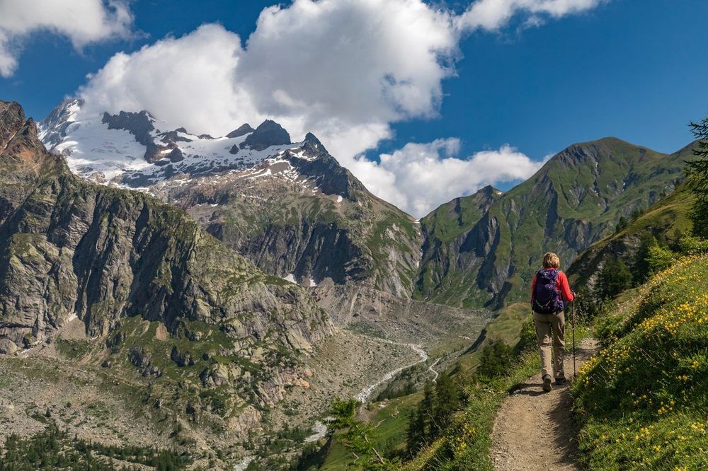
At 1,035 meters above sea level, at the foot of Western Europe's highest peak, Chamonix packs into one valley what other massifs spread across hundreds of miles: hanging glaciers, turquoise lakes, and summer pastures where herds still graze. The finest hikes around Chamonix can take you in a single morning from a shaded family trail to a ridge where roped parties are descending from Mont-Blanc. The Ryo audio-guided tour of Chamonix tells the valley's story street by street, but it is on the trails that the valley truly reveals itself.
This guide brings together around thirty routes, from the simplest to the most demanding. A lake at 2,352 meters whose water stays ice-cold all year round and draws hundreds of walkers on the same August Saturday; a stroller-friendly waterside walk ten minutes from the town center; a frost-covered forest on snowshoes twenty minutes from the center; and high-altitude climbs where you rope up on a glacier before dawn. Required level, best season, duration, and equipment are all detailed for each route.
Why Chamonix Is a Unique Playground for Hiking
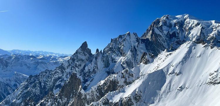
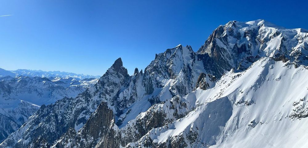
The Mont-Blanc massif peaks at just over 4,800 meters and on its own lines up around thirty summits exceeding 4,000 meters. Around Chamonix-Mont-Blanc, three glacial valleys — that of the glacier des Bossons, that of the Mer de Glace, and that of the glacier d'Argentière — reach almost to the town's doorstep, a phenomenon rare in Europe. Opposite, the Aiguilles Rouges massif plays a role few visitors anticipate: it is from there, not from the summit of Mont-Blanc itself, that the finest views of the range are found. This mirror configuration explains why the valley concentrates so many routes within such a small area.
Chamonix-Mont-Blanc remains an authentic town despite its status as the world capital of alpinism since the first Winter Olympics in 1924. The hamlets that make up the municipality — Les Praz, Argentière, Les Bois, Les Tines (74400 Chamonix-Mont-Blanc) — have each kept the character of a mountain village, with fountains, timber chalets, and small chapels. It is this juxtaposition — spectacular glaciers on one side, cobbled alleyways on the other — that sets this valley apart from other Alpine resorts.
Here you will find enough to fill a weekend or an entire month: two-hour stroller-friendly walks, technical ascents requiring a mountain guide, loop trails from the town center, and multi-day traverses. The rest of this guide details each option by level, with precise duration, elevation gain, and starting point. The Ryo audio-guided tour of the town centre also recounts the First Winter Olympics, on days when the high peaks are hidden by cloud.
The Must-Do Hikes around Chamonix

The Lac Blanc is the most photographed hike in the valley, and for good reason: its turquoise water reflects Mont-Blanc and the Drus on calm days, a scene few Alpine lakes can offer within three hours' walk. Two starting points are possible. From the Col des Montets (1,461 m), allow around 3h30 of ascent for 900 m of elevation gain — a demanding route but without particular hazards. From Tré-le-Champ, the ascent passes metal ladders bolted into the rock — a vertiginous but secured section that shortens the journey to around 2h30.
Along the way, the lacs de Chéserys are worth a stop in their own right: several tiered lakes, less crowded than Lac Blanc, where silence returns as soon as you move away from the main trail. Many hikers stop here for lack of time — a perfectly reasonable choice on a busy day. Leave early: between 10 am and 3 pm in July and August, the Col des Montets car park regularly fills up before 9 am.
Less well known than its neighbor, the Aiguillette des Posettes (2,201 m) offers one of the most exposed ridge walks in the area without ever requiring technical equipment. The starting point is either the Col des Montets or the Vallée de la Chaux, for around 4h30 round trip and 850 m of elevation gain. The distinctive feature of this route lies in its alignment: much of the walk follows a grassy ridge from which you can simultaneously see the Mont-Blanc massif to the south and the Aravis chain to the north — a rare combination on a single trail.
Marmots are plentiful on this ridge late in the morning. Bring binoculars if your children are walking with you — watching them easily fills twenty minutes without anyone getting bored.
The tour des Aiguilles Rouges is the big loop of the area — a multi-day itinerary (3 to 4 days depending on pace) that circles the massif opposite Mont-Blanc and strings together most of the viewpoints already mentioned: Lac Blanc, the Posettes ridge, the cols de la Glière and d'Anterne. Experienced hikers can also walk just one stage as a day trip, starting from La Flégère, reachable by gondola from Les Praz.
This tour has an advantage few guides mention: unlike the Tour du Mont-Blanc, it remains viable even in high-traffic years, as the huts in the Aiguilles Rouges sector fill up less quickly than those on the main massif. Allow around 2,000 m of cumulative elevation gain for the full loop, spread over 3 to 4 days of moderate walking.
The Balcon Nord refers to the trail that runs along the mid-slope of the Aiguilles Rouges between Planpraz and La Flégère, with an uninterrupted view of the Mont-Blanc massif across the valley. It is one of the rare routes in the valley where you walk almost flat for 2h30 while keeping the area's most spectacular scenery constantly in sight. The walk usually starts from Planpraz, reached by gondola from central Chamonix, and ends at La Flégère where a second cable car descends to Les Praz. Little positive elevation gain (around 300 m in total) makes this an excellent option for a first day in the valley, to get a feel for the massif before tackling more demanding routes on subsequent days.
The Aiguillette des Houches (74310 Les Houches, rated 4.9/5 on Google from 74 reviews) (2,285 m) closes the valley on the southwest side and remains surprisingly overlooked given what it offers: from its summit you take in the entire Mont-Blanc chain at a glance, from the glacier des Bossons to the Aiguilles de Chamonix, with a bird's-eye view of the Arve valley thrown in. The starting point is Les Houches via Le Bettey, or the top of the Bellevue cable car to cut the effort: allow 4h to 5h round trip and around 1,000 m of elevation gain from the village, roughly half that via Bellevue. The upper section crosses the Carlaveyron nature reserve, a plateau of peat bogs and bare rock slabs where you will often walk alone, even on an August Sunday.
At the other end of the valley, the montagne de Péclerey remains one of the best-kept secrets in the Tour sector. This suspended alpage, facing the glacier du Tour, is reached in 2h to 2h30 of ascent from the hamlet of Le Tour or from Montroc, for 600 to 700 m of elevation gain with no technical difficulty. The appeal lies in the orientation: you observe the glacier du Tour head-on, lit by the morning sun, without having to climb all the way to the refuge Albert 1er. On days when Lac Blanc is packed, this is the ideal alternative — with a good chance of encountering more cows than fellow hikers.
Hikes to the Most Beautiful High-Altitude Lakes
Beyond Lac Blanc already covered, two other lake duos are well worth the detour, each with its own atmosphere, even as the valley counts several dozen high-altitude bodies of water with very uneven access.
The Lac Cornu (2,276 m) and the Lacs Noirs (2,535 m) form one of the least-frequented routes in the Aiguilles Rouges massif, even though they are reachable by gondola from Planpraz. The reason is simple: the climb that follows — around 2h of technical walking on a rocky trail — puts off a portion of visitors who came to enjoy the panorama from the mountain restaurant terrace.
Once there, the contrast between the two lakes often surprises hikers visiting the site for the first time. Lac Cornu, surrounded by blocks of pink granite, reflects an almost orange light in the late afternoon. The Lacs Noirs, higher and more mineral, owe their dark color to the depth of their rocky basin, still frozen on the surface until mid-June in some years.
Allow a full day round trip from Planpraz, with around 700 m of cumulative elevation gain and terrain that calls for good ankle-support boots. This is not a route for beginners, despite the easy gondola access. The best window runs from mid-July to late September, as the trail remains snow-covered later than the valley average due to its north-facing aspect. Ibex and chamois regularly frequent the surrounding scree early in the morning — a good reason to take the first gondola up.
On the other side of the valley, the Lac Bleu (74400 Chamonix-Mont-Blanc, rated 4.7/5 on Google from 93 reviews) (2,299 m) and the Plan de l'Aiguille (2,233 m) offer an almost opposite experience: here it is the glacier that dominates the landscape rather than the lakes themselves. The Plan de l'Aiguille, served by the Aiguille du Midi cable car (intermediate stop), makes the most convenient starting point.
From this intermediate station, allow around 1h30 of easy walking to Lac Bleu, with a direct view of the glacier des Bossons descending from Mont-Blanc. Few hikes offer such a favorable ratio between effort and closeness to a living glacier.
One practical tip: book your cable car ticket online the evening before in high season — queues at the departure point can exceed an hour on sunny summer mornings. Compared to the Lac Cornu and Lacs Noirs duo, the Lac Bleu and Plan de l'Aiguille route remains accessible to inexperienced hikers, with only 250 m of cumulative elevation gain from the intermediate station. It is often the recommended choice for a first outing at altitude, before tackling more committing routes the following day.
High-Altitude Hikes: Glaciers, Mountain Huts, and Iconic Summits
This section is aimed at hikers in search of glacier or summit experiences. The required level is specified for each route, from the most accessible to the most technical.
The glacier des Bossons loop is the most accessible route for getting up close to a glacier without technical equipment. Starting from the hamlet of Les Bossons, below the glacier's snout, the loop takes 2h30 to 3h and involves 400 m of elevation gain.
The glacier's snout has retreated significantly over the past three decades, a withdrawal documented year by year on educational panels along the trail. Required level: occasional hiker, no particular technical skill needed.
The trip to Montenvers combines a historic rack railway (in service since 1908) with a view over the Mer de Glace, France's largest glacier. From the station, a staircase of several hundred steps — with a small gondola as an option — descends to an ice cave carved out fresh each year.
For hikers who prefer walking to taking the train, a trail connects Chamonix directly to Montenvers in 2h30 of ascent. Required level: moderate on foot, family-friendly if you take the train both ways.
The refuge Albert 1er (2,702 m), at the foot of the glacier du Tour, is reached from the hamlet of Le Tour in 3h to 4h of ascent via the moraine, with around 1,250 m of elevation gain. Shorter version: the Charamillon gondola followed by the Autannes chairlift reduces the effort to 1h30 of walking and 500 m of elevation gain, making it one of the most easily accessible huts in the Mont-Blanc massif. The refuge serves as the classic base camp for the ascent of the Aiguille du Tour, but a simple overnight trip to the hut without any summit ambition is already a fine outing in itself.
Required level: experienced hiker with good fitness, but no technical passages before reaching the hut itself.
The Vallée Blanche traverse, from Pointe Helbronner to the Aiguille du Midi, is not a hike in the strict sense but a glacier route: crampons, rope, and a professional mountain guide are indispensable, as hidden crevasses make any solo attempt dangerous.
Allow half a day, with predominantly negative elevation change as you descend overall from the Italian side toward the summit of the Aiguille du Midi on the French side. It is one of the rare opportunities to cross a national border in the middle of a glacier, at over 3,300 meters above sea level.
The ascent of Mont-Blanc (4,805 m at the last official measurement, though the historical figure of 4,810 m remains the most cited) via the Goûter route is the ultimate goal for many alpinists, but it is in no way a hike: roping up, crampons, and ice axe are mandatory, and the Goûter couloir, exposed to rockfall, demands a pre-dawn departure. A minimum of two days is required, with one night at the refuge du Goûter — booking is compulsory and slots are snapped up as soon as they open in spring. Guidance by a professional mountain guide is strongly recommended, if not virtually essential for the majority of candidates. Required level: experienced alpinist, or very good fitness combined with professional guidance.
The Pointe Lachenal (3,613 m), reached from the Plan de l'Aiguille or the Aiguille du Midi, provides an excellent introduction to glacier alpinism without the technical difficulties of Mont-Blanc. The view from its summit across the entire massif — including the Grandes Jorasses — makes it a popular climb for those seeking a first guided glacier experience. Required level: hiking alpinist with guide, crampons and rope required from the moment you leave the cable car.
The Brèche des Périades (3,401 m), via the glacier du Mont Mallet, is aimed at hiking alpinists already experienced in glacier travel. Access is from the refuge du Requin, with crevasse crossings and roped progression throughout. The panorama of the Grandes Jorasses from the brèche alone justifies the effort of the ascent. Required level: experienced alpinism, guide recommended.
The Aiguille de l'M (74400 Chamonix-Mont-Blanc, rated 5/5 on Google from 6 reviews) (2,844 m), by the normal route, is often described as the area's first ridge climb for getting to grips with rock alpinism before targeting more committing summits. Starting from Plan de l'Aiguille, around 3h of ascent with a few sections of easy scrambling.
Required level: hiker comfortable with exposure; a rope is still recommended for the most exposed sections even if the terrain does not exceed easy rock-climbing grade.
Easy Hikes and Family Walks around Chamonix
Not all hikes around Chamonix require 900 meters of elevation gain. The valley has about ten routes suitable for all-terrain strollers or young children, often overlooked by guides focused on high-altitude terrain. The Ryo Chamonix Mont Blanc audio tour also offers a guided walk through the town center that pairs nicely with these outdoor strolls, on days when the weather turns in the mountains.
The lac des Gaillands, a ten-minute walk from the town center, is the quintessential urban stroll: a circuit of the lake in 30 minutes, a summer swimming area, and a view of Mont-Blanc reflected in the still water on windless mornings.
A equipped climbing crag borders the lake on the cliff side, so you can watch climbers in action without ever leaving the flat trail. Ideal for a late afternoon with young children or a light jog after a day in the mountains.
The bois du Buchet, on a gentle rise above the town center toward Les Praz, offers a shaded path through larch trees with several benches and picnic areas. Allow 1h to 1h30 for a full loop, with no significant elevation gain.
It is one of the few routes in the valley that remains walkable even in overcast weather, the canopy offering partial shelter from light rain. A good backup plan when the summits are in the clouds.
The walk from Chamonix to the cascade du Dard follows a stream to a roughly twenty-meter waterfall tucked in a narrow gorge that stays cool even at the height of summer. Allow around 1h30 round trip from the town center, with a moderate 250 m of elevation gain.
This hike directly answers the search for a waterfall walk around Chamonix: it is the most accessible in the area, doable in trail shoes in dry weather.
The Les Bois – Le Lavancher walk (74400 Chamonix-Mont-Blanc) connects two typical valley hamlets along an almost flat path through meadows and mountain chalets. Allow 2h round trip; a route accessible to children from age 5–6.
Along the way, a workshop in Les Bois introduces visitors to the craft of stone cutting, a local tradition linked to the construction of chalets and stone-slab roofs in the area. This kind of heritage stop makes a pleasant change from a purely physical goal, and is particularly popular with families who like to mix walking and cultural discovery on the same outing.
These five routes cover the essentials of easy hiking around Chamonix. None exceeds 300 m of elevation gain, and all finish within a 25-minute walk of the town center — a real consideration when traveling with young children or elderly family members.
Snowshoe Hikes in Winter around Chamonix
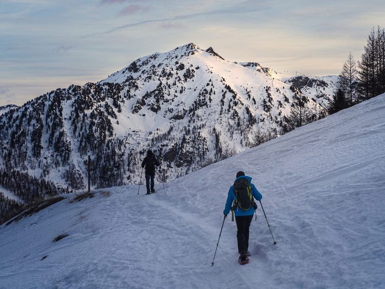
From December to March, the Chamonix valley transforms into a winter playground. Summer trails give way to marked snowshoe routes, generally shorter and less demanding than their summer equivalents — a great option for exploring the mountains in winter without skiing skills.
The snowshoe walk in the bois du Bouchet is the valley's most accessible winter route, covering the same area as the family bois du Buchet walk mentioned earlier, now blanketed in snow. Allow 1h of gentle walking, with no elevation gain — ideal for a first time on snowshoes.
Required level: complete beginner; snowshoe rentals available at several shops in the town center.
The frosted golf course circuit follows the snow-covered fairways with an open view of the entire massif, with no obstacles or relief. One hour of flat walking is enough for a complete loop.
On very cold mornings, frost coats every blade of grass with a white film that crunches underfoot — a particular atmosphere that few visitors anticipate.
The Les Tines snowshoe walk, through a forest of snow-laden fir trees, offers the most postcard-perfect winter atmosphere in the area. Starting from the hamlet of Les Tines, a 1h30 loop on largely flat terrain.
The silence of this snow-covered forest, far from the ski lifts, stands in sharp contrast to the bustle of the town center at the height of ski season.
The snowy excursion to the hamlet of Samoteux (74400 Chamonix-Mont-Blanc) crosses a zone of frozen peat bogs, a rare ecosystem that few summer hikers take the time to observe. Allow 2h of moderate walking, with a few gently rising sections.
Required level: beginner to intermediate snowshoer depending on seasonal snowfall.
The boucle des Chavants, in Les Houches, stands out for its frost-covered trees rather than powdery snow — a phenomenon linked to the freezing fog that frequently forms in this valley. Allow 1h30 for the full loop.
It is often the first choice of valley instructors when introducing beginners to snowshoeing, as the terrain remains gentle throughout. One useful reminder before heading out: off marked routes, snowshoeing carries avalanche risk, and the daily avalanche bulletin published by Météo-France is worth checking systematically.
Long-Distance Treks: Tour du Mont-Blanc and the Haute Route
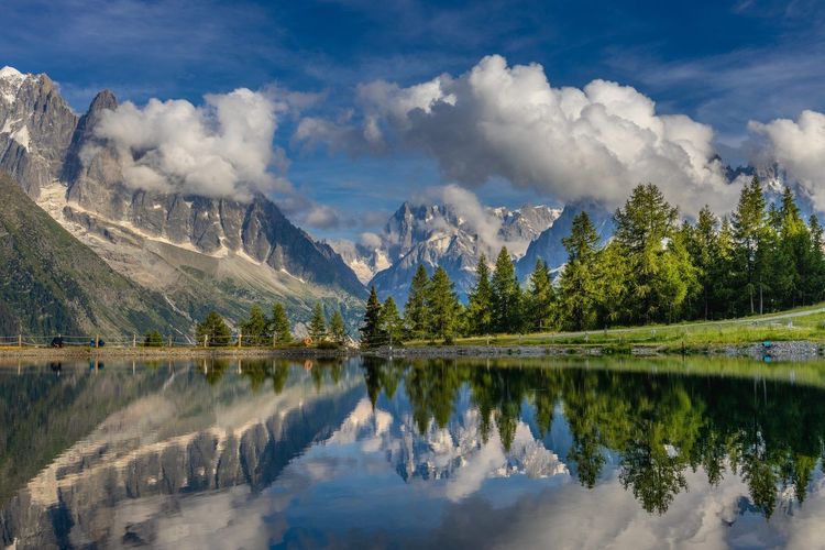
For hikers with a week or more to spare, two long-distance routes extend the experience well beyond a single day's walk. The Tour du Mont-Blanc (TMB) circles the entire massif in around 10 days of walking, crossing three countries (France, Italy, Switzerland) and about ten valleys. It is one of Europe's most complete treks, with cumulative elevation gain exceeding 10,000 meters across the full route, split between mountain huts and gîtes.
Booking your overnight stays several months in advance remains essential in July and August, as the TMB's popularity has surged over the past decade. June and September offer significantly quieter conditions, provided you accept the risk of residual snow on the highest passes in June.
More demanding still, the Haute Route des Alpes links Chamonix to Zermatt. Allow around fifteen days of walking for the classic on-foot version, up to twenty with high-level variants and rest days, while the ski touring version can be completed in a week — reserved for experienced ski mountaineers. The route crosses high-altitude passes, some above 3,000 meters, and alternates marked trail sections with more committing stretches requiring solid mountain self-sufficiency.
Unlike the TMB, the Haute Route is not an itinerary to undertake without prior experience of multi-day high-mountain trekking: navigation, pacing over multiple days, and reading glacial terrain are all skills expected of the traveler. A guide is recommended for the most exposed sections. Both traverses naturally extend the day-hike routes already covered, for anyone wishing to explore the massif more deeply.
When to Go and What Fitness Level You Need for Hiking in Chamonix
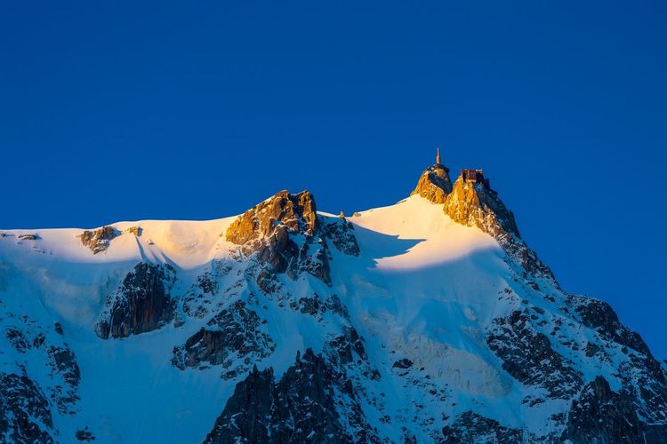
The main window for hiking around Chamonix runs from mid-June to late September, with visitor numbers peaking in July and August. Before mid-June, many high-altitude trails — above 2,000 meters — remain partially snow-covered, particularly on north-facing slopes such as Lac Blanc or the Lacs Noirs. After late September, huts close progressively and the first snowfalls can arrive as early as October in some years.
June and September remain the most appealing months for those seeking to avoid crowds while still enjoying clear trails: valley walks (lac des Gaillands, bois du Buchet, cascade du Dard) are accessible from spring, while high-altitude routes require waiting until early July for minimal residual snow.
The fitness level required varies enormously depending on the chosen route — this guide has specified a level for each hike presented. Three broad categories structure the valley's offering. Easy family walks (lac des Gaillands, bois du Buchet, cascade du Dard) require a basic level of fitness and are suitable for children from age 4–5. Confirmed hikes (Lac Blanc, tour des Aiguilles Rouges, high-altitude lakes) demand solid mountain walking experience, with 700 to 900 m of positive elevation gain in a day, often on rocky terrain. High-mountain climbs (Mont-Blanc, Vallée Blanche, Pointe Lachenal) fall within the realm of alpinism and require professional guidance, regardless of the hiker's fitness level.
A useful benchmark before setting off: if you don't hike regularly, start with a stage of the Balcon Nord or Lac Bleu before attempting Lac Blanc or the tour des Aiguilles Rouges. Also keep in mind that altitude tires you more quickly than mid-mountain terrain: above 2,000 meters, a pace of 300 m of elevation gain per hour is already a good tempo for a fit walker.
Gearing Up for Hiking around Chamonix
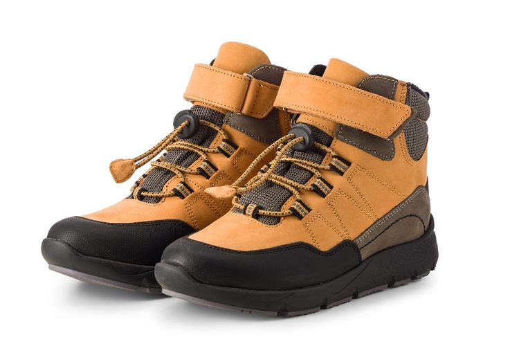
The starting point of any kit for hiking in Chamonix is footwear. A pair of ankle-support hiking boots with a lugged sole is essential whenever a route exceeds 400 m of elevation gain or involves rocky terrain — which applies to the majority of routes in this guide beyond the urban walks. For easy strolls (lac des Gaillands, bois du Buchet), standard sports shoes are perfectly adequate; there is no need to invest in technical gear for these flat routes.
For clothing, the three-layer system remains the mountain standard regardless of body type: a moisture-wicking base layer, an insulating mid-layer (fleece or lightweight down jacket), and a waterproof windshell for the afternoon storms that are common in the Mont-Blanc massif in summer. On the lower body, stretchy hiking trousers or technical leggings suit most people, with hiking shorts for the warmest days in the valley. Even in midsummer, temperatures drop quickly above 2,000 meters — always pack an extra warm layer, even for a route that looks easy on paper.
Among the genuinely useful accessories: telescopic trekking poles (invaluable on the rocky descents in the Aiguilles Rouges sector), a water bottle of at least 1.5 liters, high-factor sunscreen — UV radiation at altitude is consistently underestimated — and lightweight crampons or microspikes for May–June or October hikes on routes still partially snow-covered. A headtorch and emergency foil blanket fit in a pocket and are never regretted on the day a descent runs longer than expected.
For navigation, an IGN map at 1:25,000 (reference 3630 OT for the Chamonix area) is more reliable than an app alone when you lose signal — common in the depths of glacial valleys. A Chamonix hiking map in PDF format, downloadable for free from the tourist office or the maison de la montagne, lets you plan your route in advance and consult it offline on the day.
Where to Stay and How to Get Around for Hiking around Chamonix
The Chamonix valley stretches nearly 20 kilometers, from Servoz at the gateway to Switzerland to Vallorcine. To reach the various trailheads without a car, the Mont-Blanc Express train serves most hamlets (Les Praz, Argentière, Vallorcine) with a stop every 20–30 minutes in season. The Chamonix Bus network, included with the guest card issued by most accommodation providers in the valley, effectively complements the train for reaching gondola stations (Planpraz, Les Praz for La Flégère, Les Bossons).
For those looking for a hike in Chamonix without cable cars, several routes in this guide can be reached entirely on foot from the town center or a Mont-Blanc Express station: lac des Gaillands, cascade du Dard, bois du Buchet, the glacier des Bossons loop, and the direct climb to Montenvers. These options avoid both the cost of lifts and the queues in high season — a real advantage for an impromptu hiking weekend.
For a 3-day hiking stay in Chamonix, the most efficient approach is to base yourself in the valley (Chamonix center, Les Praz, or Argentière) and combine a different hike each day reached by train or bus, rather than multiplying nights in mountain huts — except for high-altitude routes that require it. On the accommodation side, the valley mixes town-center hotels, hostels popular with climbers, campsites at Les Bossons and Les Praz, and mountain huts generally open from mid-June to mid-September, with mandatory reservations. The Ryo Chamonix audio guide is the perfect way to spend an evening in town after a long day on the trail, exploring the valley's history at your own pace, with no booking or fixed schedule required.
Mountain Best Practices and Responsible Hiking
The Aiguilles Rouges massif, home to most of the high-altitude lakes mentioned in this guide, has been classified as a nature reserve since 1974. Staying on marked trails is an obligation there, not merely a recommendation: alpine vegetation takes decades to recover from repeated trampling off-trail, and several protected species (gentians, edelweiss, black grouse) depend on it directly. Waste — including fruit peel, mistakenly considered biodegradable at altitude — must come back down with you: there are no bins beyond the gondola departure stations.
Several nature reserves share the valley's slopes, from the Aiguilles Rouges to Carlaveyron above Les Houches, and the vallon de Bérard on the Vallorcine side. Picking flowers, lighting fires, flying drones, and camping outside designated areas are all prohibited, and dogs are not permitted even on a lead — worth checking before you set off if you are hiking with a pet. Remember also to carry your own water, as streams below the alpine pastures are not always safe to drink.
Protecting these landscapes also means respecting wildlife: keep your distance from ibex and chamois, never feed them, and avoid crossing breeding zones marked in spring. The mountains are shared, but they remain a fragile ecosystem, not a backdrop. The Ryo Chamonix audio tour touches on some of these issues in its account of the valley's history — a useful reminder before hitting a trail for the first time.
FAQ
How many days should I plan for a hiking trip around Chamonix?
Three days are enough for a first taste: one day of easy walking (lac des Gaillands, bois du Buchet), one day of more demanding hiking (Lac Blanc or a partial loop of the Aiguilles Rouges), and one day at altitude via cable car (Plan de l'Aiguille, Lac Bleu). A full week allows you to add a stage of the Tour du Mont-Blanc or a guided mountaineering outing.
Can you hike in Chamonix without taking the lifts or cable cars?
Yes. Several routes in this guide — lac des Gaillands, cascade du Dard, bois du Buchet, the glacier des Bossons loop, or the on-foot climb to Montenvers — can be reached entirely from the town center or a Mont-Blanc Express train station, without using any paid lift.
Where can I find a hiking map around Chamonix (paper or PDF)?
The IGN 3630 OT map at 1:25,000 covers the entire area. A Chamonix hiking map in PDF format is also available for free from the tourist office and the maison de la montagne, handy for planning your route offline.
What are the easiest and most accessible hikes around Chamonix?
Lac des Gaillands, bois du Buchet, and the Les Bois – Le Lavancher walk are the easiest hikes around Chamonix featured in this guide — all suitable for young children and involving no significant elevation gain.
Do I need a mountain guide for certain hikes around Chamonix?
Yes, for glacier routes or summit climbs: the Vallée Blanche traverse, the Mont-Blanc ascent, Pointe Lachenal, and the Brèche des Périades all require professional guidance, unlike day hikes on marked trails.
Are there waterfall hikes around Chamonix?
Yes, the hike from Chamonix to the cascade du Dard is the most straightforward: about 1h30 round trip from the town center to a roughly twenty-meter waterfall tucked in a cool, narrow gorge that stays refreshing even in summer.
Between the turquoise lakes of the Aiguilles Rouges, glaciers that reach almost to the town, and leisurely walks around lac des Gaillands, hiking around Chamonix offers a range of levels rarely found elsewhere in such a compact area. Whether you're planning a family day out or a guided climb on Mont-Blanc, the valley has a route to match your fitness and the time you have available.
Before you set off, round out your preparation with our Ryo audio-guided tour of Chamonix Mont Blanc: a great way to explore the town's history and hidden corners on rest days between hikes, with no booking required.