© Shutterstock
 Votre guide Ryo
Hiking around Collioure: 12 Walking Routes in 2026
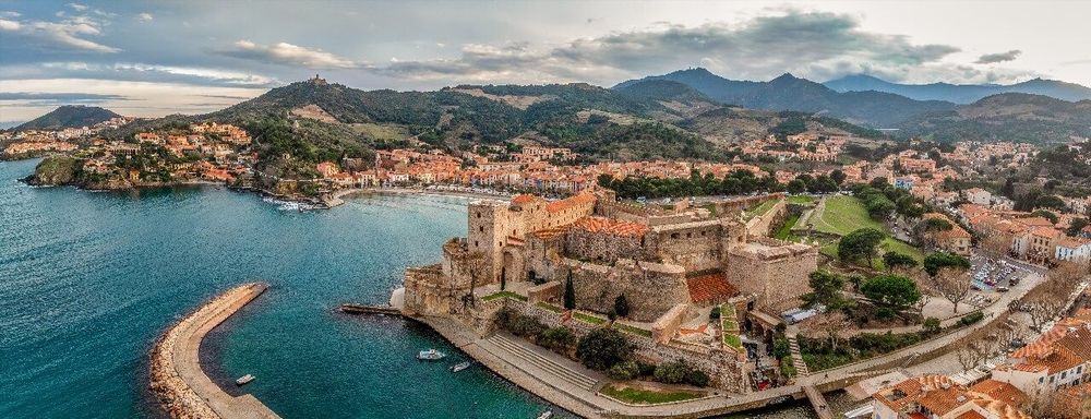
In Collioure, the trail often begins before your morning coffee is finished. From Plage Saint-Vincent, the path climbs straight up toward the terraced vineyards, and within twenty minutes the pink town has already disappeared behind the first rocky promontory. That is the whole promise of hiking around Collioure: kilometres of coastal paths and ridgelines linking the Albères massif to the Mediterranean, with the bell tower of the Église Notre-Dame-des-Anges as a permanent landmark, visible from almost every high point in the area. Before lacing up your boots, take a detour via the Ryo audio guide of Collioure: it traces the lanes of the Mouré and the Faubourg, the starting point for most of the routes listed here.
This guide details twelve waymarked trails between 2 and 18 km, from the coastal path toward Port-Vendres to the technical ascent of the Tour Madeloc, at 652 metres above sea level. You will also find a hermitage nestled in a vine-planted valley, a 16th-century fort converted into a military museum, a border pass opening onto the first Spanish ridges, and a ruined fortress perched on a rocky spur near Sorède. Each route specifies the distance, elevation gain and level required, enough to plan a half-day outing or a loop spread over several days of your stay.
The Coastal Path: From Collioure to Port-Vendres via the Chemin des Douaniers
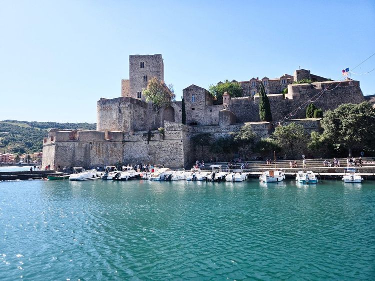
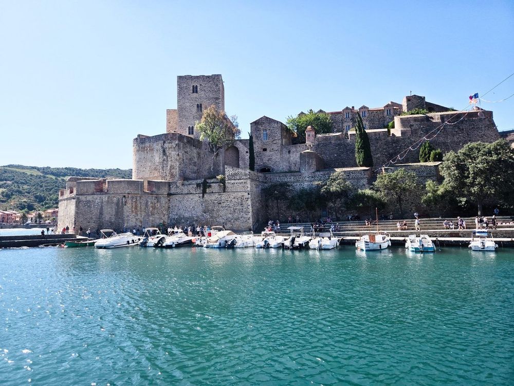
The chemin des douaniers remains the most-walked route in the region, and for good reason: it hugs the rocky coastline without ever straying from it, with views over the Mediterranean at every bend. The walk starts from the Château Royal de Collioure, the former residence of the Kings of Majorca standing at the entrance to the harbour, its massive ramparts contrasting with the lightness of the fishing boats moored just below. From there, the path climbs in short zigzags through the Faubourg vineyards before descending toward the first cove, through an atmosphere of fragrant scrubland scented with thyme and rosemary.
Allow around 5.5 km and 1h30 for this first section to Anse Dougnon, a small pebble cove tucked between two rocky headlands where the water takes on a turquoise hue by late morning. Few hikers stop here, too eager to reach Port-Vendres, which makes it a worthwhile swimming break if you set off early and don't mind descending a few steep steps to reach it. The path then continues as a balcony trail along the cliff face, offering an open view over the Cap Béar ridges and, in clear weather, the foothills of the Albères massif sketched out in the background.
After around 8 km of cumulative walking, you reach the Cap Béar Lighthouse (Cap Béar, 66660 Port-Vendres, rated 4.6/5 on Google from 1,392 reviews), built in the early 20th century on a rocky spur that towers nearly 60 metres above the sea. It is a natural rest stop before the final descent into the harbour of Port-Vendres, where there is often a breeze that makes the break cooler than elsewhere on the route.
From there, it is around 45 minutes of walking to reach the lively quays of Port-Vendres, where fishing boats still unload their crates of anchovies and sardines every morning. Allow 3h30 to 4h one way for the full route, doable as a one-way trip with a return on bus line 400 if you would rather not retrace your steps. The cumulative elevation gain remains moderate, around 350 metres spread over the full length, which places this trail among the easy hikes in the area, accessible to a child of 8 who is already used to walking for several hours.
One point to check before setting off: the southernmost section of the coastal path, between Argelès-sur-Mer and Cerbère, is subject to recurring partial closures due to cliff erosion, and only the stretch as far as Peyrefite remains open continuously. The segment we are concerned with here, from Collioure to Port-Vendres, is not normally affected, but a call to the Collioure tourist office will save you an unpleasant surprise in high season, when certain exposed sections may be closed off after a heavy rainfall event. The return bus, meanwhile, costs barely 2 euros on the coastal line, an economical option for completing the outing without retracing your steps.
If you are looking for a short version for an easy Collioure hike at the end of the day, stop at Anse Dougnon and turn back: this gives a 2-hour loop perfectly suited to an early evening outing, with the light gradually turning the cliffs pink on the way back.
Toward the Tour Madeloc: the Best View over the Albères
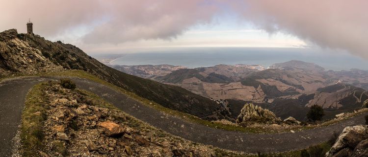
The ascent to the Tour Madeloc (66190 Collioure, rated 4.7/5 on Google from 1,581 reviews) is without doubt the most demanding route within immediate reach of Collioure, but also the one that offers the most spectacular reward in the entire area. This 13th-century signal tower, built to monitor the border and relay light signals with the fort at Salses, reaches 652 metres and commands the whole Roussillon plain as far as the Canigou on clear days, a 360-degree panorama that justifies the effort of the climb on its own.
The walk begins from the upper part of the village, heading toward the terraced vineyards classified under the Collioure and Banyuls appellations, two designations that share exactly the same schist terroir but operate under different specifications. Allow around 7 km round trip and 550 metres of positive elevation gain, or 3h to 3h30 of walking for the full route. The first section winds between the dry-stone walls of the winegrowers, with a steady gradient that is never truly steep, allowing you to keep a good pace without pushing too hard. You will often encounter mountain bikers on this stretch, as the track is shared between walkers and cyclists, so stay alert around bends.
The final climb, stonier and narrower, crosses a scrubland of holm oaks and rosemary before reaching the open summit where the tower stands. The wind blows here almost constantly, sometimes with surprising force, so even in midsummer bring an extra layer for the summit break, especially if you plan to linger and take in the view. From up there, you can clearly make out the bay of Collioure, the ochre rooftops of the village clustered around its bell tower, and on very clear days the Spanish coast as far as Cap de Creus, over 30 km as the crow flies.
Set off early in the morning during the hot season: the ascent faces due south for its first half, with no meaningful shade before reaching the denser scrubland. Bring at least 1.5 litres of water per person; there is no resupply point on this route, no fountain, no refreshment stand, until you return to the village. For photography enthusiasts, the late-afternoon light, when the sun skims the vineyards below, is the best moment for the descent.
Worth noting: the forest track serving the tower is also accessible by car as far as a car park situated just below the summit, allowing families with young children or time-pressed walkers to shorten the final ascent considerably. But covering the last few hundred metres on foot, through cistus and strawberry trees, remains incomparably more rewarding than arriving by tarmac, and it is also the best way to appreciate the strategic position of this signal tower, designed to communicate from ridge to ridge all the way to the fortresses of the plain.
The Heights of Collioure: Forts and Military Remains
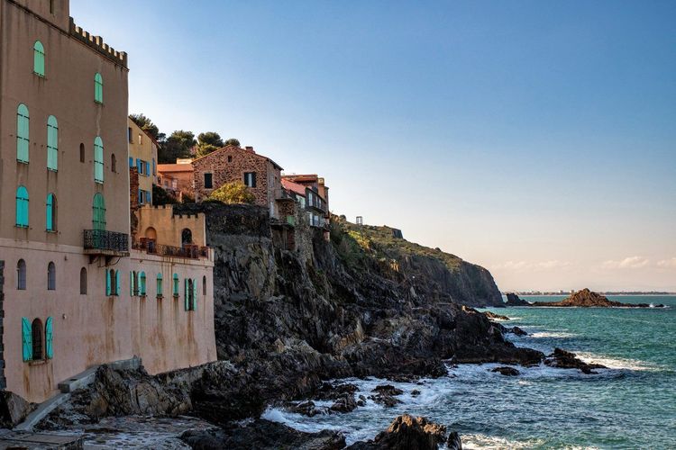
The hills above Collioure contain a remarkable concentration of fortifications, a direct legacy of the village's frontier position between the Catalan and French kingdoms over several centuries. The circuit of the heights of Collioure links several of these remains in a loop of 6 to 9 km depending on the variant chosen, with an elevation gain that remains reasonable despite the rugged terrain.
The highlight is Fort Saint-Elme, the star-shaped fortification commissioned by Charles V in 1552 to cross fire with the royal castle below on the same line of sight. The fort, now a private museum housing a collection of ancient, medieval and Renaissance weapons, can be visited outside hiking hours if you wish to extend the outing by an hour or two once you have come back down from the ridges.
Further down, the path passes by Fort Miradou and Fort Dugommier, two more modest 19th-century works, before descending back toward the village through the terraced vineyards that make up most of the landscape in this section. This stretch also takes you along the heights of the Mouré quarter, whose colourful facades inspired Matisse and Derain in the early 20th century, a period during which Collioure became an open-air laboratory for the Fauvist movement. The Ryo Collioure guide, The City of Painters traces the exact viewpoints painted by the Fauvists here, a useful detour if you want to compare the real landscape with the canvases on display at the village's Museum of Modern Art below.
The full loop, including the Fort Saint-Elme variant, takes around 3h and 300 metres of elevation gain. It is an ideal late-afternoon outing, when the raking light over the village rooftops makes the descent particularly photogenic, with the colours of the Église Notre-Dame-des-Anges shifting from pink to orange. Ryo's audio-guided tour passes right by Fort Saint-Elme too, a good way to extend the walk down into the village and the Museum of Modern Art.
The Notre-Dame de Consolation Hermitage: a Peaceful Interlude
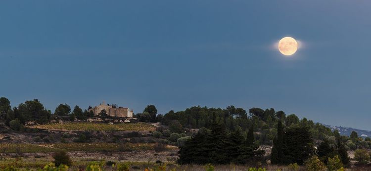
Less well known than the coastal path, the route to the Notre-Dame de Consolation hermitage (Chemin de la Consolation, 66190 Collioure, rated 4.6/5 on Google from 542 reviews) passes through a valley planted with vines and olive trees, away from the summer bustle of the coast. This Romanesque chapel, a local pilgrimage site since the 17th century, can be reached in 1h15 from the centre of Collioure via a path that is shaded for much of the way, making it an appealing option on the hottest days of summer.
The walk, 4 km round trip, is well suited to families or those looking for an easy hike around Collioure with little elevation change. The path first follows a quiet minor road before branching onto a dirt track that winds between the vine stocks. You can extend the outing by pushing on to the neighbouring ridges for a broader view over the valley, but the hermitage already makes a satisfying destination in itself, with its shaded square ideal for a midday picnic.
The place retains a genuine spiritual dimension: the hermitage remains a living pilgrimage site, and you sometimes encounter locals who have come to leave a votive offering or simply to enjoy the calm beneath the large trees. A spring nearby once refreshed pilgrims, but it is better not to count on it today and to bring your own water bottle. For families, this is probably the ideal outing for introducing children to hiking around Collioure: little elevation gain, plenty of shade, and a tangible destination that gives the walk a purpose rather than just an unmarked loop.
From Port-Vendres: Fort de la Gallina and the Sentier de la Mauresque
Port-Vendres, just 4 km from Collioure, opens up a second network of trails that is far less busy than the Collioure coastal paths. Fort de la Gallina (66660 Port-Vendres, rated 4.8/5 on Google from 12 reviews), built in the late 19th century to complement the defence of the harbour, overlooks the entrance to the roadstead from a promontory reachable in 45 minutes of walking from the town centre, via a path that climbs steadily without ever becoming technical.
From the fort, whose disused buildings can be freely explored along the path, the Sentier de la Mauresque descends to an isolated cove where the water remains surprisingly calm even in a tramontane wind. It is a favourite swimming spot among locals, far less well known than the beaches of Collioure itself, and often deserted even in the height of August early in the morning. The full loop, fort included, covers around 5 km with a light elevation gain of 180 metres, a hike that can easily be combined with a visit to Port-Vendres' morning market.
If you have a full day available, it is possible to follow this circuit with an ascent toward the Cap Béar lighthouse, thereby linking the two trail networks in a 12 km loop. Allow 5h of walking including breaks, a project best reserved for hikers already accustomed to long distances and cumulative elevation gains. Be sure to check the last return bus times before setting off on this variant, as line 400 does not run beyond a certain hour in low season.
Toward Banyuls-sur-Mer: the Col de Banyuls and the Classified Vineyards
The col de Banyuls, the natural pass between the two wine-producing villages, connects Collioure to Banyuls-sur-Mer via the ridges rather than the coastal road, for a Collioure–Banyuls hike that crosses a landscape almost entirely shaped by the vine. The trail winds between the terraces of Banyuls and Collioure, two protected designations of origin that share the same schist terroir but are distinguished by their wine styles, one tending toward sweetness, the other toward dryness.
Allow around 11 km and 4h of walking to link the two villages along this route, with a cumulative elevation gain of close to 500 metres. The initial climb from Collioure is the most sustained, but it proceeds quickly on a wide path well maintained by the winegrowers themselves, who use it daily to reach their plots. You will regularly pass dry-stone vine huts, some a century old, that punctuate the landscape every 500 metres or so and once served as shelter for agricultural workers.
Once over the col, the path descends toward Banyuls offering a continuous view over Cap Réderis (66650 Banyuls-sur-Mer, rated 4.8/5 on Google from 23 reviews), the rocky headland that marks the entrance to the marine reserve, one of the oldest in the Mediterranean, established in 1974.
This Collioure–Banyuls hike comes into its own in autumn, at harvest time, when winegrowers still carry the comportes loaded with grenache on their backs from the steepest plots, unreachable by machinery. It is one of the rare vineyards in France where the harvest is carried out almost entirely by hand, owing to the impossibility of mechanising such narrow terraces, and the landscape bears that mark at every bend in the trail.
If you do not have time to link the two villages, a shorter variant lets you reach just the col and then turn back, for a 6 km loop from Collioure. This is the option to choose for a half-day outing, without having to organise a complicated return by bus or car-sharing.
Long-Distance Hikes: the Albères Massif and the Tour de la Massane
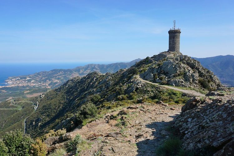
For hikers wishing to venture beyond the immediate hills of Collioure, the Albères massif offers a far wider playground, crossed by the GR10 on its final stretch before the Mediterranean. These routes require good physical fitness and a full day, but they traverse landscapes far wilder than the coastal paths, with dense forests and spectacular rocky outcrops.
The Tour de la Massane (66540 Argelès-sur-Mer, rated 4.8/5 on Google from 1,025 reviews), a medieval signal tower perched at 793 metres above Argelès-sur-Mer, can be reached in 3h30 from the hamlet of la Massane, about 25 minutes by car from Collioure. The ascent passes through a remarkable oak forest, one of the last primary forests in the region, classified as a nature reserve since 1973 and home to particularly rich wildlife, including several raptor species.
Further into the Albères, summits such as Pic Sailfort or Roc de Frausa attract experienced hikers seeking genuine ascents, with elevation gains exceeding 800 metres and full days of 6 to 7h of walking. These routes do not start directly from Collioure: a car transfer to the trailheads is required, generally near Laroque-des-Albères or Sorède, two villages that serve as logistical bases for most hikers in the area.
On these longer Albères itineraries, logistics matter as much as fitness: scout out the trailheads the evening before, as some hamlet car parks are tiny and fill up quickly at weekends. The massif also lends itself very well to a two-day discovery, with a night at a gîte near Laroque-des-Albères or Sorède, allowing you to string together two fine stages without overdoing it and to enjoy a sunrise over the ridges, as the sea and the plain slowly emerge from the mist.
If you want to keep things more manageable while still going off the beaten track, the ridge linking the Tour Madeloc to the col de l'Ouillat further south makes for a 14 km ridge walk with alternating views over the sea and the Roussillon plain. This option requires a vehicle at each end, or an organised shuttle, otherwise you will have to retrace your steps.
Château d'Ultrera and the Chapelle Saint-Ferréol-de-la-Pave
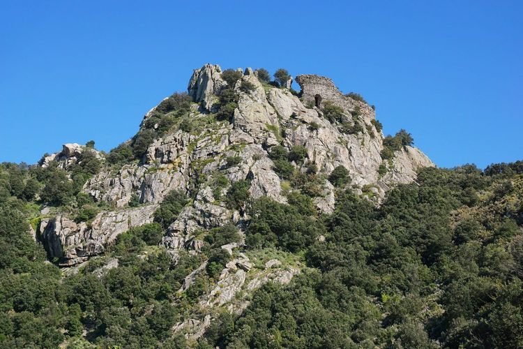
About twenty minutes by road from Collioure, near Sorède, Château d'Ultrera (66490 Sorède, rated 4.5/5 on Google from 38 reviews) occupies a rocky spur that has dominated the entire Roussillon plain for over a thousand years, having probably served as a watchtower from the Visigothic period before being reworked in the Middle Ages. This fortress, ruined but still imposing with its sections of wall rising against the sky, is reached by a stony path of 2h from the village of Sorède.
The route passes by the Chapelle Saint-Ferréol-de-la-Pave, a small Romanesque building isolated among cork oaks, before tackling the final climb to the ruins along a path that gradually narrows. The view from the ramparts extends to the Mediterranean in clear weather, making it one of the widest panoramas in the entire area, encompassing both the coast and the first Pyrenean foothills.
This hike falls slightly outside the strict perimeter of Collioure, but it complements a multi-day stay in the area well, particularly if you have already covered the coastal paths and are looking for a more mineral, more silent landscape — visitor numbers here remain far lower than in Collioure itself. Wear sturdy footwear and bring plenty of water: the trail climbs steeply toward the end without shade, and the rock radiates heat in midsummer. The reward is worth the effort, with a site steeped in over a thousand years of history, from the Visigoths to the Catalan lords of the Middle Ages, whose successive excavation campaigns have gradually unearthed their traces.
When to Go: Seasons and Crowds
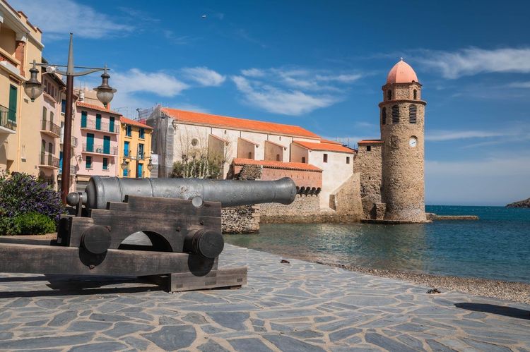
Spring, between April and June, remains the best season for hiking around Collioure: temperatures stay moderate and the coastal paths are not yet saturated by the summer tourist flow. Autumn offers similar conditions, with the added bonus of a raking light that is particularly flattering on the vineyards at the end of the harvest, generally late September or early October depending on the vintage.
Summer is still manageable, but only early in the morning: beyond 10 a.m., exposed trails such as the Tour Madeloc route become gruelling, with no shade available for several hours of walking. At weekends, the chemin des douaniers sees several hundred walkers pass through per day in high season, which significantly changes the experience compared to a weekday outing, when you can still walk alone for long stretches.
Winter, finally, suits lower-level hikes such as the hermitage or the heights of Collioure, provided you keep an eye on the tramontane, a wind that can gust above 100 km/h and make exposed ridges genuinely dangerous. Calm winter days, on the other hand, offer exceptional light and visibility that can sometimes reach as far as the snow-capped Pyrenees.
Level, Duration and Equipment
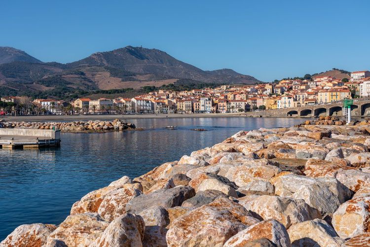
The majority of the trails listed here remain accessible to occasional walkers, with an elevation gain rarely exceeding 550 metres and distances of 2 to 12 km. Only the ascents to the Tour Madeloc, the Albères massif or Château d'Ultrera call for better physical fitness and a solid habit of walking on uneven terrain.
Wear shoes with a grippy sole: the schist terrain, slippery after rain, is unforgiving of town trainers on rocky sections or stony descents. A walking pole makes the technical descents significantly easier, particularly toward Anse Dougnon or from Fort Saint-Elme, especially if you are carrying a loaded pack for the day.
Always factor in extra time in summer, as the heat noticeably slows your pace on exposed sections, sometimes by 30 to 40% compared with an estimate made in temperate conditions.
A few accessories make a real difference on this schist and often windy terrain: a cap or hat for the shadeless sections, high-factor sun cream, and a light windproof jacket even in summer, as the tramontane can drop the perceived temperature by several degrees on the ridges. For loop hikes that end with a swim, slip in a swimsuit and a compact towel: Anse Dougnon and the Mauresque cove reward the effort with clear water that is usually quiet outside peak hours.
Safety, Water and Fire Risk in Summer
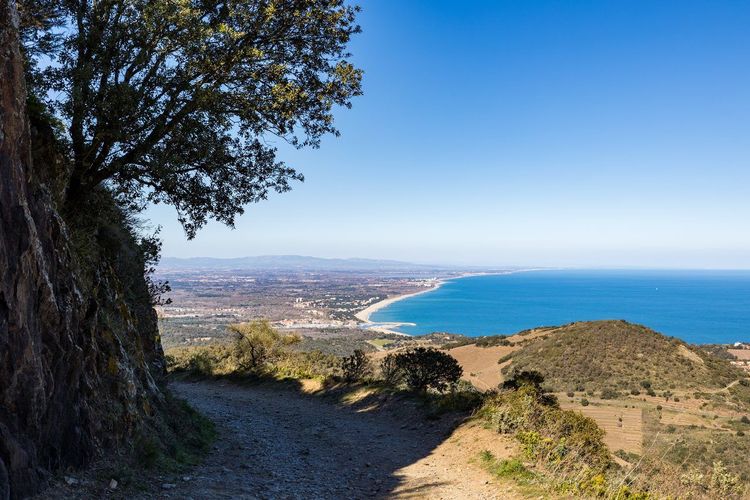
The massifs around Collioure are classified as high fire-risk zones from June to September, with possible access restrictions on certain days of strong wind or prolonged drought. Check at the town hall or on the notice boards posted at trailheads before setting off, particularly for the Tour Madeloc and the Albères massif, where access may be temporarily prohibited.
There are no water points on the majority of the ridge routes: always set off with at least 1.5 litres per person, more for outings beyond three hours or in intense heat. Let someone know your route for longer hikes such as the col de Banyuls or the Tour de la Massane, as mobile coverage remains patchy on certain ridges, particularly in the Albères massif.
Where to Sleep and Eat after the Hike
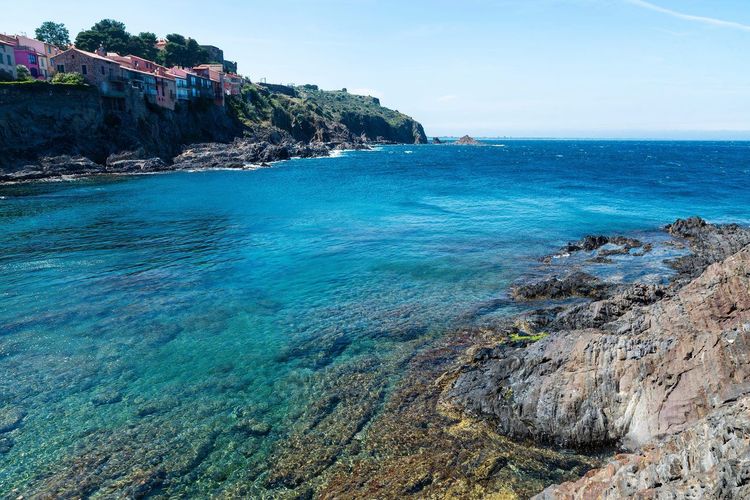
Collioure concentrates most of the area's characterful accommodation, with several guesthouses installed in the Mouré quarter, a short walk from the coastal trailheads and the heights of Collioure. Booking several weeks in advance remains essential in July and August, as demand far outstrips availability in a village that numbers barely more than 3,000 permanent inhabitants.
On the budget side, bear in mind that Collioure remains one of the most sought-after villages on the Catalan coast in high season, with room rates that climb steeply in July and August. Staying in Argelès-sur-Mer or Sorède, fifteen minutes by car, allows you to cut costs considerably while remaining within easy reach of the trailheads for the Albères massif or Château d'Ultrera. Many hikers choose this base as a way to explore the area over several days without blowing their accommodation budget.
After a hike, the harbour terraces remain the reliable choice for a simple meal: Collioure anchovies, grilled fish and Banyuls rosé make up the backbone of local menus, often served with a direct view of the royal castle. Port-Vendres, less touristy, offers fishermen's addresses that are often better value for a quick lunch, particularly around the morning market.
To extend the discovery beyond the trails, this Ryo article on the best activities in and around Collioure lists a few additional addresses, useful for filling a rest day between two hikes or an evening after a long climb to the ridges.
Maps, Apps and Trail Markers
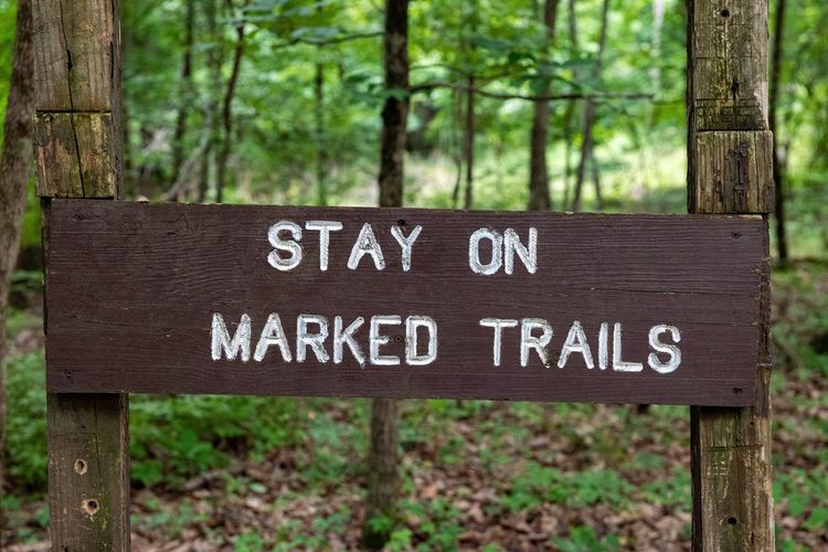
The trails around Collioure are generally well waymarked, with yellow markers or red-and-white stripes depending on whether they are local loops or sections of the GR10. On exposed ridges such as those leading to the Tour Madeloc or the Albères massif, however, waymarking becomes sparser, which is why it is worth downloading a map in advance rather than relying solely on signposts.
Community platforms such as Visorando catalogue most of the GPX tracks in the area, useful alongside a 1:25000 IGN paper map, which is always more reliable in the event of signal loss on isolated ridges. The Ryo app, meanwhile, helps you prepare the village discovery side of things before heading out to walk, placing the viewpoints and points of interest encountered along the way — between painted facades and military remains — in their proper context.
FAQ
What is the sentier des douaniers in Collioure?
The sentier des douaniers, also known as the coastal path, runs along the rocky shoreline between Collioure and Port-Vendres for around 8 km. It takes its name from its historic use as a customs surveillance route against smuggling, before becoming one of the most popular hiking trails in the region, prized for its uninterrupted views over the Mediterranean.
What easy hike can I do around Collioure?
The walk to the Notre-Dame de Consolation hermitage, just 4 km round trip with minimal elevation gain, is well suited to a family outing. The first section of the coastal path, as far as Anse Dougnon, is another accessible option completable in under two hours, with no particular technical difficulty.
How do you walk from Collioure to Port-Vendres?
The chemin des douaniers links the two villages in around 3h30 to 4h of walking, via the Cap Béar lighthouse. A return by bus line 400 avoids retracing the route in reverse, a practical option at the end of the day when legs start to tire.
Can you hike from Collioure to Banyuls-sur-Mer?
Yes, via the col de Banyuls through the classified vineyards, covering 11 km and around 4h of walking. A shorter variant allows you to reach just the col before turning back, for a half-day outing without complicated return logistics.
Where can I find a map of the coastal path around Collioure?
The 1:25000 IGN map of the Côte Vermeille area remains the most reliable reference, supplemented by GPX tracks available on platforms such as Visorando. The tourist offices of Collioure and Port-Vendres also distribute free paper maps at the main trailheads.
How long does it take to climb to the Tour Madeloc from Collioure?
Allow 3h to 3h30 round trip for the 7 km and 550 metres of elevation gain that separate the village from the tower. It is best to set off early in the morning, as the ascent faces due south with little shade for its first half.
Across these twelve routes, Collioure reveals a far more vertical face than its postcard image as a colourful fishing port might suggest. Between the chemin des douaniers, the Albères ridges and forgotten forts, there is enough to fill several days of walking without ever straying more than an hour's drive from the village. Before leaving, a final tour through the Ryo audio guide of Collioure offers a fresh reading of the lanes crossed on the way back from each hike, between colourful facades and memories of the Fauvist painters who made the village's reputation far beyond Roussillon.