© Shutterstock
 Votre guide Ryo
Rouen Neighborhoods: the Complete Guide to Choosing Wisely in 2026
The Seine splits Rouen in two, and for a long time this liquid boundary also drew a social divide. On one side, the right bank and its Gothic cathedral, whose cast-iron spire held the title of the world's tallest structure between 1876 and 1880. On the other, a left bank that was long industrial and is now being transformed by urban renewal projects that have taken shape in less than ten years. Between the two stretches a mosaic of districts with distinct identities, from the market stalls of the place Saint-Marc to the half-timbered lanes of the Vieux-Rouen. This guide to Rouen's right-bank and left-bank neighborhoods covers each of them in detail, with their strengths, their limitations, and the things worth knowing before settling in or simply strolling through. You will also find everything you need to plan a walk that stays true to the city's history, including through the Ryo audio-guided tour of Rouen, which connects several of these districts on foot in 1 hour 45 minutes.
One figure is enough to measure the gap between neighborhoods: the price per square meter can vary by a factor of two between the historic center and some peripheral areas. You will also find a live music scene born inside a former dockside warehouse, an open-air market that spills across four mornings a week, and a former plague cemetery turned into a cultural venue. All of which puts significant nuance on the image of a so-called rough Rouen that some articles enjoy overstating without evidence.
Rouen, a City Split Between Two Banks
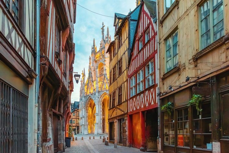
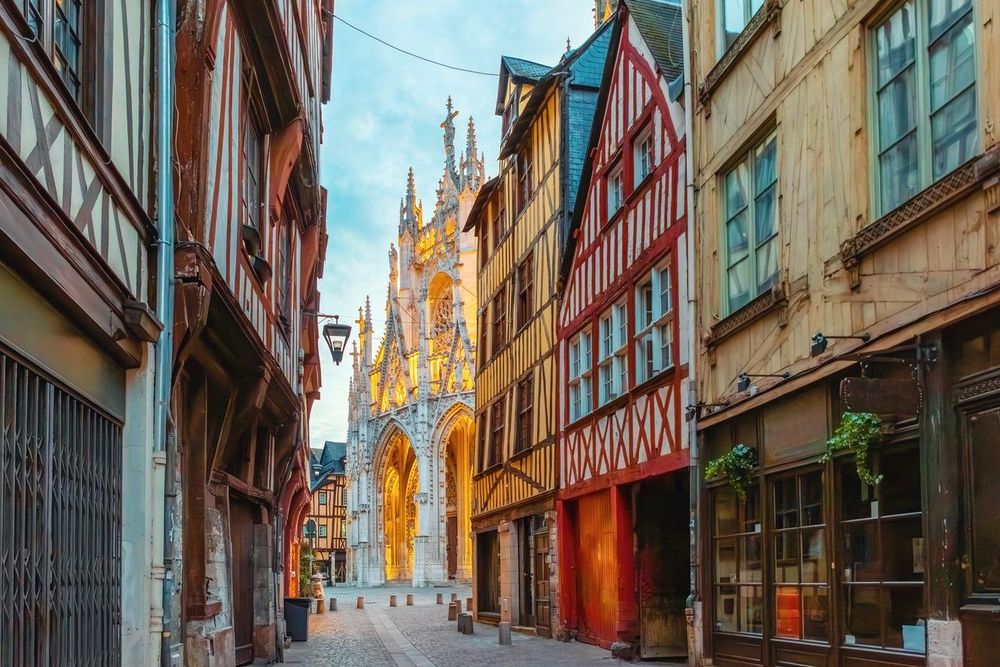
After the bombings of 1944, which destroyed a large part of Rouen's built fabric, reconstruction followed an almost binary logic. The right bank, largely spared around the cathedral, retained its status as the historic and commercial center. The left bank, by contrast, was home to the docks, textile factories, and railway lines. This distribution shaped the city's image for a long time, well after the last factories closed in the 1980s.
Crossing the pont Boieldieu (Pont Boieldieu, 76000 Rouen, rated 4.6/5 on Google with 1.2K reviews) at the end of the day gives a good sense of this contrast. On the right bank, the terraces of the Vieux-Marché and the shopfronts along the Gros-Horloge draw a crowd of tourists and locals alike. On the left bank, the atmosphere shifts: converted warehouses, wide avenues, and 1960s housing blocks now standing alongside new residential developments.
For a visitor in a hurry, the right bank concentrates the bulk of the listed heritage and can be covered on foot in half a day. For someone considering moving to Rouen, the left bank deserves closer attention: prices remain noticeably lower, the Seine is more present in daily life, and several areas have been undergoing active urban renewal for about ten years.
Administratively, the city divides this mosaic into twelve official neighborhoods, nine on the right bank and three on the left. This zoning, useful for census data and neighborhood councils, does not always match the way residents actually live: many Rouen locals refer to their area by its market, its square, or its landmark church, from the Vieux-Marché to the bell tower of Saint-Maclou. It is this lived geography, rather than the administrative map, that shapes the rest of this guide.
The Historic Heart: Cathedral, Gros-Horloge, and Vieux-Marché
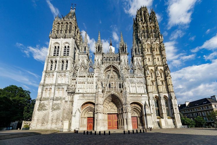
The area stretching between the cathédrale Notre-Dame de Rouen and the place du Vieux-Marché concentrates most of what visitors come to see. Monet painted its façade around thirty times from a neighboring window, obsessed by the way the Norman light changed its colors throughout the day. The current cast-iron spire rises to 151 meters: designed after the fire of 1822, it made the cathedral the world's tallest structure from 1876 to 1880, until Cologne Cathedral reclaimed the title.
Walking up the rue du Gros-Horloge, the astronomical clock of the Gros-Horloge still marks the hours beneath its Renaissance arch. Its mechanism, dating back to 1389, is among the oldest in France still in operation, and the dial displays the phases of the moon. The street itself, entirely pedestrianized, remains the busiest commercial artery in the center.
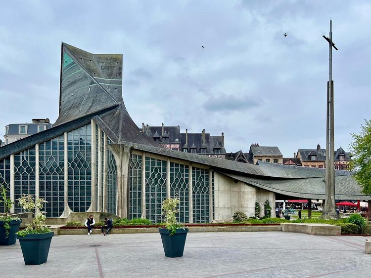
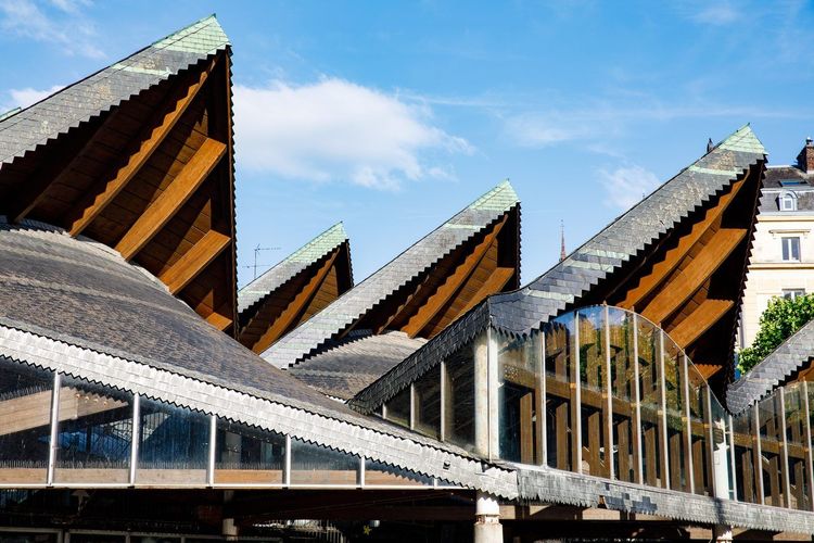
Two minutes away, the place du Vieux-Marché carries a weightier memory: this is where Joan of Arc was burned at the stake in 1431. The church of Sainte-Jeanne-d'Arc, with its unmistakable contemporary silhouette, was inaugurated here in 1979 on that very spot. Around it, covered market halls and café terraces make the square a place of everyday life as much as a memorial site. This is also where, on the rue de la Pie, Corneille's birthplace stands; our article on the houses of Corneille and Flaubert details the itinerary if you are planning a literary walk.
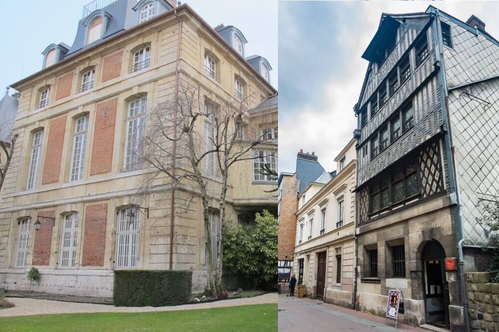
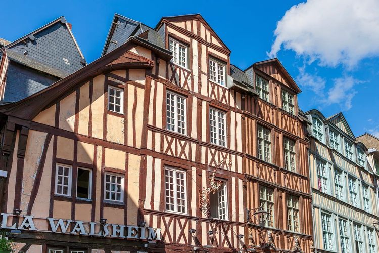
If you then head east along the rue Martainville, the Aître Saint-Maclou (Rue Martainville, 76000 Rouen, rated 4.6/5 on Google with 2,254 reviews) surprises with its past as an ossuary linked to the plague of 1348: the half-timbered frames carved with skulls and bones date from the 16th century. The School of Fine Arts remained here until 2014; after extensive renovation, the site reopened to the public in 2020 and now hosts exhibitions and a gallery dedicated to fire arts. For this particularly dense area, it is best to set aside a full half-day: every street hides a half-timbered façade or a narrow alley that rewards a second glance.
Saint-Marc, the Working-Class Neighborhood with a Century-Old Market
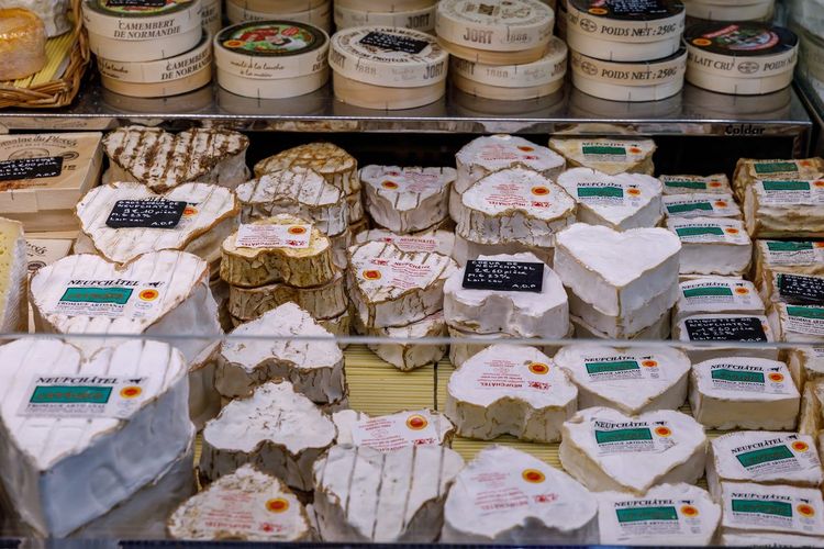
To the east of the center, the Saint-Marc neighborhood in Rouen lives to the rhythm of its market. Set up on the place Saint-Marc, it runs four mornings a week — Tuesdays, Fridays, Saturdays, and Sundays — and brings together dozens of produce stalls, with a flea market running from Friday to Sunday. Sunday morning remains the main event, one of the most popular in the greater metropolitan area.
The neighborhood remains resolutely working-class, with a more mixed housing stock than the historic center: older apartment buildings, some 1970s blocks, and a student population drawn by rents more affordable than in the city center. There is also a dense network of community associations, fueled in part by the major events and gatherings in Rouen that punctuate the local calendar, from the Christmas market to the spring flea markets.
This mix appeals to those seeking a less tourist-heavy daily life. It also means accepting a rougher street atmosphere on some evenings, though nothing that justifies the sometimes exaggerated reputation that circulates online.
Saint-Sever, the Left Bank Reinventing Itself
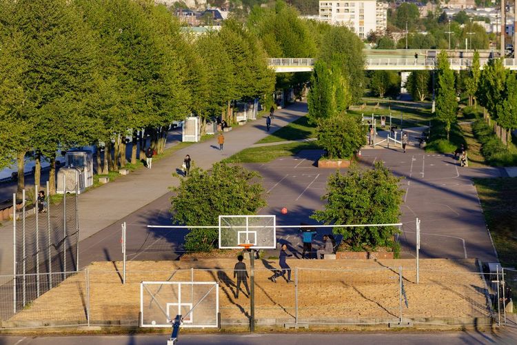
Saint-Sever was long the poor relation of Rouen: a working-class district that later became a commercial hub of little charm, centered on a shopping mall built in the 1970s. That picture is gradually changing, with urban renewal schemes along the left-bank quays and the longer-term prospect of a new Rouen Saint-Sever station planned as part of the Paris-Normandie high-speed rail project.
Today, it is mainly the metro and the TEOR bus rapid transit lines that connect the area to the center in just a few minutes; long-distance trains still depart from the Rouen-Rive-Droite station. Around it, new residential developments are completed every year, driven by the promise of a neighborhood cheaper than the center but better connected than before.
The contrast remains stark between the immediate riverfront, which has been revamped and is well-frequented, and the streets further back, still marked by aging buildings. If you are considering the left bank for accommodation, it is worth visiting on a weekday during the day before making a decision: the neighborhood's atmosphere shifts noticeably depending on the time, as is common in many areas undergoing urban transition.
On the cultural side, a little further west along the allée François Mitterrand, the 106 occupies a former dockside warehouse converted into a live music venue. Concerts, artist residencies, and rehearsal studios keep the quays alive throughout the year: one of the best examples of how the left bank recycles its industrial past rather than erasing it.
Jouvenet and Beauvoisine, the Residential and Student Side of Rouen
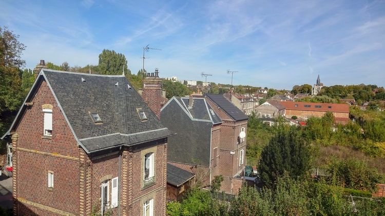
To the north of the historic center, the Jouvenet and Beauvoisine neighborhoods offer a quieter face of Rouen: 19th-century bourgeois buildings, calm streets, and immediate proximity to several university faculties, making it a popular area for students and young professionals.
The rue Beauvoisine, which gives the neighborhood its name, is home to the Muséum d'Histoire Naturelle, whose collections rank among the richest in France outside Paris, with an ornithology collection renowned well beyond Normandy.
You will find a quieter pace of life here than in the city center, with rents that sit between those of the Vieux-Rouen and the outskirts. It is often the compromise chosen by those who want to stay within walking distance of the historic core without paying the price.
Luciline and the Flaubert Project, Rouen After Industry
Between the pont Flaubert and the center, on the right bank, the Luciline eco-district was built in just a few years on former industrial and port brownfields. Contemporary low-energy buildings, pedestrian pathways along the river, and circulation designed for cyclists rather than cars: the atmosphere is deliberately different from the rest of the city, with resolutely modern architecture and an almost complete absence of historic heritage.
Nearby, the Docks 76 (Boulevard Ferdinand de Lesseps, 76000 Rouen, rated 4.1/5 on Google with 10,360 reviews), located on the boulevard Ferdinand de Lesseps, have turned this stretch of the right bank into a retail and leisure hub, alongside the Kindarena sports arena. This is the part of Rouen that has changed most dramatically over the past twenty years.
On the other side of the river, the Flaubert project extends this logic across dozens of hectares of former left-bank port land, with housing and public spaces being delivered in phases. These neighborhoods will not suit those who come to Rouen for its historic character. They do appeal, however, to working professionals in the metropolitan area who are looking for a modern living environment, close to the center by bike, without the constraints of an older building.
Pasteur, Chartreux, Croix-de-Pierre: Everyday Neighborhoods
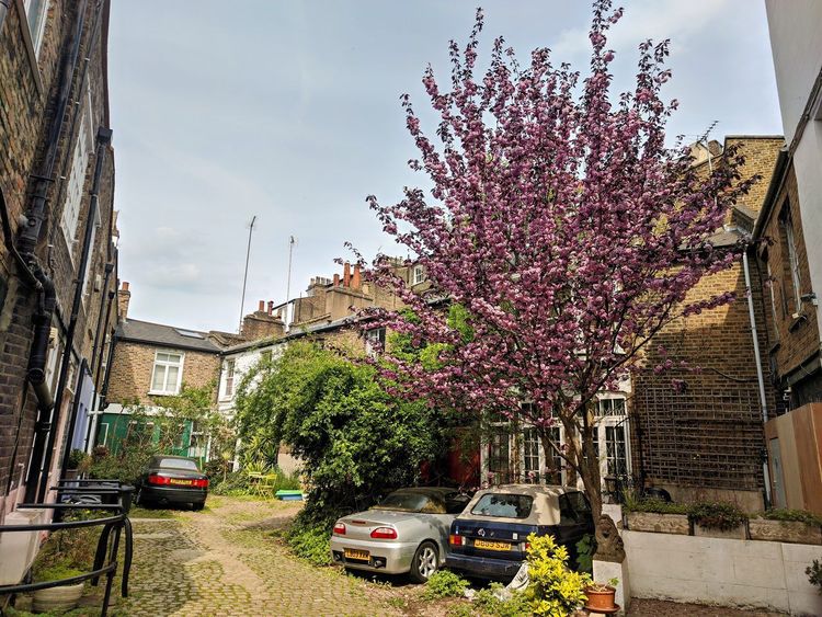
These three areas, less often mentioned in tourist guides, form the residential backbone of the city. Pasteur and les Chartreux remain largely made up of individual houses, a rarity in a city as dense as Rouen.
Croix-de-Pierre, on the left bank close to the bridges, combines older apartment buildings with small local shops. Life here is unaffected by the tourist crowds of the Vieux-Marché, and the center is just a few minutes away.
These are neighborhoods designed for everyday living rather than sightseeing: few listed monuments, but schools, local markets, and some of the most accessible property prices in the city. They appeal mainly to families and first-time buyers rather than passing visitors. For the postcard side of Rouen, Ryo's audio-guided tour circles back to the historic centre and its half-timbered streets.
Around the Charles-Nicolle University Hospital
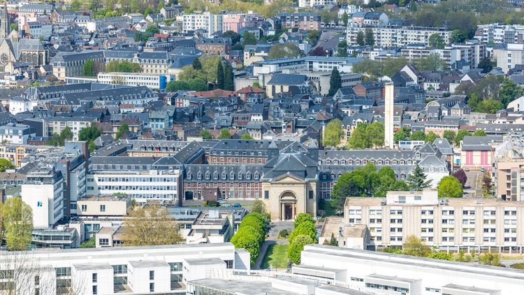
The area around the Rouen University Hospital, near the Charles-Nicolle Hospital, concentrates a specific type of accommodation: proximity sought by medical staff, families of hospitalized patients, and medical students.
The neighborhood, perched on the heights to the northeast of the center, remains primarily residential, with a handful of essential shops around the hospital. If you are looking to rent near the university hospital for a hospital stay or an internship, expect prices close to those in the city center, as demand remains tight year-round due to the constant flow of staff and visitors.
Where to Stay in Rouen Based on Your Profile
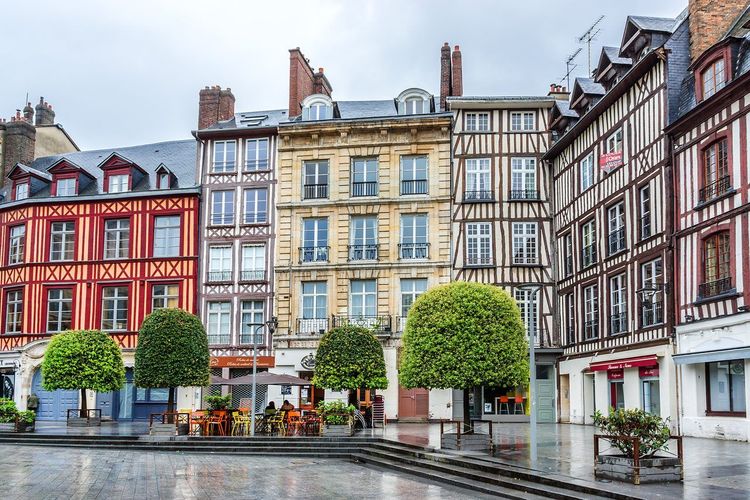
The choice of neighborhood depends first on what you are looking for. For a two- or three-day tourist stay, the Vieux-Rouen and its immediate surroundings remain the most practical choice: everything is walkable, the cathedral and the Gros-Horloge are just a few minutes away, and the accommodation offer is at its densest.
For a student, Saint-Marc, Jouvenet, or Beauvoisine combine proximity to university faculties with rents more affordable than the city center. Since the metropolitan campuses are spread across Mont-Saint-Aignan, the city center, and Saint-Étienne-du-Rouvray, it is above all worth checking your actual commute time by metro or bus before signing a lease.
For a long-term move, Saint-Sever and the renewal areas on the left bank offer the best balance between price, modern housing stock, and transport links to Paris. Families tend to gravitate toward Pasteur, les Chartreux, or Croix-de-Pierre for the space and the quiet.
If you want to combine exploration with practical logistics, the Ryo audio-guided tour of Rouen starts from the historic center and lets you scout several neighborhoods on foot, across 4 kilometers and 27 Ryo audio tracks, before deciding where to put down your bags.
Neighborhoods to Avoid: What the Numbers Actually Say
The search query "Rouen neighborhoods to avoid" comes up frequently online, driven by a handful of local news stories. The reality is more nuanced than the idea of a rough Rouen suggests. The areas classified as priority neighborhoods under national urban policy are located mainly in the Hauts-de-Rouen on the right bank: Sapins, Châtelet, Lombardie, Grand'Mare, Grieu. On the left bank, the Grammont area has also been the subject of urban renewal programs for several years.
This administrative classification reflects socio-economic indicators, not a particular level of danger for a passing visitor. These neighborhoods, located away from the tourist circuits, are not on the route of a typical visit in any case.
The most useful advice remains the same as in any city: avoid relying solely on online forums, prefer a daytime visit before judging a neighborhood, and consult a local estate agency rather than strangers on the internet if you are considering living there.
Getting Around Between Neighborhoods
Rouen is easy to get around thanks to the Astuce network, which combines two metro lines (A and B), the TEOR high-frequency bus lines, and a conventional bus network serving both the upper districts and both riverbanks. The historic center itself is explored exclusively on foot: most of the streets in the Vieux-Rouen are pedestrianized, which is why the Ryo audio guide covers its entire route without any intermediate transport.
To travel between the right bank and the left bank, allow about ten minutes by metro between the right-bank station and Saint-Sever, or about twenty minutes on foot across one of the bridges. The things to do in Rouen and the surrounding area usefully complements this guide if you are planning to venture beyond the central neighborhoods for a day trip.
The Map of Rouen's Neighborhoods, District by District
There is no single official map of Rouen's neighborhoods, but rather several overlapping divisions: the INSEE breakdown for statistics, the city hall's twelve-neighborhood system with their councils, and the looser boundaries used by residents who name their area by familiar landmarks.
To keep things simple, think in terms of three main blocks: the historic center on the right bank, the eastern and northern part of the right bank including Saint-Marc, Jouvenet, and the Hauts-de-Rouen, and the left bank as a whole, which encompasses Saint-Sever, the future Flaubert district, and the residential areas to the south. This three-block reading is more than enough to organize a visit or think through a potential move.
FAQ
What are the best neighborhoods in Rouen for visiting the city?
The Vieux-Rouen, around the cathedral and the Gros-Horloge, remains the area richest in heritage and the easiest to explore on foot. Saint-Marc is worth a visit on a Sunday morning for its market, and the left bank appeals to those who want to see contemporary Rouen, between revamped quays and the cultural scene at le 106.
Which neighborhood in Rouen should be avoided?
No area needs to be systematically avoided by a passing visitor. The neighborhoods classified as priority zones, mainly in the Hauts-de-Rouen and in Grammont, face documented social challenges, but they are located away from tourist areas and present no particular danger for anyone walking through during the day.
How many neighborhoods does Rouen have?
The city has twelve official neighborhoods, nine on the right bank and three on the left bank, each with its own neighborhood council. In everyday language, Rouen residents distinguish even more, referring to a square, a market, or a church.
Where is the Saint-Marc neighborhood in Rouen?
Saint-Marc is located to the east of the historic center, on the right bank, about fifteen minutes' walk from the cathedral. It is recognizable by its square and its market, which is held on Tuesdays, Fridays, Saturdays, and Sundays.
Is there an official map of Rouen's neighborhoods?
The city hall publishes a breakdown into twelve neighborhoods with their councils, but it coexists with the INSEE statistical zoning and the names used by residents in everyday life. None of these documents serves as the sole reference.
Where to stay near the Rouen University Hospital?
The streets immediately surrounding the Charles-Nicolle Hospital offer the closest accommodation, but demand is high year-round. Beauvoisine and Jouvenet, a few minutes' walk downhill toward the center, often offer a better price-to-distance ratio.
Ultimately, choosing a neighborhood in Rouen comes down to choosing what you are looking for first: the heritage and walkability of the Vieux-Rouen, the lively and food-loving atmosphere of Saint-Marc, or the ongoing transformation of both riverbanks. None of these areas is objectively better; they simply serve different needs.
If you are planning a stay rather than a permanent move, the simplest approach is to start with the historic center and broaden your exploration day by day. The Ryo audio guide for Rouen is designed for exactly this kind of progressive walk, neighborhood by neighborhood, with the historical context needed to understand why the city developed as it did on both sides of the Seine.
À lire également