© Shutterstock
 Votre guide Ryo
Los Angeles Without a Car: A Practical Neighborhood Guide for 2026
Los Angeles built its entire mythology around the automobile, so the question sounds almost heretical: can you actually visit Los Angeles without a car? The short answer is yes, and thousands of visitors do it every year, riding a growing rail network that links Downtown, Hollywood and the beach in ways the city rarely gets credit for. This guide walks through the FlyAway Bus that meets your flight at LAX, the Metro lines threading through DTLA and Koreatown, and the DASH shuttles that climb the hill to Griffith Observatory when no regular bus quite reaches the top. You'll find a car-free day trip to Pasadena, a realistic two-to-three-day itinerary and the neighborhoods worth basing yourself in. Along the way, Ryo's audio-guided tour of Los Angeles fills in what a transit map can't: what you're actually looking at once you step off the train.
Is It Really Possible to Visit Los Angeles Without a Car?
Yes, but it takes more planning than a trip to New York or Chicago. Los Angeles spreads across roughly 500 square miles of basin and hillside, and that sprawl is exactly why so many travelers assume you need a car in Los Angeles to see anything worthwhile. The truth is narrower: you need a car to see everything, but not to see a great deal of it.
The Metro rail network, expanded steadily since 2016, now reaches Downtown, Hollywood, Koreatown, the Arts District and Pasadena, with newer extensions pushing further into the Crenshaw corridor. Pair that with DASH shuttles, rideshare for the last mile and a willingness to walk, and a car-free Los Angeles itinerary covers a surprising amount of ground: museums, beaches, a working observatory and some of the best food in the country.
Where it gets harder is at the edges: Malibu, the San Fernando Valley's quieter corners and anything past Griffith Park's northern reaches lean heavily on driving. So the honest framing isn't possible or impossible, it's a trade. Pick a compact cluster of neighborhoods connected by rail, and skip the ones that aren't. That's the approach this guide takes.
Getting Into LA: FlyAway Bus, Union Station and Airport Transfers
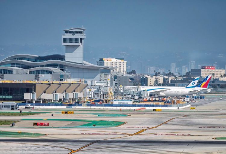
Most car-free trips start at LAX, and LAX itself is part of the problem: no terminal connects directly to rail yet. The LAX/Metro Transit Center (C and K Lines) opened in 2025, but the SkyLink people mover meant to link it to the terminals is still in testing, with passenger service now forecast for early 2027. Until then, the free airport shuttles are the only bridge.
The simplest option for reaching Downtown is the FlyAway Bus, a nonstop coach that picks you up at the curb of every terminal, from Terminal 1 to Tom Bradley International, and runs to Union Station (800 N Alameda St, Los Angeles, CA 90012, rated 4.5/5 on Google (14 293 avis)) roughly every 30 minutes (every 20 at peak times), day and night. The ride takes 30 to 45 minutes depending on traffic and drops you inside Union Station itself, which means you can step off one vehicle and onto the Metro B or D Line within minutes. A one-way ticket costs just under $10 and can be paid by card or TAP, so you won't be fumbling for change.
Union Station itself is worth a slow look, not just a rushed transfer. Opened in 1939, it's one of the last great Mission Revival train stations built in the United States, with a barrel-vaulted ticket hall, patterned tilework and a courtyard that feels closer to a mission church than a transit hub. It also functions as the city's multimodal anchor: Metro Rail, Metrolink regional trains, Amtrak and local buses all converge here, so almost every car-free itinerary in this guide loops back through it at some point.
If you'd rather skip the bus altogether, rideshare from LAX to Downtown runs $35 to $55 depending on time of day, and shared airport vans split that cost across multiple stops. For a first orientation to the city before diving into transit logistics, Ryo's guide to things to do in Los Angeles is a useful companion for mapping out what's worth prioritizing once you land.
Master the LA Metro: Rail, Buses and DASH Shuttles
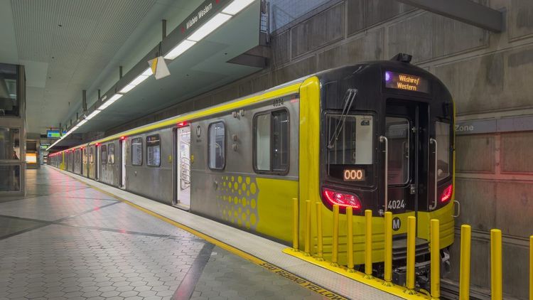
Los Angeles Metro is bigger than its reputation suggests: six rail lines (identified by letters rather than colors since a 2020 rebrand), over a hundred bus routes and a combined network that logs hundreds of thousands of boardings every weekday. None of that matters if you don't know how to use it, so here's the practical version.
Buy a TAP card before your first ride, either at a vending machine in any station or through the TAP app on your phone. A single fare costs $1.75 and covers transfers within two hours, and fare capping stops charging you once you've spent $5 in a day, so you never need to decide on a pass in advance. Reloading is instant at station kiosks, so there's no need to stockpile fare in advance.
Rail lines worth knowing. The B Line subway runs from Union Station through Downtown and up into Hollywood and North Hollywood, making it the backbone for the itineraries in this guide. The A Line light rail runs from Pasadena and the Arts District down to Long Beach, useful for the Pasadena day trip below. The E Line connects Downtown to Santa Monica along a route that roughly follows the old Pacific Electric right-of-way, and it's the single most useful line for beach access without a car. The D Line subway got its long-awaited extension on May 8, 2026: it now runs under Wilshire Boulevard from Koreatown to Wilshire/La Brea, Wilshire/Fairfax (Museum Row) and Wilshire/La Cienega on the edge of Beverly Hills, with further sections toward Century City and Westwood still under construction.
Trains run every 8 to 12 minutes during the day on most lines, stretching to 15-20 minutes in the evening. Service starts around 4:30 or 5 a.m. and generally wraps up around midnight, so plan your last ride back accordingly, especially after a late dinner in Downtown or a sunset in Santa Monica.
Buses fill the gaps rail doesn't reach. Metro's local bus network is dense in the flatlands (Wilshire Boulevard, Pico, Vermont) but thins out in the hills, which is exactly where DASH shuttles come in. These are small, cheap ($0.50-$0.75 a ride) circulator buses run separately from Metro, and they cover specific neighborhoods: DASH Downtown loops through the Financial District and Arts District, DASH Hollywood/Wilshire links the Walk of Fame area to Koreatown, and the DASH Observatory/Los Feliz route climbs from the Vermont/Sunset station straight up to Griffith Observatory, solving what is otherwise the trickiest car-free connection in the city.
One honest caveat: LA Metro's reputation for safety is mixed, and it's worth being the same kind of alert you'd be on any big-city transit system after dark. Stick to busier stations in the evening, keep valuables out of sight, and you'll likely find the experience closer to routine than risky.
Rideshare, Walking and Biking Around the City
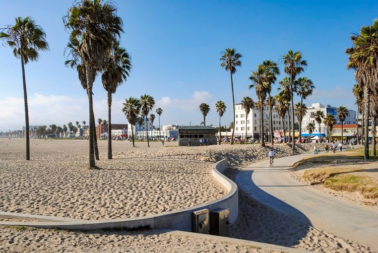
Metro and DASH cover the spine of a car-free trip, but the last half-mile is often faster on foot, by bike or in the back of an Uber.
Uber and Lyft are everywhere in LA and useful for the connections transit doesn't handle well: a late-night ride back to your hotel after the trains stop, a hop between two neighborhoods that don't share a direct line, or simply saving 25 minutes when a bus transfer would eat your afternoon. Rides within a single neighborhood typically run $8 to $15, and both apps operate at LAX, Union Station and every beach town in this guide.
Walking works better than most first-time visitors expect, but only within specific pockets: Downtown's Historic Core, the Third Street Promenade in Santa Monica, Hollywood Boulevard between Highland and Vine, and the Venice boardwalk are all properly walkable, with sidewalks, shade and things worth stopping for every block or two. Outside those pockets, distances stretch and sidewalks can thin out, so check the map before committing to a 20-minute walk that looks short on paper.
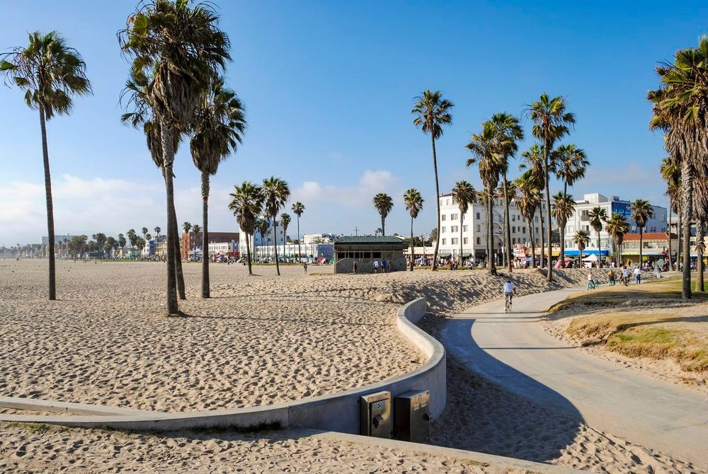
Bikes fill a useful middle ground. Metro Bike Share stations cluster around Downtown, Hollywood and the beach cities, with day passes around $5 and short rides included in the base fare. The bike path running from Santa Monica down to Venice and beyond is flat, mostly car-free and arguably the best way to cover that stretch of coastline. Bring your own lock if you plan to stop for lunch along the way; not every dock is where you'll want it to be.
Downtown LA (DTLA): Angels Flight, Grand Central Market and The Broad
Downtown Los Angeles (DTLA) rewards visitors who arrive by train more than almost any other part of the city, mostly because parking Downtown is expensive and the neighborhood was quite literally built around Union Station and the old Pacific Electric lines.
Start at Angels Flight), the world's shortest railway, a pair of orange funicular cars that have climbed Bunker Hill since 1901, with a long hiatus and a 2017 reopening after safety upgrades. The ride costs $1 and takes under a minute, but it drops you at California Plaza with a view back down Hill Street that's worth the fare on its own.
From there, it's a five-minute walk down to Grand Central Market), a sprawling food hall that's operated continuously since 1917. Expect a genuine cross-section of the city rather than a curated tourist stop: breakfast sandwiches next to decades-old Mexican stalls, Thai food, ramen, and a crowd that skews more local than the Walk of Fame ever will.
For something quieter, The Broad (221 S Grand Ave, Los Angeles, CA 90012, rated 4.7/5 on Google (18 260 avis)) sits a short walk north on Grand Avenue, a contemporary art museum built around a major private collection, with free general admission (timed entry tickets recommended in advance) and a mirrored infinity room as its most photographed corner.
Downtown's dining scene deserves its own mention: beyond Grand Central Market, the Arts District has turned into one of the city's more interesting food neighborhoods over the past decade, reachable on foot from the B Line's Little Tokyo/Arts District station.
Once you've covered the market and the museum, the Ryo audio-guided walking route through DTLA, the same one linked at the top of this guide, is worth downloading before you set off: it traces roughly this same path, past Angels Flight, Grand Central Market and The Broad, with short audio stories at each stop, so you're not just walking past history, you're hearing it explained as you go.
Hollywood Without a Car: Walk of Fame and Griffith Observatory
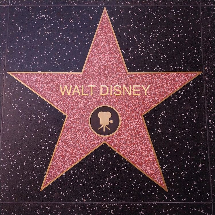
Hollywood is the one neighborhood in this guide that's arguably easier without a car than with one: parking near the Walk of Fame is scarce and overpriced, and the B Line drops you right on the Boulevard at the Hollywood/Highland station.
The Hollywood Walk of Fame) runs along Hollywood Boulevard and Vine Street, more than 2,700 brass stars set into the sidewalk since 1960. It's touristy in the way Times Square is touristy, crowded, a little scuffed at the edges, and still worth an hour if you slow down enough to spot a few names that surprise you.
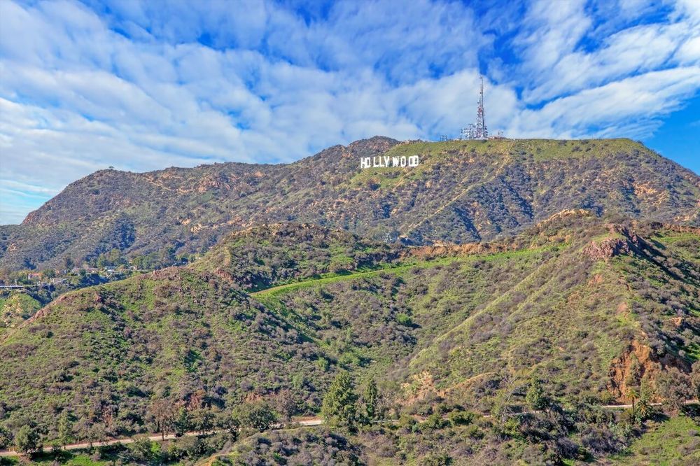
The harder question is Griffith Observatory (2800 E Observatory Rd, Los Angeles, CA 90027, rated 4.7/5 on Google (19 798 avis)), which sits at the top of a hill with no direct Metro stop. The DASH Observatory/Los Feliz shuttle runs from the Vermont/Sunset B Line station straight up to the observatory for 50 cents; check LADOT's current timetable before you go, since frequency drops on weekdays. Otherwise, a rideshare from Hollywood Boulevard takes about 15 minutes and costs roughly $12 to $18. Either way, arrive close to sunset if you can: the free telescopes open after dark, and the view over the Hollywood sign and the basin below is the kind of thing photos undersell.
Beyond the two headline stops, Hollywood rewards a slower afternoon: the TCL Chinese Theatre's forecourt of celebrity handprints, the Hollywood Museum housed in the old Max Factor building, and a genuinely good cluster of taco stands a few blocks south on Sunset.
For the full story behind the boulevard, from the silent-film era to the studios that still operate nearby, Ryo's Hollywood audio tour runs roughly 90 minutes on foot and works without a data connection, useful given how patchy cell coverage can get between the tall buildings near Highland.
Santa Monica, Venice Beach and The Coast
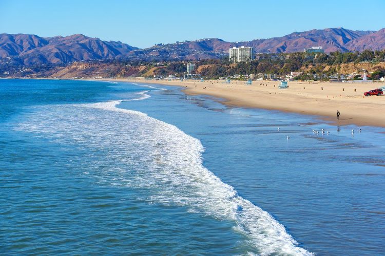
The E Line makes the coast the single easiest car-free excursion in this guide: about 50 minutes from Downtown to the Santa Monica terminus, with no transfers.
Santa Monica Pier) is the obvious first stop, a wooden pier dating to 1909 with a small amusement park, an aquarium underneath and a solar-powered Ferris wheel, a detail that surprises more people than it should. The Third Street Promenade, a few blocks inland, handles shopping and restaurants, and it's genuinely walkable from the E Line's Downtown Santa Monica station.
From the pier, a flat bike and pedestrian path runs south along the coast toward Venice Beach, about a 40-minute walk or 15 minutes by rented bike. Venice's boardwalk is louder and rougher around the edges than Santa Monica: street performers, muscle beach, vendors selling everything from sunglasses to hand-painted skateboards. That chaotic energy is exactly what makes it worth the trip.
Along the way, Perry's (930 Ocean Front Walk, Santa Monica, CA 90403, rated 4.3/5 on Google (823 avis)) rents beach cruisers and stand-up paddleboards directly on the path, a convenient stop if you didn't bring your own wheels and want to cover the stretch between the two beach towns faster than on foot.
One practical note: the E Line runs until roughly midnight on weekends, so if you're staying Downtown, don't linger past the last reasonable train back. Rideshare from the beach cities to Downtown late at night can run $40 or more with surge pricing.
This whole stretch, pier to boardwalk, is exactly the kind of route Ryo's audio guide is built for: something you can follow at your own pace, stopping wherever the water looks good, without worrying about parking meters or a car left baking in a beach lot.
More Neighborhoods to Explore Car-Free: Koreatown, Museum Row, Beverly Hills and Beyond
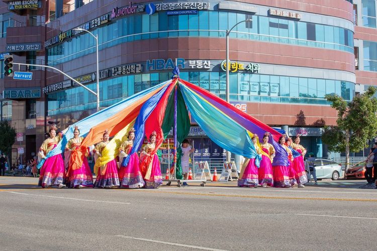
Beyond the postcard neighborhoods, Los Angeles has a long list of districts worth a detour, and grouping them by how you'd actually reach them makes more sense than listing each one in isolation.
Along the Wilshire corridor, Koreatown is the city's densest neighborhood and arguably its best-value food scene: Korean barbecue, 24-hour spas and a nightlife scene that runs well past midnight, all within walking distance of the Wilshire/Vermont (B and D Lines) and Wilshire/Normandie (D Line) stations. Stay on the D Line three more stops west and you reach Wilshire/Fairfax, the new front door to Museum Row: the La Brea Tar Pits, the Academy Museum and LACMA are all on the block. West Hollywood (WeHo) sits a short bus ride north on Fairfax, plus one of the country's most established LGBT nightlife districts along Santa Monica Boulevard, an area worth flagging separately for travelers specifically looking for LGBT Los Angeles.
Further west, Beverly Hills used to be awkward without a car; since May 2026 the D Line stops at Wilshire/La Cienega on its eastern edge, about 25 minutes on foot or a quick bus hop from Rodeo Drive. The shopping street and the palm-lined residential streets remain worth the detour for people-watching alone.
Near the harbor, San Pedro and Marina del Rey require more planning. Both are reachable via a combination of Metro bus and a transfer, and both reward the extra effort with a slower, more maritime side of the city: fishing boats, waterfront restaurants and considerably fewer tourists.
Two threads run through several of these neighborhoods rather than living in one place: LA's street art scene, concentrated in the Arts District and parts of Boyle Heights, and LA's live music scene, spread across small venues in Echo Park, Silver Lake and, again, Koreatown. Neither needs a dedicated trip; both reward keeping your eyes open wherever the Metro happens to drop you.
A Car-Free Day Trip to Pasadena
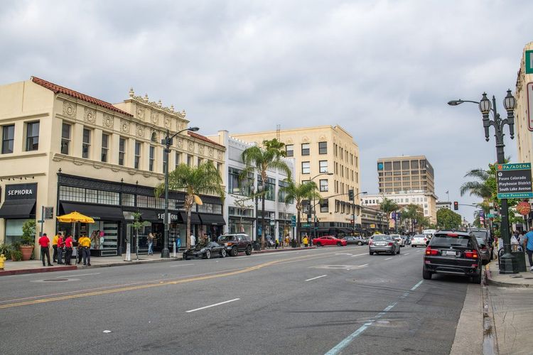
Pasadena makes an easy case for the best car-free day trip outside central LA, mostly because the A Line, the light rail once called the Gold Line before Metro's 2020 rebrand, runs directly from Union Station to Old Town Pasadena (Colorado Blvd, Pasadena, CA 91103, rated 4.6/5 on Google (1 664 avis)) in about 25 minutes, no transfers required.
Old Town itself is compact and walkable: a grid of restored 19th-century storefronts now filled with restaurants, bookstores and the kind of independent shops that have mostly vanished from Downtown LA. The Norton Simon Museum, about 20 minutes on foot west along Colorado Boulevard from Memorial Park station (or a few stops on bus 180), holds an outsized collection for a city this size, with a permanent collection built around one collector's eye.
If your visit lines up with New Year's Day, the Rose Parade rolls right down Colorado Boulevard, and the A Line is by far the easiest way in when every road is closed. It's a rare case where the car-free version of a Los Angeles day is actually the better one, not just the compromise.
Budget the full day: the ride out and back eats close to an hour combined, and Old Town alone can easily absorb three or four hours between the museum, lunch and a wander through the Playhouse District a few blocks south. Coming back, the A Line runs until around midnight, so there's no need to rush dinner to catch the last train.
Planning Your Car-Free Trip: Best Areas to Stay, Budget and How Many Days
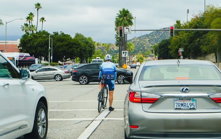
Keep the plan simple. The single biggest mistake car-free visitors make is trying to cram Downtown, Hollywood, Santa Monica and Pasadena into one exhausting day of transfers. Pick one or two neighborhood clusters per day, connected by a single rail line where possible, and let rideshare handle the awkward last-mile connections rather than the whole itinerary.
Where to stay matters more without a car than with one. Downtown and Hollywood both sit directly on the B Line, which makes them the two most forgiving home bases, everything in this guide is at most one or two transfers away. Santa Monica works well too if the beach is your priority, especially since the E Line runs straight back to Downtown when you want a change of scenery. Avoid basing yourself in the Valley or far West LA unless a rideshare budget doesn't worry you.
How many days do you need? Two days covers the essentials tightly: one for Downtown and Hollywood, one for the coast. Three days is more comfortable and leaves room for Pasadena or one of the secondary neighborhoods above without feeling rushed. Either way, a car-free Los Angeles itinerary rewards a slower pace than a driving trip would; you're trading some flexibility for neighborhoods you actually get to walk through rather than glimpse from a windshield.
Budget roughly $15-20 a day for transit, TAP fares plus the occasional rideshare, if you're sticking close to rail lines, more if DASH shuttles and longer trips to the hills factor in regularly.
As for living here without a car long-term, plenty of Angelenos manage it, mostly by choosing an apartment within walking distance of a B or E Line station and building a life around it. A quick scan of Reddit threads on the subject echoes the same conclusion this guide reaches: it's entirely possible in a handful of transit-connected neighborhoods, and genuinely difficult everywhere else.
Before you lock in an itinerary, it's worth pulling up Ryo's guide to what to do in Los Angeles alongside this one. Between the two, and Ryo's app running in your pocket without needing cell service or a rental car, you'll have a realistic two or three-day plan before you even land.
FAQ
Do you really need a car in Los Angeles?
No, not for a visit focused on Downtown, Hollywood, Santa Monica and Pasadena, all of which connect via LA Metro rail. You'll want a car, or frequent rideshare, only if Malibu, the deep Valley or Orange County day trips are on your list.
Can you live in LA without a car?
Yes, if you choose an apartment near a B or E Line station and build your routine around it. It's harder in car-dependent suburbs, and most long-term residents who manage it combine transit, biking and occasional rideshare rather than relying on one option alone.
How many days do you need to visit Los Angeles without a car?
Two days covers Downtown and the coast comfortably; three days adds Hollywood in full and a Pasadena day trip without feeling rushed. Budget extra transfer time compared to a driving itinerary.
What is the best area to stay in Los Angeles without a car?
Downtown or Hollywood, both on the B Line (Koreatown, on the B and D Lines, is a cheaper alternative), offer the most forgiving base with the fewest transfers to the rest of this guide. Santa Monica is a strong second choice if the beach is your priority.
How do I get from LAX to Downtown LA without a car?
Catch the FlyAway Bus at the curb outside your terminal and ride it direct to Union Station, about 30-45 minutes depending on traffic, for just under $10. From Union Station, the B Line connects onward to Downtown and Hollywood.
Is the LA Metro safe to use as a tourist?
Generally yes, especially during the day and on busier lines like the B and E. Use normal city precautions after dark, stick to well-lit, populated stations, and keep valuables out of sight.
Los Angeles without a car isn't the compromise it sounds like on paper. It trades the freedom of a rental for something transit actually does better: neighborhoods you walk through slowly instead of drive past, a Metro system that keeps expanding into places it didn't reach a decade ago, and the kind of unplanned stop, a mural, a taco stand, a view from Angels Flight, that a windshield tends to filter out.
Start with a TAP card and one or two neighborhoods per day, lean on DASH and rideshare for the gaps rail doesn't cover, and let the rest fill in as you go. And when you land, Ryo's audio-guided tour of Los Angeles is worth having open on your phone, a companion that keeps working whether or not you ever get behind the wheel.