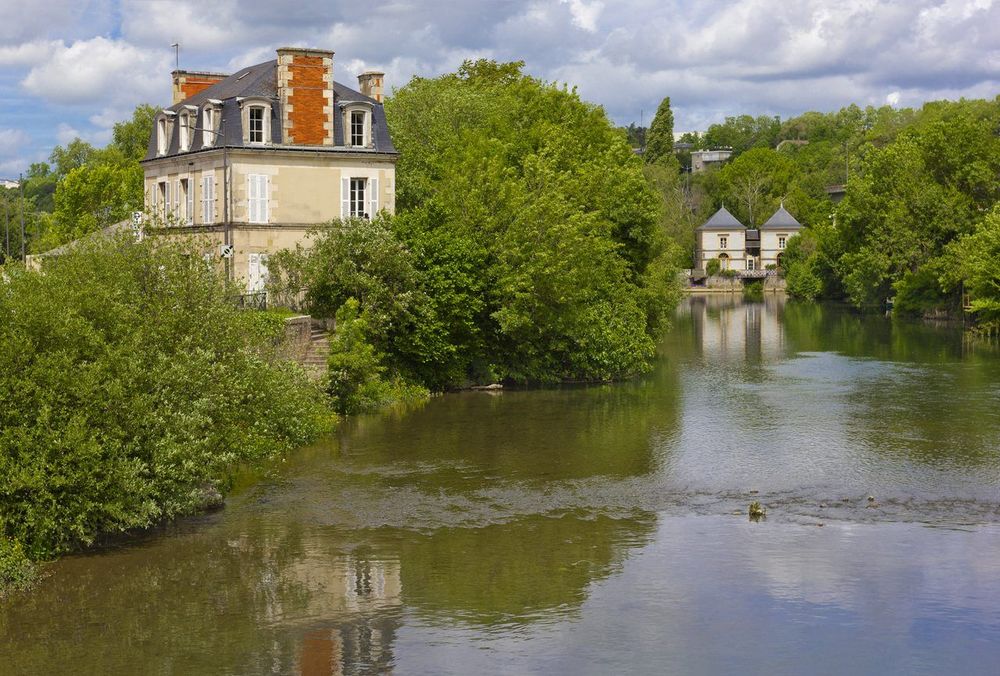
© Shutterstock
 Votre guide Ryo
Hiking around Poitiers: 12 Itineraries to Discover in 2026
Twenty minutes from the historic center, the road leaves the asphalt and plunges into a 6,800-hectare forest where you'll encounter more deer than hikers. That is the whole surprise of hiking around Poitiers: a city of art and history, surrounded by a limestone countryside woven with rivers, thousand-year-old abbeys and waymarked trails that start almost at the foot of the ramparts. Before lacing up your shoes, a detour via the Ryo audio-guided tour of Poitiers helps you understand why the city settled on this promontory between the Clain and the Boivre, two rivers that today trace the most beautiful walking loops in the area.
Among the itineraries listed here, some start on foot from the Parc de Blossac, while others require a twenty-minute drive to Chauvigny and its five medieval fortresses perched on a rocky spur. You will come across a monastery founded around 361 by Martin de Tours and still inhabited by monks, a battlefield where a king of France was captured in 1356, and two long-distance hiking trails that converge in the city before each heading off towards its own horizon. The Moulière forest alone contains more than 100 kilometres of drivable tracks. Enough to walk for months in the surrounding area without ever retracing the same path, from long sporting loops to short hikes of barely an hour.
Moulière Forest: the Green Lung within Reach of the City
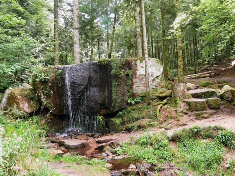
The Moulière forest alone covers around 6,800 hectares of oaks and pines, making it the largest wooded massif in the Vienne department, far ahead of the other state forests in the area. A former royal hunting reserve under the Ancien Régime, it long supplied timber before becoming the leisure space it is known as today. The massif extends east of Poitiers across eight communes, from Bignoux to Bonneuil-Matours via La Chapelle-Moulière, on an acidic plateau that peaks at around 120 metres in altitude. Twenty minutes by road from the city centre is all it takes to get there, making it the Sunday playground for a large share of Poitiers residents.
The most convenient starting point remains the Maison de la Forêt (Route de la Forêt, 86360 Montamisé, rated 4.3/5 on Google with 336 reviews), in Montamisé, a large timber building constructed in 1991 at the heart of the massif, serving as an exhibition space, information point and car park for hikers.
From there, several waymarked loops head into the forest stands, ranging from 5 to 14 kilometres depending on the time available, with the most classic route covering around 11 kilometres for nearly three hours of walking. The shorter ones are suitable for a family hike on flat, sandy terrain that remains shaded even in midsummer. The longer ones cross wilder high forest, where silence is broken only by the black woodpecker and, sometimes, by a wild boar passing at dawn. Trail runners particularly appreciate the straight forest tracks, renowned for their soft surface that is gentle on joints over long distances.
In terms of flora and fauna, the massif is home to 22 rare or threatened plant species and birds uncommon in western France, such as the honey buzzard or the yellow-bellied toad found near the forest ponds. Red deer and roe deer are plentiful, which explains the presence of discreet hunting lookouts at the edge of certain stands. In autumn and winter, driven hunts are organised: a sign at the entrance to the massif indicates the days and zones concerned, worth checking before you set off. For the rest of the year, the forest lends itself equally well to walking, mountain biking or horse riding, with wide tracks that never require passing in a single direction. Many families from Poitiers also come to pick mushrooms in September and October, a use that is tolerated as long as the harvest remains reasonable.
If you are looking to combine two itineraries in a single day, note that the southern edge of the massif connects almost directly to the heights of Chauvigny, just fifteen minutes' drive away: an option for hikers who want to combine nature and heritage without passing back through the city.
The Banks of the Clain: a Nature Escape from the City Center
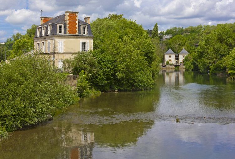
This is undoubtedly the most practical itinerary for those staying in Poitiers without a car. The path along the banks of the Clain heads south from the heart of the city to the communes of Ligugé and then Vivonne, along a route shared between walkers and cyclists, laid out along former industrial riverbanks. The GR364 also follows part of this valley as it leaves the city.
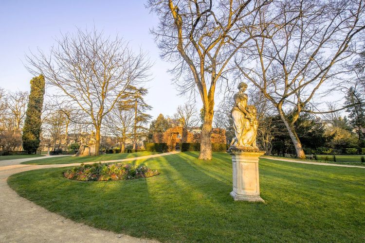
The classic starting point is the Parc de Blossac (Boulevard de Blossac, 86000 Poitiers, rated 4.5/5 on Google with 4,125 reviews), a French-style garden laid out in the 18th century by the intendant of the same name, which overlooks the valley from the old ramparts.
Leaving the park, the trail descends to the riverbanks and follows the watercourse in the shade of poplar trees. You will pass under several road bridges before reaching a more rural landscape, punctuated by restored mills and wash houses that recall the valley's past activity, when watermills still turned to grind grain or tan leather. Allow around 1h30 for a one-way trip to Ligugé, or half a day for a leisurely return journey with regular stops to watch grey herons fishing along the shallow banks.
This stretch of the Clain lends itself equally well to walking and cycling: the surface is compacted along almost the entire route, making it a reliable choice for a family outing or a trip with friends unaccustomed to technical trails. Pushchairs and children's bikes can pass without difficulty along most of the route, a rare feature for an itinerary so close to the historic centre.
Many Poitiers residents take advantage of it after work, for a short one-hour walk without leaving the city: the section running alongside the Saint-Éloi district remains accessible in the evening, with urban lighting, even when dusk falls early on weekdays.
Nouaillé-Maupertuis: between a Thousand-Year-Old Abbey and a Battlefield
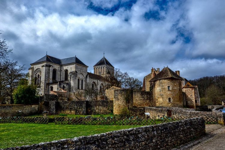
Just over 10 kilometres south of Poitiers, the village of Nouaillé-Maupertuis concentrates two layers of history within a very small perimeter. The first is monastic: the Abbaye Saint-Junien, a Benedictine foundation whose origins date back to the early Middle Ages, occupies the flat floor of the Miosson valley, in an old abandoned meander of the river. Its walls, towers and abbatial residence make it one of the most photogenic fortified religious complexes in the Vienne.
The second layer is military: it was here, on 19 September 1356, that the Battle of Poitiers took place, one of the great French defeats of the Hundred Years' War, in which King John II the Good was taken prisoner by Edward of Woodstock, the Black Prince, and then taken into captivity in England. The Sentier de la Bataille, waymarked from the abbey car park, covers part of this terrain over approximately 9 kilometres, or two and a half hours of walking through wet meadows, hillside woods and battlefield remnants.
If the full loop seems long for a first outing, a shorter version of around 6 kilometres allows you to discover the abbey, follow the Miosson and reach the communal wash house without venturing too far. The route is generally flat, with some sections through undergrowth that can be muddy after rain: shoes with good grip are recommended rather than simple town trainers, especially between November and March. Around twenty other circuits are listed in the commune and in the neighbouring Clain valleys, enough to return several times without ever retracing the same route.
The most curious hikers will take the opportunity to visit the interior of the abbey, whose Romanesque choir and carved stalls are well worth the mid-route stop. Interpretation panels, placed both on site and along the trail, trace the key stages of the 1356 clash. Take five minutes to observe the contrast between the valley floor, damp and enclosed, and the open plateaux where the English cavalry manoeuvred: the topography almost by itself explains how the day unfolded.
Chauvigny: Hiking among the Castles of the Vienne Valley
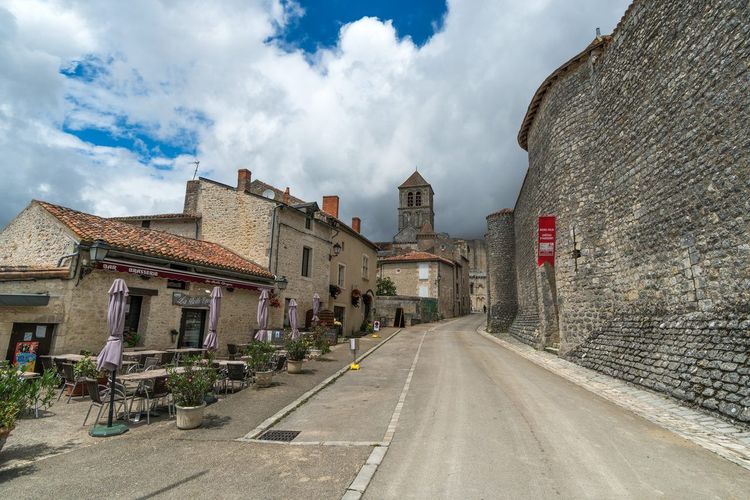
Chauvigny concentrates five medieval fortresses on a single rocky spur, a feat rare enough to justify the trip from Poitiers on its own, some twenty kilometres to the east. The baronial castle, also known as the bishops' castle, the Gouzon keep, the Château d'Harcourt, the Château de Montléon and the Tour de Flins follow one another along the same ridge overlooking the Vienne, linked by a trail walkable in a comfortable hour, with no significant elevation gain.
Below, the Collégiale Saint-Pierre (Rue de la Collégiale, 86300 Chauvigny, rated 4.6/5 on Google with 152 reviews) houses some of the most studied Romanesque carved capitals in the region, featuring biblical scenes and fantastical figures still legible despite centuries of exposure to the elements. Local guides enjoy recounting the story of the capital depicting the weighing of souls, one of the most photographed on the site.
To extend the walk, a trail descends to the banks of the Vienne, where several viewpoints allow you to photograph the ruins from the river, an angle that most hurried visitors never take the time to seek out. The water, calm at this point, also lends itself to a picnic stop with your feet almost in it, sheltered from the bustle up above.
Walkers who want a proper loop rather than an urban visit can take the Sentier des Grippes, starting from the Peuron sports hall: it follows a section of the old Roman road linking Poitiers to Bourges and passes near the former Grippes stone quarry, the very one that supplied the limestone for the monuments of the upper town. The contrast is striking between the straight alignments of the ancient road and the medieval cobbled lanes encountered on the way back.
In the amphitheatre set up at the foot of the bishops' castle, the falconry show of the Géants du Ciel sends eagles, owls, falcons and even storks or macaws soaring above the ruined towers, a moment quite striking for both children and adults.
Allow half a day to combine the castle loop, a visit to the collegiate church and a lunch break in old Chauvigny, whose lanes climb steeply from the lower town. Walking shoes are preferable to sandals: some passages between the ramparts are uneven and slippery in wet weather, particularly around the remains of the Château d'Harcourt where the stones have never been consolidated.
The Boivre Valley: a Nature Walk on the Outskirts of the City
Less well known than the Clain, the Boivre nevertheless traces a verdant valley to the west of the agglomeration, between Vouneuil-sous-Biard and Béruges. The trail running alongside it crosses damp meadows and sparse woodland, with a few wooden footbridges spanning the river's meanders and keeping the crossing possible even after heavy rain.
The classic loop covers about twelve kilometres starting from Vouneuil-sous-Biard, roughly three hours of walking without any particular difficulty, including a section shared with a long-distance trail. Intermediate access points allow you to shorten the outing as desired depending on the group's energy. The mostly flat terrain is suited to a beginner's hike, particularly in spring when the meadows are covered in wildflowers and herons return to fish in the river's backwaters. You may also spot, more rarely, kingfishers, whose vivid blue stands out against the uniform green of the surrounding vegetation.
In Béruges, upstream, discreet vestiges of old fortifications punctuate the agricultural landscape, a reminder of a time when the valley served as a defensive boundary between several domains. People come here above all for the quiet: unlike the Moulière or Chauvigny loops, the Boivre valley (Chemin de la Boivre, 86000 Poitiers) remains very lightly frequented, even on fine-weather Sundays, making it a wise choice for those looking to escape the crowds without straying far from the city.
Vouillé: Walking in the Footsteps of Clovis
About twenty kilometres west of Poitiers, the town of Vouillé owes its renown to a clash more than 1,500 years old: it was here, in 507, that Clovis, king of the Franks, defeated Alaric II and the Visigoths, a victory that tipped the south-west of Gaul into the Frankish kingdom.
The circuit known as Vouillé la Bataille links the town to the surrounding countryside over about 8 kilometres, through open fields and small copses, with interpretation panels that place the main stages of the battle in context. The exact location of the battle is still debated among historians, which adds an element of mystery to the walk: you may be treading the decisive field, or simply a wheat field.
Practically speaking, the starting point is near the church, with a free car park accessible in around twenty minutes by road from the centre of Poitiers. Bring good shoes: the trail alternates between dirt paths and field edges, sometimes muddy outside of summer, particularly on the section running alongside the cereal crops to the north of the town.
Ligugé: Walking to the Oldest Monastery in the Western World
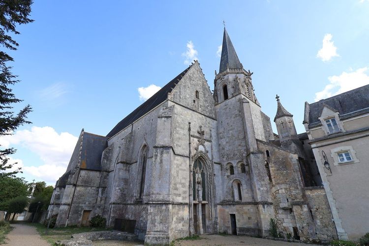
Less than 10 kilometres south of Poitiers, in direct continuation of the Clain riverbanks, stands the Abbaye Saint-Martin de Ligugé (Place du Révérend Père Lambert, 86240 Ligugé, rated 4.5/5 on Google with 335 reviews), founded around 361 by Martin de Tours even before he became bishop. It is considered the oldest monastery in the Western world still in operation, still inhabited by a community of Benedictine monks who perpetuate a way of life almost unchanged for seventeen centuries.
The trail leading there from Poitiers follows the banks of the Clain for much of the way, on flat terrain that requires no particular preparation. Many walkers set off directly from the Parc de Blossac, turning the outing into a round trip of around three hours, punctuated by shaded stops along the river.
On arrival, the abbey shop sells enamels and ceramics made by the monks themselves, a tradition of art workshops dating back to the early 20th century that has earned Ligugé a reputation well beyond the Vienne. A service can sometimes be heard from the outer courtyard, a moment that many visitors describe as more memorable than the walk itself. It is not uncommon to encounter, on the way back, local villagers who have simply come to stroll around the monastery at the end of the day.
The Lac de Saint-Cyr: Hiking and Swimming North of the City
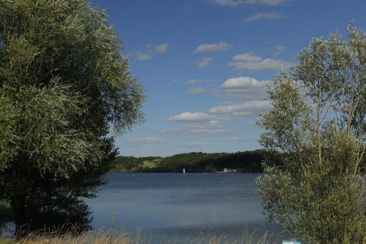
About 25 minutes by road north of Poitiers, in the commune of Beaumont Saint-Cyr, the lac de Saint-Cyr (Route du Lac, 86490 Beaumont Saint-Cyr, rated 4.1/5 on Google with 235 reviews) sits at the heart of a leisure area of some 300 hectares where people come as much to walk as to swim.
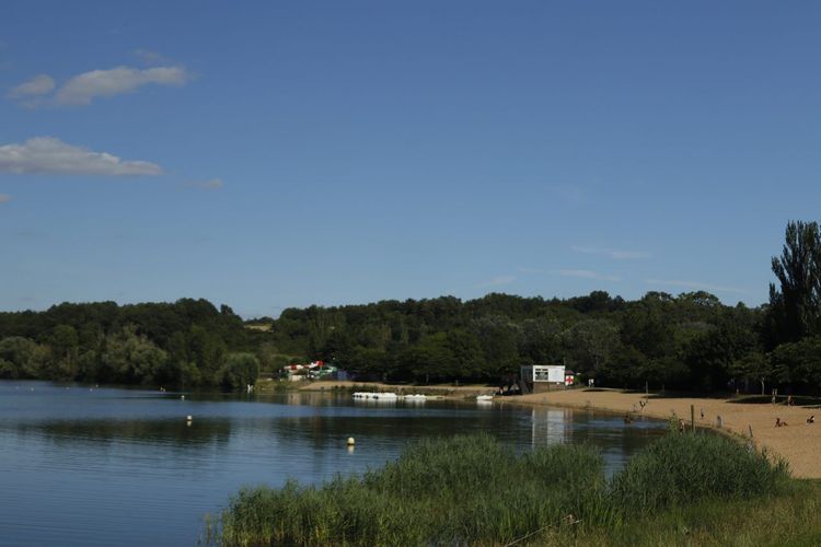
A flat trail circles the entire lake over around 5 kilometres, pleasant in any season but particularly popular in summer, when the supervised beach and water activities draw families from Poitiers in large numbers. Picnic tables scattered along the route make it easy to combine the walk with a swim at the end, and the changing facilities on site mean you don't have to set off home in wet clothes.
For a longer outing, additional paths head into the neighbouring woods and the Clain valley, adding several kilometres to the main loop on wilder terrain where you'll encounter more mountain bikers than walkers. It is one of the rare sites in the area where hiking and water leisure combine so naturally in a single afternoon.
The Auxance Valley: a Nature Hike on the Doorstep of the Futuroscope
To the north of the agglomeration, between Chasseneuil-du-Poitou and Migné-Auxances, the Auxance river traces a valley far more peaceful than its immediate surroundings might suggest, just a few hundred metres from the large structures of the Futuroscope.
The Sentier des Méandres de l'Auxance, starting from Chasseneuil-du-Poitou, loops over about 11 kilometres, through pollarded willows, wet meadows, cultivated hillsides and small wooden bridges that allow you to cross the watercourse several times. Allow nearly three hours at a leisurely pace, along an almost entirely flat route well suited to a morning walk before heading to the theme park in the afternoon.
This area remains surprisingly discreet compared to the large forests to the east of the agglomeration: the immediate proximity of the Futuroscope diverts the attention of most visitors, who head straight for the attractions without suspecting the valley hidden just behind the car park. Come early in the morning and you stand a good chance of having the riverbanks to yourself, with mist still drifting over the water — a nature break worth pairing with Poitiers' own audio-guided walk through downtown in the afternoon.
The Marais Poitevin: a Nature Escape an Hour's Drive Away
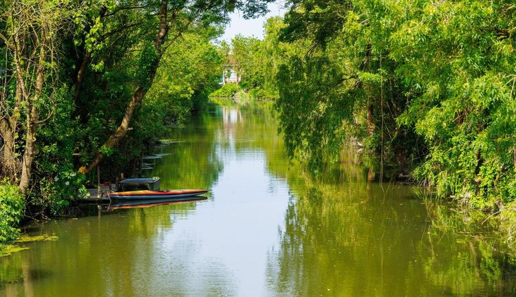
A little further than the previous ones, the Marais Poitevin nonetheless deserves its place in any inventory of hikes around Poitiers: allow about an hour's drive to Coulon, the traditional gateway to the Venise Verte, in the Deux-Sèvres.
The marshland can be explored on foot as much as by flat-bottomed boat, with trails running alongside canals shaded by poplars and pollarded ash trees, those ball-pruned trees characteristic of the local landscape. Several waymarked loops set off from Coulon and Arçais, between 6 and 15 kilometres, along paths often raised above the waterline to remain walkable even after moderate flooding.
The best time to visit remains spring or early summer, when the leaves cover the canals with a green veil that gives the marsh its name. In winter, the atmosphere changes radically: floods transform some trails into inundated areas, worth checking before you leave with the local tourist offices. For a full day, many visitors combine a morning walk with a boat trip in the afternoon, a way of seeing the marsh from two very different angles, one from solid ground and the other at water level, among the low branches of the ash trees.
A tip for summer: the marsh is a mosquito paradise from dusk onwards. A light long-sleeved top and a repellent at the bottom of your bag will prevent the end of the walk from turning into a race against bites.
GR364 and GR655: Crossing the Poitou on Foot over Several Days
For walkers with several days available, two long-distance trails pass through Poitiers. The GR364 links Plein-Bois, between La Roche-Posay and Pleumartin in the north-east of the Vienne, to Les Sables-d'Olonne on the Vendée coast, covering nearly 495 kilometres in total. It crosses the city then descends the Clain valley via Ligugé, Vivonne and Lusignan before entering the Deux-Sèvres, along a technically undemanding route that alternates between woodland, valleys and limestone plateaux.
The GR655 corresponds to the Via Turonensis, one of the four great historic French routes to Saint-Jacques-de-Compostelle. Several monuments along these itineraries, including the church of Saint-Hilaire-le-Grand in Poitiers, are inscribed on the UNESCO World Heritage List as part of the Routes of Santiago de Compostela in France. The GR655 also passes through the city, then heads south-west towards Lusignan and Saint-Sauvant, on a stage of around 25 kilometres particularly appreciated by seasoned walkers preparing a departure towards Spain.
The two trails therefore share part of the same corridor south of the city, which makes it possible to compose multi-day loops by switching from one to the other. They are not walked like the previous circuits: they require logistical organisation, including accommodation in walkers' lodges and transporting belongings from one point to the next. But nothing prevents you from walking only a section, returning by train or car-sharing from the next stage. Many Poitiers residents walk the stretch to Lusignan in a single day, without aiming for Compostela, simply for the experience of a long walk on a historically charged path. An up-to-date IGN map remains essential: waymarking can sometimes be lost in consolidated agricultural zones where field paths have changed their course.
When to Go: the Best Seasons for Hiking in the Vienne
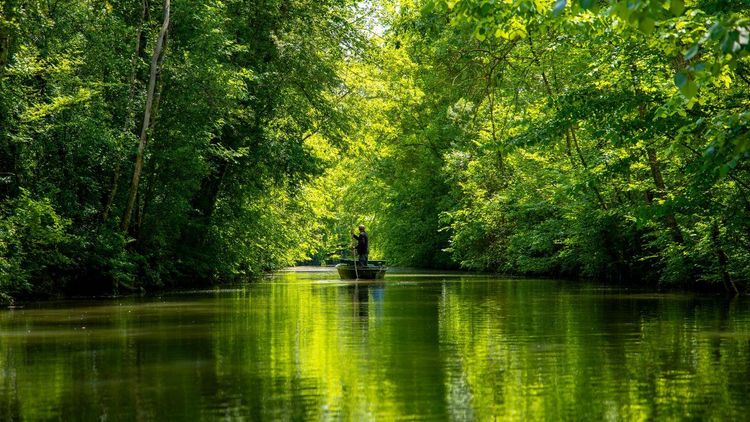
Spring, between April and June, remains the most comfortable period: temperatures stay moderate, vegetation is lush without being overwhelming, and forest trails have not yet been dried out by the summer heat. It is also the season when the Marais Poitevin is at its most photogenic, with canals of a vivid green.
Summer is best suited to itineraries close to water, such as the lac de Saint-Cyr or the banks of the Clain, where the shade of the trees tempers the heat. In the middle of a July or August day, it is better to avoid the exposed loops of Vouillé or Chauvigny and opt for an early morning start, before the limestone starts reflecting heat in the late afternoon.
Autumn turns the Moulière forest into a festival of colours, but coincides with the hunting season: always check the driven hunt days before setting off. Winter, finally, remains walkable on most flat itineraries, provided you accept trails that can be muddy after several days of rain, particularly in the Boivre valley and at Nouaillé-Maupertuis.
Equipment and Safety: Preparing Your Outing Well

Nothing sophisticated is needed for most of these itineraries. Closed-toe shoes with a grippy sole are sufficient for short loops; save ankle-high boots for outings of more than 15 kilometres or for trails through undergrowth after rain, where the ground quickly becomes slippery.
Always bring water, even on the shortest routes: drinking fountains are rare outside the villages you pass through. A paper map or a GPS tracking app downloaded in advance avoids unpleasant surprises in areas without network coverage, particularly in the Moulière forest and the Marais Poitevin, where mobile coverage remains patchy depending on the operator.
Always let someone know your itinerary before a long outing, especially if you are going alone outside of the tourist seasons. 112 remains the emergency number valid across the entire territory, including in forests and the most isolated areas of the marsh. One last useful reflex in forested terrain: note the stand numbers marked at crossroads, as they allow rescue services to locate you far more quickly than a vague description of undergrowth.
Hiking with Family in the Surrounding Area
Families with young children will find what they are looking for at the Maison de la Forêt in Montamisé, along the banks of the Clain from the Parc de Blossac, or on the circuit around the lac de Saint-Cyr — three flat, shaded itineraries short enough not to discourage the little ones within the first few kilometres.
To turn the day into a complete outing, many Poitiers families combine a morning walk with the afternoon at the Futuroscope, just a quarter of an hour's drive from the city centre. It is also an opportunity to vary the pleasures without straying too far from your base, alternating nature and thrills on the same day.
If you are looking for other ideas to round out the stay beyond the trails, the Ryo blog also lists a top 6 of things to do in Poitiers, useful for rainy days or late afternoons once the walk is done. Also consider packing a picnic rather than relying on a restaurant: most family itineraries have dedicated picnic areas, often better suited to children than a terrace in the city centre. With children under six, aim for 3 to 4 kilometres and plan a stop every forty minutes, even if it means cutting the route short: a loop finished in good spirits is worth far more than a long walk abandoned halfway.
Access, Parking and Apps for Planning Your Itinerary
Most of the starting points mentioned have free parking, often limited in spaces on fine-weather Sundays: arriving before 10am is the best reflex during the high season, particularly at the Maison de la Forêt and the lac de Saint-Cyr. For itineraries close to the centre, such as the banks of the Clain, the Poitiers bus network serves the Parc de Blossac directly, allowing you to set off on foot without a car.
Before setting off, consider recording your hike on a GPS tracking app: this allows you to keep a record of the route, useful if you are unsure about a poorly waymarked junction, but also to compare your times from one outing to the next. The tourist offices of Poitiers and Chauvigny also distribute detailed paper sheets for most of the loops mentioned here, a valuable option in areas where mobile signal is weak.
If you are staying in the city centre, our Ryo app lets you round off the day by identifying the must-see spots once you are back in town, between outings, without having to dig out a paper guide after a long walk.



FAQ
What is the most beautiful hike around Poitiers?
The Chauvigny castle loop often comes out on top thanks to its rare blend of medieval heritage and panoramic views over the Vienne valley, but the Moulière forest appeals more to lovers of pure nature and long distances.
How long does it take to hike through the Moulière forest?
It depends on the loop you choose: allow 1h30 for the short routes starting from the Maison de la Forêt, up to 3 or 4 hours for the longer loops that cross the massif from one end to the other.
Can you hike with children near Poitiers?
Yes, several flat and short itineraries are well suited, including the circuit around the lac de Saint-Cyr, the banks of the Clain from the Parc de Blossac, or the short trails of the Moulière forest.
Which itinerary is closest to the city center?
The path along the banks of the Clain starts directly from the Parc de Blossac, just a few minutes' walk from the historic ramparts of the city.
Do you need to book to hike in the Marais Poitevin?
Walking requires no reservation; only guided boat trips require advance booking, especially during the summer high season.
What is the best time of year to go hiking in the Vienne?
Spring offers the best balance between pleasant temperatures and walkable trails, but autumn remains very photogenic in the Moulière forest, outside of hunting days.
Where can I find GPS tracks for trails in the area?
The tourist offices of Poitiers, Chauvigny and the Vienne provide downloadable trail sheets, in addition to mainstream GPS tracking applications.
Does the GR655 pass through Poitiers?
Yes, this historic path to Saint-Jacques-de-Compostelle passes through the city before heading towards Lusignan and Saint-Sauvant, on a stage appreciated by seasoned walkers.
Between royal forest, forgotten battlefields and quiet rivers, this corner of Poitou reveals a territory far more varied than the city's academic reputation might suggest. Whether you have two hours or several days ahead of you, there is always a suitable loop within driving distance, or even cycling distance. And to extend the exploration once the hiking boots are put away, the Ryo audio-guided tour of Poitiers perfectly completes the picture, telling on foot what the trails do not say.