© Shutterstock
 Votre guide Ryo
The Most Beautiful Spots in the Gulf of Morbihan to Discover in 2026
The Gulf of Morbihan, meaning "little sea" in Breton, is a geographical reality unlike anything else in France. This inland sea of some 120 km² encloses around forty islands and islets along the southern coast of Brittany, swept by currents that rank among the strongest in Europe with each tide. With every tidal shift, water levels can vary by five metres in just a few hours: beaches disappear, passages close, and the colour of the water swings from deep green to slate grey depending on the time of day and the wind.
You will find far more here than coastal scenery. A twenty-metre menhir that has lain fallen since the Neolithic age, the medieval ramparts of a prefecture whose gardens run alongside centuries-old moats, oyster beds producing one of the most prized oysters in Brittany, and two permanently inhabited islands where cars are banned. From the ramparts of Vannes to the alignments of Carnac, taking in two islands accessible only by bike along the way, here are the places worth seeking out along this extraordinary stretch of Breton coastline.
Vannes, the Medieval Gateway to the Gulf
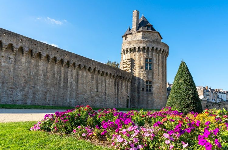
Every exploration of the gulf begins or ends with Vannes. The city is the sole prefecture of Morbihan, but it is above all its historic centre that leaves a lasting impression: an almost entirely intact medieval town encircled by 14th-century ramparts, with turrets rising above formal French gardens. Few cities of this size in France have preserved such a coherent medieval urban fabric.
Start by walking along the ramparts of Vannes from the Porte Saint-Vincent to the Tour du Connétable. This stretch runs alongside the moats, now transformed into the Jardins de la Garenne — an ideal morning stroll before the lanes fill up. On weekdays out of season, you will mostly encounter local Vannes residents on their walk, which makes for a very different atmosphere from the summer crowds.
The Cathédrale Saint-Pierre stands at the very heart of the old town. Its construction spanned from the 13th to the 16th century, and the façade blends Gothic and Renaissance details that reveal themselves gradually as you draw closer. Inside, highlights include the Chapelle du Saint-Sacrement and the tomb of Saint Vincent Ferrer, a preacher who died in Vannes in 1419 and one of the most visited burial sites in the old town.
The port of Vannes (Quai des Indes, 56000 Vannes, rated 4.6/5 on Google with 9,558 reviews) deserves at least an hour of your time. It remains active for leisure sailing and island ferry services, giving it a livelier feel than purely tourist ports. From the quays, the distant silhouette of Île aux Moines is already visible on clear days. A handful of restaurants line the northern side of the port, but the best crêperies and seafood spots are found in the side streets running off the Place Gambetta.
To explore the old town in depth, the Ryo audio-guided tour of Vannes on the Ryo app guides you from lane to lane. Along the way, look out for the half-timbered houses on the Place Henri IV, dating from the 16th and 17th centuries: some have kept their original jetties, an architectural rarity you could easily walk past without noticing if no one points it out.
What other guides tend to overlook: the Vannes market (Place du Poids Public, Wednesday and Saturday mornings) is where local producers from the Rhuys peninsula and the islands come to sell directly. Oysters from Pénestin, small-farm salted butter, fresh galettes — two hours here will give you more insight into the region than any tourist brochure.
Île aux Moines, Breton Gentleness
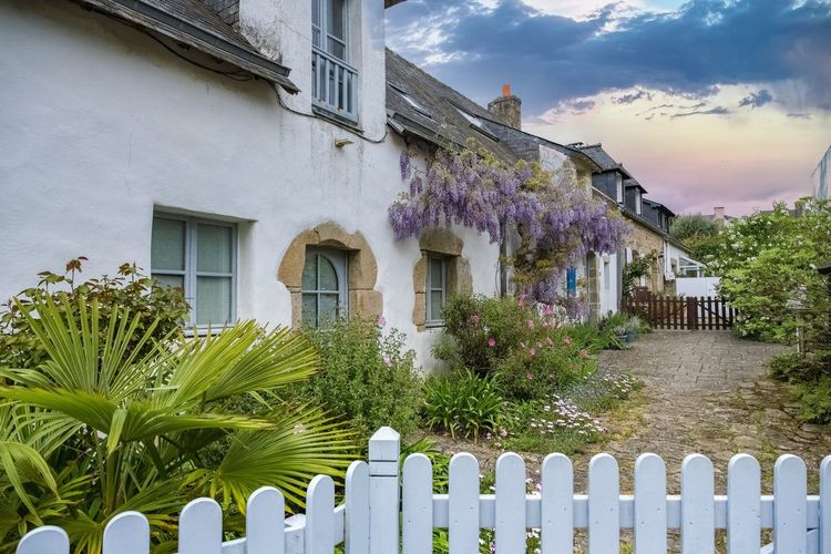
A ten-minute crossing from Port-Blanc (commune of Baden), Île aux Moines (Embarcadère de Port-Blanc, 56780 Île-aux-Moines, rated 4.5/5 on Google with 2,141 reviews) is the largest inhabited island in the gulf, with around 600 permanent residents. Its nickname, the Island of Flowers, is well earned: camellias, mimosas and fig trees grow in the open air year-round, benefiting from an exceptionally mild microclimate for Brittany. In February, the mimosas are in full bloom while the rest of the region is barely emerging from winter.
There are no tourist cars here. The island is best explored on foot or by bike, making it an ideal retreat for families or anyone in need of a break. The full circuit (around twelve kilometres) takes three to four hours at a relaxed cycling pace, with several viewpoints over the tidal inlets. The cromlechs at Rocher Vézid and Bois d'Amour — two megalithic ensembles largely unknown to the general public — lie hidden in the vegetation; look for the discreet signposts on the main road.
Dining options on the island are limited: it is best to picnic with provisions bought in Vannes or from the village shops. In July and August, bike rentals are often fully booked by 10am. Reserve the day before if possible.
Île d'Arz, the Other Pearl of the Gulf
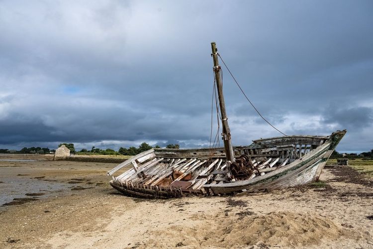
Smaller and quieter than Île aux Moines, Île d'Arz (Port de l'Île-d'Arz, 56840 Île-d'Arz, rated 5/5 on Google with 2 reviews) is home to around 250 permanent residents and noticeably fewer tourists. It is reached from Conleau (Vannes) or from Séné. Its rugged Atlantic-facing shores and sheltered coves on the gulf side offer contrasting landscapes across just 4 km². The coastal path circles the island in two hours on foot — allow more time if you stop at the World War II blockhouses dotting the northern shore, a quiet reminder of an occupation that remains part of local memory.
Locmariaquer and Its Megalithic Monuments
The village of Locmariaquer sits at the southern tip of the gulf, where the waters of Morbihan meet the Atlantic Ocean. This is where the highest concentration of Neolithic monuments in the region is found, forming one of the most spectacular prehistoric sites in Western Europe.
The centrepiece of the site is the Grand Menhir Brisé. Standing twenty metres tall in its original form and weighing 280 tonnes, it ranks among the largest monoliths ever shaped and erected by prehistoric peoples. Today it lies in four pieces on the ground, broken — most likely millennia ago. Even fallen, its sheer scale is overwhelming; you find yourself standing before it for a while, lost for words.
Just a few metres away, the Table des Marchands (Site de Locmariaquer, 56740 Locmariaquer, rated 4.3/5 on Google with 2,328 reviews) is a passage dolmen whose capstone bears one of the finest known Neolithic engravings: a pattern of crooks and ears of grain repeated across the entire inner surface. The site is managed by the Centre des Monuments Nationaux; entry is paid (around 7 euros), with a well-marked route and solid explanatory panels.
The village itself is pleasant, with a small harbour and a few seafood restaurants. The Er Grah tumulus, adjacent to the site, is less frequently mentioned but almost as impressive: one of the longest burial mounds in Europe at 140 metres long. The Locmariaquer archaeological ensemble brings all three monuments under a single ticket — do not treat them separately.
For those interested in Breton prehistory, the connection with Carnac is a natural one: the two sites probably functioned together within the same ritual or astronomical framework, even if no scientific consensus yet exists on their precise purpose. Do not try to combine both in a single day — you will see neither properly. Better to visit Locmariaquer in the morning and Carnac in the late afternoon, when the golden light on the stones completely transforms the reading of the landscape.
The Rhuys Peninsula and Port Navalo
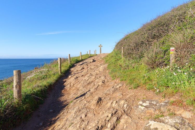
The Rhuys peninsula is the headland that closes the gulf to the south, separating Morbihan from the Quiberon bay. Around twenty kilometres long, it packs several distinct atmospheres into a compact area: open beaches on the Atlantic side, sheltered coves and oyster beds on the gulf side, and medieval châteaux inland.
At its western tip, Port Navalo (Quai de Port Navalo, 56640 Arzon, rated 4.7/5 on Google with 78 reviews) is the natural entrance point to the gulf. The channel it forms with the Kerpenhir headland is renowned for its violent currents during spring tides — sometimes reaching 9 knots — making it one of the most active maritime passages on the Breton coast. From the restaurant terraces at the harbour, watching boats negotiate this channel is genuinely mesmerising. Several island cruises also depart from here.
The peninsula's beaches — Fogeo, Bétahon and Saint-Colombier on the gulf side — are less crowded than those at Quiberon and offer a welcome alternative in high season. The water is generally warmer than on the open Atlantic coast, thanks to the shallow depth and the constant tidal mixing.
The Château de Suscinio in Sarzeau
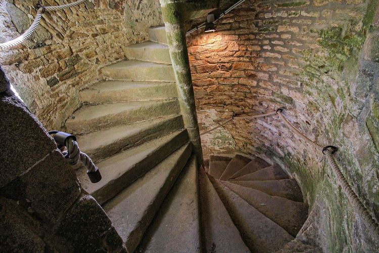
Deep in the heart of the Rhuys peninsula, the château de Suscinio (Route du Château, 56370 Sarzeau, rated 4.6/5 on Google with 12,612 reviews) is one of the best-preserved ducal residences in Brittany. The dukes of Brittany used it as a hunting lodge and holiday retreat from the 13th to the 15th century, at a time when Brittany was still an independent duchy with its own diplomatic standing. The château fell into ruin during the Revolution before undergoing gradual restoration in the 19th and 20th centuries.
What sets Suscinio apart from other Breton châteaux is its relationship with water: surrounded by wide tidal moats, it resembles a miniature fortified island. Inside, a well-documented museum of Breton history houses collections focused on the ducal period. Allow between 1h30 and 2 hours for a complete visit. Adult admission: around 9 euros.
The Séné Marshes Nature Reserve
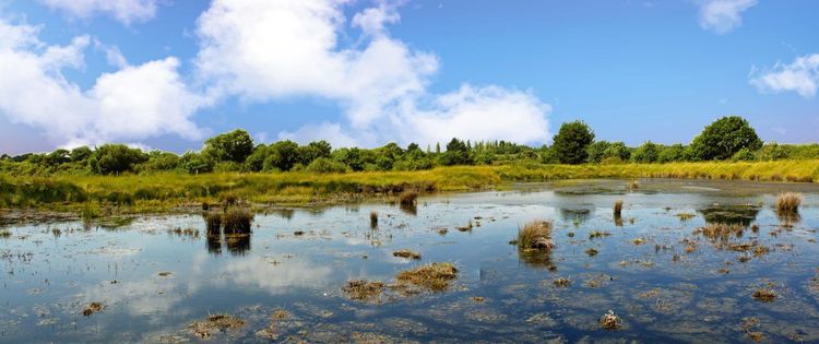
A few kilometres from Vannes, on the eastern shore of the gulf, the Séné marshes (Rue de la Maison du Parc, 56860 Séné, rated 4.4/5 on Google with 846 reviews) form one of the most important ornithological reserves in Brittany. These 530 hectares of salt marshes, saltmeadows and mudflats host more than 240 bird species throughout the seasons — little egrets, spoonbills, avocets, curlews and storks during the spring and autumn migrations.
Access is via the Maison de la Réserve, where guided naturalist outings are organised in season. Hides set up along the trails allow you to observe birds without disturbing them. The best time to visit: dawn between March and May for nesting waders, or in autumn for the migrations. In summer, the heat drives birds away from areas visible from the paths.
Bring binoculars — those available on loan at the Maison de la Réserve are often booked in advance. The weekend guided walk (around 1h30) is well worth it if you are not an experienced birdwatcher: the guides know exactly where to look and offer precise commentary on whatever is passing over the mudflats.
Cruises and Boat Tours in the Gulf
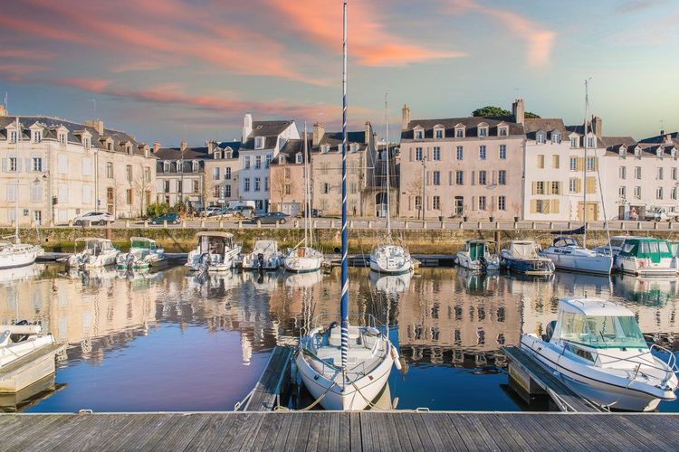
The best way to understand this little sea is not from the land, but from the water. The currents, the island geography and the ever-changing light over the mudflats only reveal themselves fully once you are on board. Several companies offer cruises departing from Vannes, Port Navalo or La Trinité-sur-Mer.
Discovery cruises generally last between two and four hours, passing the main islands — Île aux Moines, Île d'Arz, the small island of Boëdic with its maritime pines, and the islet of Gavrinis with its decorated Neolithic cairn visible from the water. Some routes include a stop at Locmariaquer or a call at Île aux Moines for lunch. Prices range from 20 to 40 euros per adult depending on duration and operator.
In July and August, book at least 48 hours in advance: places go quickly, especially on the morning departures. Outside of high season — September and October in particular — it is often possible to board on the morning of your visit, and sunsets from the deck are unforgettable.
For independent sailors, yacht and motorboat rentals are available from Port Blanc or Vannes. Navigating the gulf without knowledge of the currents is dangerous: SHOM charts for the area are available at the harbour master's offices, and several rental operators require a mandatory briefing before handing over the helm. For those staying ashore, our Vannes audio-guided tour walks the old walled town in nineteen stops.
Kayaking, Stand-Up Paddleboarding and Water Sports
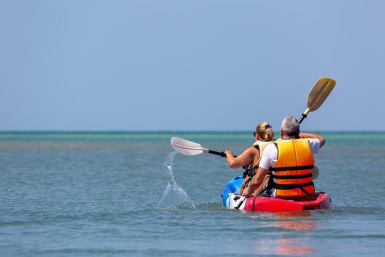
Sea kayaking is the most popular water activity in the gulf after cruising. Several bases at Arradon, Larmor-Baden and Locmariaquer offer hourly or half-day rentals. The golden rule: plan your outing around the tides, paddling with the current rather than against it. The slack water periods — a twenty-to-thirty-minute window around high or low tide — are the ideal windows for crossing the tidal channels between islands without unnecessary effort.
Sailing, windsurfing and funboarding also have their enthusiasts on the more open waters of the Rhuys peninsula side and the Quiberon bay, a twenty-minute drive from the gulf shores.
The GR34, the Customs Officers' Trail
The GR34, known as the Sentier des Douaniers (Customs Officers' Path), runs along the entire Breton coastline and crosses the gulf shores for several dozen kilometres. The section running between Vannes and Locmariaquer, via Séné, Arradon and Larmor-Baden, is one of the most varied: oak forests along estuary edges, mudflats at low tide, views over the islands, and passages through granite fishing hamlets.
The full circuit around the gulf covers around 80 kilometres — a week's leisurely walking with overnight stops possible at Arradon, Larmor-Baden or Séné. But there is no need to tackle the whole route: the stretch between Arradon and Larmor-Baden (around ten kilometres) is often cited as the finest, with open views over Île aux Moines. Walking boots are recommended even in fine weather — the paths remain muddy after rain, and sections over rocks require sure footing.
Oysters and Morbihan Gastronomy
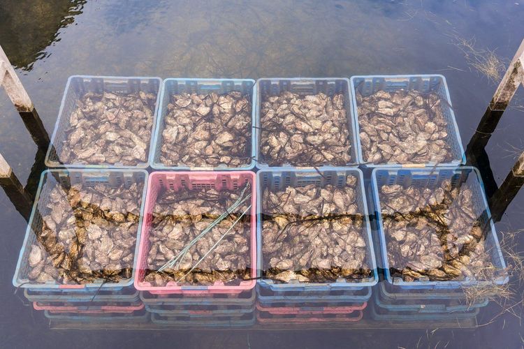
The gulf is a leading oyster-farming territory. Its shallow waters, churned by strong currents and rich in plankton, create ideal conditions for cultivating Pacific oysters. The main beds are concentrated around Pénestin, Penerf and the coves of the Rhuys peninsula.
In oyster-farming ports such as Saint-Philibert and La Trinité-sur-Mer, several producers' shacks sell oysters directly for tasting on the spot. A dozen oysters with rye bread and salted butter, eaten standing at the water's edge, rarely costs more than 10 to 12 euros. It is one of those experiences no restaurant can faithfully reproduce. The shacks generally close on weekdays outside of season — Saturday morning is your best chance to find them open.
Beyond oysters, local gastronomy revolves around line-caught sea bass and pollack, Breton blue lobster found on menus in Vannes or Arzon, and clams gathered from the mudflats at low tide. Crêperies are everywhere but quality varies considerably: be wary of those too close to the ferry terminals, and favour spots recommended by local residents.
A detail that mainstream guides often overlook: unlike the bouchot mussels from the bay of Mont-Saint-Michel — the only shellfish in Brittany to hold a PDO label — the gulf's oysters and mussels carry no official designation. Their reputation rests on water quality and the expertise of local oyster farmers, passed down from generation to generation along the shores of the gulf. Ask a producer exactly where their harvest comes from: here, traceability is told in person.
Carnac, the Alignments at the Gateway to the Gulf
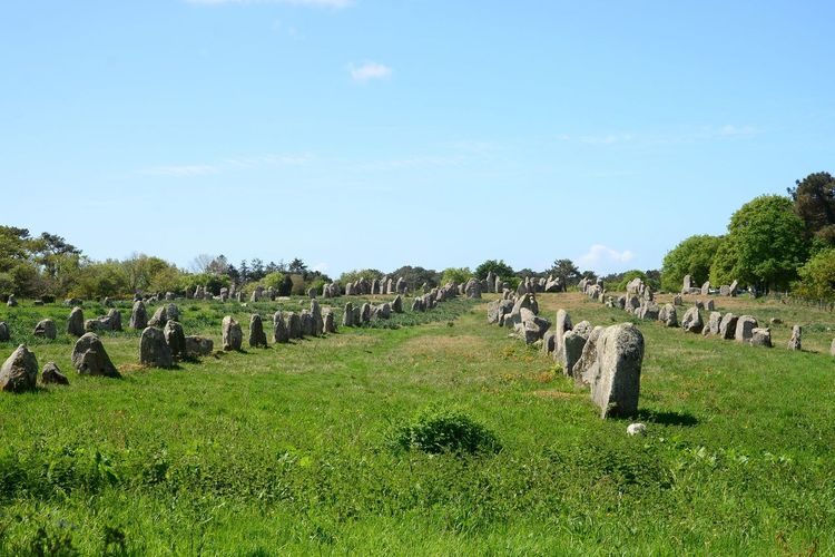
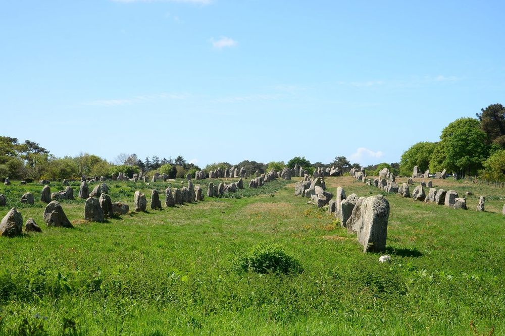
Technically, Carnac lies just to the west of the gulf shores, on the Quiberon peninsula. But no stay in Morbihan would be complete without visiting the alignments of Carnac — the world's largest ensemble of standing stones, with nearly 3,000 upright stones spread over more than 4 kilometres.
Access to the alignments has been restricted since 1991 to allow vegetation to recover. Most of the ensembles (Ménec, Kermario, Kerlescan) are visited from marked perimeter paths, with guided walks inside organised from the Musée de Préhistoire de Carnac (10 Place de la Chapelle, 56340 Carnac, rated 4.2/5 on Google with 1,428 reviews). Opt for the guided tour: from outside, the stones appear to be arranged randomly, but the structure of each section reveals a precise logic still debated by contemporary archaeologists.
The village of Carnac itself is a seaside resort with ocean-facing beaches, an atmosphere very different from that of the gulf. If you visit in July or August, the alignment area is packed during the day: arrive at opening time or in the evening (night visits are possible in summer). The beach at Carnac-Plage makes for a pleasant end to the afternoon after the megaliths.
If you are extending your exploration further into Brittany, our Ryo selection of the most beautiful villages around Saint-Malo will give you more gems from the northern coast to add to your itinerary.
Practical Information: Planning Your Visit to the Gulf
Best time to visit: May–June and September are the ideal months — pleasant temperatures (17–22°C), smaller crowds than in July–August, and exceptional late-day light on the water. July and August are warmer and livelier, but the islands and archaeological sites can be very busy.
Getting there: from Paris, the TGV reaches Vannes in 2h30 (Brittany line, Vannes station). By car, take the A11 then the N165 from Nantes. Local transport is limited outside of Vannes — a vehicle remains essential for visiting the Rhuys peninsula, Locmariaquer and Carnac independently.
Accommodation: Vannes has the widest range of hotels. Gîtes and B&Bs can be found in Sarzeau, Arradon and Larmor-Baden for a closer immersion in the gulf.
Budget: allow between 40 and 70 euros per person per day for activities (cruises, archaeological sites, meals), excluding accommodation.
FAQ
How long does it take to visit the Gulf of Morbihan?
To see the essentials — Vannes, one island, Locmariaquer and Carnac — allow a minimum of 3 days. For a more complete experience including the Rhuys peninsula, the château de Suscinio, the Séné reserve and a cruise, plan for 5 to 7 days. A full week allows you to travel at a leisurely pace and enjoy the tidal changes that transform the landscape several times a day.
How do you reach the islands of the gulf?
Ferries and fast boats regularly connect the shores of the gulf to the inhabited islands. Île aux Moines can be reached from Port-Blanc (commune of Baden) in about ten minutes, with frequent crossings year-round. Île d'Arz is accessible from Conleau (Vannes) or from Séné. In high season, direct services also run from the port of Vannes. No reservation is needed for the ferries, but schedules vary with the tides — check the harbour master's notice board on the morning of your visit.
Can you visit the gulf with children?
Yes, it is a particularly family-friendly destination. The islands can be explored by bike without cars, the beaches of the Rhuys peninsula are calm with few waves, and boat cruises are generally a hit with children. The Locmariaquer site offers an interpretation trail suitable for children aged 8–10 and up. The Séné marshes reserve organises nature-themed activities specifically for families during July and August.
What are the best viewpoints over the gulf?
The Beg Lann viewpoint (Larmor-Baden) offers a panorama over Île aux Moines and the central islands. The heights around Arradon and Baden, locally nicknamed the "Balcons du Golfe" (Balconies of the Gulf), provide open views at sunset. From Port Navalo, the gulf's entrance channel and its spectacular currents can be watched from restaurant terraces, with a fine view of the Kerpenhir headland opposite.
Are there beaches for swimming in the gulf?
The inner side of the gulf offers calm, shallow beaches ideal for children, though the water can remain cool as the currents constantly churn it. On the Rhuys peninsula side (beaches at Fogeo, Kerfontaine, Bétahon), the beaches are better exposed and well suited to summer swimming. The wide sandy beaches with waves are found on the Carnac and Quiberon side, a 20-to-30-minute drive from the gulf.
Conclusion
The Gulf of Morbihan rewards return visits. A first trip to take in the geography and the megaliths, a second for the islands and the light on the water, a third for the equinox tides and the oyster markets. If you are continuing your adventure into the Pays de la Loire, discover our Ryo selection of the most beautiful villages in the region for more hidden gems within easy reach. The Ryo app accompanies your explorations with contextual audio guides — a way of going far deeper into the history of each place than the usual information panels ever allow.
À lire également