© Shutterstock
 Votre guide Ryo
Hiking around Besançon: 12 Trails for All Levels in 2026
Between the meanders of the Doubs encircling the old town and the first Jura foothills less than an hour's drive away, Besançon occupies a rare position for those who love walking: it never forces you to choose between heritage and nature. From Vauban's ramparts to the gorges carved by the Loue, hiking around Besançon ranges from a 45-minute loop to a full-day expedition to a forgotten Doubs waterfall. Before lacing up your boots, take a moment to discover the Ryo audio-guided tour of Besançon, which traces the history of the fortified city on foot and perfectly complements the wilder itineraries presented here.
Twelve itineraries make up this guide, from the most urban to the most distant. You will find a forts loop of under 5 km accessible directly from the city centre, a hidden waterfall 55 km away in the Cirque de Consolation, a hike along the Doubs that never leaves the shade of the plane trees, and the Saut du Doubs, the full-day outing that alone justifies the 100 km of road from Besançon. Whether you're looking for a hiking club to walk with on Sundays or a Visorando track to follow solo, each section specifies the distance, duration and level required, so you can put together a tailor-made outing rather than blindly following a route that doesn't suit you.
Hikes in Besançon: the Citadelle and the Forts Loop
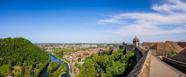
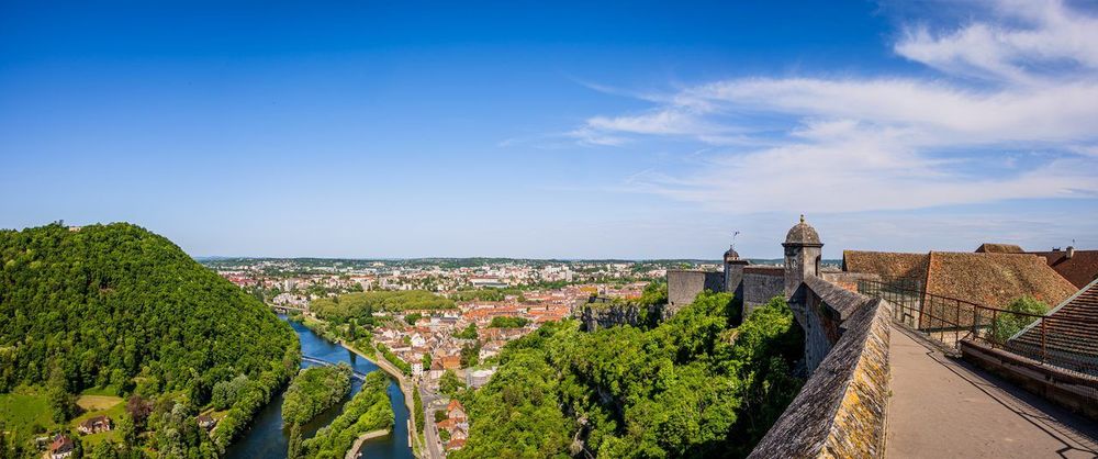
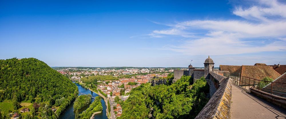
You only need to look up from the pont Battant to understand why Besançon inspired Vauban: the entire city is coiled in a meander of the Doubs, locked in by a hill that the engineer fortified point by point. It is this topography that makes the forts loop so distinctive — an urban hike but not an easy one, climbing and descending without ever leaving the city.
The most logical starting point remains the Citadelle de Besançon, a UNESCO World Heritage Site perched 118 metres above the Doubs. Allow around two hours to visit the ramparts, the three museums it houses and the zoological park set within the moats, before joining the path that follows the escarp wall northward.
From the Citadelle, the path descends towards Fort Griffon, a Vauban fortification now occupied by a training institute and closed to visitors, before climbing again towards Fort de Chaudanne, one of the most complete observation posts overlooking the Doubs meanders. The full loop between these three forts covers around 7 km with approximately 250 metres of cumulative elevation gain, a format that suits a whole afternoon, even with children who are used to walking.
The path then descends back towards the historic centre via steps cut into the rock, a shortcut that locals have been using for generations to reach the Boucle without going back via the road. At the bottom, Parc Micaud (Avenue Edouard Droz, 25000 Besançon, rated 4.5/5 on Google with 1,444 reviews) offers a sharp contrast with the fortifications: shaded lawns, a bandstand and Doubs riverbanks laid out for a welcome picnic stop after the climb.
You can turn this urban hike into a cultural visit by combining it with the audio-guided tour Une histoire de temps: this 2h10 tour crosses the old town and tells the watchmaking history of Besançon between two climbs to the forts, never straying more than a few hundred metres from the walking route described here.
Besançon Viotte station is fifteen minutes' walk from the foot of the Citadelle, making it possible to explore this first hike without a car. Many visitors make the mistake of trying to fit everything into a single morning: it is far better to set aside the entire half-day, as the forts and their viewpoints deserve a proper pause.
Between Fort Griffon and Fort de Chaudanne, a quieter secondary path heads towards the Bregille viewpoint on the other side of the Doubs. The elevation gain is more sustained, but the view over the historic meander — with its glazed-tile rooftops and the grey-green ribbon of the river — more than justifies the detour for anyone with an extra hour to spare.
For a guided discovery, several local associations organise free outings on this loop in spring, led by a guide who explains the defensive logic Vauban devised, fort by fort. Checking with the tourist office is usually enough to find the next dates, which are often announced only a few weeks in advance.
Along the Doubs: the Green Loop and the Riverbanks, between 2 and 8 km
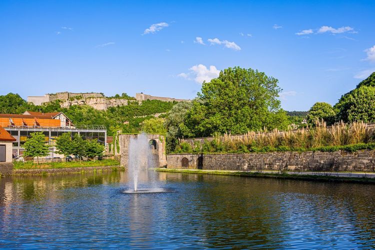
Besançon has the rare distinction of letting the Doubs flow through its prefecture without ever imprisoning it behind a concrete wall. The result is a long, uninterrupted riverside walk, usable in summer and winter alike, which allows you to put together a tailor-made stroll along the Doubs in Besançon of 2 to 8 km depending on the day's mood.
The simplest starting point is the Pont Battant (25000 Besançon, rated 4.4/5 on Google with 1,159 reviews), at the heart of the Boucle, where the towpath begins to follow the left bank downstream. Allow around 45 minutes of relaxed walking to reach the pont de la République, with views of listed façades and moored barges in the fine season.
For a longer outing, continue beyond the Boucle towards Beure and Chalezeule: the path then skirts reed beds and a few allotment gardens, a noticeably more rural landscape barely twenty minutes after leaving the city centre. This is a route appreciated by Besançon joggers as much as by cycling families, which means staying alert to two-wheelers on the shared stretches.
Heading upstream, towards Micropolis and the Palente district, the path becomes a proper greenway that eventually connects to the Doubs cycling loops leading south through the département, an axis that also serves the Osselle caves area mentioned later in this guide.
The river itself is worth slowing down for: grey herons, coots and occasionally a kingfisher can be spotted from the landscaped banks, especially early in the morning when the quays are still deserted. Local anglers, often the first ones up, are a good source of information about the Doubs water level, which can rise quickly after a rainy spell and make some stretches temporarily muddy.
If you're looking for a less urban variant, a footbridge near the Velotte district allows you to cross to the right bank and return via a narrower woodland path that nearly doubles the sense of nature without adding many kilometres. This is the option that regulars on the towpath generally recommend when they want to vary their daily loop without leaving the city. One final useful landmark: between May and September, several outdoor cafés set up on the quays, turning a simple hike into an end-of-day outing.
The Forêt de Chailluz: among the Oaks with Views over the City, 5 km from the Centre
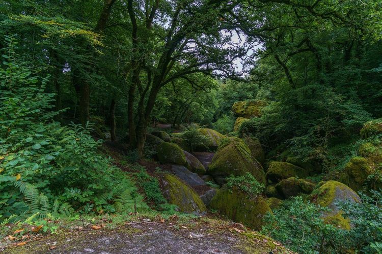
Just beyond the northern outskirts of Besançon, the forêt de Chailluz (Rue de Chailluz, 25000 Besançon, rated 4.8/5 on Google with 10 reviews) spreads more than 750 hectares of oak and beech woodland across the plateau overlooking the city. This is the address that Besançon residents recommend first for a forest walk near the city without having to take the motorway.
Several marked loops start from the main car park, ranging from 3 to 10 km, the most popular leading up to the fort de Chailluz before descending via a path with an open view over the Boucle and the Citadelle below. The elevation gain remains modest, under 150 metres, making it an accessible outing for families and Sunday-morning joggers alike.
In autumn, the forest also attracts mushroom pickers, a traditional use that broadly coexists well with hiking as long as everyone stays on the marked paths. In spring, however, favour the south-facing paths: the undergrowth can remain muddy for several days after rain, as the plateau's clay soil drains poorly.
A recent addition of educational panels about local wildlife — wild boar and roe deer at the top of the list — along the main path makes the outing particularly well suited to a family hike with nature-curious children. For runners, the forest also serves as a training ground for several Besançon clubs, which organise group outings on Wednesday evenings in summer when the light allows late running without a headtorch. There is nothing to stop a solo hiker joining these groups occasionally, as the atmosphere remains deliberately open.
On the logistics side, two car parks serve the forest — one near the fort, the other on the Chalezeule side — allowing you to vary starting points depending on the chosen loop. Neither charges a fee, a significant advantage over the more tourist-oriented forests of the neighbouring Jura where parking is increasingly monetised.
Chalezeule and the Roche d'Or: Panoramas within 10 km
Less than ten minutes by car from the centre, the village of Chalezeule hides one of the finest viewpoints over Besançon, reachable in under an hour's walking there and back. The path climbs gently from the village church to the Roche d'Or (Chalezeule, 25220 Chalezeule, rated 4.7/5 on Google with 101 reviews), a limestone promontory dominating the Doubs valley.
Allow 2.5 km for the full loop, a perfect format for a late afternoon or before lunch in town. The view takes in the entire Boucle, the Citadelle and, on a clear day, the first Jura ridges on the horizon. The path stays shaded for the first half, making it a pleasant option even in the height of summer when longer Jura hikes require an early start to beat the heat.
Quiet during the week, this viewpoint becomes a local meeting point at weekends around sunset, with residents coming to picnic rather than hike in the strict sense. It also makes a good fallback option if the weather deteriorates during the day and a more ambitious itinerary becomes risky.
Heading to the Gorges de la Loue and Ornans, 30 km from Besançon
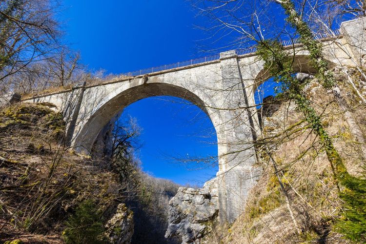
Beyond thirty kilometres, the landscape changes register: the Doubs valley gives way to the limestone gorges carved by the Loue, one of Franche-Comté's most photogenic rivers. It is here, in Ornans, that Gustave Courbet painted most of his canvases, and the hike follows almost exactly the viewpoints he immortalised.
The classic itinerary starts at Ouhans, where the source de la Loue surges up — a spectacular resurgence at the foot of a high cliff, after an underground journey that remains partly mysterious for hydrogeologists. Allow 30 minutes of easy walking from the car park to reach the blue-green pool, particularly striking after a rainy period when the flow rises.
For more experienced hikers, the path then climbs to the belvédère de Renédale, a rocky balcony overlooking the gorges from about 200 metres up. The full loop from the source covers around 8 km with 350 metres of elevation gain, a half-day outing that remains one of the most complete itineraries within an hour of Besançon.
On the way back down towards Ornans, stop at château de Cléron (25330 Cléron, rated 4.5/5 on Google with 24 reviews), a 14th-century fortress that still watches over the river from its rocky spur. The castle is not always open to visitors depending on the season, but the view from the nearby bridge more than justifies the detour, with the Loue literally wrapping around the building's foundations.
Ornans itself is worth an extra hour: the old town, built on stilts above the river, resembles a miniature version of Besançon, with its colourful houses plunging directly into the water. Combining the morning hike with an afternoon stroll through the alleyways is a better idea than rushing straight on to another site.
To prepare this outing in detail, our Ryo article on the 14 must-sees of the Doubs devotes several paragraphs to this valley and usefully complements the practical information in this guide, notably on castle opening times and the best seasons to see the source in flood.
Art lovers will recognise, from certain points along the path, the almost exact composition of Courbet's Source de la Loue painted in 1864: the vegetation has changed remarkably little in a century and a half, giving the hike an almost contemplative quality that is rare on a trail as busy as this one in summer.
Another option to extend the outing: from Renédale, a lesser-known path continues to the village of Lods, listed among France's most beautiful villages, adding around 5 km to the main itinerary. Few hikers push this far, making it an excellent choice if you want to avoid the crowds that typically gather near the source in July and August.
On the logistics side, the Ouhans car park fills up quickly at weekends in season; arriving before 9:30 am remains the only reliable way to find a space within ten minutes' walk of the site. Public transport from Besançon exists but is infrequent, so a car or carpooling organised through a hiking club greatly simplifies access to this valley.
The Cascade and Source du Cusancin, 40 km Away
The word waterfall comes up often in searches for trails in this area, and the Cusancin valley, some forty kilometres to the north-west, remains one of the surest answers. The source du Cusancin (25340 Cusance, rated 4.2/5 on Google with 89 reviews), at Cusance, bursts directly from the rock to form a succession of pools and small falls along its upper course.
The path that follows the river from the village winds through woodland, shaded even in midsummer, making it a pleasant outing when the gorges de la Loue, more exposed, become too hot for comfortable walking. Allow 5 km round trip for the classic loop, with modest elevation gain that suits a family hike.
The successive pools, a deep blue-green fed by the karst resurgences typical of the Doubs, invite swimming in summer — a practice that is tolerated but remains entirely at your own risk, as the water stays cool year-round at around 10 degrees on average. Upstream from the village, a restored mill recalls the historical use of the Cusancin's hydraulic power, which once supplied several sawmills and a spinning mill before the industrial era.
Less frequented than the source de la Loue, this valley remains one of the best options for those seeking a waterfall near Besançon without the summer crowds of better-known sites. July weekends here remain noticeably calmer than at Ouhans, a factor that carries a lot of weight for many hikers familiar with the area.
To turn the outing into a more complete itinerary, a side path connects the village of Cusance to Belvoir, known for its medieval castle perched on a rocky spur. The total loop then rises to around 12 km, an option for walkers who want a full day out rather than a simple half-day.
In terms of access, no regular bus service runs to Cusance from Besançon, making a car or local club organisation necessary. The village car park, free and rarely full, remains a straightforward starting point, just a few metres from the first hiking signpost.
The Cirque de Consolation and Its Hidden Waterfall, 55 km Away
A little further still, around 55 km from Besançon, the Cirque de Consolation closes the Dessoubre valley in an amphitheatre of wooded cliffs that long inspired the Romantic painters of the 19th century before drawing today's hikers. It is one of the département's most spectacular sites, and yet one of the least known beyond the Doubs.
The monastery of Consolation, whose current buildings date from the 17th century, marks the logical starting point for the hike. From there, a path descends to the cascade du Lançot (25520 Consolation-Maisonnettes, rated 4.6/5 on Google with 142 reviews), a vertical 47-metre drop fed by the Lançot cave spring, particularly spectacular after a few days of rain or at snowmelt.
The full Cirque loop, which then climbs to the cliffs before descending via the opposite slope, totals around 9 km with 300 metres of elevation gain. It is a demanding but never technical hike, with several vertiginous viewpoints over the monastery below and the forest that carpets the inside of the cirque.
Autumn is undoubtedly the best season for this outing: the beech forests covering the cirque's slopes turn russet and gold, a spectacle that attracts more photographers every year, without turning the site into the crowded attraction that some places closer to Besançon can become.
One practical detail to know before setting out: the path to the waterfall is partly cut into wet rock, slippery after rain, and is not recommended for those prone to vertigo on the section that hugs the cliff face. Bring walking poles if you're used to them — they make a real difference on this stretch.
The village of Consolation-Maisonnettes has only a handful of permanent residents, which means no shop allows you to stock up on site outside the monastery's snack bar, which opens irregularly depending on the season. It is better to set off with your own picnic and enough water, particularly in summer when shade is lacking on certain plateau sections.
For those interested in religious history, the monastery itself deserves a visit before or after the hike: rebuilt several times over the centuries, it retains a particular atmosphere, almost suspended in time, reinforced by the site's isolation at the bottom of the valley. The community that runs it today occasionally welcomes visitors for short presentations of the place.
This site also features among the hikes regularly shared by Visorando users, with the community highlighting both the elevation challenge and the rarity of the site among the best-rated Doubs hikes. Following an existing Visorando track remains a good option for this outing, as the official waymarking can be discreet on the woodland sections.
Finally, if time allows, push on to the gorges du Nouailley a few kilometres away for a longer variant. Few guides mention this extension, making it an excellent choice for hikers returning to the area a second time who want to venture beyond the Cirque's most frequented paths, before returning to Besançon for Ryo's audio-guided tour of the old town.
The Saut du Doubs: the Hike 100 km from Besançon
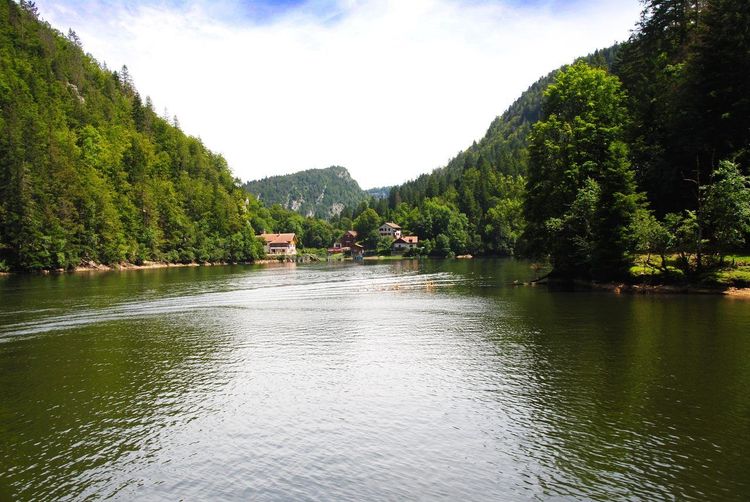
If a single hike were to justify a full day out far from Besançon, it would be this one. The Saut du Doubs, around 100 km by road via Morteau and Villers-le-Lac, remains the most impressive waterfall in the Jura massif, plunging 27 metres.
The classic path starts from the Terres Rouges car park in Villers-le-Lac and first skirts the lac de Chaillexon (25130 Villers-le-Lac, rated 4.5/5 on Google with 112 reviews), a natural reservoir formed by the Doubs on the Swiss border, before reaching the waterfall itself after around 5 km of easy woodland walking.
Two viewpoints allow you to observe the falls from different angles: the first looking down from above, the second at water level after a steeper descent of around a hundred steps. Good footwear is essential, as the rock around the second viewpoint remains permanently wet from the spray.
An alternative exists for those who prefer to spare their legs: a boat connects Villers-le-Lac to the foot of the site in summer, allowing you to combine a lake cruise with a short hike to the falls, without the full 10 km round trip. Many Besançon families choose this mixed option for a day out without excessive fatigue.
The Saut du Doubs has historically marked the natural border between France and Switzerland, the Doubs cutting a spectacular bend here before plunging over the edge. This border position partly explains the site's tourist richness, visited since the 19th century by regional spa-goers who came by horse-drawn carriage to admire the falls.
For hikers who want to avoid the summer crowds, an alternative path sets off from the Swiss side at Le Locle and reaches the site via a far less-trodden route, with equally spectacular views over the lac de Chaillexon. This option simply requires having an identity document, as the border normally has no checks but remains an international frontier.
Another possible variant for the most motivated walkers: extend the hike into the Doubs gorges upstream of the lake, turning a half-day outing into a genuine full-day itinerary, with a midday picnic by the water.
With the drive from Besançon, allow a full day to make the most of the site, including the journey, the hike and a lunch stop in Villers-le-Lac, renowned for its specialities featuring comté and morteau sausage. For access from Besançon, the train to Morteau followed by a short bus or carpooling transfer to Villers-le-Lac is possible for those who do not wish to drive. Several hiking clubs in the region also organise group outings to this site at least once a season, a great option for discovering the Saut du Doubs without worrying about logistics.
The Grottes d'Osselle and the Doubs Valley, 15 km to the South
Less visually dramatic but equally surprising, the southern sector of Besançon conceals the grottes d'Osselle (3 Rue des Grottes, 25320 Roset-Fluans, rated 4.5/5 on Google with 1,827 reviews), around 15 km from the city centre along the Doubs valley. The guided underground visit, lasting approximately 1h15, is paired with a short surface hike along the river, a good option for varying the experience after several days of open-air trails.
Above the caves, a ridge path offers an unobstructed view over the Doubs meander winding southward, a viewpoint far less frequented than those described earlier in this guide. Allow around 4 km for the full surface loop, a short format that combines easily with the underground visit.
This area is also accessible by following the greenway described earlier along the Besançon quays, which means that cycling hikers can link the city centre to the caves without getting back in the car. An option worth considering for those with a full day and a wish to combine several discovery formats, on foot and by bike.
The cave itself stays cool year-round at around 13 degrees, making it a good fallback option when summer heat makes open sunny paths too uncomfortable. The stalactites and limestone formations, built up over thousands of years, usefully complement the geological discovery begun with the karst springs of the Loue and Cusancin described earlier. Bringing a thin layer even in summer is advice that many visitors overlook before going underground, as the temperature difference from outside makes itself felt from the very first metres of the gallery.
Quick Hikes under 10 km: the Selection for a Half-Day
Not everyone has a full day to devote to hiking, and Besançon is full of short loops, achievable in 10 km or less without really leaving the urban area. This selection complements the itineraries already presented for those looking for a two-to-three-hour outing at most.
The forts loop, described above, remains the most complete option for those wanting to combine heritage and moderate physical effort. For a shorter version, limiting the outing to the Citadelle–Fort Griffon stretch reduces the distance to around 3 km, a format compatible with a city-centre lunch break straight afterwards.
The Roche d'Or viewpoint in Chalezeule, mentioned earlier, is also one of the best choices for a short outing, as is the easiest 3 km stretch of the forêt de Chailluz from the main car park.
A lesser-known itinerary rounds out this selection nicely: the Bregille hill, on the right bank of the Doubs facing the Citadelle, offers a 5 km path with moderate elevation gain and a counterpoint view of Vauban's fortifications from the other side of the river. Few guides mention this side, yet it is just as photogenic as the Citadelle side.
For an end-of-day outing, the quayside promenade combined with an out-and-back to Parc Micaud is unbeatable for simplicity — no elevation gain, no technical difficulty, and perfectly doable even for those who genuinely have no desire to change clothes after work.
What all these short outings have in common is an absence of logistical constraints: none requires a car, most start less than twenty minutes' walk from a bus or tram stop, and all finish early enough to follow up with lunch or dinner in town. This is a notable difference from the longer hikes presented above towards the Loue, Cusancin or Saut du Doubs, which all require a car and a good part of the day.
For visitors passing through Besançon on a short weekend, combining two of these short loops in a single day — for example the Roche d'Or in the morning and the forts loop in the afternoon — offers a complete overview of what the area can offer without ever leaving the urban agglomeration.
Joining a Hiking Club near Besançon
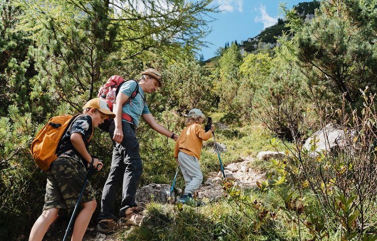
Walking with others often changes the experience, especially on longer itineraries such as those of the Cirque de Consolation or the Saut du Doubs. Besançon has several active hiking clubs, most affiliated with the Fédération Française de Randonnée Pédestre, which organise weekly or monthly outings open to non-members for a first try.
These clubs generally publish their programme on their website or through the Grand Besançon tourist office, with a difficulty level indicated for each outing, from an 8 km family walk to a sporty format exceeding 20 km with significant elevation gain. This is often the simplest way to discover itineraries less documented online, passed on by hikers who have been walking the area for decades.
For those who prefer autonomy, our Ryo selection of activities in Besançon also lists several local providers who organise occasional guided outings, an intermediate option between a year-long club commitment and a completely solo hike.
Joining a club also offers a practical advantage that is not to be overlooked for the most distant outings in this guide: carpooling organised in advance, which avoids driving alone to Villers-le-Lac or the Cirque de Consolation, and shared knowledge about trail conditions according to the season — information that standard hiking apps often lack.
Planning Your Hike: Season, Equipment, Maps
The Doubs and the neighbouring Jura offer hikes that vary greatly in their demands, making it important to adapt your preparation to the chosen itinerary. A forts loop in the city centre requires nothing more than decent trainers, while the Cirque de Consolation or the Saut du Doubs justify proper hiking boots with good grip.
In terms of season, spring and autumn remain the most comfortable periods for the longest outings, as summer heat makes the gorges de la Loue and Cusancin particularly gruelling in the middle of the day due to insufficient shade on certain stretches. Winter, on the other hand, turns the forêt de Chailluz and the forts loop into perfectly viable outings, provided you are happy with occasionally frozen or muddy ground.
For route preparation, IGN maps at 1:25,000 remain the most reliable reference, usefully complemented by a Visorando track downloaded in advance: the community often details variants or flags a temporarily closed section, information that is rarely updated on paper maps.
Finally, one last simple reflex to adopt before any outing longer than 10 km: let someone know your planned route and estimated return time. The gorges de la Loue and the Cirque de Consolation are among the Doubs areas with the worst mobile network coverage, a detail that often surprises hikers coming from better-connected urban areas.
Always carrying more water than you think you'll need also applies even on the shorter circuits in this guide: the springs encountered along the way, however clear they may look, are not all safe to drink without treatment — including the source du Cusancin and the source de la Loue.



FAQ
What is the most beautiful hike around Besançon?
It's hard to pick just one given how different each trail is, but the Cirque de Consolation with its hidden waterfall earns the most superlatives, featuring wooded cliffs, an isolated monastery, and far fewer crowds than the gorges de la Loue. For a more accessible option without a car, the forts loop from the Citadelle is the safest bet, with UNESCO-listed heritage as a backdrop to every climb.
Where can I hike under 10 km around Besançon?
The forts loop, the forêt de Chailluz from its main car park, and the Roche d'Or viewpoint in Chalezeule all cover under 10 km and start less than twenty minutes from the city centre. These are the best options for a two-to-three-hour outing with no car and no complex logistics.
Where can I see a waterfall near Besançon?
Two sites stand out: the source du Cusancin, 40 km away, with its successive forest pools, and the cascade du Lançot in the Cirque de Consolation, 55 km away, a 47-metre drop at the foot of the cliffs. The Saut du Doubs, 100 km away, is however the most impressive waterfall in the area if you're willing to make a full-day trip of it.
How do I get to the Saut du Doubs from Besançon?
Allow around 100 km by road via Morteau and Villers-le-Lac, which takes just over an hour. Trains serve Morteau, with a connecting bus or carpooling option to Villers-le-Lac, but a car remains much more practical given the limited schedule of this connection.
Is there a hiking club in Besançon for beginners?
Yes, several clubs affiliated with the Fédération Française de Randonnée Pédestre organise outings open to non-members for a first try, with varying difficulty levels. The Grand Besançon tourist office generally centralises the current season's programmes.
Can I follow a Visorando trail around Besançon?
Absolutely — the Visorando community lists many routes in the area, including some Cirque de Consolation variants that are less documented elsewhere. Downloading a route before you set off is a good practice to complement IGN maps, particularly for spotting a recently closed or altered section.
What is the best season for hiking around Besançon?
Spring and autumn are the most comfortable seasons for longer outings such as the Cirque de Consolation or the gorges de la Loue, which are less exposed to summer heat. Winter is perfectly suited to the urban loops around Besançon, including the forêt de Chailluz, provided you're happy with occasionally frozen ground.
Twelve itineraries, from the urban forts loop to the Saut du Doubs waterfall 100 km away, are rarely enough to exhaust everything hiking around Besançon has to offer. The city itself, coiled in its Doubs meander and crowned by Vauban's Citadelle, remains a rare starting point that combines listed heritage with direct access to far wilder landscapes, from the Jura to the gorges de la Loue.
Whether you're looking for a loop under 10 km for a late afternoon, a waterfall to discover as a family, or a full-day trip to the Saut du Doubs, every itinerary in this guide states the distance and level required so you can plan your outing without nasty surprises. Joining a local club is the best option for tackling the most demanding routes, while a well-chosen Visorando track is more than enough for shorter loops.
Before or after your outdoor outings, take the time to explore the historic centre on foot with the Ryo audio-guided tour of Besançon: it naturally complements this selection of hikes by telling the story of the city you will have walked through, seen from above, from each of the viewpoints in this guide.