© Shutterstock
 Votre guide Ryo
Walking in Besançon: The Complete On-Foot Itinerary in 2026
A walk in Besançon rarely starts where you'd expect: here, all it takes is crossing a bridge to travel back in time. On one side of the Doubs, the ochre facades of the old town and the watchmaking workshops that built the industrial reputation of this Comtois city; on the other, the terraced vineyards of the Battant neighborhood, cultivated on the hillside since the Middle Ages. It is this constant shift between water, stone, and relief that makes a walk in Besançon so distinctive: the river almost entirely encircles the historic center, forming a near-closed loop that you can follow without ever leaving the riverbanks.
In the pages that follow, we head up the Grande Rue to Victor Hugo's birthplace, climb the slope separating the city center from the Vauban citadel—a UNESCO World Heritage Site since 2008—and venture as far as the Chailluz forest for a wilder interlude. An astronomical clock made up of 30,000 parts, a 16th-century bridge still in use today, Renaissance mansions tucked between two shops: the city reads like an open book for those who take the time to look up. Some stages take an hour; others deserve an entire morning, and it is precisely this alternation of rhythms that shapes the itinerary proposed here.
For a hands-free narration, the Ryo audio-guided tour of Besançon covers a large part of this itinerary, from the Grande Rue to Victor Hugo's Birthplace, with commentary in your ear and the pace entirely your own.
The Old Town: Place Victor Hugo and the Saint-Jean Cathedral
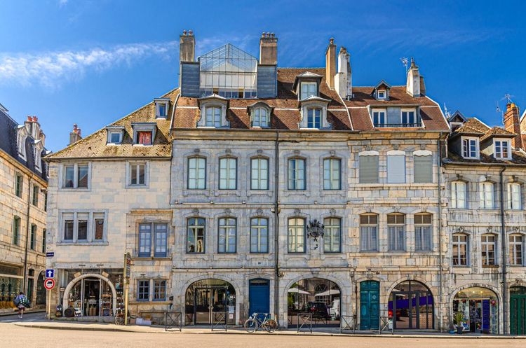
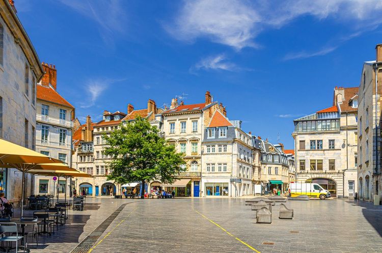
Most walks through Besançon begin at the same spot: Place Victor Hugo, paved with pale stone and lined with café terraces that open as early as 8am. The writer was born here in 1802, in a house now converted into a museum a few streets away. On this square, the city already displays what sets it apart from its Franche-Comtois neighbors: a density of old buildings packed onto a tongue of land surrounded by water, a legacy of a topography that long prevented any expansion of the center.
If you're traveling with children, the square itself is well suited to a break: the terraces generally accommodate strollers, and the central fountain inevitably draws younger visitors in summer, making it a handy rallying point before tackling the rest of the walk.
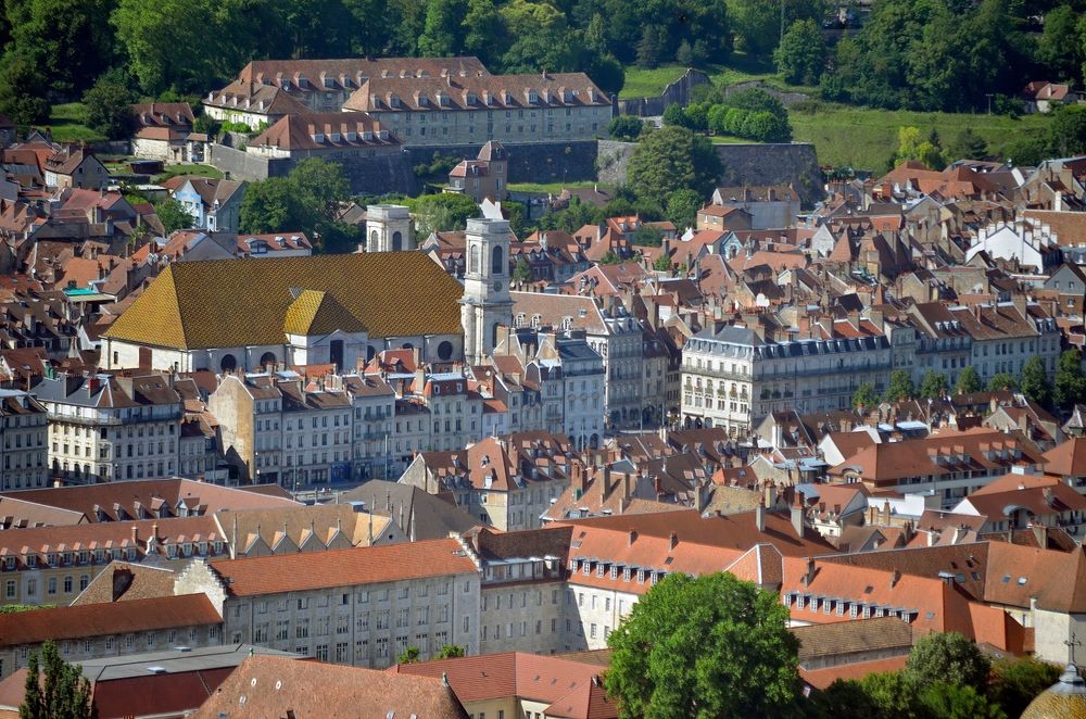
A few minutes' walk from the square leads to the Saint-Jean Cathedral, whose construction spanned from the 4th to the 18th century: each expansion left a visible layer, from the Romanesque chevet to the Classical facade. The building is distinguished by a rotating altar unique in France, the Rose de Fer, and by an apse featuring two symmetrical apsidal chapels—an exceptionally rare arrangement for a church of this size. Allow around twenty minutes to walk around it if you want to identify the different periods of construction at a leisurely pace.
Many hurried visitors miss a striking detail: the stained-glass windows of the north transept, rebuilt in the 20th century after the bombings of 1940, stand in sharp contrast to the rest of the building with their brighter colors and near-abstract style. Far from harming the whole, this juxtaposition neatly illustrates the layered logic that characterizes Besançon's entire historic center: nothing has ever been razed to start from scratch; everything has accumulated, century after century.
Just behind the cathedral, the Porte Noire surprises with its austerity: this 2nd-century Roman triumphal arch, erected in honor of Marcus Aurelius, has turned grey-black over the centuries, hence its name. It once marked the entrance to the ancient city of Vesontio. Nearby, the square Castan preserves the remains of a Roman theater and an aqueduct, beneath a small shaded esplanade where locals often come to read at the end of the day.
Head back down toward the Grande Rue to reach Victor Hugo's birthplace (140 Grande Rue, 25000 Besançon, rated 4.2/5 on Google from 1,026 reviews), at number 140. The facade is unassuming, but the interior traces the writer's childhood and his ambivalent relationship with his hometown, which he actually left only a few months after his birth. The small museum can be visited in 30 to 40 minutes and makes a useful complement to the old-town walk before continuing northward.
Between these four stops, the old town invites leisurely exploration: the Rue du Palais de Justice and Rue des Granges are lined with 17th-century facades, often pierced by carriage gateways that hint at flower-filled inner courtyards. You'll find more independent shops than chain stores here, giving this part of the center an almost village-like pace despite the city's 116,000 inhabitants. Take a moment to look at the sculpted lintels above the doorways: several date from the 16th century and recall the trade of the original owner—tanner, goldsmith, or wine merchant — a detail the Ryo "A Matter of Time" audio-guided tour picks up on right at the Porte Noire stop.
The Astronomical Clock and the Musée du Temps
Back inside the cathedral, the second stage of this walk in Besançon steps up a notch in precision: the Besançon astronomical clock, installed in 1860, comprises 30,000 mechanical parts and 57 dials displaying the time in 16 cities around the world, the tides of six French ports, the phases of the moon, and even leap years up to 2400. The guided visit, offered several times a day, lasts around 30 minutes and remains one of the rare opportunities to observe such a complex mechanism still in daily operation at close range.
At the twelfth stroke of noon, a small automated display is triggered on the face of the mechanism: several automatons come to life in turn, including a representation of Christ surrounded by the apostles, watched over by a rooster that beats its wings. This spectacle, timed to the second for more than 160 years, draws a handful of curious onlookers each day at noon who look up at just the right moment, often alerted by a tourist office guide stationed nearby.
This local passion for measuring time is no coincidence: Besançon held the title of France's watchmaking capital for more than a century, with up to 20,000 jobs tied to the industry in the 1960s. The Musée du Temps (96 Grande Rue, 25000 Besançon, rated 4.5/5 on Google from 1,671 reviews), housed in the Palais Granvelle, extends this history through a collection of clocks, watches, and precision instruments, as well as through the architecture of the building itself: a Renaissance arcaded courtyard commissioned in the 16th century by Charles V's chancellor, Nicolas Perrenot de Granvelle.
To delve deeper into the city's watchmaking history, the Ryo audio-guided tour "Une histoire de temps" devotes 26 audio stops to this heritage of timekeeping, from the Palais Granvelle to the workshops of the Boucle that once produced watches and chronometers.
The Besançon Citadel: The Climb and the Panorama
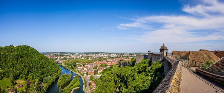
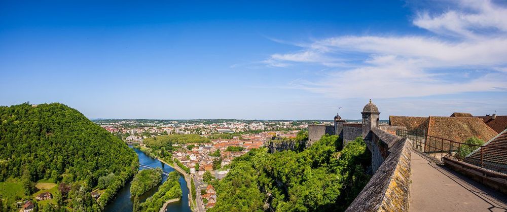
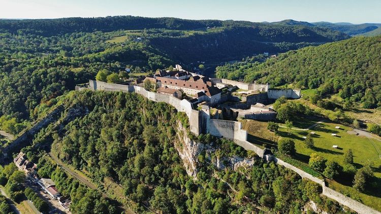
It takes about 20 minutes on foot from the Grande Rue to reach the Besançon citadel (99 Rue des Fusillés de la Résistance, 25000 Besançon, rated 4.5/5 on Google from 8,936 reviews), perched on the rocky spur that closes the Doubs loop. Vauban designed it from 1668 onward on the orders of Louis XIV, to lock down a border then close to the Holy Roman Empire. The fortification is now listed as a UNESCO World Heritage Site, as part of the Vauban fortifications, alongside eleven other sites spread across French territory.
The climb follows a cobbled path that becomes fairly steep toward the end, but shuttles are available in season for those who prefer to save their legs for the visit itself. Once at the top, allow half a day if you want to take in all the spaces: the site includes three museums—the Musée comtois dedicated to regional traditions, the Natural History Museum with its insectarium and aquarium, and the Museum of the Resistance and Deportation housed in the former barracks—as well as a small zoological garden and several kilometers of ramparts open for free exploration.
The citadel has not always had a tourist vocation: requisitioned by the German army during the Second World War, it also served as an execution site for resistance fighters, whose story is recounted with great sobriety in the dedicated museum on site. This memorial dimension contrasts with the lighter atmosphere of the rest of the site, where children and families flock mainly to the vivarium and the zoological garden.
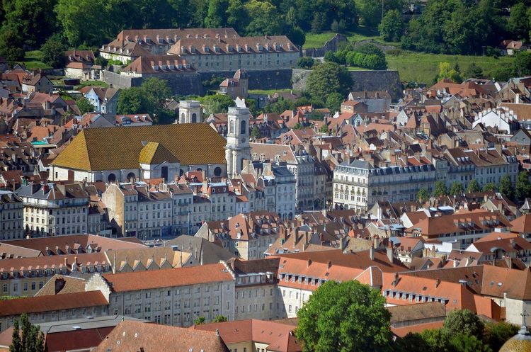
It is precisely from the ramparts that this walk in Besançon comes into its own: the panorama takes in the full Doubs loop, the brown-tiled rooftops of the old town, and on clear days, the first foothills of the Jura on the horizon. Few French cities offer such a complete view of their own geography from a single point. Make sure to wear sturdy shoes: some of the rampart paths are unevenly paved and can become slippery after rain.
Families are well catered for too: the Museum's "Insects and Small Creatures" trail is designed to hold younger visitors' attention, and the zoological garden, modest in size though it is, features red pandas and otters that are always in high demand at the end of a visit. If you're visiting with young children, note that strollers can navigate most of the paths, with the exception of a few staircases in the watchtowers.
On some summer weekend evenings, the citadel hosts nighttime sound-and-light shows projected onto the ramparts—a different way to discover the site once the daytime visitors have gone. If you can only choose one moment to visit, opt for late morning on a weekday, when the light is still soft and school groups have yet to arrive.
Entry is paid, ranging from €9.50 in low season to €13.50 in high season for an adult ticket giving access to all areas, but it remains one of the best time-to-content ratios in the city: between military history, regional wildlife, and the panorama, there is easily enough to fill an entire morning without leaving the enclosure. The site covers more than 11 hectares: it's worth picking up a map or downloading the one available at the entrance to avoid unnecessary back-and-forth between the different pavilions. The Ryo "A Matter of Time" audio-guided tour devotes several stops to the citadel before heading back down toward the Grande Rue.
The Doubs Loop: A Walk Along the Water
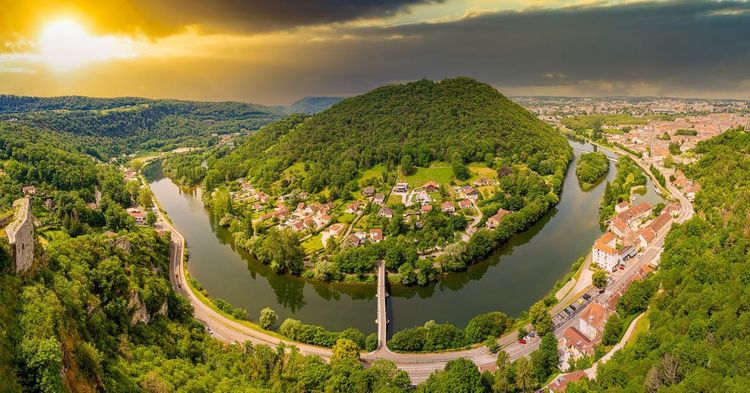
Back down from the citadel, you can choose to follow the river rather than the streets: the Doubs loop almost entirely encircles the historic center, and a developed towpath allows you to walk or cycle the full circuit without leaving the riverbanks for more than a few minutes. The complete loop, around 6 kilometers, can be walked in an hour and a half at a relaxed pace, photo stops included.
The Doubs has not always been mere scenery: by almost entirely encircling the rocky spur, it allowed Vauban to fortify only a single front—the citadel side—rather than surrounding the entire city with ramparts. This economy of means partly explains why the historic center was able to preserve such a dense urban fabric: the space saved on fortifications went directly into housing.
The Pont Battant (Pont Battant, 25000 Besançon), the first bridge crossable from the north, dates from the 16th century in its current structure, even though a bridge existed at this spot as far back as Roman times. Today it marks the transition between the old-town bank and the Battant neighborhood, and is one of the best spots to watch, in late afternoon, the reflections of the citadel on the water.
Following the Quai Vauban downstream, the promenade Chamars opens up into a wider space, popular for picnics and impromptu pétanque games on summer evenings. It is also from here that, in season, electric boats depart upriver through the tunnel cut beneath the citadel: a ten-minute passage through the rock, lit in a slightly theatrical way, which appeals as much to children as to adults curious about 19th-century engineering.
A little further along, the pont de Bregille marks the other end of the loop and offers, from its deck, a worm's-eye view of the fortifications dominating the river. It's a good turning point if you'd rather head back to the center via the opposite bank rather than retrace your steps: the walk then shifts perspective entirely, with the citadel appearing in turn above you, then opposite, then behind.
On the far bank, downstream from the pont de Bregille, the Rivotte neighborhood long concentrated tanneries and leather-dressing workshops that drew on the current for their craft activities. Only a few converted industrial buildings remain today, but the memory of the neighborhood lives on among older Bisontins who still recall the distinctive smell that once hung over this stretch of the loop.
The Battant Neighborhood: The Other Bank of the Doubs
Once across the Pont Battant, the scene changes immediately. The Battant neighborhood long lived apart from the rest of the city: its inhabitants, mostly winegrowers until the 19th century, cultivated the slopes that still rise above the neighborhood today, even though phylloxera brought this viticultural activity to an end at the close of the 19th century.
In 1720, a major fire destroyed a large part of the neighborhood, which explains why most of the current facades date from the subsequent rebuilding rather than from the Middle Ages as one might initially assume. This reconstruction gave the neighborhood a certain architectural unity, with more consistent building heights than in the old town.
The narrow streets and colorful facades, often more modest than those of the old town, tell this working-class story. You'll also find the Puces de Battant here, a flea market held several times a year that draws browsers from across the region, as well as a concentration of bars and small restaurants that make it, come evening, one of Besançon's liveliest neighborhoods.
Above the neighborhood, fort Griffon (Rue de Belfort, 25000 Besançon, rated 4.2/5 on Google from 113 reviews) occupies a promontory that formed part of the same defensive system as the citadel. Less visited than the latter, it is nonetheless worth the detour for the view it offers over the rooftops of Battant and the old town on the far side of the river, with far fewer crowds than at the citadel's peak hours.
The climb to the fort follows a fairly steep staircase cut into the rock—around a hundred steps that deter some visitors but can be climbed in about ten minutes without any real difficulty for those with a reasonable level of fitness.
If you can only take away one image from this bank, let it be this: the vanished vineyards have given way to terraced gardens, where a few residents still grow tomatoes and flowers on the same terraces their winemaking ancestors once tended. To combine this bank with other must-sees in the city, a Ryo article listing the best things to do in Besançon offers a complementary itinerary, useful if you're looking to vary the experience beyond this waterside walk.
Parc Micaud and the Doubs Riverside Gardens
Between the station and the city center, Parc Micaud (Avenue Edouard Droz, 25000 Besançon, rated 4.5/5 on Google from 1,445 reviews) runs along the Doubs for nearly a kilometer. Laid out in the late 19th century in the English style, it remains one of the Bisontins' favorite green spaces for a mid-walk break, not least thanks to its rose garden, which boasts several hundred varieties in bloom from May to October.
The bandstand, restored a few years ago, still hosts free concerts on some summer Sundays—a good excuse to sit on one of the benches facing the river rather than pressing on. Families also appreciate the playground and picnic tables set in the shade of century-old plane trees.
The park also hosts, every June, an outdoor short-film festival organized by the city, projected directly onto a screen stretched between two trees—a good opportunity to extend the walk into the evening if your visit to Besançon coincides with the event.
A few minutes' walk away, the botanical garden of the University of Franche-Comté rounds out the green offering in this area with its tropical greenhouses and arboretum, free to enter for most of the year. The greenhouses house a collection of carnivorous plants and a space dedicated to the flora of the Jura massif—less spectacular than a large tropical greenhouse, but dense enough to fill 20 to 30 minutes of peaceful visiting. It's a less well-known stop for passing visitors, but it offers a chance to break up the urban walk with a quieter, almost timeless moment before heading back toward the Grande Rue.
The Grande Rue and Its Historic Mansions
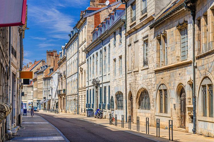
Heading back down toward the center, the Grande Rue forms the backbone of any walk through Besançon: this straight thoroughfare, inherited from the Roman cardo maximus of Vesontio, runs the full length of the Boucle from north to south for nearly a kilometer and a half.
It lines up a succession of 17th- and 18th-century mansions, often recognizable by their limestone ashlar facades and sculpted gateways. The Palais de Justice, a former archbishopric, and the town hall are among the most richly ornamented buildings on the street, while many more discreet residences now house independent shops, art galleries, or law offices, their facades little changed in three centuries.
Among the most remarkable facades, the Hôtel Terrier de Santans, now occupied by municipal services, displays a particularly elaborate sculpted gateway, while a few meters further along, the former Hôtel de Champagney preserves an inner courtyard that can sometimes be glimpsed from the street when the gateway is left ajar.
This blend of listed heritage and everyday life is perhaps what most distinguishes this street from historic centers frozen into open-air museums. Shops close and reopen, terraces change hands, but the architectural proportions have not moved.
Several covered passages, inherited from the 19th century, also allow you to cut from one parallel street to another without returning to the Grande Rue itself: a discreet way to avoid the crowds on market days, which are traditionally held on Tuesday, Friday, and Saturday mornings on the neighboring squares. In the late afternoon, the raking light that sweeps down the street sets off the sculpted reliefs on the facades—a good moment to slow down and look up, rather than rushing toward the next stop on the walk.
Viewpoints and Panoramas over Besançon
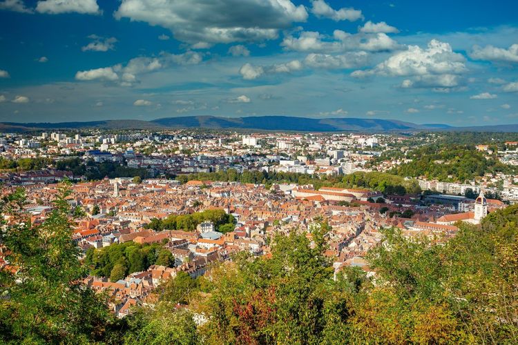
Beyond the citadel's ramparts, two other viewpoints are worth a detour if time allows, for anyone wanting to extend the Besançon walk at altitude. The fort de Bregille (Rue du Fort de Bregille, 25000 Besançon, rated 4.5/5 on Google from 370 reviews), on the opposite bank, looks directly across at the citadel and offers one of the best angles for photographing it in its entirety, especially in late afternoon when the stone takes on a golden hue.
The Chaudanne hill, slightly further out, completes the picture with an orientation table that lets you identify the city's main landmarks below. Allow around twenty minutes to climb from the pont de Bregille, with no particular technical difficulty, for a vantage point that most hurried visitors never take the time to discover.
If you can only visit one of these viewpoints, choose fort de Bregille in the late afternoon: the raking light crossing the valley at that hour particularly highlights the relief of the citadel, a contrast you won't find from the ramparts themselves, which inevitably face outward rather than toward the city.
Nature Walks around Besançon
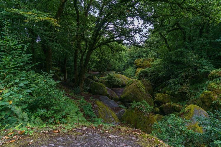
To extend the walk in Besançon beyond the historic center, the Chailluz forest (Route de Chailluz, 25000 Besançon, rated 4.5/5 on Google from 63 reviews) stretches over more than 1,300 hectares north of the city, making it one of the largest urban forest areas in France. Several marked loops, ranging from 3 to 12 kilometers, let you lose yourself there for half a day without ever crossing a road.
The plateau also hosts an equestrian center, marked mountain-biking trails, and in winter, a few kilometers of cross-country ski runs when snow permits—a rather unexpected use for a forest just 15 minutes from the city center by car. Runners also find a well-regarded training ground here, with enough elevation change to vary the pace without leaving the forest.
Closer to the center, the Vaîtes plateau forms a regional nature reserve of dry grassland—a rare ecosystem in Franche-Comté that harbors several species of wild orchids in spring. The walk is shorter here, around an hour's round trip from the Palente neighborhood, but it shifts register completely compared to the cobbled lanes of the center: here, grasshoppers and butterflies set the pace rather than Renaissance facades.
The Roche de la Baume massif, which overlooks the citadel to the south, rounds out these open natural spaces. Less extensive than the Chailluz forest, it mainly attracts local climbers, the limestone cliff offering several equipped routes visible from the pont de Bregille for those who know where to look.
Along the Doubs itself, one last route deserves a mention: the path that follows the river upstream toward Chalezeule winds through reed beds where grey herons and kingfishers nest. Nature enthusiasts come early in the morning, when the mist rising from the water gives this stretch of the walk an almost otherworldly atmosphere, very different from the bustle of the city center during the day.
The Chailluz forest is about fifteen minutes by car from the center, or around thirty minutes by bike along a road that climbs gradually from the Palente neighborhood. A free car park is located at the main entrance to the forest, near the equestrian center, which is practical if you plan to spend half a day there rather than just an hour's walk. For those who want to broaden their horizons further, our Ryo article on the 14 must-sees of the Doubs lists other natural stops within an hour of Besançon, from river gorges to hilltop villages in the Doubs.
Cycling along the Doubs
Besançon also lends itself very well to a cycling trip, thanks in particular to the EuroVelo 6, the cycling route linking the Atlantic to the Black Sea that passes through the city along the Doubs and then the Rhône-Rhine canal. The urban section, almost entirely flat and separated from motor traffic, suits families and more sporting cyclists alike who simply want to cross the city without stopping.
The city's bike-sharing service allows you to rent a bicycle by the hour or by the day from around thirty stations spread across the center and nearby neighborhoods, with no subscription required for occasional use. It is often the quickest way to link several points of the walk described above, particularly for connecting Parc Micaud, the Doubs loop, and the Battant neighborhood without retracing your steps.
For those who prefer electric assistance, several rental shops in the center offer e-bikes by the half-day or full day—a welcome option for tackling the climb to the citadel or fort Griffon without too much strain. The city has also invested in recent years in a network of cycle lanes separated from traffic, particularly along the main roads linking the center to the outlying neighborhoods, an infrastructure still incomplete but sufficient to reach most points of interest on this walk without mixing too much with motor vehicles.
For longer outings, the greenway following the canal toward Dole or Montbéliard allows you to extend the ride by several dozen kilometers, almost entirely on a dedicated path. Allow a full day if you want to reach one of these two cities and return by train—a practical option since local stations accept non-folded bikes during off-peak hours.
Where to Take a Break during the Walk
A walk in Besançon naturally calls for food breaks along the way. The Grande Rue and its surroundings concentrate most of the terraces, but local specialties are worth stepping slightly off the most-traveled route.
Comté, produced just a few kilometers from the city, appears on almost every menu, usually accompanied by a vin jaune or a less well-known Jura wine. Food lovers will also spot the croquant bisontin, a small almond pastry sold in several bakeries in the center for more than a century.
The Beaux-Arts covered market, open every morning except Monday, remains a good address for sampling local produce without going to a restaurant: aged cheeses, charcuterie, and pastries sit side by side in a more authentic atmosphere than the tourist terraces of the Grande Rue.
For a fuller overview of local cuisine, our Ryo selection of Bisontin culinary specialties details ten addresses and products not to miss alongside the walk, from cheese to the heartier dishes of Comtois cuisine.
When to Go and How Long to Allow for the Walk
For the short version of this walk in Besançon, focused on the old town and the astronomical clock, allow half a day. To include the citadel—which deserves two to three hours on its own—a full day is preferable, especially if you add the Doubs loop.
Spring and early autumn remain the most comfortable periods for walking: Besançon summers can be hot and humid due to the proximity of the river, while winter—often grey and cold—lends itself better to a walk centered on indoor spaces, museums and the cathedral, than to long outdoor routes.
Also bear in mind that some sites, such as the citadel's Natural History Museum, reduce their opening hours in the low season: it's worth checking opening times before planning your walk precisely around a given morning or afternoon.
Good to Know before You Go
The historic center of Besançon, concentrated within the Boucle, can be explored entirely on foot: it's best to leave the car in one of the park-and-ride facilities on the outskirts rather than hunting for a spot in the narrow lanes of the center, where parking is limited and usually paid.
Two stations serve the city: Besançon Viotte, more central and about fifteen minutes' walk from Place Victor Hugo, and Besançon Franche-Comté TGV, linked to the center by shuttle and tram, more convenient if you're arriving from Paris or Lyon by high-speed train.
For visitors with reduced mobility, the old town is generally accessible on flat ground, with the exception of the climb to the citadel, which requires a vehicle or good physical condition. Themed guided tours organized by the tourist office also allow you to explore certain aspects in depth—watchmaking, Vauban architecture, or the Battant neighborhood—without having to plan your own itinerary.
In case of rain, several stages of this walk can easily retreat indoors: the cathedral, the Musée du Temps, and the citadel museums can fill a good part of the day without ever venturing out into a downpour for more than a few minutes between buildings.
For those traveling light, a luggage storage facility exists near Viotte station, useful if your train leaves in the evening and you don't want to haul your bags over the cobblestones of the citadel. Remember to bring a water bottle too: the public fountains in the city center are drinkable, allowing you to refill for free at several points along the route.
FAQ
How long does a walk in Besançon take?
Allow half a day for the old town, the cathedral, and the astronomical clock. With the citadel and a full loop of the Doubs, a whole day is more realistic, especially if you add a lunch break or a detour into the Battant neighborhood.
Where should you start your walk in Besançon?
Most itineraries begin at Place Victor Hugo, a short walk from Besançon Viotte station and the Saint-Jean cathedral. It's a central starting point from which you can head toward the citadel, the Grande Rue, or the Doubs loop depending on how much time you have.
Is the Besançon citadel easy to visit on foot?
Yes, it's about a twenty-minute walk from the city center, though the final stretch is fairly steep. Shuttles are available in season for those who prefer to save their legs for touring the museums and ramparts once at the top.
What walks in Besançon are good for families?
Parc Micaud, the Doubs loop, and the citadel—with its zoo garden and insectarium—are all well suited to children. The tunnel used by electric boats beneath the citadel is also a popular stop with younger visitors, combining an underground passage with views over the river.
Can you cycle along the Doubs in Besançon?
Yes, the EuroVelo 6 runs through the city on a dedicated path along the river, and a bike-sharing service rounds out the offer for those without their own bicycle. It's a great option for linking several neighborhoods without retracing your steps.
What is the best season to walk in Besançon?
Spring and early autumn offer the most pleasant conditions for walking several hours. Summer can be hot and humid near the river, while winter—often grey—is better suited to a walk focused on museums and the cathedral.
Do you need to book the citadel visit in advance?
It's generally not necessary outside of school holidays and public holidays. In high season, however, booking online helps avoid queuing at the ticket office, especially for combined visits including the three museums on site.
A Walk That Comes Full Circle
A walk in Besançon is like no other because the city itself refuses to choose between its identities: Roman and watchmaking, fortified and riverine, working-class in Battant and bourgeois in the Boucle. It is this layering of strata, visible at every street corner, that makes you want to do the itinerary in reverse, or push further into the Chailluz forest another day.
Whether you have half a day or a long weekend, the city can be discovered without a complicated plan: follow the river, climb to the citadel when your legs allow, and let yourself be surprised by the details—a sculpted lintel, a reflection on the Doubs, a hidden terrace in Battant. At Ryo, we have a particular fondness for cities that tell a different story depending on the direction you take, and Besançon is an almost perfect example. And if one day isn't enough, there's nothing stopping you from coming back: the city shifts noticeably in atmosphere with the seasons, from the lights of the Christmas markets on the Grande Rue to the cool of the Doubs riverbanks in the height of summer.
To extend the experience once you're on the ground, the Ryo audio-guided tour of Besançon offers a geolocated audio commentary for a large part of this route—handy for days when you'd rather walk with your head up than your nose in a map.