© Shutterstock
 Votre guide Ryo
Hiking Around Saint-Malo in 2026: Ramparts, GR34, Two Capes and the Pays Malouin Loop
At low tide, a strip of sand connects Saint-Malo's walled city to a small island where a writer asked, in his will, to be buried facing the open sea. Two hours later, the sea rises and closes the passage again. This constant interplay between land and sea sums up rather well what awaits anyone who goes hiking around Saint-Malo: here, the tide dictates the itinerary just as much as the waymarking does. Our Ryo À l'abordage audio-guided tour already explores the ramparts and the old town; this guide ventures beyond the walls.
For this is not just one walk but an entire network of trails stretching from the bay of Mont-Saint-Michel all the way to cap d'Erquy. Along the way you will encounter a coastal path several hundred kilometres long, a rocky headland facing the Chausey archipelago, a tidal barrage that has been generating electricity since 1966, and a village listed among the most beautiful in France, perched on a promontory above the Rance. Enough to build a programme lasting half a day or a full week, on foot, with the family, or over a multi-day hiking trip.
The Ramparts Walk and the Pointe du Grand Bé, the Must-Do Stroll in the Heart of Saint-Malo Intra-Muros
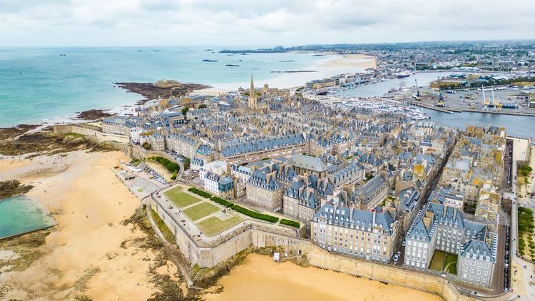
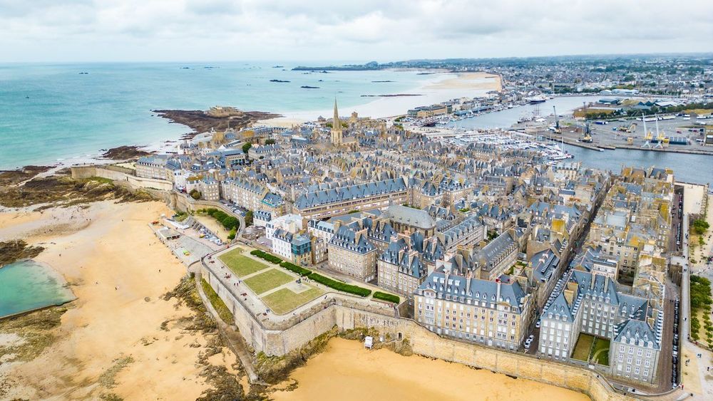
Before heading out to tackle the coastline, the warm-up happens on the ramparts themselves. The full circuit of the Saint-Malo ramparts covers about 1.75 km and takes between forty-five minutes and an hour, passing rusted cannons, corner watchtowers and views that sweep in turn over the English Channel, the harbour and the slate rooftops of the walled city.
At the foot of the seaward wall, a sandbar emerges at low tide and opens the way to Grand Bé, the small island where Chateaubriand lies buried: his tomb, a plain granite slab topped by a cross and bearing no inscription whatsoever, faces the horizon he gazed at as a child. Check the tide times before venturing out: the island is cut off roughly two hours before high tide and the crossing becomes submerged again just as quickly. Every summer, many impatient visitors are caught out.
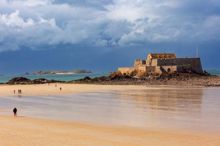
A little further along the same path, Fort National sits on its own rock and can be visited at low tide in season. To extend the walk without leaving the fortified city, the Ryo article on the Cité d'Aleth details the other historic peninsula of Saint-Malo, on the Saint-Servan side, which is often overlooked by visitors in a hurry.
The GR34 Coastal Path: the Route That Connects All Hikes Around Saint-Malo
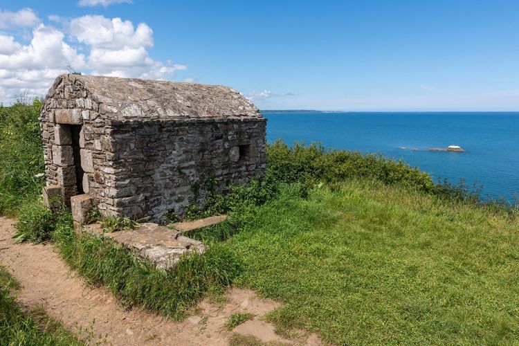
Most of the walks described in this article follow, if only for a few hundred metres, the same trail: the GR34, also known as the sentier des douaniers or customs officers' path. Originally, this route was used by the revenue men who patrolled the Breton coastline against salt smuggling and, later, against the landing of spies or contraband. Today it follows nearly 2,000 km of Breton shoreline, from Mont-Saint-Michel to the Vilaine estuary, making it one of the longest coastal long-distance paths in Europe.
Along the Saint-Malo coastline, the route is divided into two main official sections. The first, "GR® 34: from Mont-Saint-Michel to Saint-Brieuc", sets off from the bay and passes through Cancale, Saint-Malo, Dinard, cap Fréhel and cap d'Erquy before reaching Saint-Brieuc. Allow several days of walking for the full section, covering 20 to 25 km per day for a fit hiker. The second, "GR® 34: from Saint-Brieuc to Morlaix", continues westward, beyond the scope of this guide, for anyone wishing to carry on towards Finistère.
The waymarking follows the standard long-distance path code: two horizontal stripes, white above red, painted on posts, low walls or rocks. A crossed stripe marks the wrong way; an arrow signals a sharp turn. Along the Saint-Malo coast, the path is generally easy to follow, but it climbs and descends constantly around the rocky headlands (Grouin, Meinga, Décollé, Fréhel) where wind and sea spray can make some sections slippery after rain.
For planning a precise itinerary, the IGN 1:25,000 map (blue series, sheets 1116O and 1015O for the Saint-Malo to Cancale area) remains the most reliable reference, supplemented in the field by an app such as Komoot or Visorando, which displays the GPS track in real time. Bear in mind the key principle: every walk in this guide — whether the pointe du Grouin, the two capes or the Pays Malouin loop — connects to a section of this same coastal path. The Ryo article on the most beautiful hikes around Saint-Malo complements this backbone with further suggestions for shorter loops.
The Pointe du Grouin and the Cancale Area: Wild Cliffs and Oysters
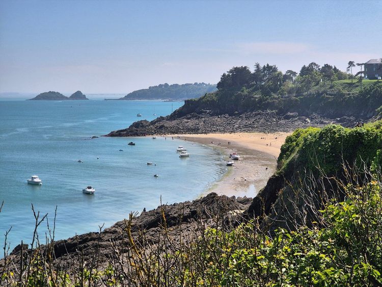
The Pointe du Grouin and Its Loop Facing Chausey
The pointe du Grouin marks the north-eastern boundary of the Saint-Malo area, about twenty minutes' drive from the city. This is where the Channel changes character: on a clear day, the Chausey archipelago stands out on the horizon some forty kilometres offshore, while Mont-Saint-Michel appears on the other side of the bay. The classic loop covers about 5 km and takes 1h30 to 2h of walking, following the GR34 to the îlot Besnard, also accessible only at low tide.
The moorland covering the headland is home to an ornithological reserve where cormorants and gulls nest; the fences marking off certain areas are not decorative — they protect nesting zones in spring. Bring binoculars if you are hiking between April and July. The wind blows almost constantly here, which noticeably lowers the felt temperature even in the height of summer, a detail that many visitors in T-shirts discover to their cost.
To complete the outing without retracing your steps, many hikers continue westward towards Vivier-sur-Mer and its mussel beds on bouchots, visible at low tide from the path. Allow a good half-day for the full round trip from the car park at the headland. That car park fills up quickly at weekends in season; arriving before 10 a.m. or opting for a late afternoon visit means both finding a space and enjoying a lower, more raking light on the pink rocks that line the trail.
The Pointe du Meinga, the Anse du Gueslin and the Port-Briac Trail
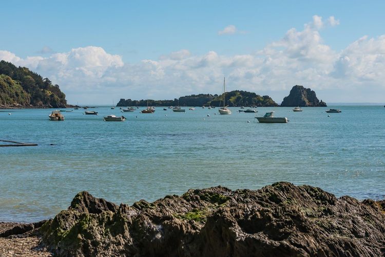
Heading back down towards Cancale, the GR34 passes through three other sites that are less crowded but just as photogenic. The pointe du Meinga offers an open panorama over the bay, with a few coves accessible at low tide for a sheltered picnic spot out of the wind.
A little further on, the Anse du Gueslin carves a sandy indentation between two rocky headlands, while the Port-Briac loop offers a more sheltered route into Cancale, partly through woodland, on days when strong winds make the clifftop path uncomfortable.
This section takes 2h to 2h30 from the pointe du Grouin, with no particular technical difficulty, making it a good option for continuing the day without backtracking. Families with young children often prefer this variant via Port-Briac: it is less exposed and also shortens the total distance by about a kilometre compared with the full coastal path.
Cancale, Its Oysters and the Best Stops at the End of the Walk
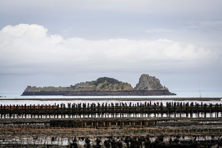
Any walk in this area ends, almost inevitably, at the port de la Houle (Port de la Houle, 35260 Cancale, rated 4.8/5 on Google from 10 reviews) in Cancale. The oyster beds lining the bay produce some of Brittany's most celebrated shellfish, and eating a dozen standing on the quayside, facing the sea, has been a local ritual for generations.
To extend the experience on the water rather than on foot, several operators offer a catamaran trip in the bay of Cancale, with views over the oyster beds and the Chausey archipelago from the sea. For accommodation, bed and breakfasts in the town centre and lodgings with a view of Mont-Saint-Michel often need to be booked months in advance in July and August; out of season, prices drop noticeably and the best tables on the harbour remain accessible without a reservation. To broaden the picture around the town, the Ryo article What to See Around Saint-Malo lists other stops to add to a stay in the area.
The oyster market runs every day in season directly on the quayside, with a dozen stalls selling shellfish accompanied by bread, butter and a glass of muscadet. For a sit-down meal, the terraces overlooking the harbour from the rue du Port offer a better view but higher prices than the stalls right on the cobblestones.
From Saint-Malo to Dinard Along the Rance: Tidal Barrage and Fishing Villages
Between Saint-Malo and Dinard, two routes stand out: the classic GR34 coastal path, longer and more exposed, and the crossing via the interior of the Rance estuary, more sheltered and punctuated by an industrial landmark that made history in French energy. Most hikers combine both on the same day, setting out early to make the most of low tide on the first few kilometres.
The Rance Barrage Loop Between Saint-Malo and Dinard
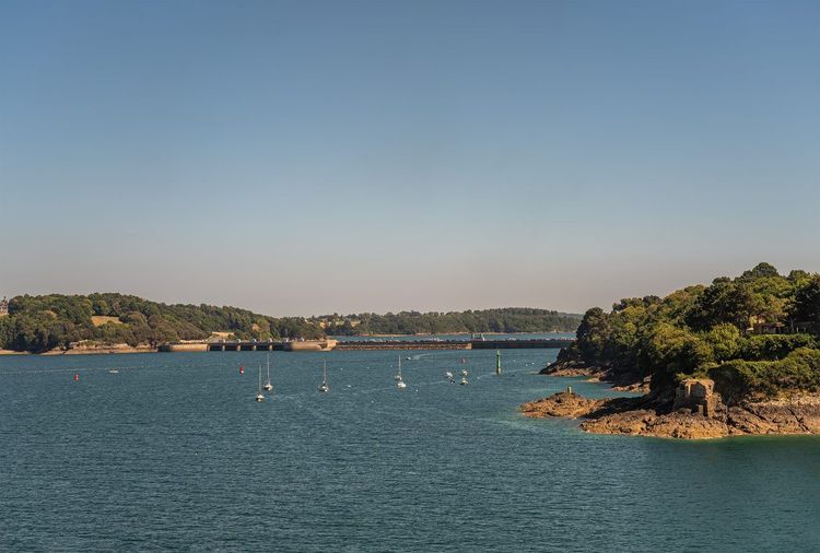
The path linking Saint-Malo to Dinard first follows the Rance estuary before crossing the structure that transformed the river: the Rance tidal barrage. Commissioned in 1966, it remains the world's oldest tidal power plant still in operation and generates enough electricity to power the equivalent of a city the size of Rennes. The 750-metre road across it can be walked or cycled, with sweeping views over the estuary on both sides.
The full loop between Saint-Malo and Dinard, following the coast then crossing the barrage, totals about 18 km return; many hikers prefer to split the journey by going one way on foot and returning by the sea shuttle, a ferry that crosses the estuary in about ten minutes. Allow €6.30 for a single adult fare outside peak season, €6.60 in July and August, and €8.90 for a return; bikes board for an additional €3.20 or so, which makes it possible to combine walking one way with cycling the other. Along this section, the path alternates between steep coastal trails and small sandy beaches, particularly near la Passagère, where it is common to see people fishing at low tide.
Saint-Suliac, an Essential Stop Along the River
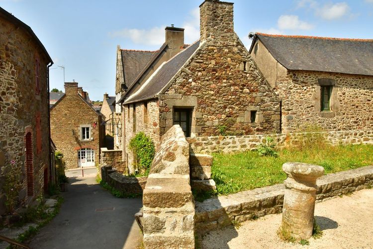
Upstream from the barrage, the village of Saint-Suliac (Saint-Suliac, 35430 Saint-Suliac, rated 4.7/5 on Google from 950 reviews) is worth a detour, even if it means straying slightly from the main coastal route. Listed among the most beautiful villages in France, it lines its granite houses and flower-filled gardens along a street that descends straight to the Rance, with the old mont Garrot as a backdrop.
The walk around mont Garrot, about 5 km, offers one of the finest panoramas over the estuary, with mussel beds visible below at low tide. Sailing enthusiasts often spot traditional rigged vessels moored in the village harbour in autumn, during local gatherings; for the rest of the year, just a few fishing boats bring the quayside to life. To explore the villages of the area more thoroughly, the Ryo article on the most beautiful villages around Saint-Malo also covers Cancale, Dinan and Combourg.
Dinard and Saint-Lunaire: the Rocky Headlands and the Promenade du Clair de Lune
Dinard's seafront is a striking contrast to the austerity of the Saint-Malo ramparts. Here, the coastal path winds between the gardens of Belle Époque villas with their colourful shutters — the legacy of the wealthy British holidaymakers who made the resort's reputation from the late nineteenth century onwards. The Promenade du Clair de Lune, lit up in the evenings in season, runs along the Écluse beach for about 1.5 km and can be walked year-round, even by families with pushchairs.
For visitors short on time, a shortened 45-minute version simply connects the pointe de la Vicomté to the Écluse beach, keeping to the waymarked promenade with no significant elevation gain. It is the simplest option for discovering Dinard without planning a proper hike. The contrast between the two banks of the estuary often strikes visitors arriving from Saint-Malo by sea shuttle: on one side, granite ramparts; on the other, pastel-coloured seaside villas, separated by barely ten minutes of crossing.
Past the pointe de la Malouine, the path becomes wilder again as far as Saint-Lunaire, where the pointe du Décollé (Pointe du Décollé, 35800 Saint-Lunaire, rated 4.7/5 on Google from 1,359 reviews) offers one of the most vertiginous viewpoints in the area: a deep rocky cleft splits the headland in two, crossed by a metal footbridge that sends a shiver through anyone with a head for heights. At high tide, waves surge in with a characteristic deep rumble.
Allow about 2h30 to walk from Dinard to Saint-Lunaire along the coast, not counting swimming stops. Out of season, parking is easy near the pointe de la Malouine, whereas in July and August it is better to park near the casino and walk to the promenade. The path then continues towards Lancieux, whose long sandy beach and oyster beds already hint at the landscape around cap Fréhel. A handful of good crêperies and seafood restaurants line the village seafront, at prices noticeably kinder than those in Dinard.
The Two Capes, Fréhel and Erquy: the Most Spectacular Hike on the Côte d'Émeraude
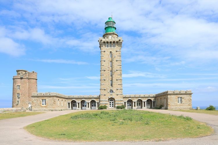
Allow 30 to 40 minutes' drive from Saint-Malo to reach the two-cape area — further than the previous walks, but spectacular enough to justify a half-day in its own right.
From Cap Fréhel to Fort La Latte: Moorland and Vertiginous Cliffs
Cap Fréhel rises more than 70 metres above the sea, covered in heather and gorse moorland that turns violet and yellow between July and September. Its lighthouse, 32 metres tall with its beam at 103 metres above the waves, can be visited in season and offers a view from the top that stretches, on a clear day, as far as the island of Bréhat and Jersey.
The path linking the cape to Fort La Latte winds for about 4 km one way — nearly 8 km return — along the cliff edge, with moderate elevation gain but impressive sheer drops that have earned this stretch of the GR34 its reputation as the finest segment of the Côte d'Émeraude. The medieval fort, remodelled in the seventeenth century and made famous by several film shoots, can be visited with its drawbridge and its two towers linked by a wall-walk.
Wear sturdy footwear: the path, exposed to the prevailing wind, becomes slippery after rain, particularly on the rocky sections near the fort. The 340 hectares of moorland at cap Fréhel are protected under the Natura 2000 designation and the site has held the Grand Site de France label since 2019; an ornithological reserve covers the cliffs, where seabird colonies nest between March and July — crested cormorants, guillemots and occasionally Atlantic puffins can be observed through binoculars from the waymarked paths, without ever approaching the edge. Two car parks serve the site, one near the lighthouse and one further out on the Fort La Latte side, which also makes a one-way walk possible if you leave a car at each end. Most hikers complete the round trip in 2h30 to 3h, not counting time spent visiting the fort.
Cap d'Erquy and Its Pink Sandstone Coves
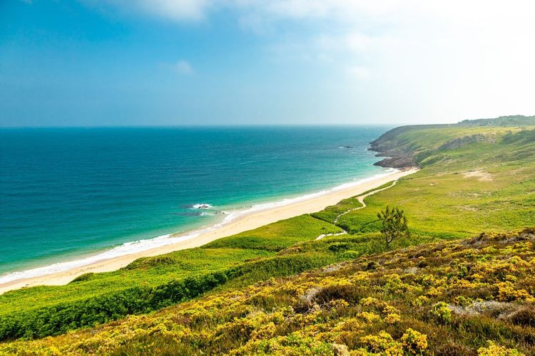
About fifteen minutes' drive from cap Fréhel, cap d'Erquy (Cap d'Erquy, 22430 Erquy, rated 4.8/5 on Google from 1,375 reviews) shifts geological register: cliffs of pink sandstone, quarried until the early twentieth century, drop straight into pebbly coves where the sea takes on turquoise hues in fine weather.
The classic loop around the cape covers about 7 km and crosses moorland similar to that of Fréhel, with views alternating between the pink coves and the bay of Saint-Brieuc. The old pink sandstone quarries supplied building sites across the region for many years before operations ceased in the 1930s; today they leave behind an almost lunar landscape, much photographed in spring when the gorse blooms all around. Unlike Fréhel, the cap d'Erquy trail is generally more accessible, with less elevation gain, making it a good option for families with children used to walking for several hours.
Erquy itself remains primarily a fishing port, renowned for its scallops fished in the bay of Saint-Brieuc from October to May. A foodie address on the harbour, open year-round, serves freshly landed scallops with a glass of muscadet — a well-earned stop after the walk. The harbour itself merits a pause even out of season: on certain mornings the fish auction is open to the public, allowing visitors to watch the catch being unloaded before it heads off to the region's markets. Allow 2h30 to 3h for the full loop, a little more if you stop to photograph the quarries. Back in Saint-Malo, the All Hands on Deck! audio-guided tour offers a well-earned second wind for exploring the walled city on foot.
The 3-Day Pays Malouin Loop: the Long-Distance GR de Pays from Saint-Malo
For those wanting to go beyond a simple half-day outing, the GR® de Pays Tour du Pays Malouin offers a complete 47.5 km loop starting from Saint-Malo, generally completed in three days of walking. Unlike the GR34, which strictly follows the coastline, this route alternates between coastal paths and rural tracks inland, offering a fuller picture of the Pays Malouin than the seafront alone. The waymarking, yellow and red this time (the code for GR de Pays circuits), follows a set direction of travel that is best respected in order to find the pre-booked accommodation along the way without difficulty.
Day 1: Saint-Malo to la Guimorais (12 km)
The first stage, the shortest of the three, connects Saint-Malo to la Guimorais (La Guimorais, 35350 Saint-Coulomb) in about 3h05 of walking, following the coast to Rothéneuf before cutting slightly inland. A relaxed morning is more than enough for this section, leaving plenty of time to settle into the pace without rushing.
Along the way, the sculpted rocks of Rothéneuf — the work of a nineteenth-century abbé who spent twenty-five years carving hundreds of figures into the granite — are worth a brief detour. La Guimorais, a quiet little seaside hamlet, has a handful of bed and breakfasts that are perfectly adequate for a first night without looking any further. At the end of the day, the plage du Guesclin, just before the finish, offers a welcome swim after the walk, provided you check the high-tide time: the sea covers a large part of the sand within just a few hours.
Day 2: Cancale to Saint-Père (19 km)
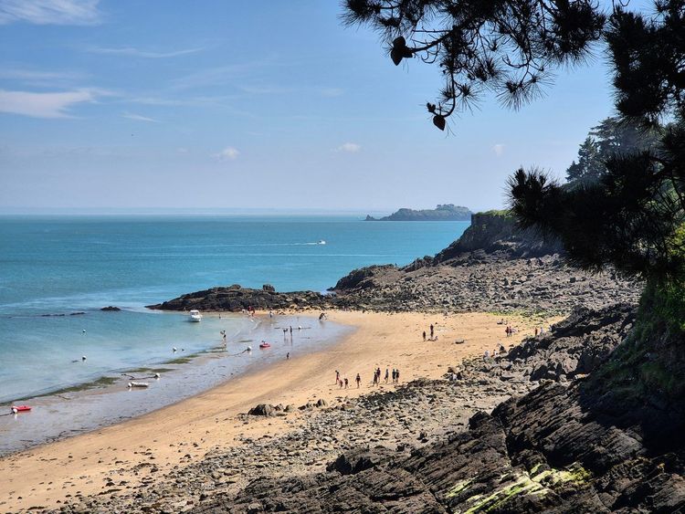
The second stage is the longest on the route: about 19 km and 4h50 of walking between Cancale and Saint-Père-Marc-en-Poulet (Saint-Père-Marc-en-Poulet, 35430 Saint-Père-Marc-en-Poulet), again crossing the pointe du Grouin, the pointe du Meinga and the Anse du Gueslin described above, before veering inland past Cancale.
The cumulative elevation gain on this stage remains moderate, around 250 metres over the day, but its length makes it the most physically demanding of the three days, particularly for hikers not accustomed to stages of more than four hours. Several walkers choose to split it into two half-days with an extra night in Cancale, at the cost of adding a day to the trip. Along the inland section, the path passes occasional old windmills now in private hands, remnants of a milling tradition that long shaped the rural Malouin landscape before electricity arrived. For provisions, it is best to carry a packed lunch for midday: shops are scarce once you leave Cancale, until you reach Saint-Père where a few simple options allow you to eat and sleep.
Day 3: Saint-Père to Saint-Suliac (16.5 km)
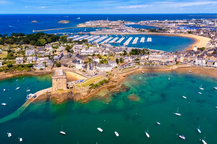
The final stage, 16.5 km and 4h10 of walking, closes the loop by bringing hikers from Saint-Père to Saint-Suliac, described above, before a final stretch along the Rance back to Saint-Malo.
The route again alternates between country lanes and a gradual approach to the estuary, with an arrival into Saint-Suliac that is particularly rewarding at the end of the day, when the low-angled light illuminates the village's granite houses. Many hikers choose to spend a final night there before taking the bus or walking the last stretch back to Saint-Malo the following morning. For this kind of multi-day itinerary, it is best to book accommodation well in advance, especially between June and September when bed and breakfasts in the area fill up several weeks ahead.
The Ryo Saint-Malo audio-guided tour allows you, once back in the city, to round off the stay with a discovery of the walled town — a perfect complement to three days in the open air. To continue planning the trip, the Ryo article Visiting Saint-Malo in 3 Days offers an itinerary combining heritage and hiking.
Family Hiking Around Saint-Malo: Short and Easy Loops

Not all the hikes described above are necessarily suitable for young children, especially on the more exposed sections of the GR34. Several shorter, safer loops — ending at a beach or a playground — allow younger walkers to be introduced to hiking without discouraging them within the first kilometre.
The sculpted rocks of Rotheneuf (Rochers sculptés de Rotheneuf, 35400 Saint-Malo, rated 3.7/5 on Google from 5,309 reviews), about ten minutes' drive from Saint-Malo intra-muros, remain one of the most popular family outings in the area: a roughly 1 km walk along the water's edge, punctuated by hundreds of figures carved into the rock, short enough not to tire the youngest visitors.
Around Dinard, the Promenade du Clair de Lune already mentioned lends itself very well to a pushchair or bike outing, with no elevation gain and several supervised beaches in season for a swimming break along the way. Near Cancale, a shortened version of the pointe du Grouin loop — limited to a one-way walk to the îlot Besnard without continuing towards Port-Briac — brings the outing down to about 1 hour of walking return. For families who prefer cycling to walking, several sections of the area — particularly around the Rance barrage and along the Promenade du Clair de Lune — can be covered just as easily on two wheels, with rentals available in both Saint-Malo and Dinard in season.
Whatever route you choose, keep an eye on the tide times whenever the walk comes close to an island, a beach or a submersible crossing: children are quick to wander off among the rocks in search of crabs, and the returning sea can surprise you faster than you might expect along this stretch of coast. Always bring water, a hat and closed-toe shoes even for the shortest walks, as the path frequently alternates between tarmac, sand and slippery rocks within just a few metres.
For a half-day outing without a car, the loop that starts directly from the Saint-Malo ramparts towards the plage du Sillon is suitable for children from the age of 4 or 5: about 2 km of flat walking, with a playground and several colourful beach huts along the way, with the option of finishing with an ice cream on the seafront. It is also the simplest option for families staying intra-muros who do not want to use a car. Between the spring and autumn half-term holidays, crowds remain reasonable on most of these family loops, making parking easier and leaving more room on the narrower paths than in the height of summer.
The Ryo article Visiting Saint-Malo with the Family complements these walk suggestions with other activities designed for children beyond the coastal path, while the Ryo guide to the beaches of Saint-Malo helps you choose the right beach to end the day.
Towards Dinan: Hiking Inland Along the Rance Valley
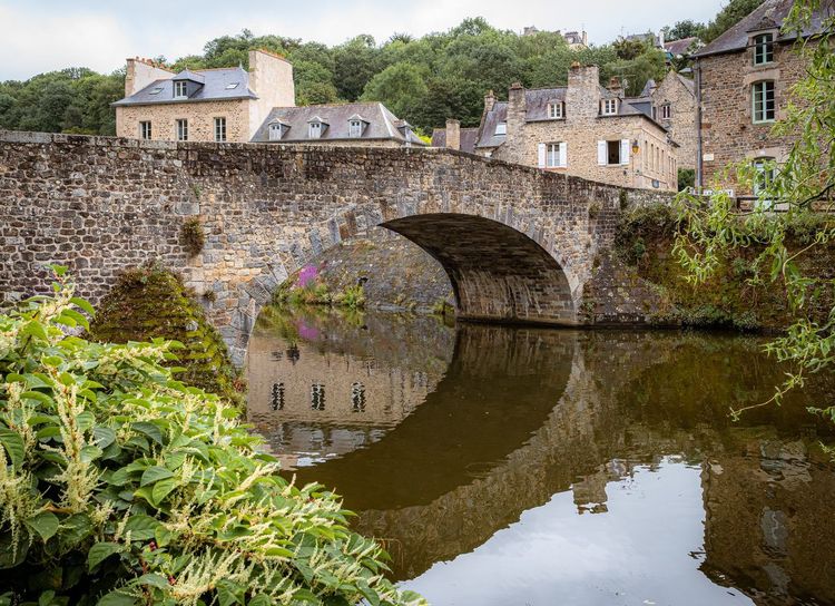
Unlike the previous walks, the route to Dinan leaves the coast behind and follows the Rance valley inland. From Saint-Suliac or the barrage, a path runs along the river for around thirty kilometres to the medieval town — a distance usually covered over two days or supplemented by cycling for the less scenic stretches.
The port of Dinan (Port de Dinan, 22100 Dinan, rated 4.7/5 on Google from 4,586 reviews), at the foot of the ramparts, makes for a particularly rewarding arrival: cobbled quays, half-timbered houses and a view up to the nineteenth-century viaduct spanning the valley. Many hikers prefer to walk one way and return by boat — a river cruiser runs between Dinan and Saint-Malo in season in about 2h30, avoiding the need to retrace the entire route.
The climb up to the upper town via the rue du Jerzual is steep but short — a satisfying final effort before settling onto a terrace. On market days, Thursday mornings, the place du Guesclin and the surrounding lanes are particularly lively. This inland detour also shifts the scenery completely from the rocky headlands and beaches described earlier: here it is orchards, meadows and river meanders that accompany the walk, a contrast that is often appreciated after several days spent facing the open-sea wind.
For an overnight stay, the historic centre of Dinan concentrates most of the bed and breakfasts and small hotels, generally more affordable than those in Saint-Malo intra-muros. Booking is still advisable in summer, but far less pressured than for coastal accommodation, as Dinan attracts fewer day hikers.
Practical Information: Maps, Apps, Transport and Accommodation
To reach the starting point of most of these hikes, two options stand out. By car, Saint-Malo is accessible via the A84 then the RN137 from Rennes, in just over an hour; by train, the direct line from Paris-Montparnasse takes just over 2h30 by TGV, a comfortable option for those planning to hike without a car. Dinard airport, more modest, provides access for a few international routes in season.
For accommodation, where to stay in Saint-Malo depends largely on the type of trip: intra-muros offers the most character and the closest access to the ramparts, but also the highest prices, while the Paramé or Rothéneuf districts, slightly further out, offer better value for money while remaining within walking distance of the first coastal paths. In peak season, it is best to book from spring onwards, as the town regularly fills up in July and August.
For planning a precise itinerary, the IGN 1:25,000 map remains the reference tool, supplemented in practice by a mobile app such as Komoot, which lists most of the popular routes in the area with user reviews, walking times and up-to-date elevation profiles. Local tourist offices, particularly in Saint-Malo and Cancale, also hand out free walking maps covering the most popular waymarked loops and flagging sections temporarily closed due to coastal erosion.
The best season for hiking on the Côte d'Émeraude falls in spring and early autumn: moderate temperatures, moorland in bloom between April and June, and noticeably fewer people on the narrowest paths such as the pointe du Grouin or cap Fréhel than in July and August. Summer is still manageable but means setting out early in the morning to avoid the heat on the shadeless sections.
On the safety front, the hiker's number-one hazard on this coast is the tide, not the gradient. Before any outing that approaches an island, a beach or a submersible crossing, check the day's tide times — available from any tourist office or dedicated app — and always allow a margin of at least two hours before high tide. The rest of the kit is standard: hiking boots with grip rather than trainers on the rocky sections, a windproof layer even in summer, and enough water, as supply points are few and far between on the more remote stretches between Cancale and cap Fréhel.
For getting between the various starting points without returning to the car, the bus network serves the main towns in the area (Cancale, Dinard, Dinan) from Saint-Malo station, with reduced frequencies out of season that are worth checking in advance. The sea shuttles connect Saint-Malo to Dinard from late March to early November, with a daily service in peak season, and usefully complement the road network for hikers wanting to do a one-way journey; in mid-winter, it is better to plan for the car or bus, as the sea shuttle does not run. Parking, finally, is generally straightforward outside Saint-Malo intra-muros: the car parks at the pointe du Grouin, cap Fréhel and cap d'Erquy are free or inexpensive for most of the year, with noticeably higher demand on sunny July and August weekends. To extend the trip's planning beyond hiking, the Ryo app also allows you to follow an audio-guided tour once back in the city, as a complement to these days spent on the coastal path.

FAQ
How long does it take to walk around the ramparts of Saint-Malo?
Allow between 45 minutes and 1 hour to complete the 1.75 km of ramparts without stopping, a little more if you visit Fort National or Grand Bé along the way. It is the shortest walk in this guide, suitable for all ages and at any tide.
What is the most beautiful hike around Saint-Malo?
It is hard to pick just one, but the GR34 section between cap Fréhel and Fort La Latte comes up most often in recommendations, for its cliffs and spectacular moorland. The pointe du Grouin, closer to the city, remains a solid alternative for a half-day outing.
Is the GR34 suitable for families near Saint-Malo?
Some sections are, particularly around Dinard or between Saint-Malo and the Sillon, on flat and less exposed stretches. Others, such as the pointe du Grouin or cap Fréhel, have steeper passages best reserved for children already accustomed to hiking.
What is the best time of year to hike on the Côte d'Émeraude?
Spring and early autumn offer the best compromise between mild weather, flowering moorland and moderate crowds. Summer is still manageable if you set out early in the morning, before the heat and crowds make some trails less comfortable.
Where can you park to hike on the Côte d'Émeraude?
Most starting points — pointe du Grouin, cap Fréhel, cap d'Erquy — have free or inexpensive car parks outside the walled city. Arrive early in July and August, as these car parks fill up quickly on sunny weekends.
Should you book accommodation for the 3-day Pays Malouin loop?
Yes, strongly recommended between June and September: bed and breakfasts and small hotels along the route, particularly in Cancale and Saint-Suliac, are fully booked several weeks in advance during high season.
What is the easiest trail to explore the area around Saint-Malo?
The Promenade du Clair de Lune in Dinard, flat and about 1.5 km long, remains the most accessible option, suitable for pushchairs or wheelchairs. The sculpted rocks of Rotheneuf are another short, family-friendly walk less than ten minutes from Saint-Malo.
Between the ramparts, the coastal path and the two capes, these routes suit both a two-hour outing and a full week on the Pays Malouin loop. The one thing all these trails have in common is the tide, which governs the possibilities far more than the waymarking itself: it is always worth checking the tide times before heading out to an island or a beach.
Once back in town, with tired legs and a healthy appetite, the Ryo À l'abordage audio-guided tour offers another way to discover Saint-Malo — corsair history and granite alleyways included — without having to lace up your hiking boots again.
À lire également