© Shutterstock
 Votre guide Ryo
Hiking in Saint-Malo: 7 Itineraries to Explore the Breton Coast (2026)
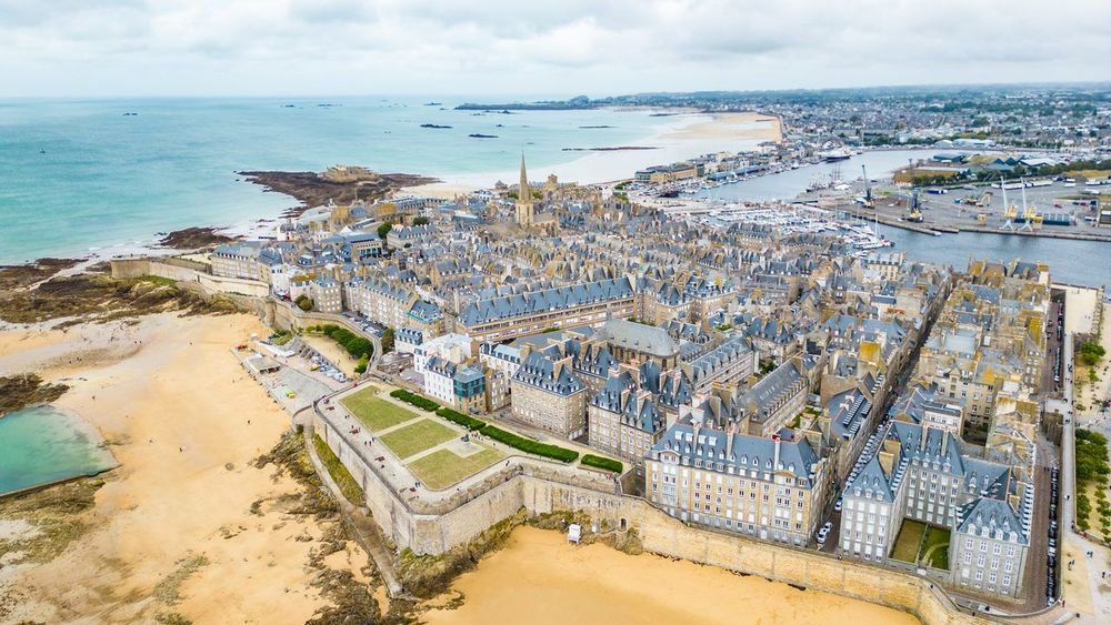
There's something slightly disorienting about arriving in Saint-Malo for the first time: the city seems to want to keep you there. The grey granite ramparts, the scent of seaweed and salted-butter crêpes, the raking light that turns the bay into a Turner painting — everything invites you to set down your bags and walk. Hiking in Saint-Malo means discovering that the corsair city is not merely a place to admire from the ramparts, but a starting point for one of the most spectacular coastlines in France. The Ryo audio-guided tour À l'abordage, 29 audio tracks, 6.6 km, 2h40, is in fact the best way to begin before hitting the trails.
This guide covers seven hiking itineraries in Saint-Malo for all abilities, from the casual stroller along the ramparts to the seasoned walker setting out to conquer the Pointe du Grouin 25 km away. You'll find exact distances, elevation gains, pitfalls to avoid and secrets that standard guidebooks overlook: a cave accessible only at low tide between Saint-Coulomb and Cancale, a panorama over Mont-Saint-Michel that even the locals barely know, and the best spots to pick up a warm kouign-amann after the effort. Saint-Malo rewards those who walk — here's how to make the most of it in 2026.
The GR34 Customs Officers' Trail: Saint-Malo's Iconic Hike
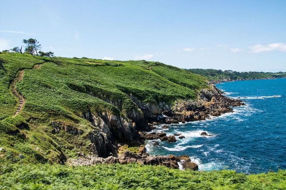
The GR34 is not simply a hiking trail — it is a Breton institution. Stretching more than 2,000 km in total (sources vary between 2,000 and 2,130 km depending on which coastal variants are included), this route follows the entire Breton coastline from the bay of Mont-Saint-Michel to the bridge at Saint-Nazaire, tracing the exact paths once walked by customs officers tasked with watching for smugglers. Around Saint-Malo, the GR34 takes on a particular dimension: the density of the coastal scenery — white sandy beaches, pink granite boulders and panoramas over the islands — makes it one of the most photographed sections of the entire trail. It is here, on the Côte d'Émeraude, that hiking in Saint-Malo truly comes into its own.
Start from Porte Saint-Vincent in the ramparts, heading east toward Plage du Sillon and then the dunes of La Guimorais. The first few kilometres run alongside Rochebonne beach before climbing onto the heathland of the wild coast. The landscape gradually transforms: Belle Époque seaside villas give way to schist cliffs, then to unnamed coves where only locals know you can swim. At Saint-Coulomb, marked by its 11th-century Romanesque church, a detour of around 400 metres leads to a sea cave accessible only within two hours either side of low water — check the tide times before venturing in.
Near Rothéneuf, the trail passes close to the famous sculpted rocks — 300 figures carved into the granite by Abbé Fouré between 1894 and 1907. This 15-minute detour is absolutely worth it; it is one of the most singular works of outsider art in France. Allow around 3h30 to 4h to walk the full distance from Saint-Malo to Cancale along the GR34 (17 km, cumulative elevation gain: 280 m), though there is nothing to stop you doing shorter loops and returning inland.
For a half-day outing, the Saint-Malo to Saint-Coulomb section (8 km one way, around 2 hours) is ideal for families and less experienced walkers. The path remains accessible and the GR's red-and-white waymarking is impeccable. For hikers wanting to push further, the stretch between Rothéneuf and Pointe du Meinga offers remarkable views over the Îles des Landes and Cézembre, especially late in the day when the raking light turns the granite orange.
Logistics: there are no shelters on this section, but several restaurants and small shops in Saint-Coulomb. Carry plenty of water, as public fountains are scarce between the two villages. The free car park at Pointe de la Varde (Route de la Pointe de la Varde, 35400 Saint-Malo, rated 4.6/5 on Google from 640 reviews) allows you to split the route and do each half as an out-and-back.
The Intra-Muros Ramparts Walk: Saint-Malo on Foot
Before heading out onto the wild coastal trails, start where everyone should start: the intra-muros ramparts of Saint-Malo. This 2 km walk (around 45 minutes at a brisk pace, though allow double that with photo stops) is not technically a hiking trail, but it is the perfect introduction to the Malouin landscape and offers views that few cities in the world can match.
The granite walls date mainly from the 17th and 18th centuries, although the first fortifications go back to the 12th century. Vauban left his mark here: the successive bastions follow the principles of modern fortification he theorised, with angles calculated to eliminate blind spots. But what stays with you as you walk the battlements is above all the 360° view: Plage de l'Éventail and Le Sillon to the east, Grand Bé and Petit Bé to the west, the Channel islands to the north and, on a clear day, the Norman coastline on the horizon.
Grand Bé deserves a digression: this island, reachable on foot at low tide, is home to the tomb of Chateaubriand, who had insisted on being buried "facing the sea, in the wind." The crossing from Plage des Bas-Sablons takes less than 10 minutes at low tide, but beware — the sea comes back fast and several unwary tourists have had to be rescued. Check the tide times (available at the tourist office or on marees.info) and set off at least 2 hours before low water.
From the ramparts you can also spot the Tour Solidor, in the Saint-Servan district to the south — a 14th-century medieval tower overlooking the Rance estuary. It has its own dedicated article on the Ryo blog, discover it here.
The classic ramparts route starts at Porte Saint-Vincent (opposite the bus station), climbs to the Tour Bidouane, runs along the Bastion de la Hollande, passes above Porte Saint-Thomas and ends at the château. Access is free and open year-round. The best time slot: early morning (before 9 am in July and August), when the tour groups haven't arrived yet and the eastern light illuminates the western ramparts.
Saint-Malo to Dinard: The Rance River Loop
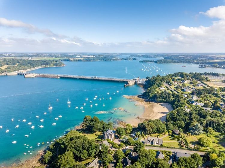
This is the itinerary Malouins recommend in hushed tones, as if sharing it too widely might spoil it. The Saint-Malo to Dinard loop via the Rance is a 22 km hike (cumulative elevation gain: 350 m, duration: 5h30 to 6h) that combines maritime coastline, estuary and woodland. It regularly appears on lists of Brittany's finest walks, and rightly so.
Start from the forecourt of the Cathédrale Saint-Vincent in the intra-muros. Leave the old town quickly through the Porte de Dinan, then follow the Rance quaysides southward. The Saint-Servan district reveals a quieter, more residential side of Saint-Malo — renovated fishermen's cottages, small gardens, cats on the walls. This is where the Cité d'Aleth is found — the old Gallo-Roman town that preceded Saint-Malo, whose remains are well worth a stop: German World War II blockhouses, traces of the medieval enclosure and a striking panorama over the harbour. A dedicated Ryo article covers it in full: the Cité d'Aleth.
Continuing south, the path passes Tour Solidor and then enters the woods along the Rance. The vegetation changes: you leave the exposed coastline and enter an oak and chestnut forest where the trail rises and falls with the rhythm of the inlets and coves. The views over the estuary are particularly beautiful between La Passagère and Moulin du Prat — a 16th-century tidal mill whose ruins overlook the water.
The crossing to Dinard is made via the Rance tidal barrage (Ville-ès-Nonais, 35430 Saint-Jouan-des-Guérets, rated 4.3/5 on Google from 395 reviews) — a tidal power station inaugurated on 26 November 1966 by General de Gaulle, the first in the world to generate electricity from the tides. From the barrage, the view over the harbour of Saint-Malo and the offshore islands is one of the most spectacular on the entire route. In Dinard, allow yourself 30 minutes to walk down to the Grande Plage and the Promenade du Clair de Lune, lined with Belle Époque villas that once belonged to wealthy Americans and Britons at the end of the 19th century.
The return to Saint-Malo can be done either on the same path (full loop) or by taking the Dinard–Saint-Malo ferry (10-minute crossing, around €4 one way, operates April to September). This "mixed" option — walk one way, boat the other — is recommended if you have children or your legs are starting to protest. Note: the last boat is generally at 8:30 pm in summer; check the operator's website before setting off.
Saint-Malo to Cancale: In the Footsteps of the Oyster Farmers
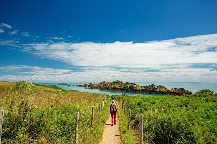
The Saint-Malo to Cancale hike is undoubtedly the most popular in the area, and the most photographed. These 17 km along the GR34 (4 to 5 hours, cumulative elevation gain: 220 m) take you from the heart of the corsair city to the world oyster capital, through coastal scenery that alternates between cliffs, wild beaches and salt marshes. It is one of the most iconic hiking routes from Saint-Malo.
The first hour of walking follows Le Sillon beach — the long strip of sand separating the city from the open sea. The architecture of the seaside villas lining Avenue Aristide Briand is a reminder that Saint-Malo was a favourite resort of the Parisian elite at the start of the 20th century. Past the Pointe des Corbières, the scenery turns wilder: you climb onto the cliffs of Pointe de la Varde (altitude: 45 m, but the view stretches for dozens of kilometres) before descending to Plage des Chevrets (Route des Chevrets, 35350 Saint-Coulomb, rated 4.6/5 on Google from 523 reviews).
The section between Plage des Chevrets and Saint-Coulomb crosses what walkers often consider the most beautiful stretch of the entire route: near-private coves accessible only on foot, a white sandy seabed progressively revealed by the falling tide, and the silhouettes of offshore islands as a backdrop. This is also where seabirds are most abundant — common guillemots, gannets passing through, common terns. If you have binoculars, get them out.
As you approach Cancale, the landscape transforms one final time: rocks give way to oyster beds — wooden tables covered in metal cages where Cancale's flat oysters grow for several years before going to market. The bay of Mont-Saint-Michel gradually opens up in full width; on a clear day, the Mont itself is visible around 50 km to the south-east.
Arrival at Cancale harbour: take time for a dozen oysters at the fish auction (between €1 and €2 each depending on size), eaten straight from the shell facing the sea. It is one of those local rituals you won't forget in a hurry. For the return to Saint-Malo, the Ilien bus (line 4) runs from Cancale to Saint-Malo station in 25 minutes — check the Ilien network timetables as frequency drops in the evening and at weekends.
Variant for those wanting a greater challenge: departing from Cancale, an 8 km loop climbs to the cliffs of Pointe du Grouin via the Chapelle du Verger — a separate route detailed in the next section.
Saint-Malo to Pointe du Grouin: The Edge of the Breton World
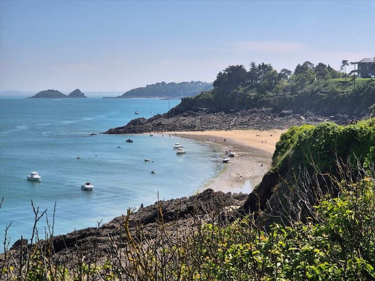
The Pointe du Grouin is one of those places that leaves you speechless. Perched 40 metres above the sea, this rocky promontory at the far edge of northern Brittany offers a 360° panorama that, on a clear day, simultaneously takes in Mont-Saint-Michel to the south-east, the Chausey islands to the north, Jersey on the horizon and the Norman coast across the bay. It is the natural centrepiece of the Saint-Malo–Cancale–Pointe du Grouin hiking route.
From Saint-Malo, allow 25 km following the GR34 in its entirety (6 to 7 hours of walking, cumulative elevation gain: 450 m). This is a route for well-trained and properly equipped walkers. The most common approach is to take the bus to Cancale, then walk the 8 km separating the harbour from Pointe du Grouin and Pointe de la Chaîne.
The climb from Cancale toward Chapelle du Verger crosses gently sloping fields before ascending onto the coastal heath. The chapel itself, built in the 15th century and long a place of pilgrimage for sailors, deserves a stop: it houses votive model boats hanging from the ceiling, testament to an era when the sea was both provider and killer.
The final kilometre before Pointe du Grouin runs alongside a protected nature reserve. The Île des Landes, visible from the headland, is the main breeding site for the European shag in mainland France. In May and June, colonies nest in large numbers on the rocks. Access to the island itself is prohibited from March to August to protect the nests, but binoculars will let you observe the birds from the Pointe.
Between Pointe du Grouin and Cancale, the variant along the western coast (on the Mont-Saint-Michel bay side) is often less crowded and just as beautiful. The path descends toward Plage du Verger (Pointe du Grouin, 35260 Cancale, rated 4.6/5 on Google from 1,447 reviews) — a small sheltered cove perfect for a swim in summer — before climbing back up toward the village of Cancale through the lanes of Les Herbus.
Hiking from Saint-Malo to Mont-Saint-Michel: A Bay Adventure
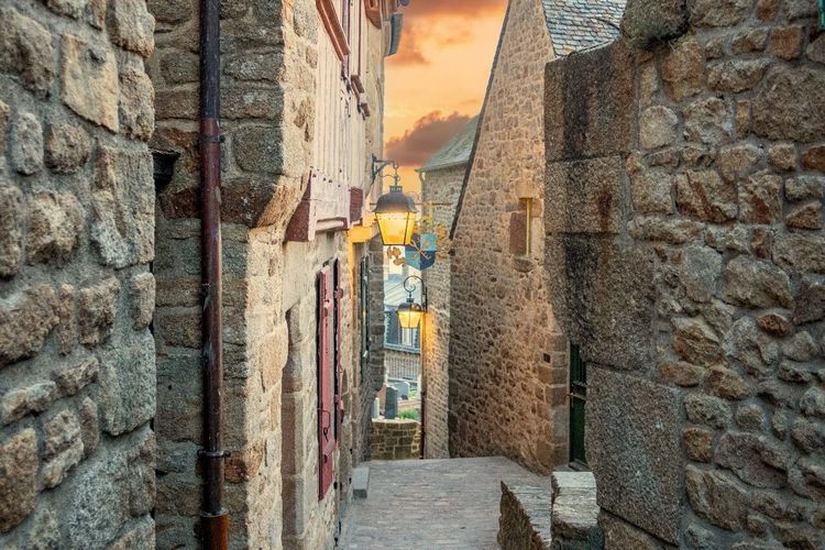
Walking from Saint-Malo to Mont-Saint-Michel is one of the most ambitious hiking projects you can undertake from the corsair city. Allow 2 to 3 days to cover the 70 km separating the two sites, following the coast via Cancale, Pointe du Grouin, Pontorson and the polders of the bay. This is not a spontaneous weekend hike — it is an adventure.
The first stage (Saint-Malo to Cancale, 17 km) is described above. The second links Cancale to the Pointe du Grouin then descends toward Vivier-sur-Mer, following the mussel and oyster beds that line the bay on the Breton side. This section crosses salt-meadow landscapes that the tidal flood partially covers with each cycle; the cropped grass and grazing sheep (the famous pré-salé lambs, whose meat is prized across France) create a setting unlike any other.
The final approach to Mont-Saint-Michel from the land is breathtaking. The Couesnon — the river that, as the saying goes, "put the Mont in Normandy" (the historic boundary between Brittany and Normandy) — is crossed today via the pedestrian footbridge opened in 2014. The Mont itself gradually appears above the salt meadows, first floating in the mist, then increasingly imposing.
If you only have one day, an alternative is to reach Mont-Saint-Michel by bus from Saint-Malo (Keolis lines, around 1h15), visit the abbey, then walk the 13 km back across the salt meadows and polders with a specialist bay-crossing guide — this crossing is strongly discouraged without a licensed escort, as the quicksands and rising tides are unpredictable. For more on the abbey itself, see our article visiting the abbey of Mont-Saint-Michel (BP 02, 50170 Le Mont-Saint-Michel, rated 4.7/5 on Google from 14,750 reviews).
One important note: the bay-crossing section (walking across the flats from the shore to the Mont) requires checking the tidal coefficients. The tides in the bay of Mont-Saint-Michel are among the largest in Europe, with tidal ranges that can exceed 13 metres during spring tides. Bay services offer official guides at around €10 to €15 per person for the crossing.
The Cité d'Aleth and Saint-Servan: The Forgotten Hike
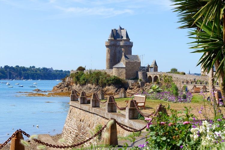
Saint-Servan, the southern district of Saint-Malo, is often overlooked by walkers rushing toward the GR34 or the ramparts. That's a mistake. The Aleth–Tour Solidor–Rance loop (6 km, 1h30 to 2h, very modest elevation gain) is perhaps the most historically rich of all the Malouin walks, and it remains accessible to absolutely everyone — including pushchairs on the paved sections. If you're looking for an easy hike in Saint-Malo steeped in history, this is the one.
Start from the Cité d'Aleth car park at the tip of the peninsula. The Cité d'Aleth is the site of the old Gallo-Roman town that preceded Saint-Malo — founded around the 1st century AD, it was the true cradle of the Malouin city before the rocky islet of the intra-muros rose to prominence in the Middle Ages. The ruins of the medieval enclosure, the German blockhouses built during the Occupation and the World War II memorial coexist in a compact yet fascinating space. The view over the harbour and the distant Norman coast alone justifies the trip.
Descending from the peninsula toward the Rance, you pass the Port des Sablons (Avenue Louis Martin, 35400 Saint-Malo, rated 4.3/5 on Google from 1,577 reviews) — a modern marina with around 1,200 berths — before reaching Tour Solidor, a medieval tower built around 1382 under Duke Jean IV of Brittany to control the entrance to the Rance estuary. This tower, made up of three linked keeps, houses the Musée international du Long-Cours Cap-Hornier, dedicated to the sailors who tackled the passage of Cape Horn — a fitting theme for a city that was home to shipowners and corsairs. Entry is around €3.50 to €6 depending on the current rate.
From the tower, the path follows the Rance along the Corniche d'Aleth — a panoramic promenade with views over the estuary and, in the distance, the Rance barrage. The vegetation here takes on a southern character: hydrangeas, fuchsias and palm trees planted in the 19th century by sailors returning from distant voyages, all contrasting with the severity of the Breton granite. The Ryo audio guide "À l'abordage" passes through several points in this district, weaving together corsair stories and architectural anecdotes across 29 audio tracks.
The loop ends at Plage des Bas-Sablons and the promenade along Plage de Bon Secours, with its famous sea baths — natural pools carved into the rock and fed by the tides, still used today by Malouins for a safe swim even when the sea is rough. Back inside the walls, our All hands on deck! audio-guided tour picks up the story across 30 stops.
When to Go Hiking in Saint-Malo
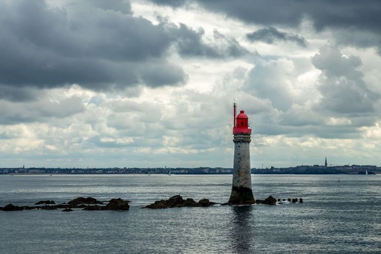
The question deserves an honest answer: Saint-Malo is by no means a hiking destination to avoid in winter — quite the contrary. The Breton coast in January or February has a wildness that the summer tourist influx completely erases. The trails are empty, the guesthouses quiet, and the winter light — low, white, biting — gives the coastal landscapes an intensity that summer magazine photographs never capture.
That said, here are the key factors to know for each season:
Spring (April–May): ideal. Gorse and heather are in bloom on the coastal heath, birds nest in numbers on the islands, the trails are walkable and the tourist crowds have not yet arrived. Temperatures remain cool (10–16 °C), which is comfortable for hours of walking. Pack a waterproof jacket — the Breton sky changes quickly.
Summer (June–August): footfall explodes on certain sections, particularly the GR34 between Saint-Malo and Cancale and the intra-muros ramparts. Set off early (before 8 am) to avoid the crowds. The sea temperature rises enough for a swim in the coves.
Autumn (September–October): a second ideal window. The autumn light on the Rance estuary is remarkable, the trails regain their tranquillity, and Cancale's restaurants serve the first oysters of the cold season, said to be at their most flavoursome.
Winter (November–March): for seasoned walkers only — not for safety reasons (the trails are well maintained) but because some facilities close. Check ferry and museum opening hours before making plans.
Practical Tips for Hiking in Saint-Malo
Equipment
The Malouin coastline is windy and weather changes are frequent. Whatever the month, bring a lightweight waterproof jacket — Breton showers arrive without warning and disappear just as fast. Waterproof walking shoes are recommended for heathland sections and stretches after rain. For hikes over 15 km, trekking poles reduce fatigue on the hilly sections.
The coastal paths are generally well waymarked (red-and-white GR markings for the GR34, yellow for local trails), but an IGN map (TOP 25 series, sheet 1116 OT Pays de Saint-Malo) is still useful at junctions. Alternatively, downloading the GPX track on Komoot or Wikiloc before you leave is the most practical solution.
Tides
This is the most important factor to plan around. Saint-Malo has one of the largest tidal ranges in Europe: 13 to 14 metres during spring tides. Several sections of the GR34, particularly between Rothéneuf and Saint-Coulomb, are cut off or difficult at high tide. The crossing to Grand Bé and certain coves between Saint-Malo and Cancale are only accessible at low tide. Consult the tide tables (available on marees.info or at the Saint-Malo tourist office) and plan your departure accordingly.
Practical rule: begin your hike 2 hours before low water when your route passes through exposed areas. You will then have a 4-hour window before the incoming tide forces you to alter your course.
Transport and Access
Saint-Malo is accessible by TGV from Paris Montparnasse (2h15, several trains daily). The SNCF station is 15 minutes on foot from Porte Saint-Vincent. For itineraries heading toward Cancale, the Ilien bus (line 4) departs from the station and serves the coast. The Dinard–Saint-Malo ferry runs from April to September (~€4). For hikes toward Mont-Saint-Michel, several operators run direct coach services from the station.
Where to Eat After a Hike in Saint-Malo
Providing an exhaustive list of Malouin restaurants is not the purpose of this guide, but ignoring the local food scene after hours of walking would be unforgivable. Saint-Malo sits at the confluence of two major culinary traditions: seafood (lobster, scallops, oysters) and Breton baking.
After a hike on the GR34, a stop in Cancale for fresh oysters from the fish auction is non-negotiable. Expect to pay €1 to €2 each depending on size, eaten on the spot with a glass of muscadet. The experience is simple and perfect.
In the intra-muros, the Grande Rue is packed with crêperies and seafood restaurants at varying prices. Avoid establishments with laminated photo menus in the window and favour places with no visible menu from the street — a sign the daily selection follows the catch. For something sweet, craquelins de Saint-Malo (crispy puffed pastry biscuits, an old local speciality) and kouign-amann are the essential post-hike treats. For a deeper dive into local specialities, our article on kouign-amann, craquelins and culinary specialities of Saint-Malo details the best addresses.
In Dinard, at the end of the Rance loop, the cafés along the Grande Plage are ideal for a coffee and apple tart before catching the boat back.




FAQ
What is the Best Hike to Do in Saint-Malo?
It all depends on your fitness level and available time. For a half-day, the walk along the intra-muros ramparts (2 km, free, accessible to everyone) is the best introduction to the corsair city. For a full day, the Saint-Malo to Cancale hike along the GR34 (17 km, 4 to 5 hours) is the most complete and spectacular itinerary. For experienced walkers with a weekend to spare, the loop via the Rance to Dinard (22 km) offers the greatest variety of landscapes.
Does the GR34 Customs Officers' Trail Really Pass Through Saint-Malo?
Yes. The GR34 runs along the entire Breton coastline, from the bay of Mont-Saint-Michel to the bridge at Saint-Nazaire, passing straight through Saint-Malo. The Malouin section — heading east toward Saint-Coulomb, Rothéneuf and Cancale, as well as west toward Dinard — is marked and maintained to the same standard as the rest of the trail. It is one of the most heavily used sections in July and August.
Can You Hike in Saint-Malo with Children?
Absolutely. Several itineraries are perfectly suited to families with young children. The ramparts walk (flat terrain, no elevation gain) is pushchair-friendly for half of the route. The Cité d'Aleth–Tour Solidor loop (6 km, very little elevation) is manageable from age 5–6. The GR34 section between Porte Saint-Vincent and Rothéneuf (8 km one way) is accessible from age 8–10 depending on the child's walking pace. Avoid the crossing to Grand Bé with very young children, however, as the incoming tide can rise quickly.
How Far is it from Saint-Malo to Cancale on Foot?
About 17 km following the GR34 along the coast. The cumulative elevation gain is around 220 metres (moderate). Allow 4 to 5 hours of walking at a steady pace, including breaks. The route is not continuously marked from Saint-Malo intra-muros; you need to pick up the GR waymarking at Plage du Sillon (about 20 minutes on foot from the ramparts) before the trail becomes clearly identifiable.
Do You Need to Watch the Tides When Hiking the GR34?
Yes, it is the single most important factor. Some sections of the GR34 between Saint-Malo and Cancale are impassable or dangerous at high tide. The crossing to Grand Bé can only be made at low tide (a window of roughly 4 hours around low water). Tide times are available free of charge at the Saint-Malo tourist office, on the website marees.info, and at all local newsagents.
Are There Hiking Clubs in Saint-Malo?
Yes. Several clubs affiliated with the Fédération Française de la Randonnée Pédestre (FFRandonnée) organise weekly outings on local trails, often open to non-members on simple registration. It's an excellent way to discover lesser-known routes with locals who know the tides and the best rest spots. Contact the Saint-Malo tourist office for up-to-date details.
Can You Hike from Saint-Malo to Mont-Saint-Michel?
Yes, but it is a 2-to-3-day adventure (around 70 km). The full itinerary passes through Cancale, the Pointe du Grouin, Vivier-sur-Mer, Cherrueix and the polders of the bay. The final section crossing the bay of Mont-Saint-Michel on foot must be led by a licensed guide due to quicksands and fast-rising tides. Specialist organisations (Chemins de la Baie, Découverte de la Baie) offer this guided crossing for around €10 to €15 per person.
Conclusion
Hiking in Saint-Malo means accepting that you will lose your bearings — in the most literal sense. The trails change character with every tide, the landscapes shift with the light, and the 17 km of the GR34 to Cancale look nothing like the same walk in May as they do in October. That is precisely what makes the Malouin coast addictive: you come back.
To explore the city itself before or after your hikes, the Ryo audio-guided tour À l'abordage is an ideal way to immerse yourself in Saint-Malo's corsair history — 29 audio tracks over 2h40 of walking, which is exactly the length of an afternoon between two spring tides. And to make the most of the surrounding area, our guide to the most beautiful villages around Saint-Malo naturally complements the itineraries described here.
À lire également