© Shutterstock
 Votre guide Ryo
The Most Beautiful Natural Parks in France in 2026: Complete Guide
At dawn in Camargue, flamingos take flight by the hundreds from the shores of the Vaccarès lagoon before the light even reaches the reedbeds. In the alpine meadows of the Vanoise, at 2,500 metres, ibexes warm themselves on schist slabs while marmots whistle from the limestone pavements. In Corsica, the maquis fills the air with fragrance before you even open your tent.
France has a natural network of singular richness: 11 national parks (including three overseas) and 59 regional nature parks, covering more than 30% of the national territory under one form of protection or another. In the Mercantour, the Vallée des Merveilles preserves 40,000 rock engravings from the Bronze Age on rocks polished by glaciers. The Port-Cros national park, the first marine park in continental Europe since 1963, shelters millennia-old posidonia meadows beneath its translucent waters. On La Réunion, the Piton de la Fournaise has erupted more than 200 times over the past century. Whether you are planning a weekend in the Calanques from Marseille or fifteen days between the Pyrénées and Corsica, here are the concrete elements to help you plan your visit: surface area, iconic wildlife, access, and best time to go.
National Parks and Regional Nature Parks: Two Approaches to Protection
Before you set off, clarifying the distinction between the two types of protected areas will help you avoid many unpleasant surprises on the ground.
A national park is built around two distinct zones. The core zone, the most protected, is a high natural-value area where human activities are strictly regulated: camping prohibited (except bivouacking between 7 pm and 9 am), dogs banned, foraging prohibited, off-road motor vehicles strictly excluded. No permanent residence is permitted there, with the notable exception of the Cévennes national park, the only inhabited national park in mainland France. The adherence zone groups the surrounding municipalities that have signed the park's charter; economic activities remain free there but are framed by a collectively negotiated sustainable development plan.
A regional nature park (PNR) follows a radically different logic: it is an inhabited territory shaped by centuries of human activity (farming, livestock, crafts, forestry), whose local elected officials have collectively decided to promote and protect its natural and cultural heritage through a charter renewable every 12 years. Farming, hunting, and tourism are fully present. France currently has 59 PNRs, covering 17% of mainland territory and home to more than 4 million inhabitants.
In practical terms for the visitor: a national park imposes a discipline of visit (no dogs, no free bivouacking, no foraging) but offers raw landscapes rarely matched elsewhere in Western Europe. A PNR provides outdoor activities in a preserved setting while allowing you to sleep in village gîtes, visit local markets, and sample regional produce. The two are complementary within the same itinerary, and most major routes through France combine at least two or three.
One final distinction: the UNESCO biosphere reserve classification can apply to both types. The Cévennes and Mont Perdu (Pyrénées) are both national parks and UNESCO World Heritage Sites. The Chaîne des Puys, within the Volcans d'Auvergne PNR, received its UNESCO listing in 2018.
Vanoise National Park, the Alpine Pioneer
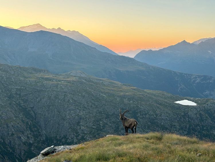
In 1963, when the decree creating the Vanoise park was signed, the Alpine ibex population had virtually disappeared from France, decimated by hunting since the Middle Ages. Sixty years later, approximately 2,000 ibexes graze freely on the granite slopes of the massif, alongside some 8,000 chamois. This faunal recovery is one of the most successful in Europe and, in itself, justifies the journey to Savoie.
The Vanoise national park covers 530 km² in its core zone, flanked by the Tarentaise valley to the north and the Maurienne valley to the south. Its altitude ranges from 1,280 metres to 3,855 metres at the summit of the Grande Casse, the park's highest point. The Italian border to the south-east marks the junction with the Gran Paradiso national park: together, the two parks form the largest protected area in the Alps, covering more than 1,200 km² in one continuous block.
The bearded vulture, the largest raptor in continental Europe with a wingspan that can exceed 2.80 metres, regularly soars over the ridges between May and September. The list of plant species in the core zone exceeds 1,500, including edelweiss, waxy gentian, and the martagon lily, which ibexes consume in considerable quantities during the first months of summer.
Entry from Paris is by train to Modane (TGV Paris–Turin, 3h15) or Bourg-Saint-Maurice (TGV from Paris, approximately 4h). From Modane, the D215 road heads up towards Aussois and Sollières-Sardières. From Bourg-Saint-Maurice, the road reaches Pralognan-la-Vanoise in 45 minutes; this village of 700 inhabitants houses the main park rangers' information office, open from April to October.
The flagship route remains the Tour de la Vanoise (GR55), a 10-day circuit crossing the core zone alternating between staffed huts and bivouacs permitted between 7 pm and 9 am. For a first full-day immersion, the trail leading to the Lac du Col de la Vanoise (2,515 m) from Pralognan offers, in clear weather, a direct view of the north face of the Grande Casse with its seracs.
July and August concentrate the bulk of visitor numbers. To see ibexes close to the trails, May and June are often more favourable: males still gather on the ridges before females give birth in the more remote areas of the core zone. The herds observed in the evening on the ridges above Pralognan sometimes number several dozen individuals.
Écrins National Park, the Roof of the Southern Alps
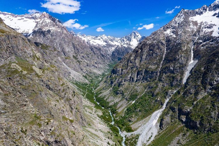
The Écrins massif is the only one, outside Mont Blanc, to line up several summits exceeding 4,000 metres in France: the Barre des Écrins (4,102 m), the Dôme de neige des Écrins (4,015 m), and the Meije (3,983 m) dominating the Emparis plateau. At 918 km² in its core zone, it is the largest of France's mainland national parks.
The massif's glaciers have lost more than 40% of their surface area since the early 20th century, a retreat visible to the naked eye when comparing old photographs with today's landscapes. Ibexes, chamois, and golden eagles occupy the alpine meadows between 2,000 and 2,800 metres. The bearded vulture, reintroduced in the Southern Alps from the 1980s onwards, is regularly spotted from the ridges of the Valgaudemar.
The GR54, Tour de l'Oisans et des Écrins, is the reference route: 170 km, 9 to 10 days, 14,000 metres of cumulative elevation gain. One of the most spectacular entry points is the Route de la Grave (D1091) from Grenoble, with the Meije cable car ascending before a glacial panorama.
Gap and Briançon are the gateway towns best connected by public transport (regional trains from Marseille or Grenoble to Gap; shuttle buses from Briançon). The best hiking season runs from mid-June to mid-September, with passes opening progressively depending on residual snowfall.
Calanques National Park, the Park a Metro Ride Away
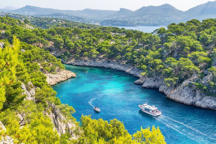
The Calanques national park, created in 2012, is a unique case in Europe: simultaneously terrestrial (8,500 ha), marine, and underground, with a marine protection zone of 43,500 ha between Marseille and Cassis. It can be reached from the centre of Marseille in less than an hour by public transport, making it also the most visited national park in mainland France, with several million visitors per year.
The most accessible calanques on the Marseille side are Sormiou and Morgiou, at the far end of the 9th arrondissement. The most spectacular, accessible from Cassis, En-Vau and Port-Pin, require 1h30 to 2h of walking from the Crêtes car park, or 20 minutes by water shuttle from Cassis harbour.
The park's great enigma remains the Cosquer Cave, discovered in 1985 by diver Henri Cosquer. Its entrance lies 37 metres below sea level. Its walls preserve nearly 500 cave paintings dating back 27,000 years: bison, great auks, and negative handprints. Access remains forbidden to the public due to the risk of rising sea levels, but a faithful replica opened in Marseille in 2022 under the name Cosquer Méditerranée.
A major precaution in summer: the Calanques massifs regularly close their ridges by prefectural order in the event of fire risk, sometimes for several consecutive weeks between mid-June and mid-September. Checking current restrictions on the park's website before every summer outing is essential.
To combine a visit to the Calanques with a discovery of Marseille, allow 2 to 3 days: one day on the Cassis side (En-Vau, Port-Pin), one day on the Marseille side (Sormiou, Sugiton), and one for the city, the MuCEM, the Vieux-Port, and the Panier neighbourhood.
Pyrénées National Park, Bears and Glacial Cirques
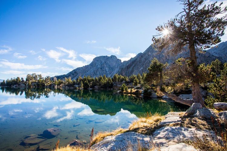
The Pyrénées national park is the only national park in Western Europe where brown bears live freely outside the Iberian Peninsula and the Balkans. The estimated population in 2024 along the Franco-Spanish range reaches approximately 80 individuals, the majority on the Spanish side. Spotting one remains a matter of patience and luck, but knowing it roams there fundamentally changes your relationship with the ridges.
The cirque of Gavarnie, listed as a UNESCO World Heritage Site as part of the "Pyrénées, Mont Perdu" property, is a limestone amphitheatre carved by glaciers: 3 kilometres in diameter, walls rising to 3,000 metres, and at the base, the Grande Cascade plunging 422 metres, the highest waterfall in France and one of the highest in Europe. The walk from the village of Gavarnie to the foot of the waterfall takes 2h30 return along a flat path accessible to everyone.
In terms of logistics, Lourdes has a TGV station (3h20 from Paris-Montparnasse). Shuttle buses connect Cauterets and Gavarnie during the summer season. The Pont d'Espagne (Route du Pont d'Espagne, 65110 Cauterets, rated 4.7/5 on Google with 9,974 reviews), the starting point for Lac de Gaube and the ascent of the Vignemale (3,298 m, the park's highest point), is located 7 km from Cauterets via the D920.
Isards (Pyrenean chamois) are visible year-round, often in herds on open slopes. In summer, griffon vultures ride thermals above the gorges of the Gave de Cauterets. For a stopover town on the way down from the Pyrénées towards the Mediterranean, the audio-guided tour of Narbonne offers 20 audio guides to explore the remains of the ancient Roman capital Narbo Martius.
Cévennes National Park, the Only Inhabited Park
Approximately 600 people live permanently within the core zone of the Cévennes national park, and nearly 70,000 across its entire territory, in hamlets of granite and schist clinging to valley slopes. Most national parks exclude all permanent residents from their protected core. Here, farmers, livestock breeders, and craftspeople are an integral part of the territory's identity, which earned the Cévennes the status of a UNESCO biosphere reserve since 1985, a distinction unique to a French national park.
The griffon vulture illustrates the success of conservation policy. Having disappeared from the region in the early 20th century, they were reintroduced in 1981 into the gorges of the Jonte. Today, several hundred of these 2.70-metre-wingspan gliders soar above the causse plateaus. From La Malène in the Tarn gorges, columns of vultures on thermals can often be seen from 10 am, and local guides offer birdwatching canoe trips that rank among the most impressive in France.
The Stevenson Trail (GR70) crosses the park over 272 kilometres, between Le Puy-en-Velay and Saint-Jean-du-Gard. Robert Louis Stevenson walked it in 1878 with his donkey Modestine to write "Travels with a Donkey in the Cévennes". Several park farms today offer pack donkeys for hire; the recommended daily walking distance remains between 15 and 20 km for the animals' comfort.
The Mont Aigoual (Route de l'Observatoire, 30570 Valleraugue, rated 4.7/5 on Google with 3,364 reviews) (1,565 m), with its century-old weather station still in operation, is the park's most accessible viewpoint: in clear weather, the Alps can be seen to the east and the Mediterranean to the south. The road climbs there from Le Vigan in 45 minutes.
To reach the Cévennes from Paris, Nîmes (80 km to the south-east) offers the most direct TGV connections (under 3h). Nîmes deserves a day's stopover for its 1st-century Roman arena and its Maison Carrée.
Mercantour National Park, Wolves and Petroglyphs
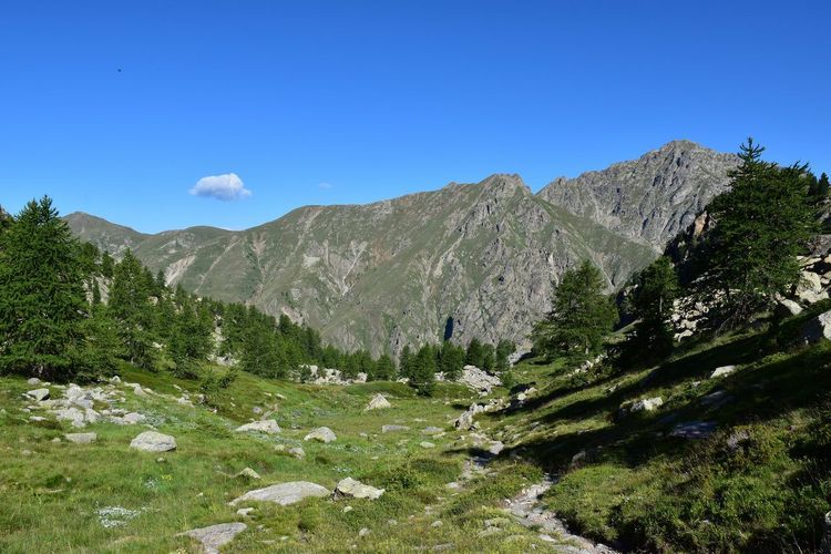
The Vallée des Merveilles, in the north-eastern sector of the Mercantour national park, preserves approximately 40,000 rock engravings on rocks polished by Quaternary glaciers at the foot of Mont Bégo (2,872 m). These petroglyphs – long-horned oxen, daggers, anthropomorphic figures – were made between 1800 and 900 BC.
Access is regulated: in the core zone, the presence of an accompanying guide is mandatory for leaving waymarked trails, and certain areas with a high density of engravings are closed to off-trail access. It is this strict protection that has allowed their remarkable state of preservation despite centuries of exposure to the elements.
The Mercantour national park is also the first French national park where the wolf naturally reestablished itself, arriving from the Italian Apennines, in 1992. The park's wolf population is estimated at several dozen individuals spread across about a dozen packs. Hikers who actually spot one remain the exception; documented observations mostly concern tracks, footprints, and nocturnal howling.
From Nice (55 km), several winding mountain roads lead to the park's core. Saint-Martin-Vésubie is the main base for departures to the Vallée des Merveilles. The July–August period is ideal for high-altitude hikes, with cool nights from 1,800 metres upward.
Port-Cros National Park, the Marine Sanctuary
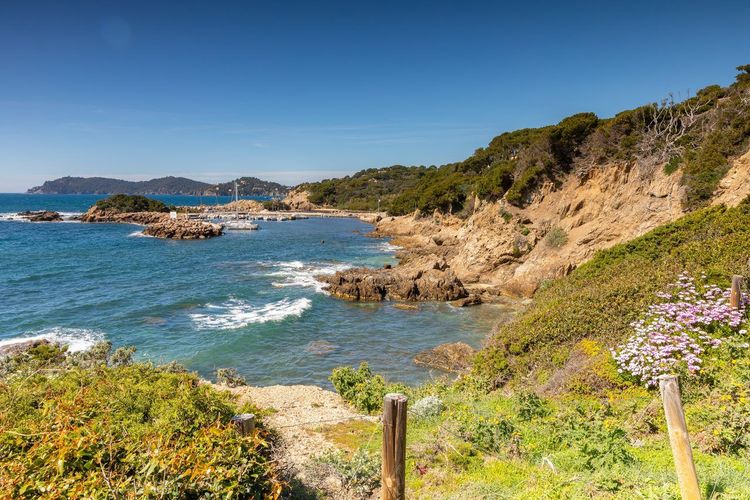
Port-Cros is only accessible by boat. No cars, no paved roads, no supermarket – the only things you will find on the island beyond the trails and the maritime pines are a handful of year-round inhabited houses and a single hotel. Created in 1963 at the same time as the Vanoise, it is the first marine national park in continental Europe. Its marine zone of 1,290 ha is one of the best-protected areas in the Mediterranean.
The fish biomass in the park's waters is 2 to 3 times higher than in neighbouring unprotected fishing zones. The underwater trail, a waymarked route at 6 metres depth accessible with mask and snorkel, is one of the most accessible snorkelling experiences in France. You can encounter large dusky groupers, shoals of white sea bream, rainbow wrasse, and the noble pen shell (Pinna nobilis), an endemic bivalve in the process of recovery after a parasitic crisis that decimated the species in 2016.
The crossing from Tour-Fondue harbour (Hyères) takes 35 minutes. In summer, boat tickets must be booked well in advance; places are limited to preserve the island's ecological balance.
La Réunion National Park, Volcanoes, Cirques, and World Heritage
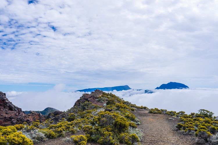
On La Réunion, the landscape was built over 3 million years from a hot spot on the ocean floor. The Piton de la Fournaise (2,632 m), one of the world's most active volcanoes, erupts on average 2 to 3 times a year. The Piton des Neiges (3,070 m), now dormant, is the highest point in the Indian Ocean. Between the two, the three cirques of Mafate, Cilaos, and Salazie carve the island's interior into enclaves of basalt and primary forest.
Listed as a UNESCO World Heritage Site since 2010, the park covers 42% of the island's surface area, approximately 1,050 km². The cirque of Mafate is the only cirque inaccessible by road: you can only reach it on foot or by helicopter. Its 14 hamlets (known as "îlets") operate in partial self-sufficiency, with solar-powered guesthouses and terraced gardens.
The GRR2 (Grande Traversée trail) connects Cilaos to Saint-Denis via Mafate in 5 to 6 days depending on the pace. For observing the volcano in activity, the Pas de Bellecombe (Route Forestière du Volcan, 97418 La Plaine des Cafres, La Réunion, rated 4.8/5 on Google with 502 reviews) is the classic viewpoint at 2,311 m altitude, accessible via the Route Forestière du Volcan. Entry into the enclosure during an eruption is strictly prohibited; outside of eruptions, the hike to the Dolomieu crater takes approximately 4 hours return from the Pas de Bellecombe.
The park's endemic fauna includes notably the Barau's Petrel, a seabird that nests exclusively in the island's highlands. Daily flights from Paris to Saint-Denis take approximately 11 hours (non-stop); the island is subject to the same regulations as mainland France for national parks.
Volcans d'Auvergne Regional Nature Park, the Land of Lava
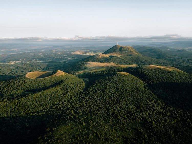
At 395,000 hectares, the Volcans d'Auvergne regional nature park is the largest regional nature park in mainland France. Its landscape is that of volcanism recent on a geological scale: the Chaîne des Puys, an alignment of 80 volcanic cones over 40 kilometres, last erupted only 6,000 years ago. The entire chain and the Limagne fault were inscribed on the UNESCO World Heritage List in 2018.
The Puy de Dôme (Route du Puy-de-Dôme, 63870 Orcines, rated 4.7/5 on Google with 21K reviews) (1,465 m) welcomes more than 500,000 visitors per year. A rack railway connects it to the Bruyère des Moines car park in 15 minutes; from the summit, on a clear day, the Alps can be seen 400 kilometres away. The ascent on foot via the Chemin des Muletiers takes 1h30 from the car park and remains free. At the summit, the ruins of a Gallo-Roman temple to Mercury and the weather observatory installations add an unexpected historical dimension to the volcanic panorama.
Further south, the Sancy massif peaks at 1,886 metres, the highest point in the Massif Central. In summer, the high-altitude meadows are carpeted with yellow gentian (of which the park is Europe's leading producer) and wild narcissi. In winter, the Mont-Dore and Super-Besse ski resorts maintain tourist activity that helps fund the park's management.
The volcanic lakes (maars) are well worth a detour. Lac Pavin, formed approximately 7,000 years ago in an explosion maar, is France's deepest volcanic lake (92 m). Its dark, still waters reflect the surrounding beech forests. The hiking trail around it takes 45 minutes on flat terrain, one of the park's most accessible circuits for families.
Clermont-Ferrand, accessible by TGV from Paris (3h), is the ideal starting point. The Ryo article on the most beautiful hikes in the Puy-de-Dôme details the routes from Clermont-Ferrand with duration and difficulty levels. Saint-Étienne, 80 km to the east, is another gateway to the Massif Central: the Ryo audio guide tour of Saint-Étienne covers 19 audio guides on the city's industrial and creative history before setting off towards the volcanoes.
Camargue Regional Nature Park, Flamingos and White Horses
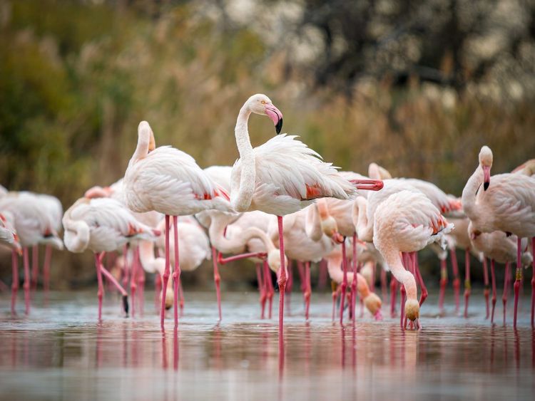
The Camargue has the largest flamingo colony in Western Europe: between 10,000 and 20,000 nesting pairs settle each spring on the shores of the Fangassier lagoon. These numbers vary considerably from year to year depending on water levels and the presence of predators, but watching flocks of several hundred flamingos against a backdrop of salt marshes remains an experience hard to match in continental Europe.
The park covers the Rhône delta over 93,000 hectares, organized between strict reserve zones, buffer zones accessible by vehicle, and areas open to tourism. The white Camargue horses and the black bulls roam semi-freely in the marshes; traditional ranches (manades) offer half-day or full-day horse-riding outings with local gardian guides.
To visit the Camargue without a car, Arles is the ideal base: direct regional train service from Nîmes (40 min) and Marseille (50 min), with cycle paths connecting the park's main sites. Nîmes, 30 km away, offers the nearest TGV connections from Paris (2h40). For a day combining Roman arenas and the Rhône delta, the Ryo audio guide tour of Nîmes covers 26 audio guides for 2h45 of walking through the city of ancient monuments.
Verdon Regional Nature Park, Europe's Deepest Gorges
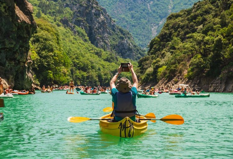
The Gorges du Verdon reach in places 700 metres in depth with a width of just a few tens of metres at the bottom, making them the deepest gorges in Western Europe. The Verdon river, whose characteristic blue-green colour is due to suspended calcite, flows through the gorges for 25 kilometres between the villages of Rougon and Moustiers-Sainte-Marie.
The Sentier Martel (GR49), which winds through the gorges over 24 kilometres in their most enclosed section, is one of the most spectacular hiking routes in France. The full crossing takes approximately 7 hours, with cliff-edge passages and a final descent by cable. Hikers wanting a taste without the full route favour the departure from the Point Sublime, with the finest views in a 2-hour return walk.
To the west of the gorges, the Lac de Sainte-Croix (2,200 ha, created by the 1974 dam) is a kayak and canoe spot accessible to all levels. Rentals are organised in the village of Salles-sur-Verdon. The perched villages of Moustiers-Sainte-Marie (ceramics) and Aiguines (root wood turning) are far more pleasant in June or September than in the height of August. Back in the capital, Ryo's audio-guided walk From the Mona Lisa to the Notre-Dame Cathedral covers 23 stops over 7.3 km through the historic heart of Paris.
The best logistical base remains Castellane, reachable by car from Nice (1h30) or Marseille (2h30); no direct public transport runs to the park's core.
Armorique Regional Nature Park, the Edge of Europe
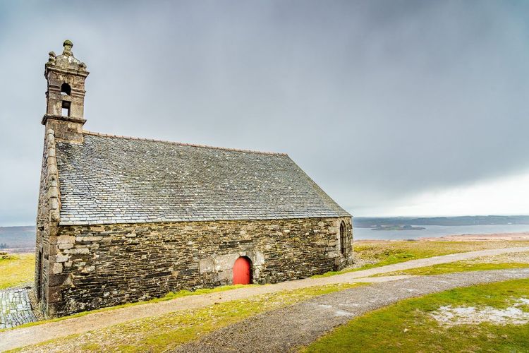
The Armorique regional nature park brings together across 172,000 hectares granite moorlands swept by the Atlantic, sphagnum bogs, and some of the most exposed coastlines in Western Europe. It encompasses the Monts d'Arrée at the heart of Finistère, the Crozon peninsula, the island of Ouessant, and the Molène archipelago.
The Crozon peninsula concentrates the park's most striking landscapes. The Pointe de Pen-Hir (Presqu'île de Crozon, 29160 Crozon, rated 4.9/5 on Google with 847 reviews), the Tas de Pois, and the Pointe des Espagnols overlook a sea whose colour shifts from emerald green to slate grey with the weather. The GR34 (coastal path) follows the entire Breton coastline; the Crozon section is among the wildest stretches of the route.
The island of Ouessant, accessible by ferry from Brest (2h30) or Le Conquet (1h15), is exposed to one of Europe's strongest Atlantic swells. Its Créac'h lighthouse is one of the most powerful in the world. On the island, the wool of the Ouessant sheep, Europe's smallest breed, is still hand-woven into traditional embroideries.
Brest, accessible by TGV from Paris in 4h15, is the most convenient gateway. The audio-guided tour of Brest covers 27 audio guides for 3h30 of city exploration before heading into Armorique. From Rennes, 2h30 by bus from Brest, the Ryo audio guide tour of Rennes offers 25 audio guides to explore the Breton capital and its historic half-timbered city centre.
Corsica Regional Nature Park, the GR20 and Endemic Species
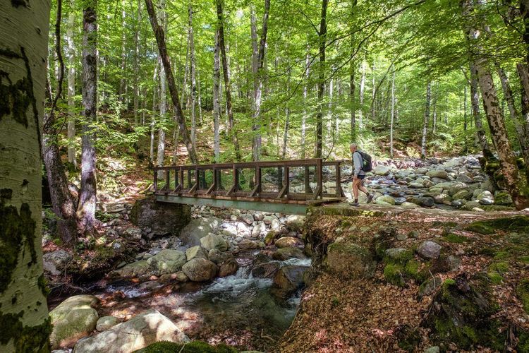
The Corsica regional nature park covers 40% of the island's surface area, a proportion unmatched by any other French PNR. Its territory includes the island's highest massifs, among them the Monte Cinto (2,706 m, Corsica's highest point) and the Rotondo (2,622 m). The Vizzavona forest, at the heart of the park, is dominated by the Corsican laricio pine, a conifer endemic to Corsica that can reach 50 metres in height.
The GR20 crosses the park over 180 kilometres from north to south. Universally regarded as one of the most demanding high-mountain treks in Europe, its 16 stages require good physical fitness, full equipment, and early booking at the park's mountain huts (often 3 to 4 months in advance for July–August). The stages in the northern section (between Calenzana and Vizzavona) are more technical than the southern stretch.
Corsica's endemic fauna is among the most remarkable in France: the Corsican mouflon (the only wild bovid endemic to France), the Bonelli's eagle, and the Hermann's tortoise inhabit the park. The flora is equally distinctive: low maquis at altitude, holm oak forests on sunny slopes, and alder and laurel groves in valley bottoms.
Ajaccio, 1h30 by road from the GR20's southern trailhead (Conca), is the main arrival point by air from the mainland. The audio-guided tour of Ajaccio offers 18 audio guides to explore Napoleon's imperial city before heading towards Corte or the Niolu valley.
Ballons des Vosges Regional Nature Park, the Route des Crêtes
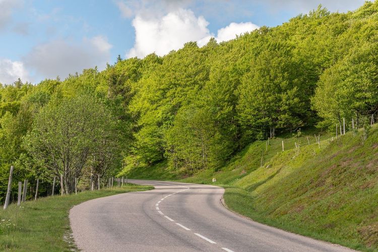
The Grand Ballon (Route des Crêtes, 68700 Wattwiller, rated 4.7/5 on Google with 1,912 reviews) (1,424 m) is the highest point in the Vosges and in the park. The Route des Crêtes, created in 1914–1918 to conceal French troop movements from German observation, follows the ridgeline for 80 kilometres between Cernay and Sainte-Marie-aux-Mines, offering an alternation of conifer forests and upland pastures with panoramic views over the Alsace plain.
The western capercaillie is the emblematic and one of the most endangered species: fewer than 200 individuals survive in the Vosges. Quiet zones have been established to protect its breeding season (access prohibited outside waymarked trails from November to June). The lynx, reintroduced in the 1980s, is present but very rarely observed.
Colmar, accessible by TGV from Paris in 2h15, is the most pleasant gateway. The Alsatian vineyard, on the park's eastern slope, can be explored by bike along the wine route between Colmar and Thann.
Normandie-Maine Regional Nature Park, Bocage and Deep Forests
The Norman bocage, with its hedgerows, sunken lanes, and shaded streams, forms the founding landscape of the Normandie-Maine regional nature park. This territory of 260,000 hectares brings together the last large-scale forests of north-western France: the Forêt d'Écouves (15,000 ha) is Normandy's largest forest.
The Château de Carrouges (Route du Château, 61320 Carrouges, rated 4.6/5 on Google with 1,445 reviews), managed by the Centre des monuments nationaux, is one of the best-preserved medieval châteaux in north-western France, with its moat and 15th-century granite and red brick towers. Around Alençon, waymarked hiking circuits cross the pine and oak forests. For a comfortable base, Caen offers direct connections from Paris (2h by train) and easy access to the D-Day beaches. The Ryo audio guide to Caen covers the Abbaye aux Hommes and the Abbaye aux Dames, both built under William the Conqueror in the 11th century.
Luberon Regional Nature Park, Ochre, Lavender, and Hilltop Villages
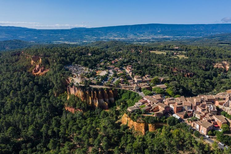
The Luberon is divided into two massifs with distinct characters: the Petit Luberon to the west (garrigue, vineyards, and hilltop villages) and the Grand Luberon to the east (Atlas cedar forests, peaking at 1,125 metres). Between the two, the Combe de Lourmarin connects Apt to the Durance valley.
Gordes, perched on a limestone spur at 373 metres, regularly features among France's most beautiful villages. At Roussillon, cliffs of natural ochre colour the village in brick red, saffron yellow, and burnt orange – a quarry worked until 1960, now a discovery trail (45 min). The lavender of the Valensole plateau, adjacent to the park, is in bloom from mid-June to mid-July. Aix-en-Provence (30 km) and Avignon (40 km) are the best-connected bases by train.
Marais Poitevin Regional Nature Park, the Green Venice
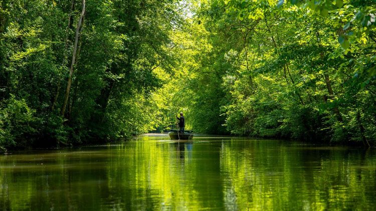
Nicknamed "the Green Venice", the Marais poitevin is France's second largest wetland after the Camargue. Its 8,000 kilometres of canals and ditches were dug progressively from the Middle Ages to drain the coastal marsh and make the land cultivable.
Coulon, at the heart of the wet marsh, is the main departure point for guided or self-hire boat trips. On waterways shaded by ash and poplar trees, you glide silently for hours without encountering a road or a house. The aquatic fauna is remarkably rich: grey herons, little egrets, otters active at dawn. The rare European mink benefits from a specific protection programme within the park.
Niort, accessible by TGV from Paris in 1h40, is the most practical gateway (20 min by car or taxi from Coulon).
Grande Brière Regional Nature Park, Atlantic Marshland and Thatched Hamlets
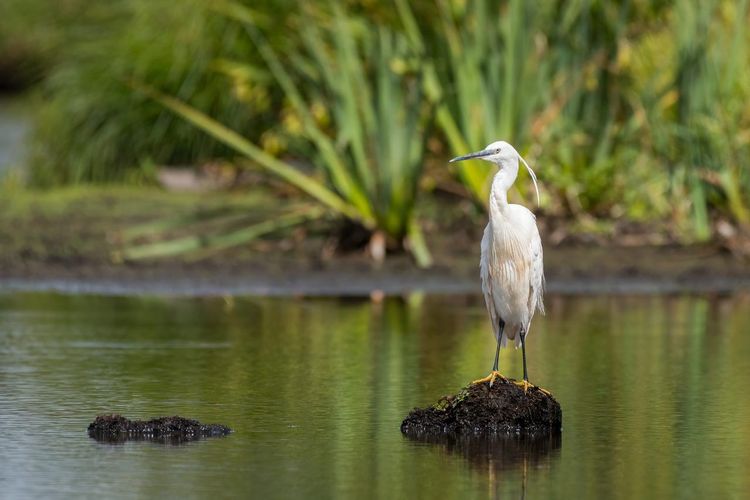
The Grande Brière regional nature park covers a peat bog marsh of 49,000 hectares, encircled by Guérande, Saint-Nazaire, and La Baule. It is France's second largest marsh after the Camargue, yet remains far less known to travellers. Its originality lies in the Île de Brière, a group of raised land accessible only by drawbridges, and in the thatched-roof villages dotting its shores.
Kerhinet, the park's best-restored village, brings together 18 Loire-stone thatched cottages dating from the 17th century, inhabited and brought to life in summer by craftspeople. A trip in a chalandière (traditional flat-bottomed boat) remains the most authentic experience: gliding silently along the canals between rushes and reeds, with the croaking of frogs and marsh harriers passing overhead through the phragmites.
To combine culture and marshland in a single stay, Guérande and its fortified medieval city are 5 km away. The Ryo audio guide to Guérande takes you through the lanes of the old town. Saint-Nazaire, 15 km away, is worth a visit for its shipyards and submarine base with the audio-guided tour of Saint-Nazaire.
When to Go and How to Plan Your Visit
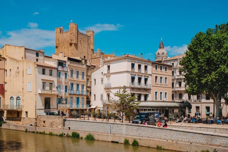
France does not have a single ideal season for its protected areas – it has several, depending on the geography and the type of landscape you are looking for.
For mountain parks (Vanoise, Écrins, Mercantour, Pyrénées): the ideal window runs from mid-June to mid-September. High-altitude passes and huts only open from late June, when residual snowfall allows. July and August concentrate the bulk of visitors; to avoid the crowds on the most popular trails (Tour de la Vanoise, GR54 in the Écrins), opt for weeks outside school holidays and early starts before 7 am. September, often sunny, offers an excellent compromise: quieter huts, magnificent light, and alpine flora in its autumn transition.
For Mediterranean parks (Calanques, Verdon, Luberon): spring (April–May) and the shoulder season (September–October) are the best periods. In July–August, the Calanques can close their massifs for several consecutive weeks due to fire risk. The Verdon in July is magnificent, but campsites in Castellane need to be booked 3 to 4 months in advance. In May, the flowering garrigue and the still-cool sea create ideal hiking conditions in the Luberon.
For wetland parks and the Camargue: March–May for migratory birds (the Rhône delta lies on Western Europe's main migration route) and October for the concentration of wintering species. Flamingos nest from March to July. In summer, the heat and mosquitoes make marsh outings uncomfortable; setting off early in the morning and using effective insect protection are essential.
For Brittany and the north-west (Armorique, Brière, Normandie-Maine): May and September are the best periods. Armorique can be visited year-round; moorland landscapes in the rain have their own singular austerity, and the islands of the Iroise are more accessible (less wind) in spring.
A few general rules to keep in mind before you go:
- In the core zones of national parks, bivouacking is tolerated from 7 pm to 9 am only (except in prohibited zones). At Port-Cros, all bivouacking is forbidden.
- Dogs are banned in the core zone of most national parks (Port-Cros, Vanoise, and Écrins in particular).
- Foraging for plants and fishing without authorisation are prohibited throughout core zones.
- Off-road motor vehicles are strictly forbidden in all national parks.
- For overseas parks (La Réunion, Guadeloupe, Guyane), budget for air travel between 250 and 600 euros per person from Paris, depending on the season.
FAQ
What is the difference between a national park and a regional nature park?
A national park is established by government decree and includes a core zone with high-level protection (camping, dogs, and foraging prohibited; economic activities very limited) and an adherence zone grouping surrounding municipalities committed to a charter. A regional nature park (PNR) is an inhabited territory shaped by human activities, whose local elected officials have chosen to promote its natural and cultural heritage through a charter renewed every 12 years. In practice, regulations are much stricter in a national park; a PNR preserves landscapes while maintaining agriculture, crafts, and tourism. Both types can coexist in nearby territories and complement each other within the same travel itinerary.
Which is the largest natural park in France?
In mainland France, the Volcans d'Auvergne regional nature park is the largest PNR at 395,000 ha, ahead of the Ballons des Vosges (300,000 ha) and the Landes de Gascogne (296,000 ha). The largest mainland national park by its core zone is the Écrins national park (918 km²), ahead of the Cévennes (915 km²). If overseas territories are included, the Guyane national park (created in 2007) covers more than 3 million hectares, making it one of the largest tropical national parks in the world.
Can you camp freely in French natural parks?
In national parks, bivouacking (one night, lightweight tent) is tolerated in the core zone from 7 pm to 9 am, away from roads and paths, except in areas with specific regulations. At Port-Cros, all bivouacking is strictly prohibited. Organised camping is not permitted in core zones. In regional nature parks, camping rules follow common law: wild camping is prohibited on private property, but natural camping areas exist in virtually all PNRs. Remember to book staffed mountain huts several months in advance for major long-distance routes (Tour de la Vanoise, GR54, GR20).
What iconic animals can be spotted in French natural parks?
The Alpine ibex in the Vanoise (approximately 2,000 individuals). The brown bear in the Pyrénées (approximately 80 individuals along the range). The flamingo in Camargue (up to 20,000 nesting pairs). The bearded vulture in the Écrins and the Mercantour. The wolf in the Mercantour (since 1992). The Corsican mouflon in the Corsica PNR. In marine parks, the dusky grouper at Port-Cros and the bottlenose dolphin off the Crozon peninsula in Armorique.
Which natural parks are most accessible without a car?
The Calanques (bus and metro from Marseille, water shuttles from Cassis). The Camargue (regional train to Arles, cycling or hiking). The Marais poitevin (TGV to Niort, cycling or taxi to Coulon). The Vanoise (TGV to Modane or Bourg-Saint-Maurice). Port-Cros (ferry from Hyères). All of these parks have waymarked routes accessible from railway stations or public transport stops, without requiring a rental car.
Do you need to book in advance to visit French national parks?
Most national parks do not require reservations for daytime hiking. However, staffed mountain huts in the core zone (Tour de la Vanoise, GR54 in the Écrins, GR20 in Corsica) generally need to be booked 2 to 4 months in advance for July and August. For Port-Cros, boat tickets must be booked well in advance during the season. Guided outings in the Vallée des Merveilles (Mercantour) require reservations with park-approved guides; expect to pay between 15 and 25 euros per person depending on the duration.
Conclusion
The diversity of France's protected areas follows no simple regional logic. You can travel from the Camargue to the Mercantour in four hours by road, from Port-Cros to Corsica in two hours by ferry, from the Marais poitevin to the Ballons des Vosges in an overnight train. Each protected area has its own visiting rules, its own seasonal rhythms, and its own iconic species.
For those who want to combine nature with urban discovery, the gateway towns of the parks often offer remarkable and underrated architectural heritage. Our Ryo app covers several of these stopover towns: Brest for access to Armorique, Nîmes for the Camargue and the Cévennes, Ajaccio for Corsica, Caen for Normandy. Ryo audio guides work offline, making them particularly well suited to mountain or island territories where mobile coverage is limited or non-existent.
À lire également